|
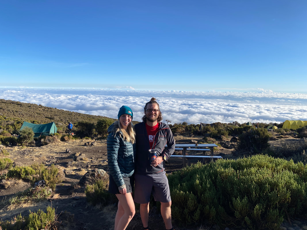
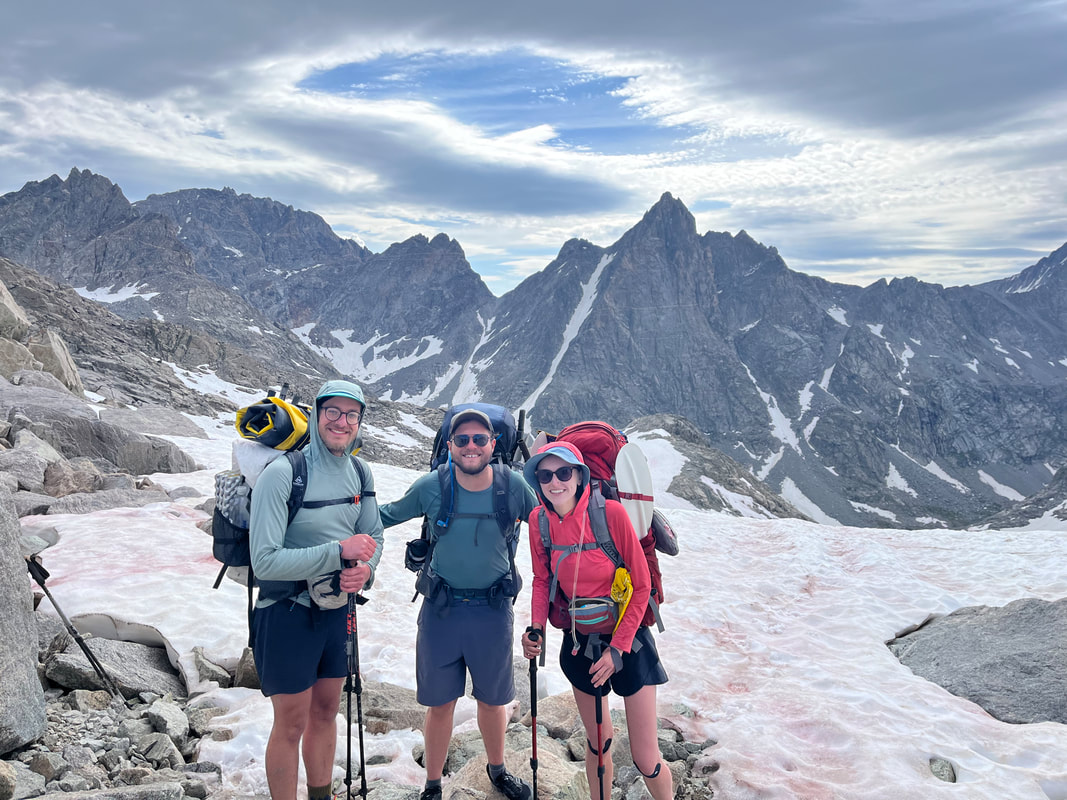
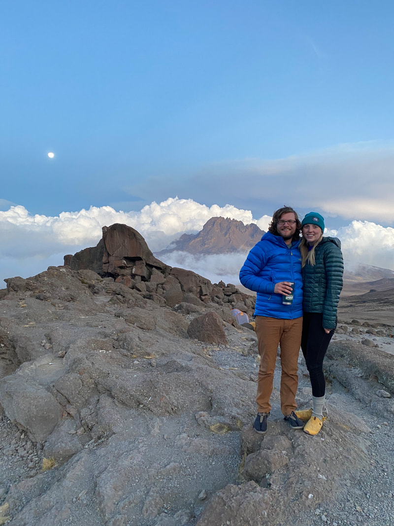
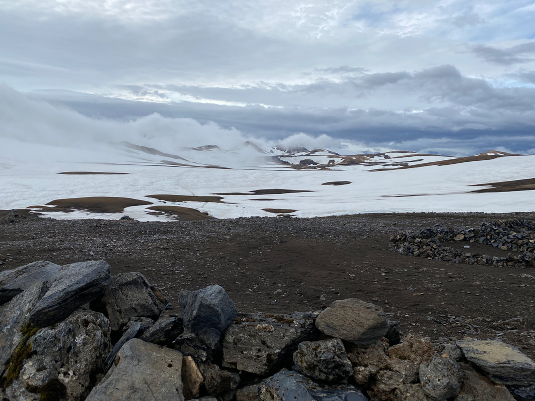
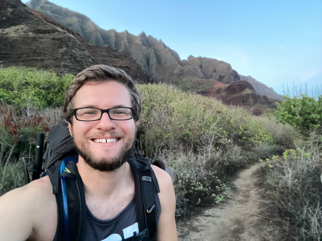
If you don’t know where in the world the Wind River Range is, it’s a mountain range in western Wyoming that traverses roughly 100 miles from Atlantic City, WY to its terminus near the Green River Lakes and Dubois, WY. It’s considered to be a part of the Greater Yellowstone Ecosystem and one of the largest areas of wilderness and public land in the lower 48 with over 2,800 square miles of public land. I’ve had the pleasure of traveling into the Winds twice, once in 2015 and again in 2017, visiting the Cirque of the Towers, Titcomb Basin and Indian Basin, some of the most popular areas. It was a beautiful and wild place that captured my imagination about what all its vast wilderness held. Sometime at the end of college I read about a route through the range that encompassed sections of the CDT and then other more wild valleys east and west of the Continental Divide and over the course of the next few years I kept it on my to-do list. This year I found my chance to attempt the Wind River High route, Kat would be finishing the PCT and I have unlimited PTO with my current job…. I convinced my buddy Dalton to go in with me, we wrangled our friend Emily (who had just finished the Rainier trip with me) and we had a crew. Our plan was to arrive in the Winds at Big Sandy Trailhead, get a shuttle up to Green River Lakes and traverse over 80 miles back to our car over the course of 10 days. We’d get a spot pack resupply halfway from a local outfitter and on top of all that, we’d do it with packrafts and add an additional 15 miles to the traditional route with a summit of Wind River Peak. We signed up for a lot.
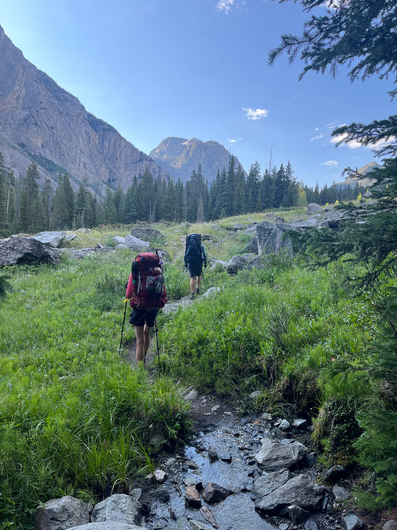
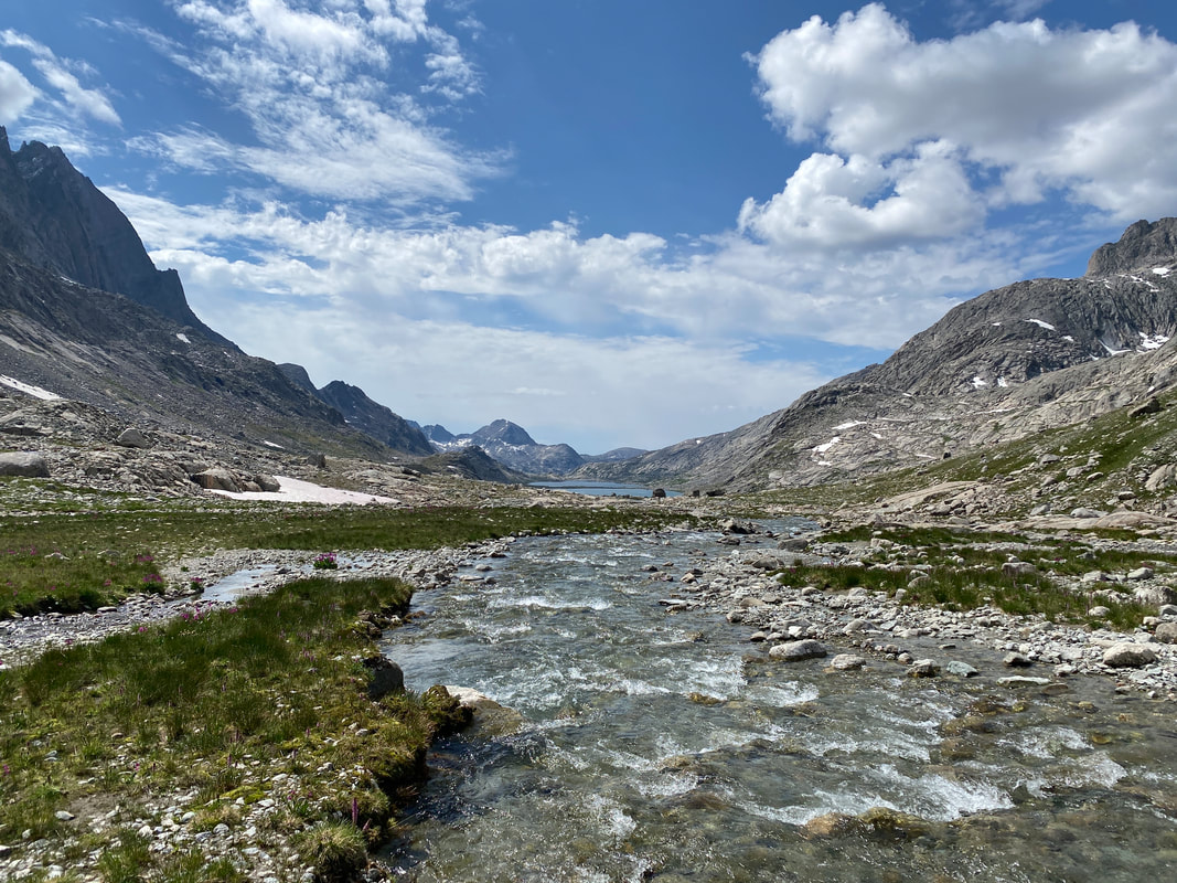
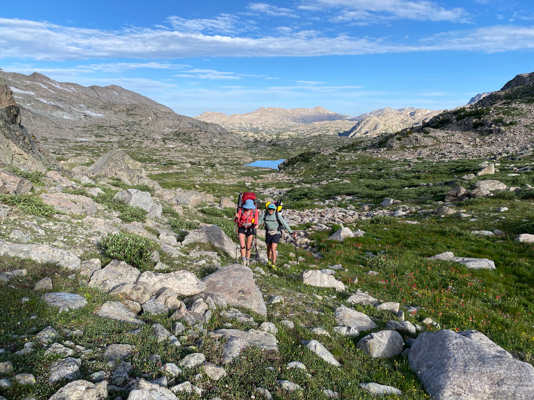
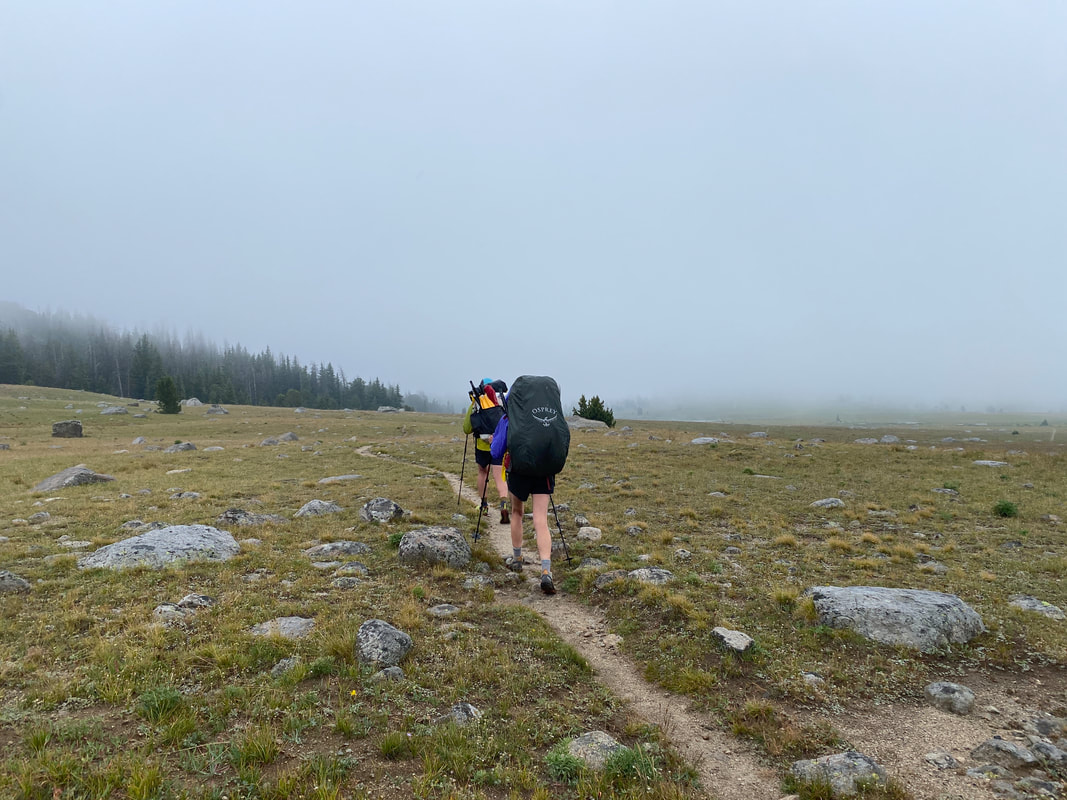
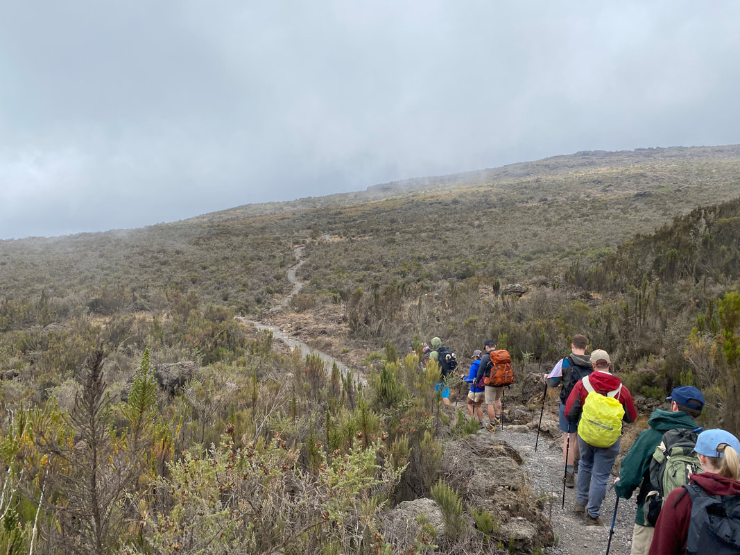
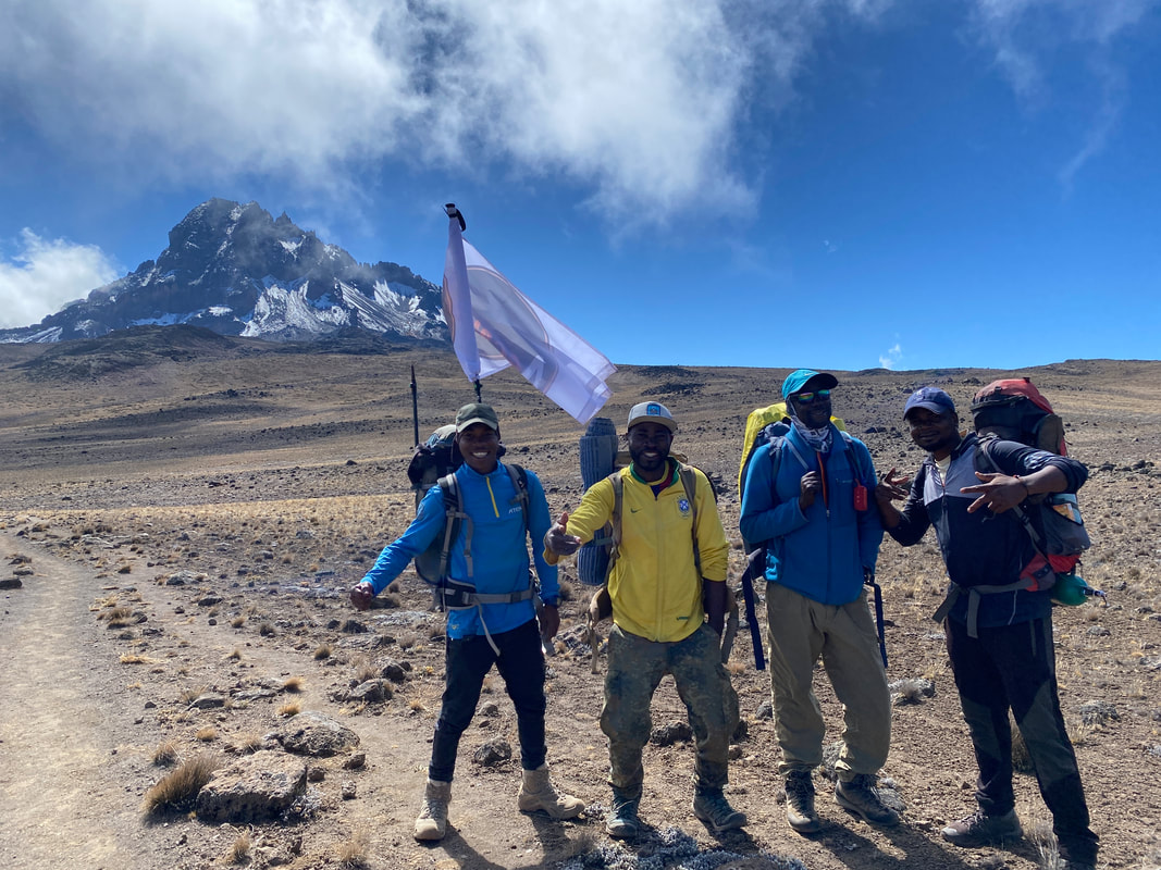
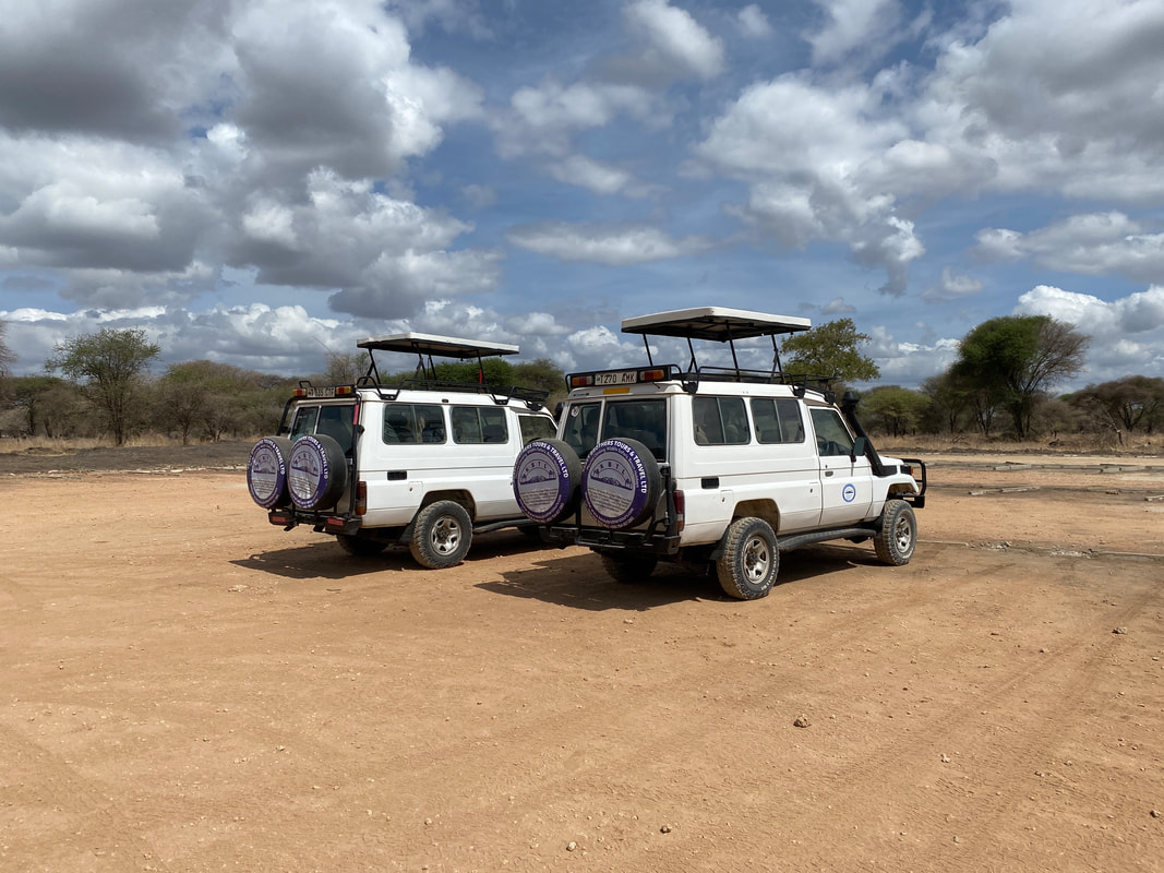
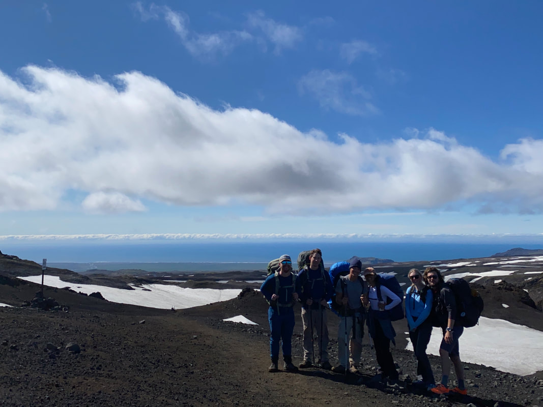
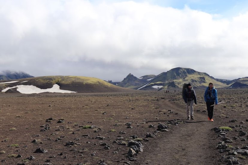
Day 1 We arrived at the Big Sandy Trailhead the night before. An 8-hour drive, errands in Pinedale dropping off our resupply, getting dinner and chatting with a CDT hiker named Hummingbird landed us there around 9:30pm and we all quickly fell asleep. Up by 7am and packing up for our shuttle we were excited. Our driver Ric arrived 20 minutes early and we frantically finished packed up. We were off. Our driver Ric was a character, he was a retired high school teacher and used the shuttling as a good way to chat with folks and get out in the mountains. He told us stories about the area along the way, made us nervous about our resupply showing up and encouraged us in what seemed like an endless knowledge of the area. A 3-hour car ride, good conversation and a little sightseeing tour by Ric along the way got us to Green River Lakes at 11am on the dot. We said our farewell to Ric, blew up the packrafts and headed south. The goal was that each day, we paddled, whether it be a lake by camp or a section of the route, we needed to make use of the extra 8lbs on our backs. We set off across Green River Lake and went almost two miles paddling right out of the gate. It was a beautiful sunny day and we were all happy to be moving in the right direction. Eventually we hit the south end of the lake and transitioned to foot. As we wound up the valley along the Green River, we chatted with other hikers about what to expect. No one had been up and over Knapsack Col, so we had some unknown lying ahead of us. That first day we hiked an extra couple of miles and got just past Square Top and Granite Peak to camp in a grassy meadow. It was a nice relaxing first evening, playing cards, chatting and enjoying being in the mountains.
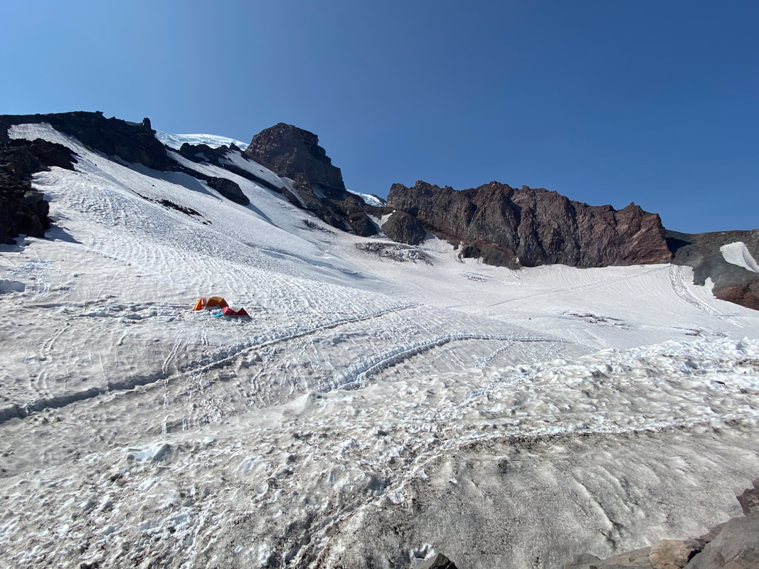
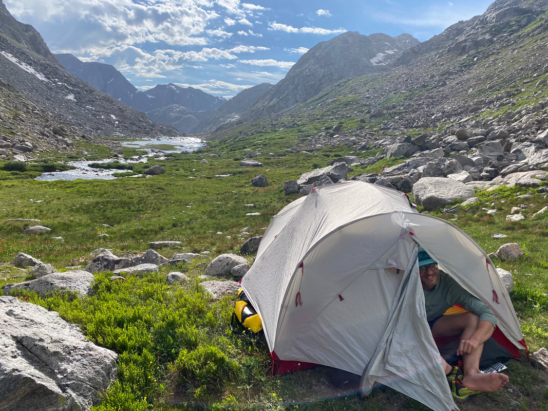
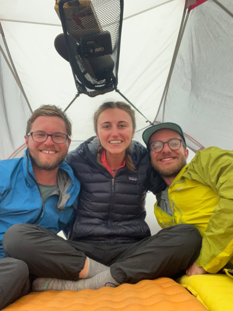
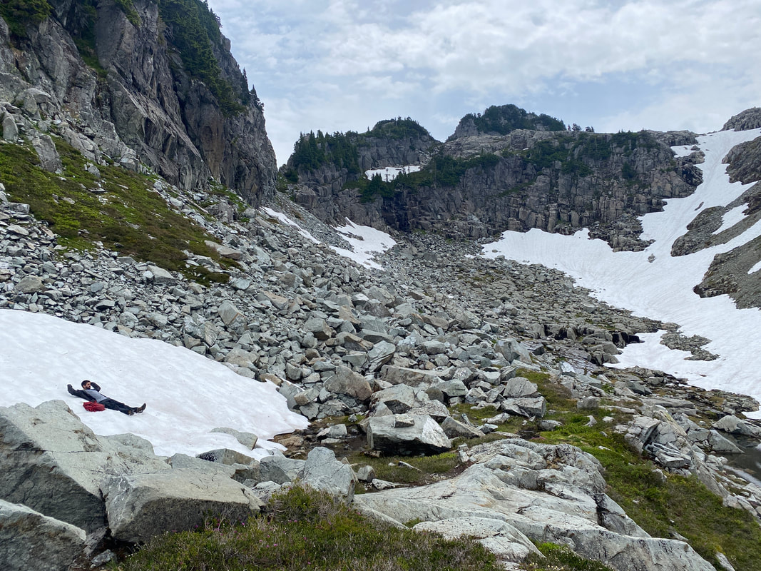
 Day 2 I woke up with the sun around 5am and tossed and turned until 6 when I finally got up, got all the bear bags down and woke Emily and Dalton to start the day. We’d mostly slept well and were in high spirits. It was an 8-mile day but we planned to go further if the weather permitted us. After a quick breakfast we were heading south. The first climb of the day went by quickly and we switch backed up to over 9,000’. Right before hitting the Knapsack Col cutoff, we ran into Hummingbird again, had a quick chat with him and continued on our ways. The next section to Vista Pass and Cube Rock Pass was steep and slow. This was a day we regretted the packrafts…. We wound our way up the Green River headwaters and went up and down as we hoped to climb consistently and gain Peak Lake. Some sections of snow and scree slowed our ascent on the first day and tired us out with 5 days of food still in our packs. After a long ascent we finally reached the small lake in Cube Rock Pass and quickly made our way down to Peak Lake. We’d gone the distance we needed to and it was only 1pm… As we sat and ate lunch we went back and forth about continuing over Knapsack Col into Titcomb Basin. We decided to go further but not over the pass since we were all pretty beat from the climb. We found a grassy knoll near 11,000’ in the beautiful valley just below the Col. A few CDT hikers passed us and ran over the pass as we setup our tent. About 30 minutes later the clouds and rain came in and we hopped in the tent. It was a pleasant afternoon at camp, we played cards in the tent to the pitter patter of rain and gassed each other out with what would likely only become worse flatulence as we progressed through the mountains. Eventually the rain stopped and we were treated to a beautiful sunny evening in the alpine. Based on our itinerary, day 2 would be the hardest of the 10….
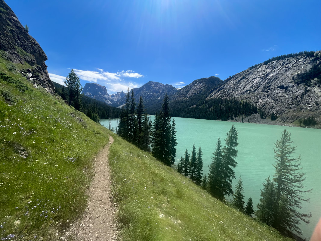
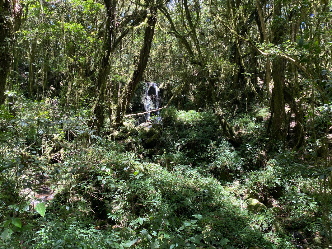
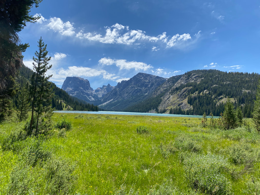
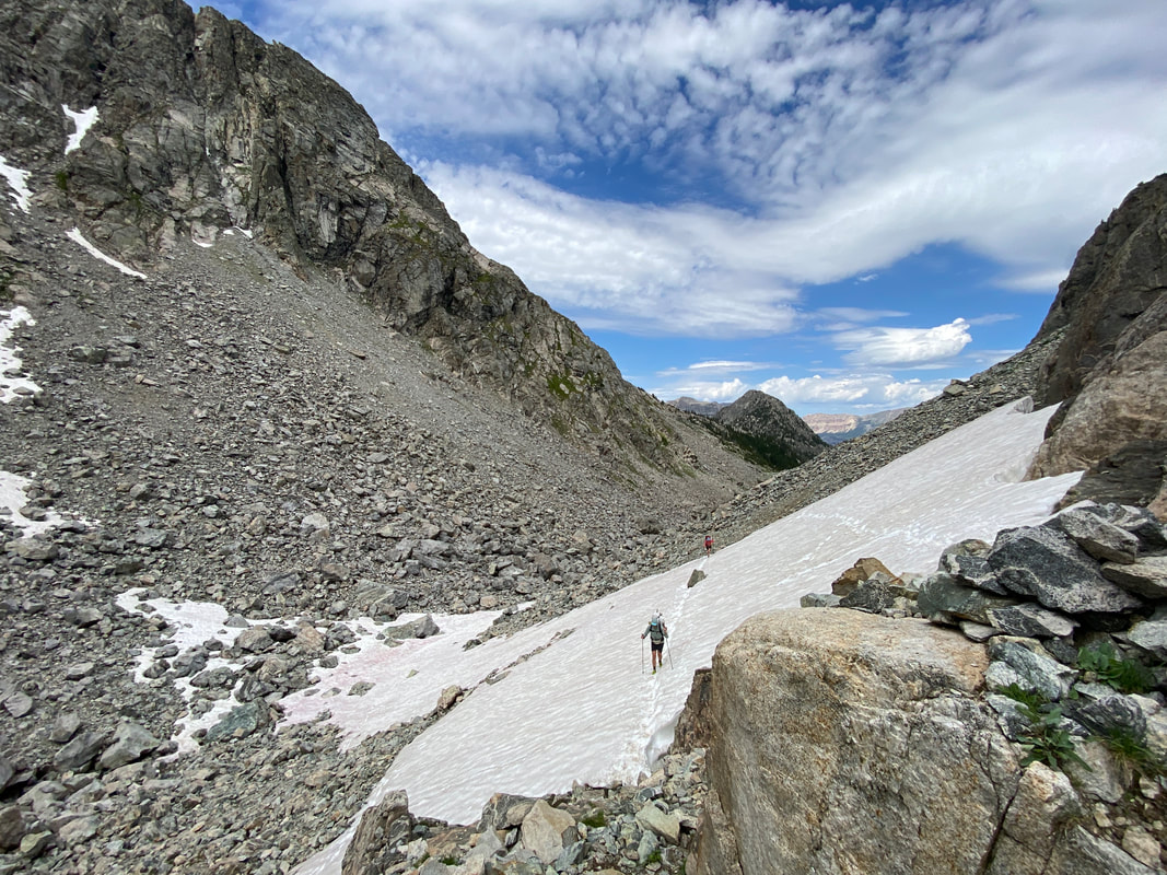
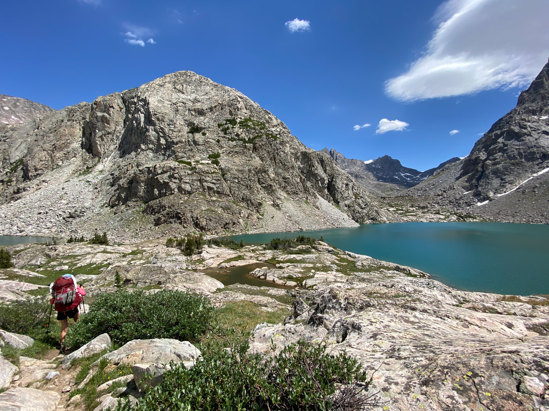
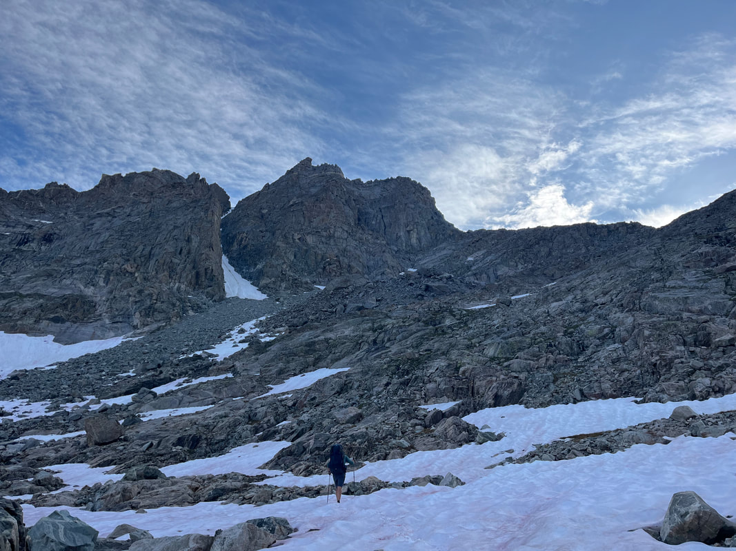
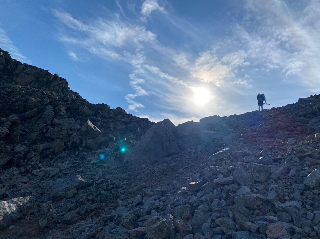
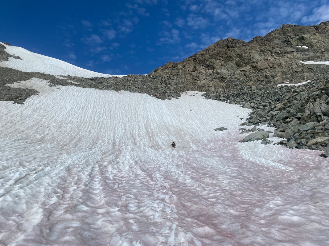
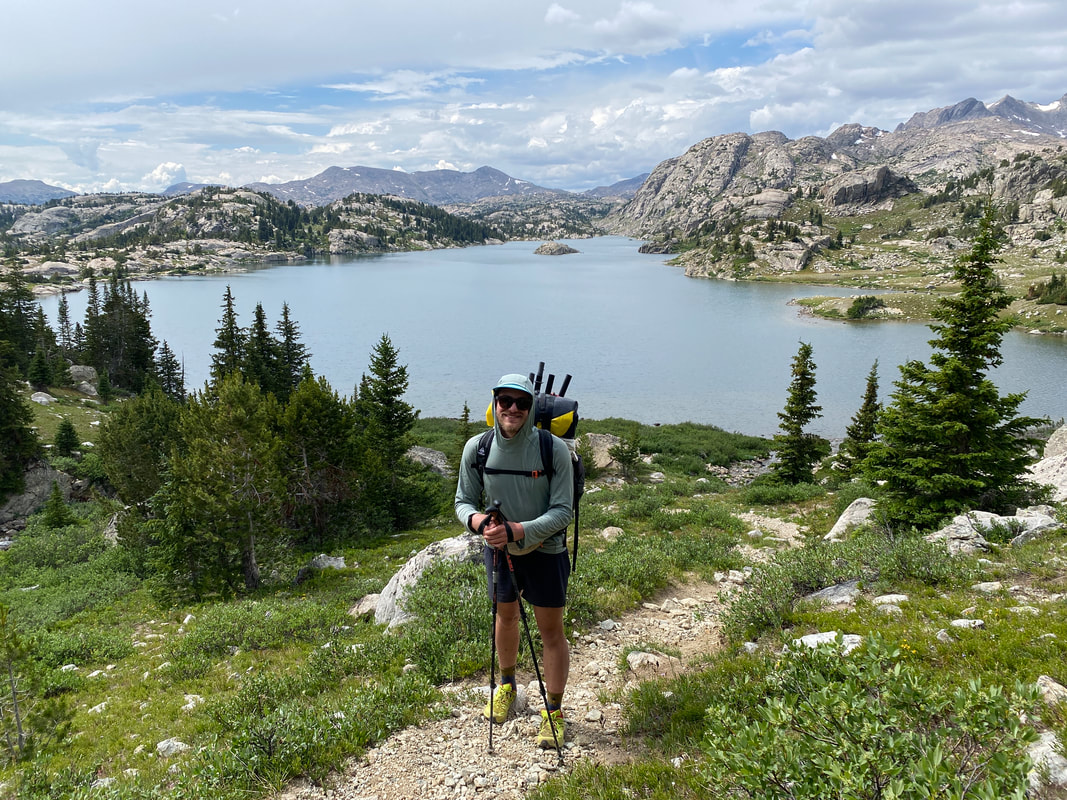
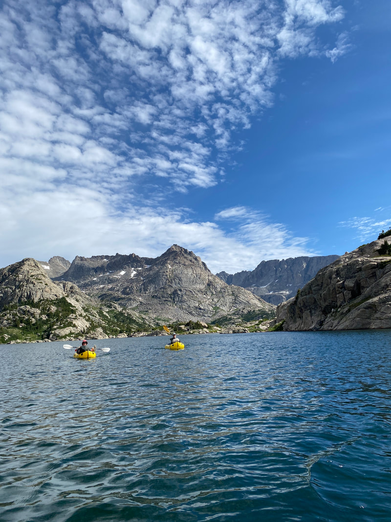
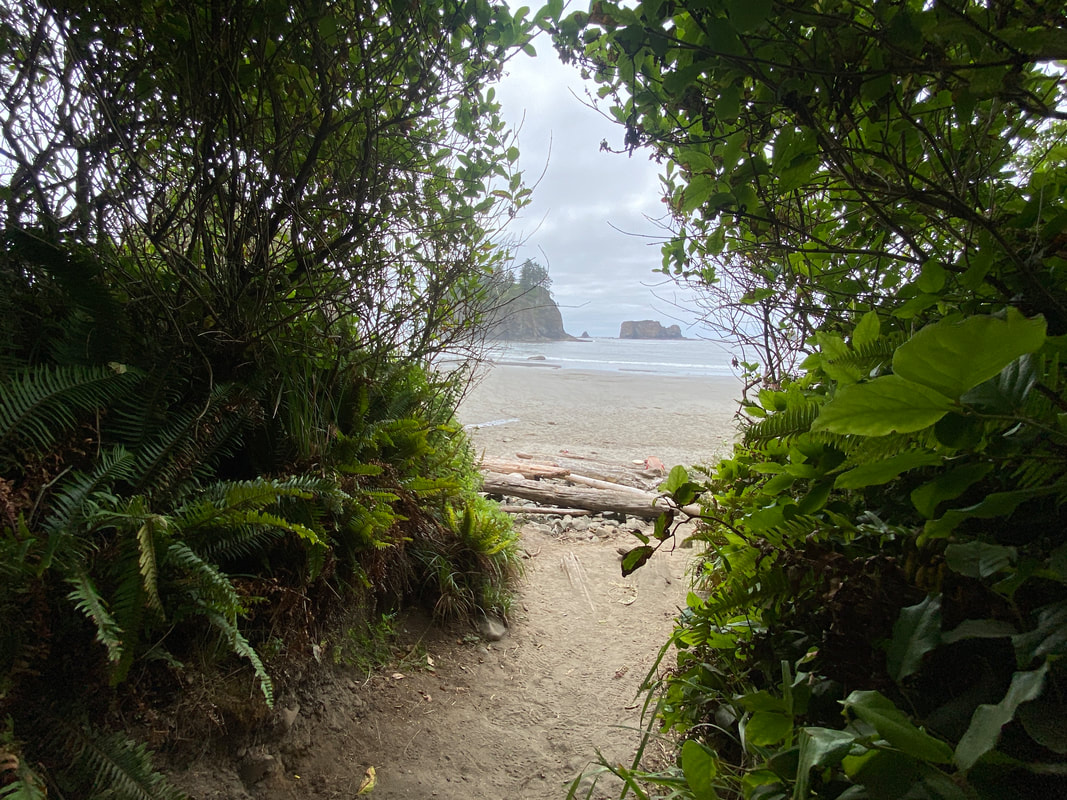
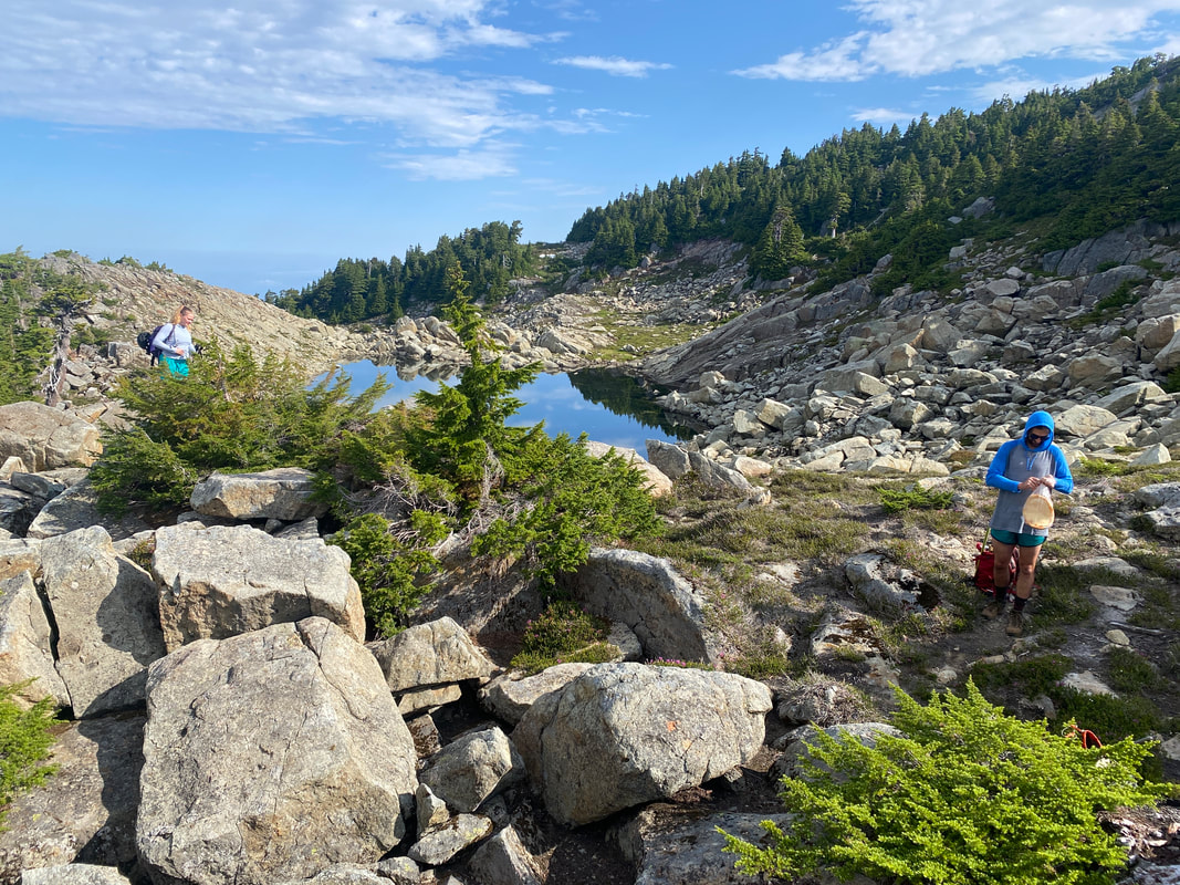
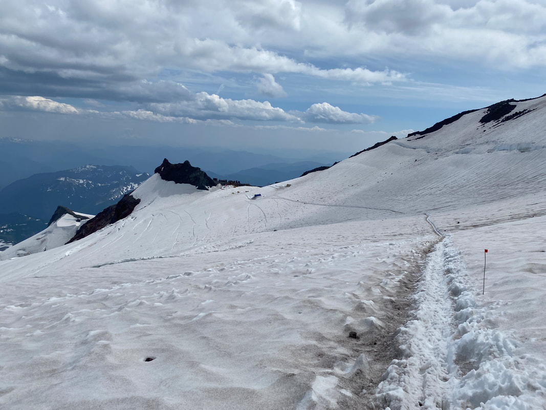
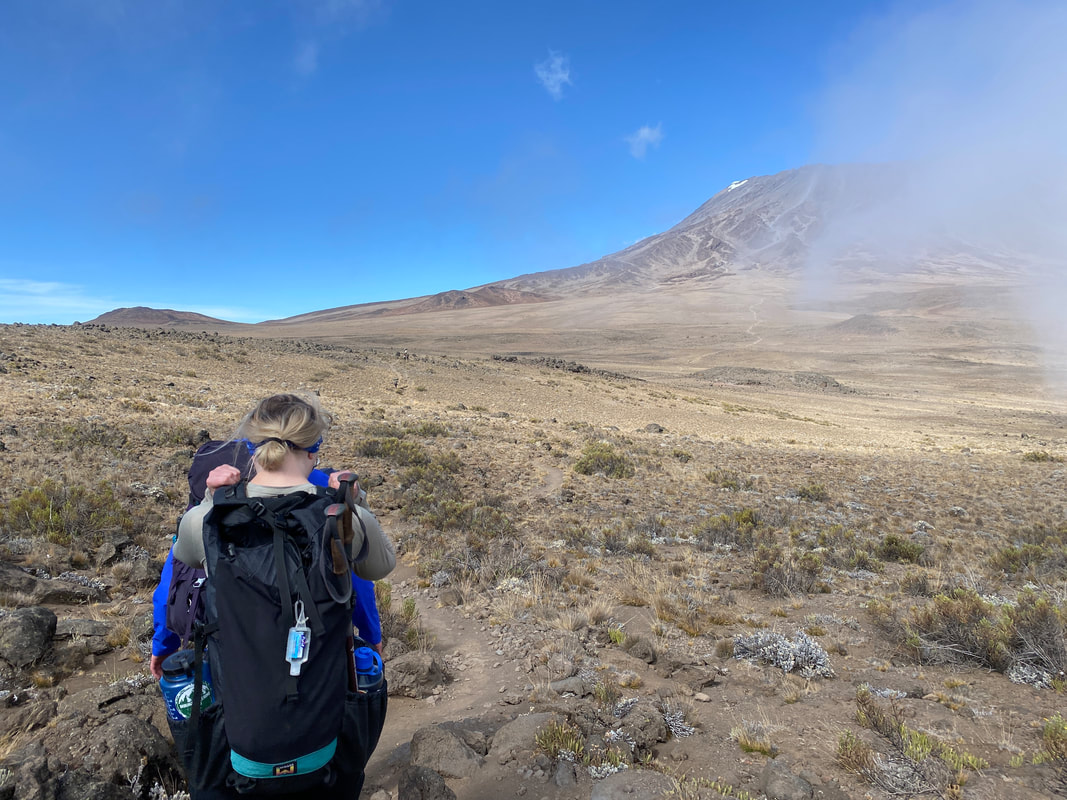
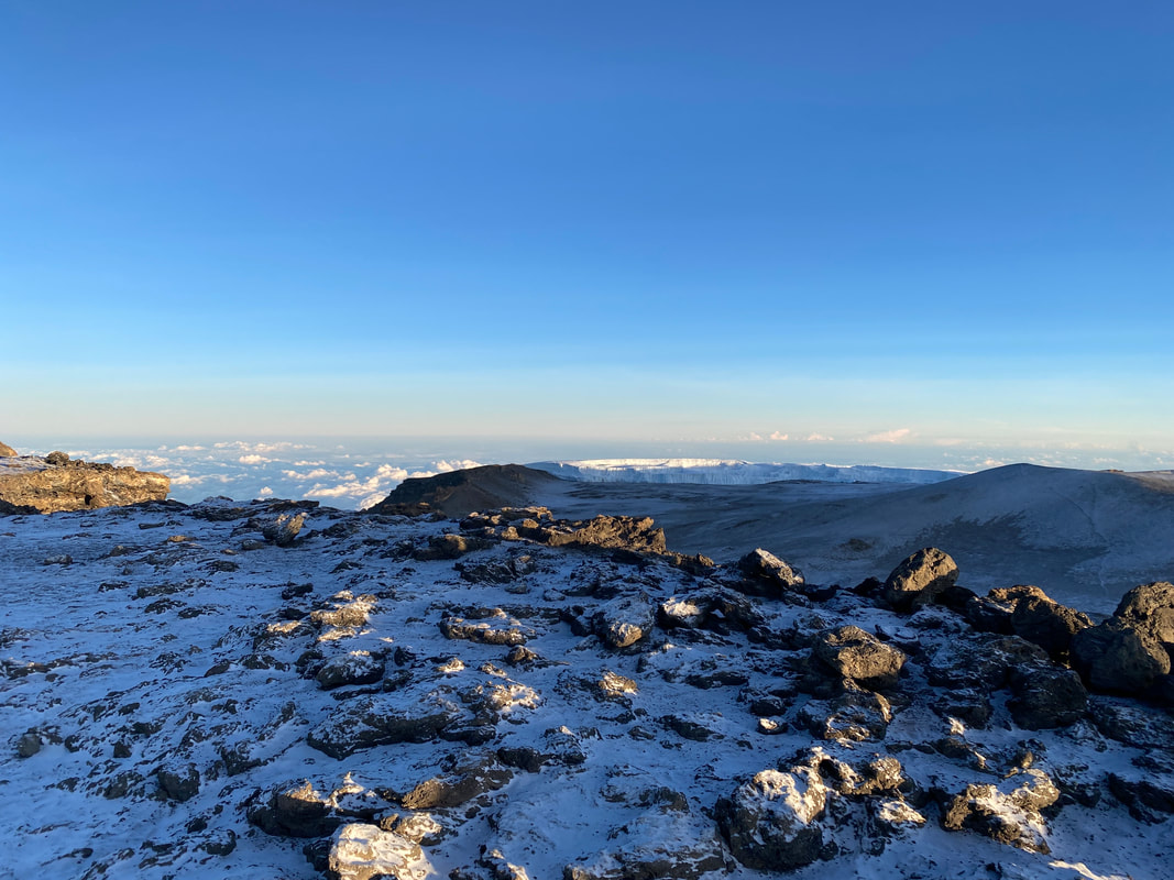
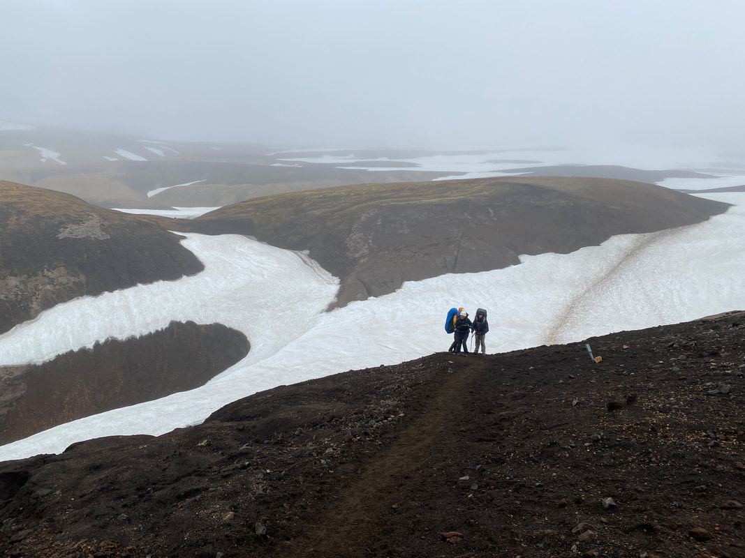
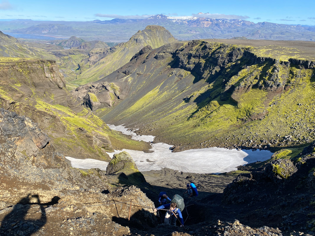
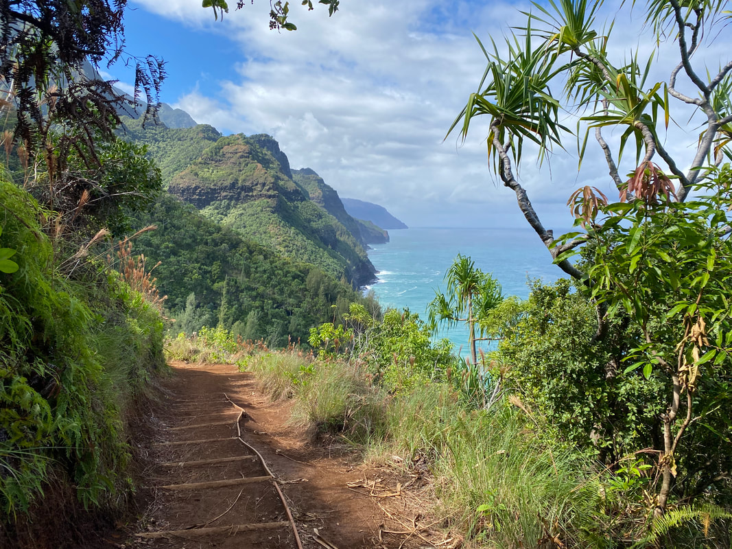
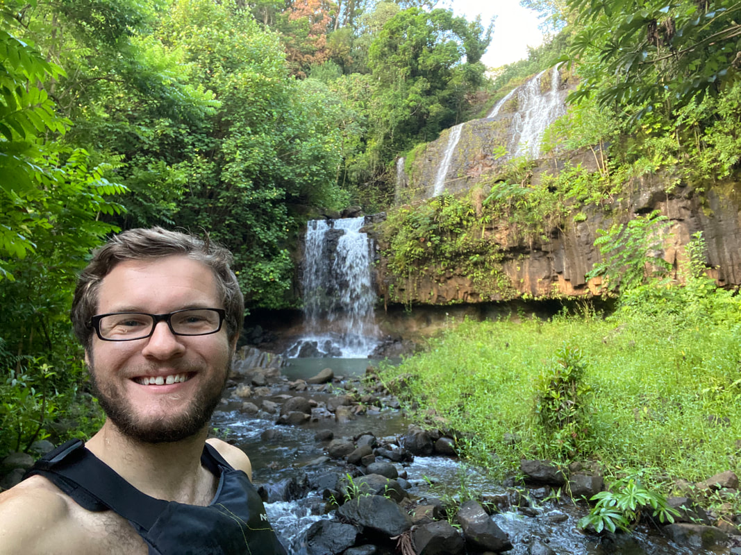
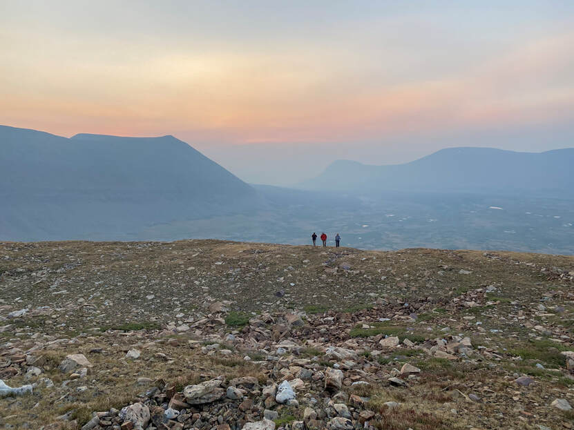
Day 3 I woke up nervous. By 6am we were all eyes open staring at each other, not wanting to get up. We had a steep climb up Knapsack Col, about 1,500’ over a mile. By 7:30, we had wormed our way out of the tent, broke camp and started the climb. The gradual trail we’d followed the day before faded and we wondered in and around boulder fields trying to avoid water and snow. We were gaining quickly to the base of the 500’ climb to the top of the Col, the closer we got, the steeper it looked. After almost two hours, we scrambled our way to the notch in the mountain and could see over into the Upper Titcomb Basin, the hardest part of the day was behind us. As we sat eating a well-deserved snack, we tried to calculate a safe way down the other side. There was a loose boulder field we could follow, or we could try to descend fast down the face. We went straight down, quickly descending and glissading to the flatter snow. It was a long walk, but we eventually found our way down the mile long glacial moraine and got our first view of the Titcomb Lakes. I’d visited once before from the south side in 2017, but the day today and coming into the basin the way we did was stunning.
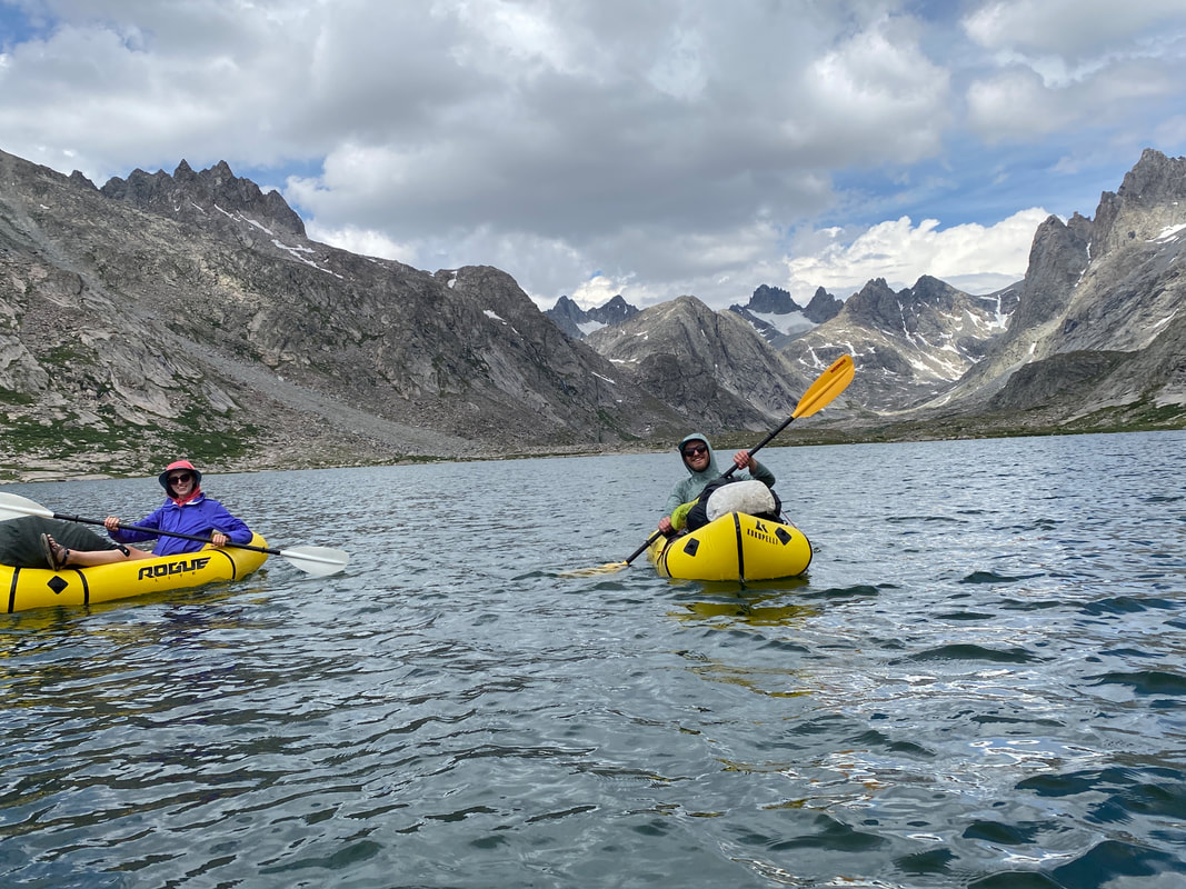
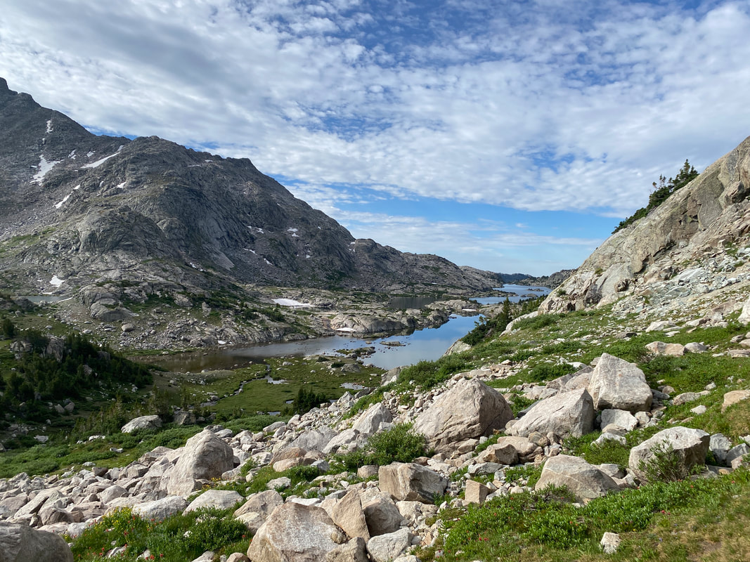
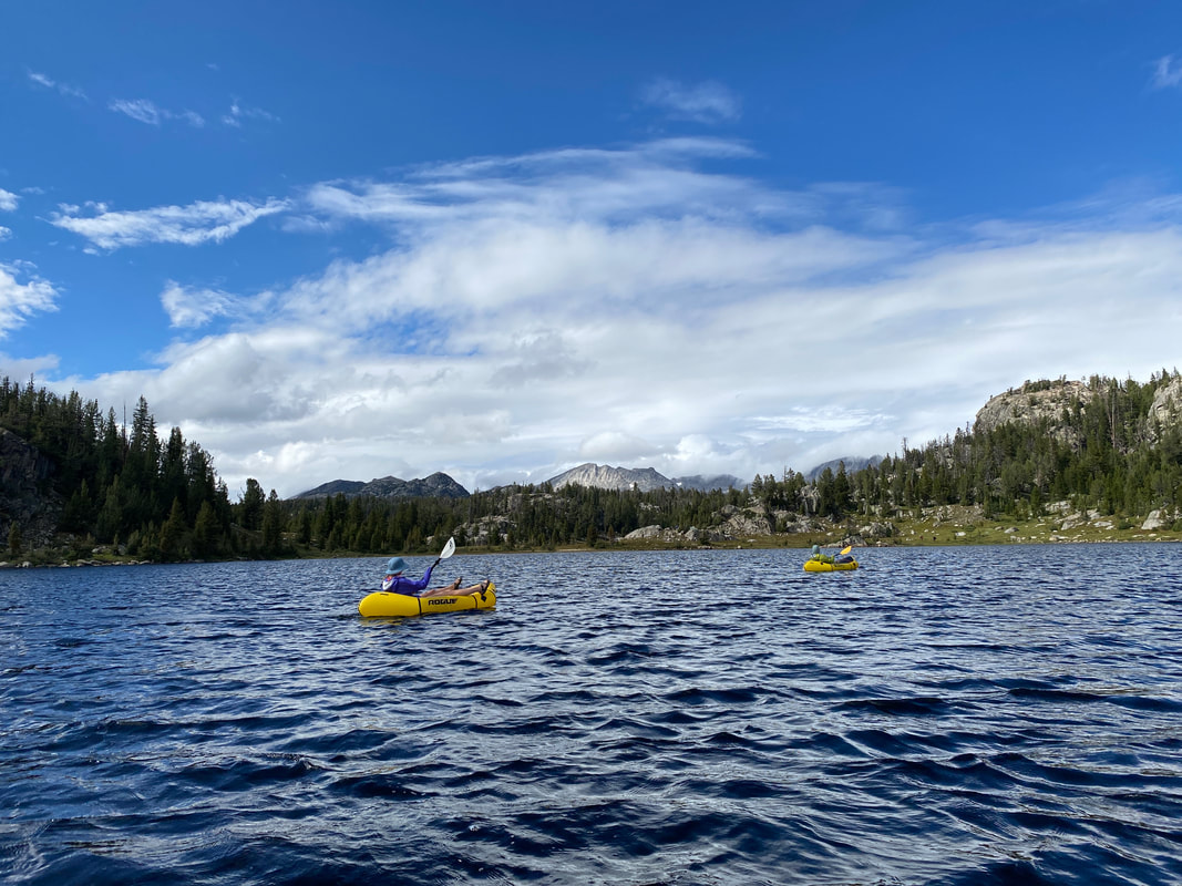
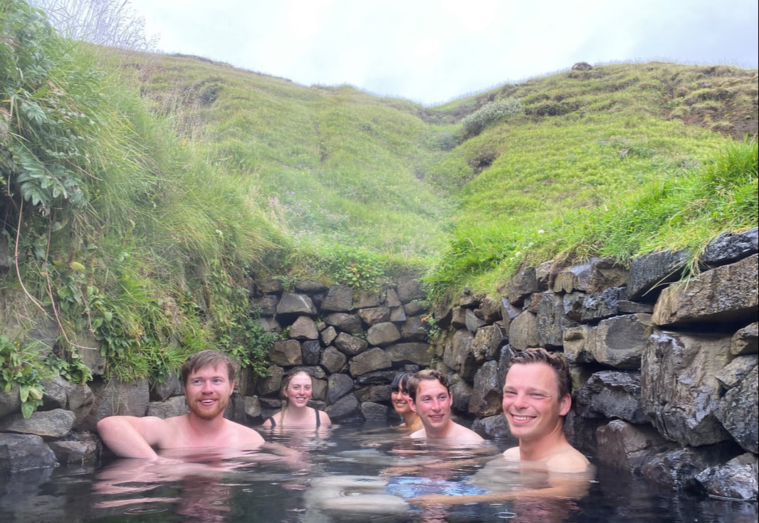
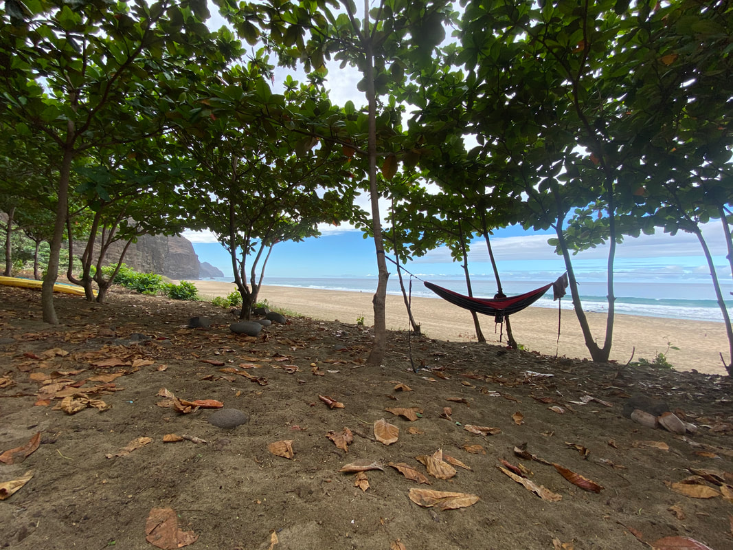
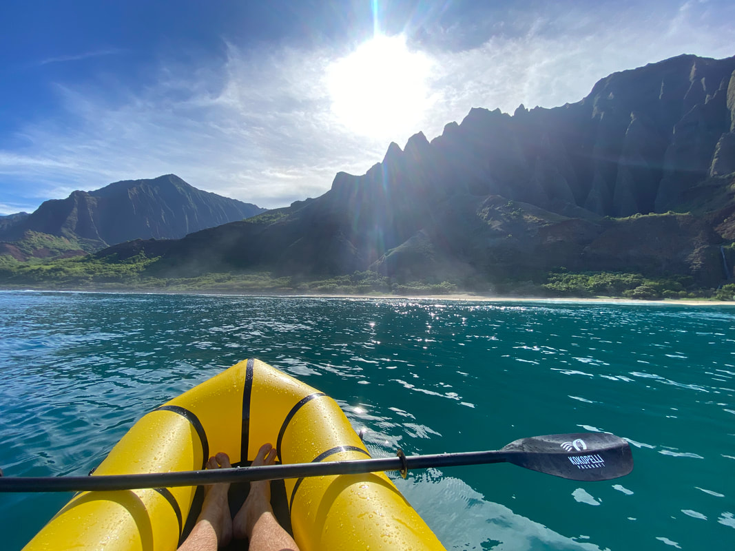
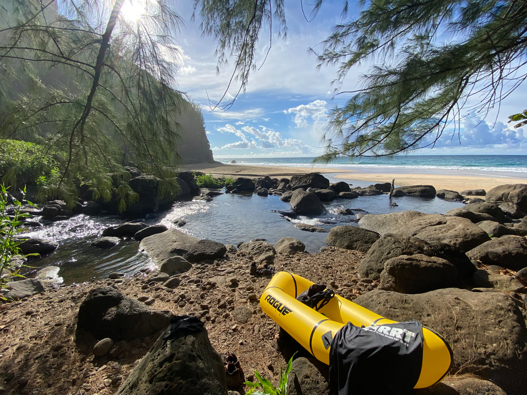
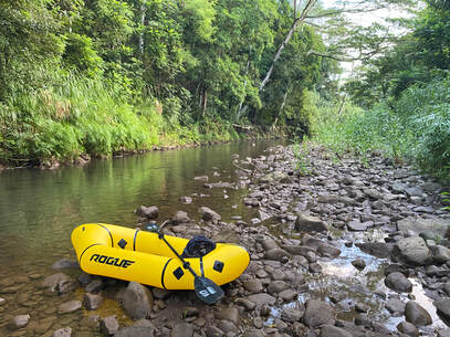
Around noon, we got the packrafts situated and hit the water. It was amazing… We had two, almost mile long, sections we got to paddle down the upper and lower lakes. We had a great time; paddling was a pleasant change from hiking after the knee pounding hike up and down Knapsack Col. As we neared Island Lake, we had a decision to make, continue the main high route or detour lower towards Wall Lake. After our morning in more snow than expected, knowing our pack weights and knowing that bad weather was coming in later in the week, we opted to take an alternate. By the end of the day, we were sitting in a beautiful lakeside camp at 10,800’, just below our 11,200’ pass for the next morning. Very early on in the planning for this trip, I came to the conclusion that we might not walk the exact line I’d charted on the map. Unforeseen circumstances, weather, high snow or a slew of other factors could change what was actually possible and safe to do in the range once we started. The spirit of a “route” is finding wild places and doing wild things while traversing from point to point with your best judgment and safety always in mind.
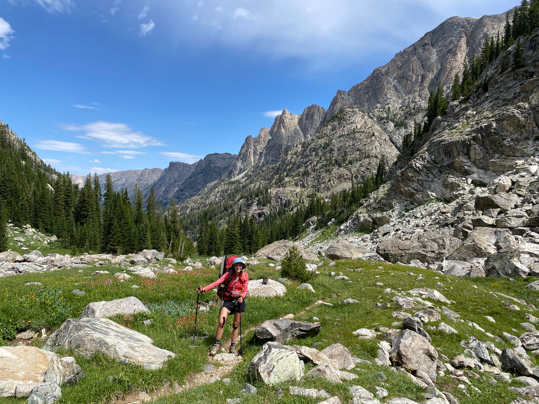
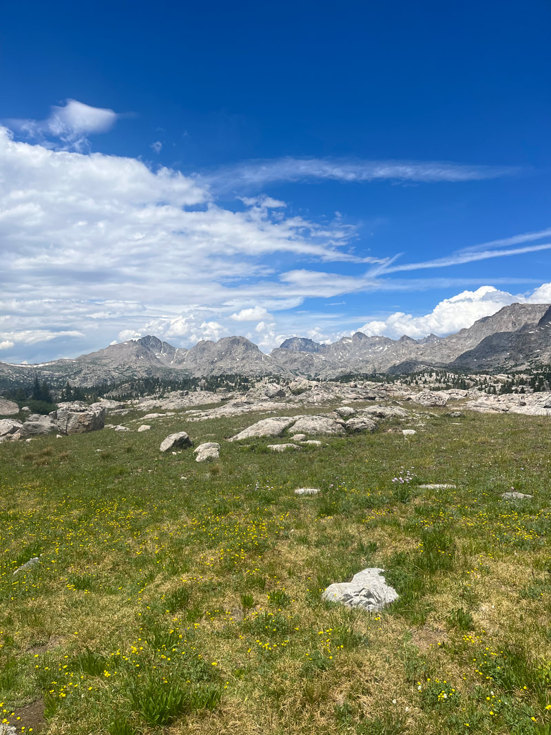
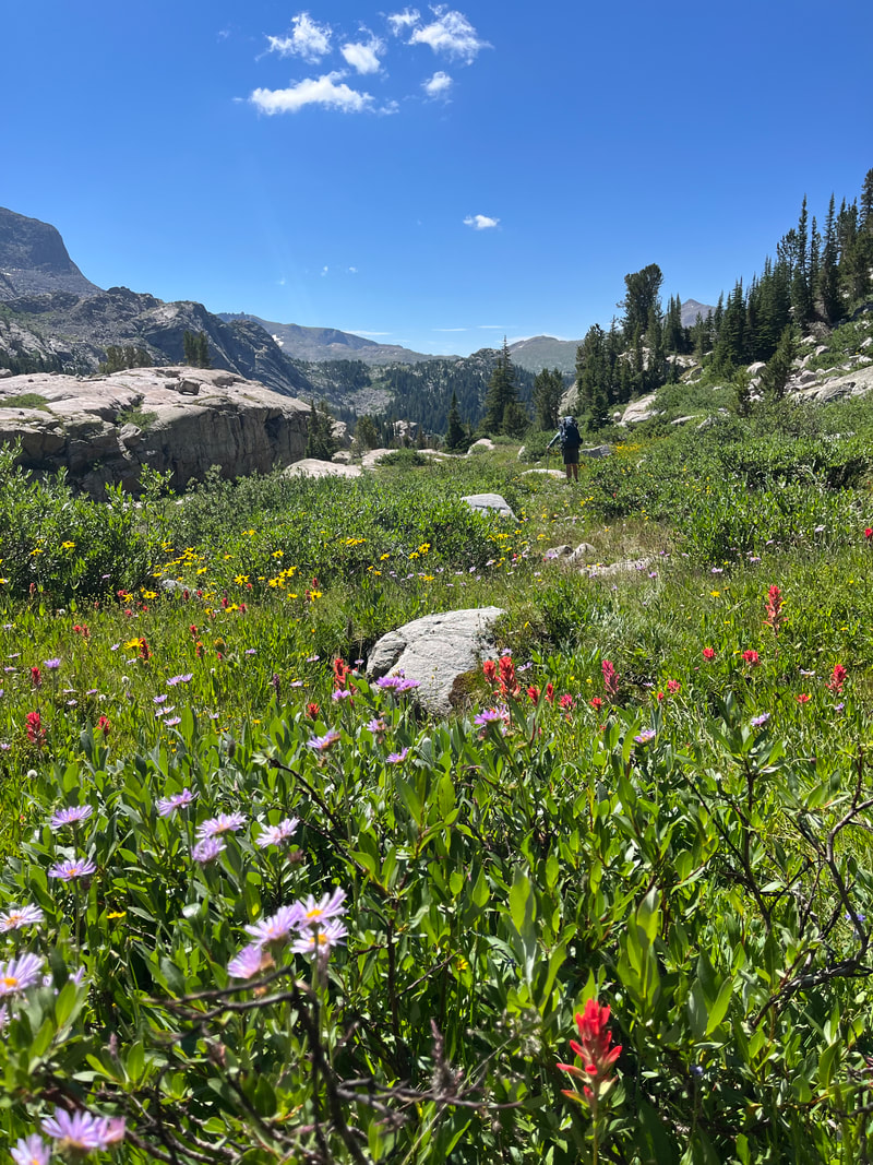
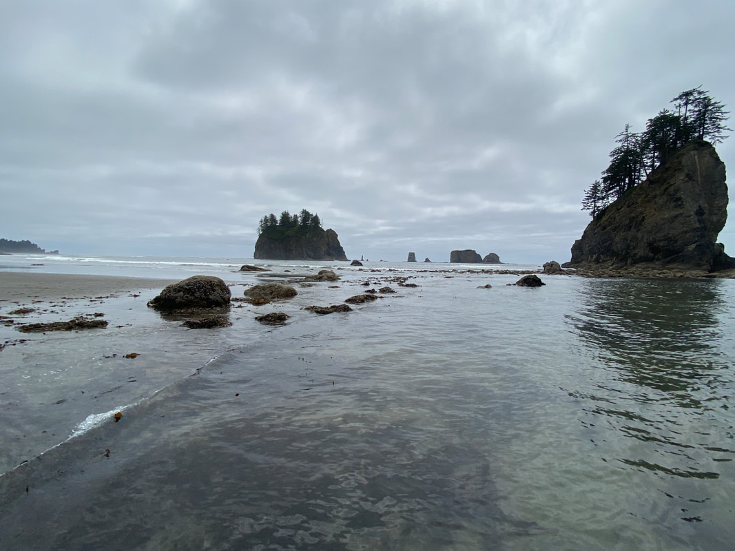
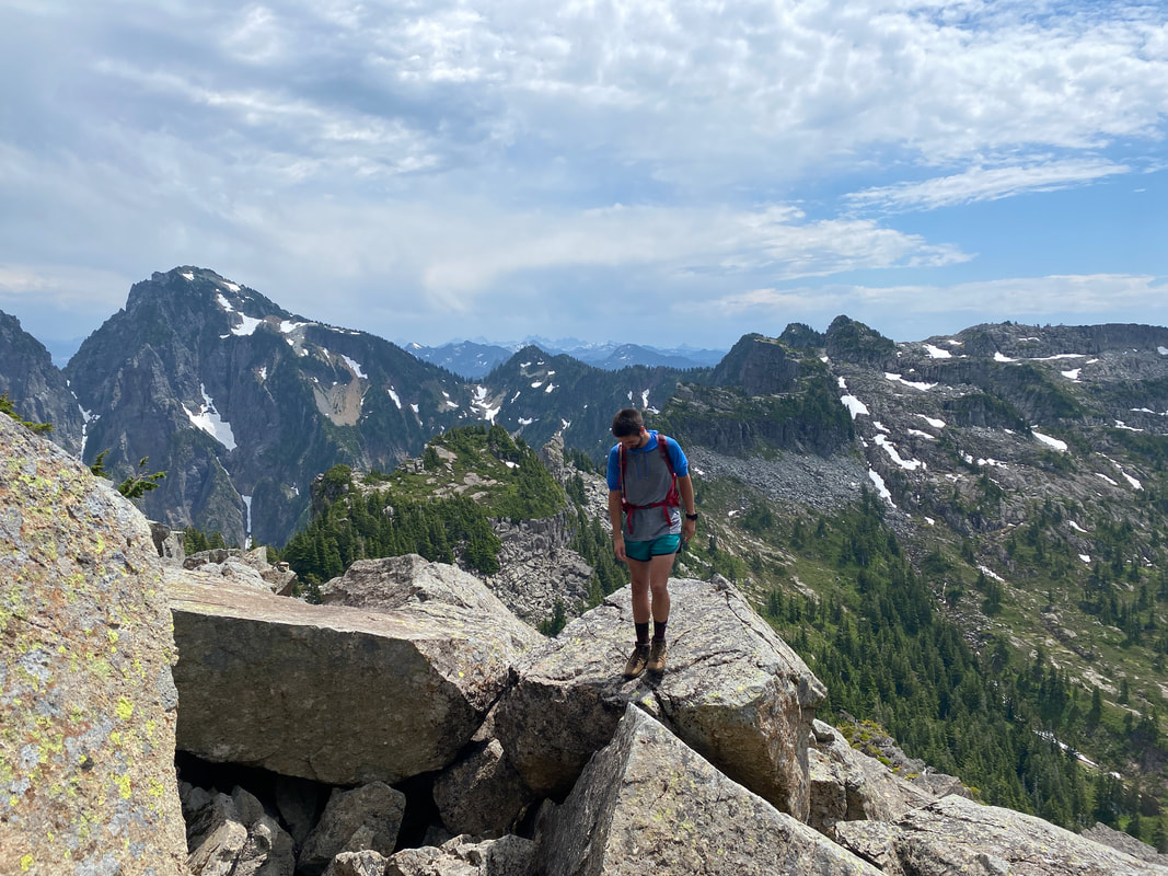
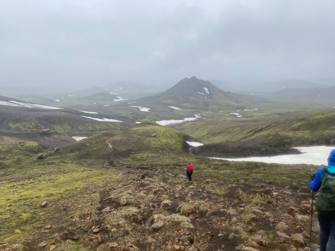
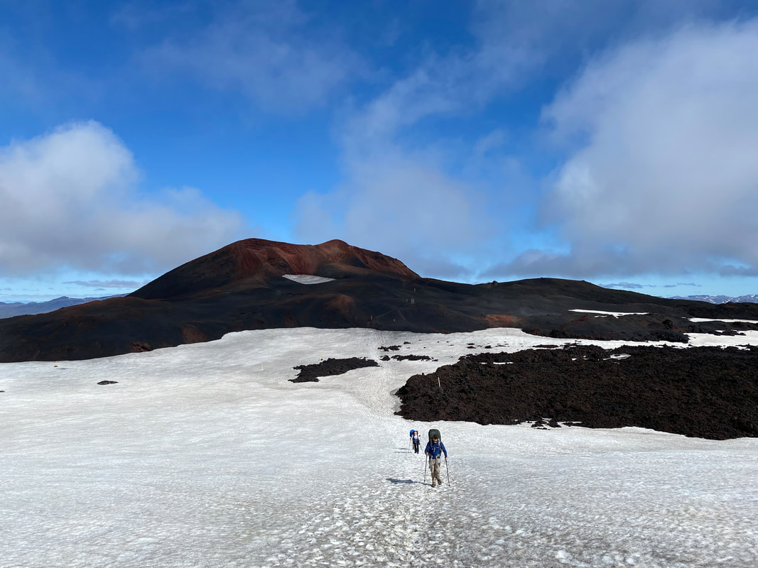
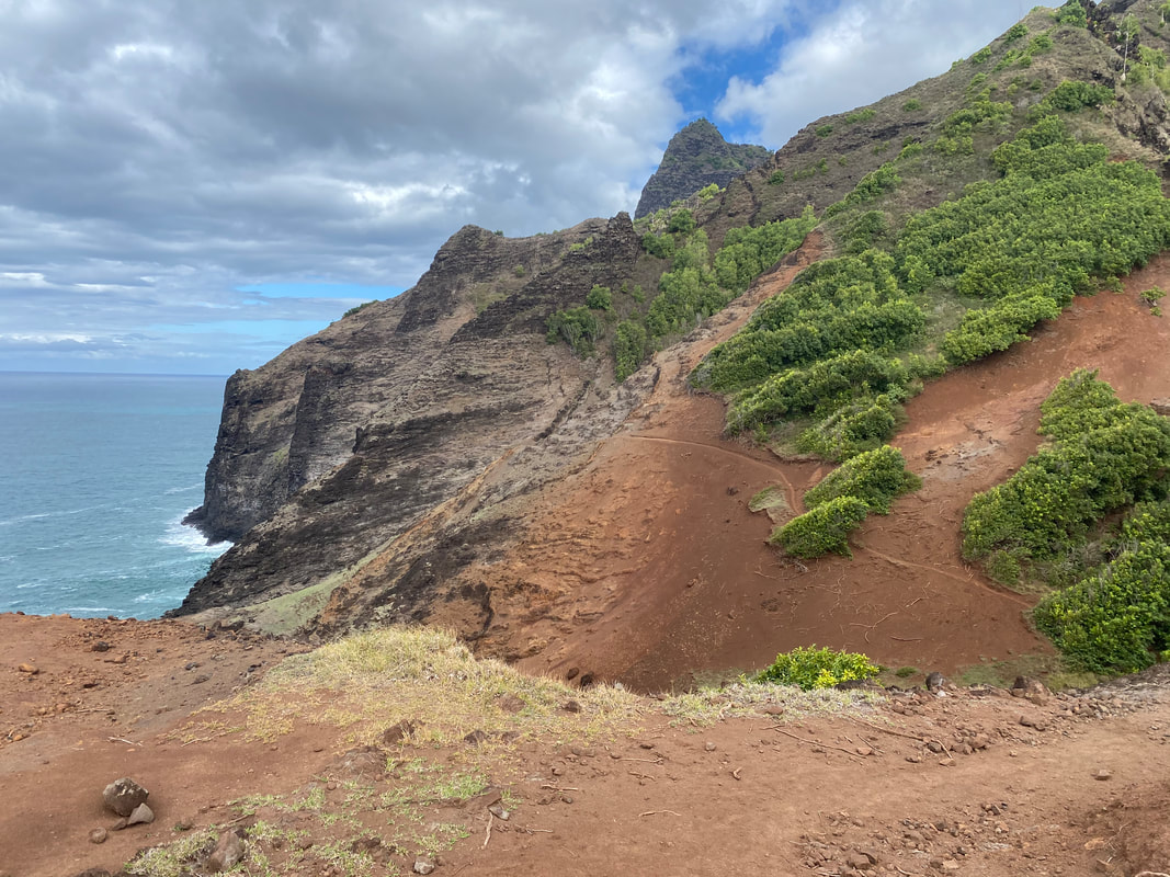
Day 4 As the sun broke over the ridge, we got walking. Our goal for the day was to cover some off trail miles, paddle a lake we had no idea about and make our way back to the CDT to get our resupply and head south towards the Cirque of the Towers. It was a cruisy pass and a fun downhill, there were wildflowers everywhere. We hit the water by 10am and spent the next hour enjoying a beautiful paddle down a gorgeous lake. Wall Lake seemed like a dreamland, a body of water completely surrounded by mountains and about as varied as you could get with sandy beaches, steep cliffs and waterfalls pouring in. As we made our way down the lake, we looked for takeouts and made sure to not get too close to the outlet of the lake, a 50-foot waterfall. Eventually we found a rocky beach not too far from where a trail supposedly picked up and headed overland towards it. Again, it was magical, the high country was covered in wildflowers and we quickly made our way back to the CDT. After 3 days mostly above treeline, it was a treat to be back in the sporadic forest along the CDT.
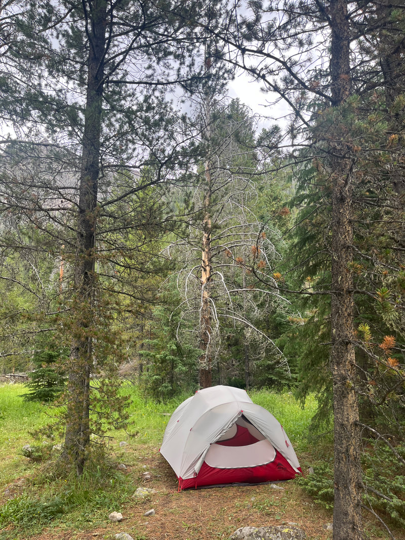
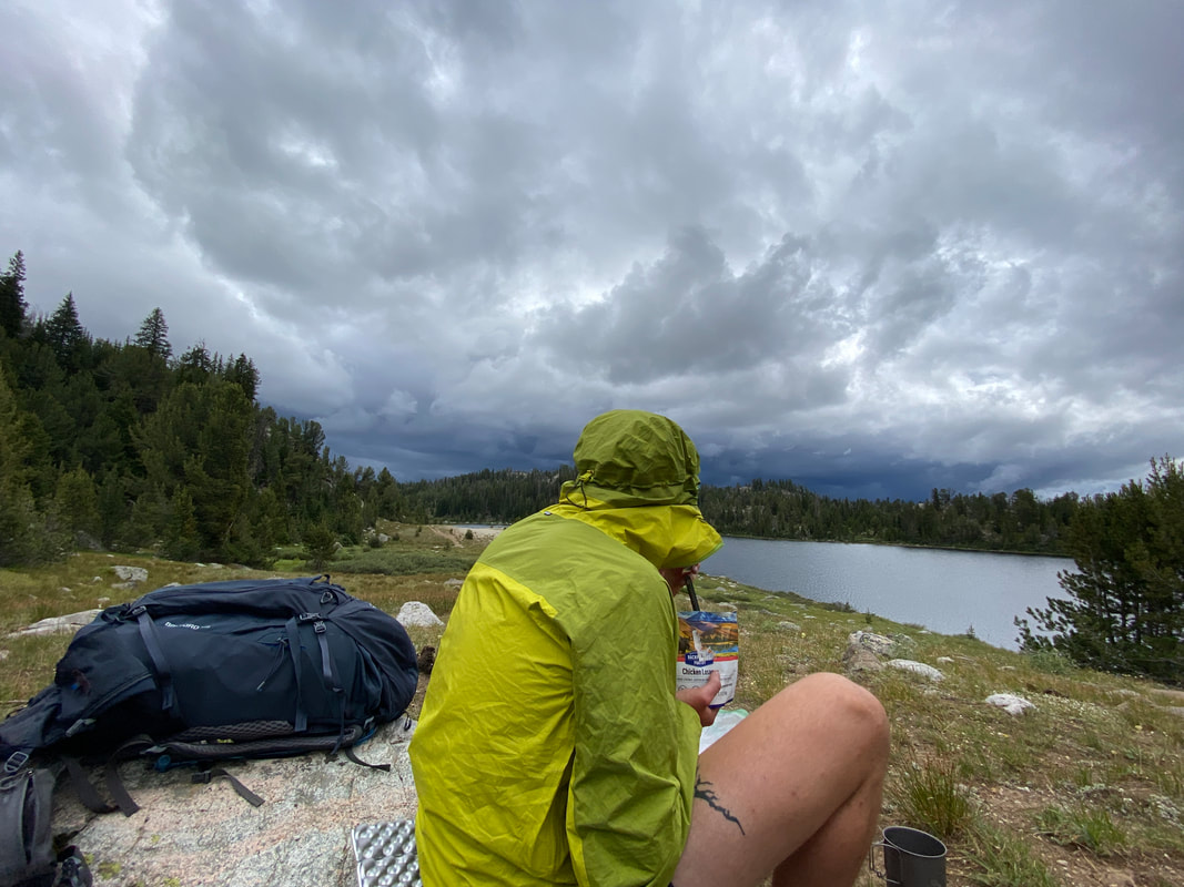
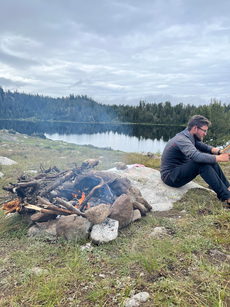
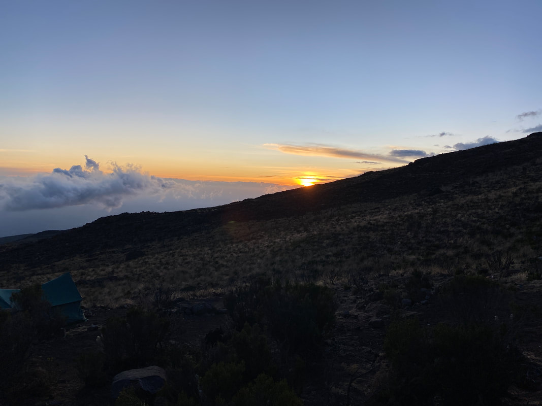
We pushed south as the clouds rolled in, chatting with other hikers about the weather and the upcoming terrain as we passed each other. By 4pm we still had a big pass to get over and rain was coming down softly. The higher we climbed, the less it seemed to rain, a little present from the trail gods. Eventually we made it to our home for the night near Rambaud Lake, a nice little basin just above 10,000’. It had been a long day, almost 14 miles between paddling and hiking, we were all exhausted. We went about our various tasks, setting up the tent, filtering water and this night, we’d have a fire to dry out our wet shoes. The rain held off for us a little longer and it was pleasant. As we sat by the fire and ate dinner, we all recovered a bit from our rough day. We found our way to the tent for some bedtime cards before drifting off to sleep.
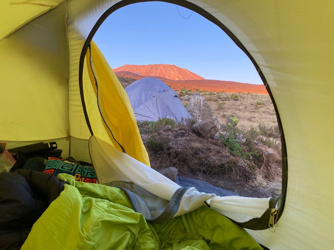
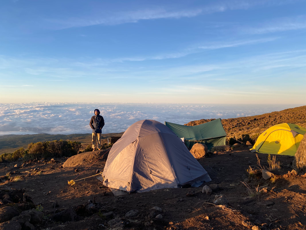
Day 5 Today was a lazy morning, due to our earlier detour from our original route we’d be arriving to our resupply point quite early today. We had coffee, enjoyed the warmth of our sleeping bags and let the tent dry off a bit after the rain from the night before. By 9am, we were up and walking, heading south along the now familiar line in the dirt of the CDT. The morning brought us cruisy miles, cloudy skies and pleasant hiking temperatures. As we hiked our eight miles to camp, we crossed several chilly streams, hypothesized about what time our resupply would arrive the following day and played talking games. For being a shorter day, it was a wonderful and enjoyable day. By 1pm we’d arrived at Sandpoint Lake and scouted out a tent site with a good vantage point over the lake and surrounding trail. We wanted to be able to see anyone passing by and we wanted them to easily be able to see us. We went about setting up camp and diving in and out of the tent between rain. By 3pm a large storm had moved in and we were hunkered down in the tent, reading and hoping for a break. Luckily the storm broke and we had a few sunny hours for a paddle on the lake, drying wet clothes and a nice dinner before we fell into our usual pattern of cozying up in the tent and playing a few hands of rummy before bed. As I fell asleep, the next storm rolled in and getting the resupply delivered the next day was on-top of my mind. If they showed up, we had 4 more fun days heading into Cirque of the Towers, if they didn’t, we’d be scrounging food and running the twenty miles directly back to the car the following day. I hoped for the best…
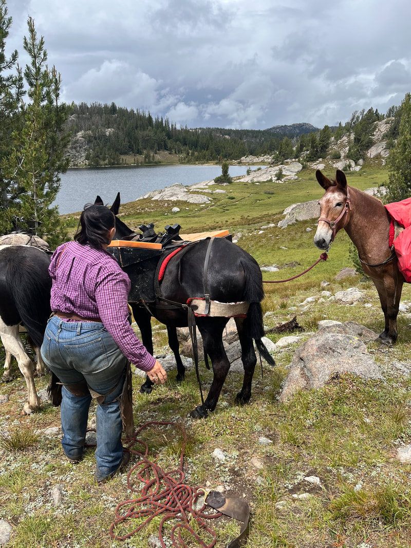
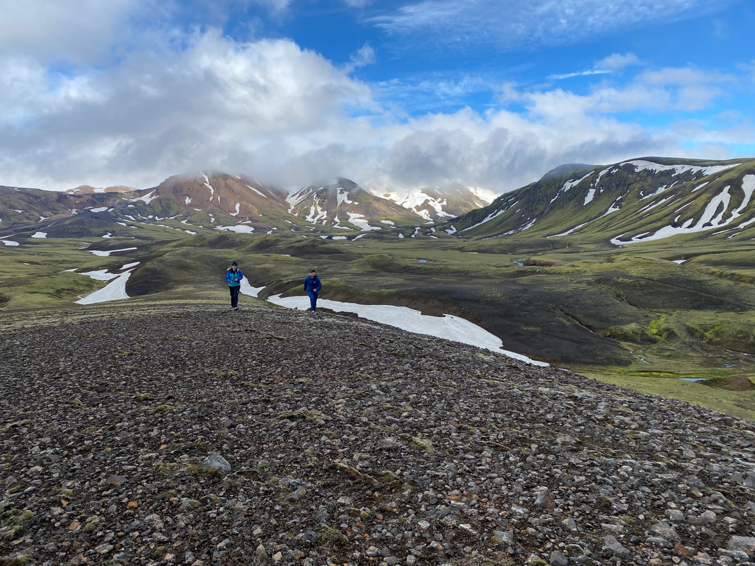
Day 6 By 6am I was up and had a fire going, we hopped the smoke and smell would help the horsemen find us. Emily and Dalton slept in on our day of rest but eventually wondered out for coffee and breakfast. Every hour, one of us would walk the half mile back the way we came to the Middle Fork Lake Trail junction to ensure they hadn’t left the food at the north end of the lake. By noon it was gently raining, we’d seen hikers pass by but no one had seen any horses or supplies besides the trail. We scurried into the tent to play rummy as the rain picked up and peaked out of the tent every so often to look over the trail around Sandpoint Lake. It was a slow morning and we were all getting anxious. Around 1pm we heard a clunk clunk clunk going down the trail and peaked out again. There was a woman riding down the trail with three horses, we clambered out of the tent and hollered “Are you from Bald Mountain Outfitters?!” Sure, enough she was and a minute later she’d climbed up to our camp on horseback and we were rearranging supplies. She’d been roaming the mountains for 30 years and knew all the trails and basins, one of the friendliest people we’d met so far. After a few minutes of shuffling supplies, she was off to her next group and we were frantically packing camp trying to get moving before the afternoon rain arrived. We covered 9 miles through rolling terrain and on and off rain. We’d all had in our minds for a moment that we might be heading back to the car but we’d have our chance to polish off the route. We camped a mile from the Cirque of the Towers Cutoff trail next to a rolling creek. We put on Dodgeball for a nice tent movie night, when it finished I fell into a deep sleep, happy that all of our plans were working out.
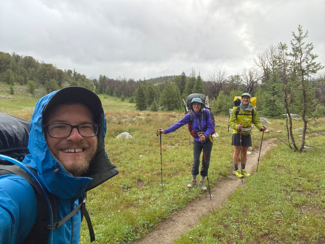
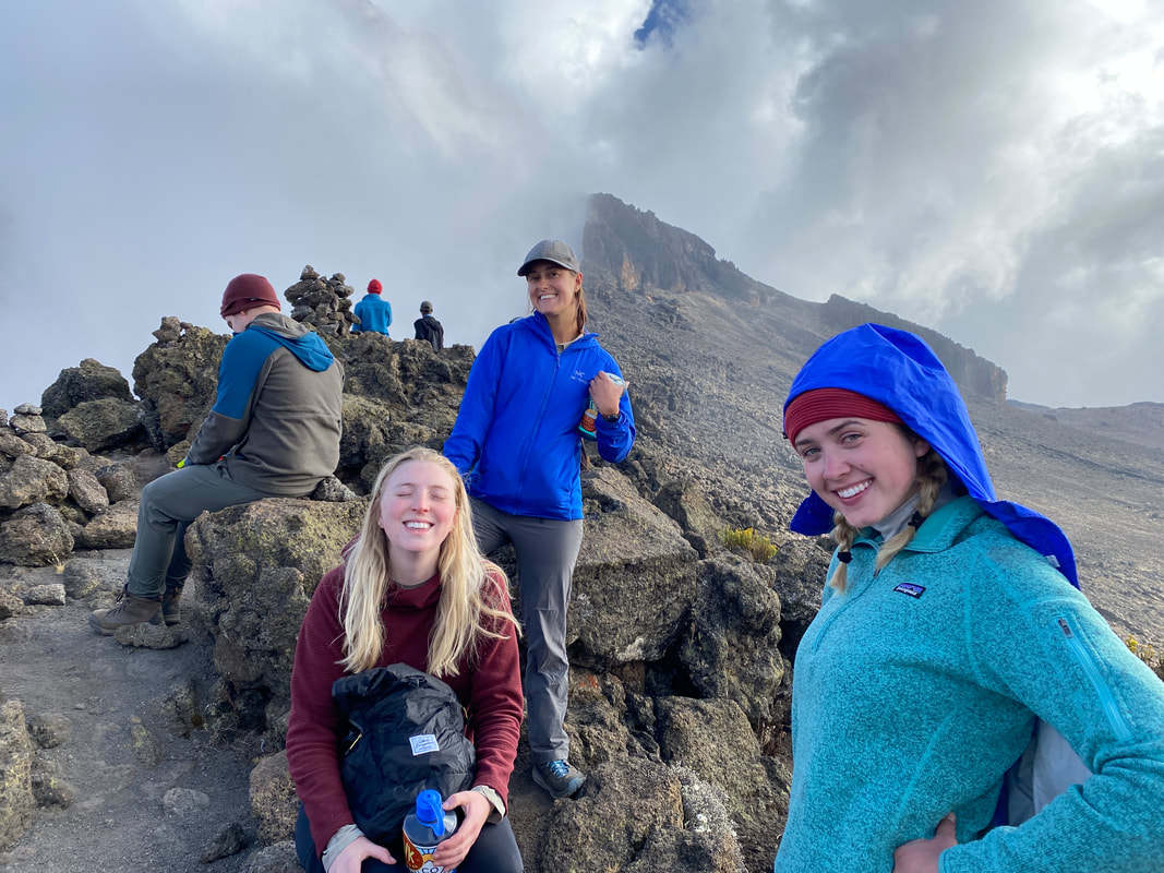
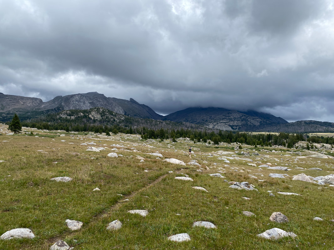 Day 7 It’d rained every other hour through the night, it was supposed to be mostly dry. The tent was soaked, our sleeping pads were wet, our shoes were still wet from the day before and morale was low. All of us were slow to wake up, no one wanted to leave the tent into rain. We spent almost an hour eating breakfast and debating whether or not to go in The Cirque and add another day or cut our losses and hike the 9 miles straight to the car to be warm and dry that night. Thinking about cutting a trip is never easy. No one wants to end early or think of something as a failure. In my mind, I had been to The Cirque in good weather and in bad and knew there wasn’t much reason to go up if it’d be socked in the clouds for the next 48 hours. Eventually we got hiking and when we got to the cutoff, we took a vote on whether to go up or head out. The decision was to leave. We were done with a beautiful trip that came to a wet and rainy end.
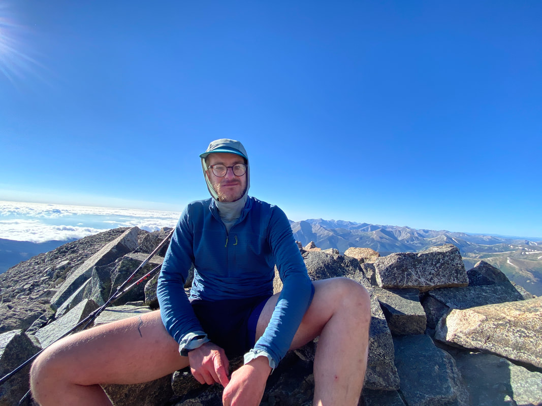
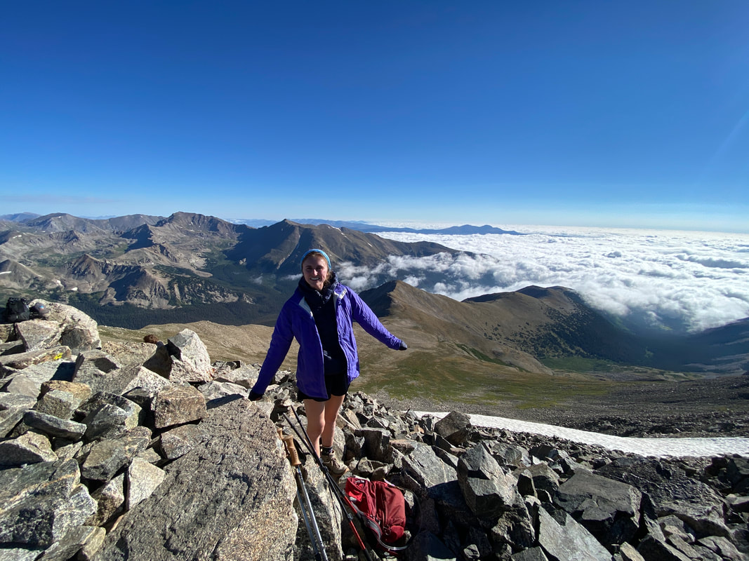
By noon we were at the car and by the evening we were in northern Colorado telling stories to our friend Maddie, who’d invited us to stay on the way back. We got to enjoy a warm home and chow down on some delicious nachos. It was a great time. In the days that followed we’d explore the state park Maddie was a ranger at, we’d eat more food than our bellies could handle and we’d head out to Central Colorado and bag multiple fourteener summits. We took what time we had left from our original plan and made the best out of it. I was somewhat bummed the original plans didn’t work out but I was happy by what all we’d done and filled to the brim on my adventure gauge. We were all tired and ready for rest.
Whenever you set out to do big things, you have to be willing to adapt, you have to find the fun in the tough moments and enjoy whatever happens. I think the biggest lesson this trip taught me, a lesson I continue to learn, is to be fluid when trying to make big plans. Don’t get crushed when your idea doesn’t work out, adjust and find the next way to keep having a good time.
0 Comments
We’d summited Rainier, we’d accomplished the goal we’d traveled to Washington to accomplish but we were still hungry for more. The hope was to get a permit to climb Mt. Saint Helens, the route is about 9 miles with 4,600’ of vertical gain, compared to Rainier it would have been a walk in the park. As we left Mt. Rainier National Park and headed for Aberdeen, Washington we tried to get permits but the system was confusing so we figured we’d call the National Forest Service the next day with hopes they’d be able to point us in the right direction. Aberdeen was a treat, hot showers and soft beds at a nice little motel, beers at the local brewery and a nice dinner for Emily’s birthday that day. It was nice to celebrate what’d we’d done and relax for a little bit before we were off on whatever adventure was awaiting us the next day. When I woke up, I immediately called the Forest Service, they had less than stellar news…. Apparently two years before, the permit system for St. Helens moved online. All the permits for the month get released on the 1st of the month at noon that day, the only way to legally climb the mountain is getting one of those permits. Sometimes people cancel their permits and some will appear but it’s not often, and with my personal experience with Recreation.gov, canceling a permit is a pain in the ass…. Climbing St. Helens was likely out of the question for this trip. We continued north along the Olympic Peninsula to Forks, Washington to scratch Lizzie’s Twilight itch and to scratch my itch to go to the beach. We did a little driving tour and then eventually found our way out to the Washington coast near La Push. The cool ocean breeze, sound of the crashing waves and hazy sky were a treat to my soul. There is always something magical to me about wandering through the coastal rainforest and coming out on an isolated beach. If I were to live anywhere in the US besides Colorado, it’d be Washington…
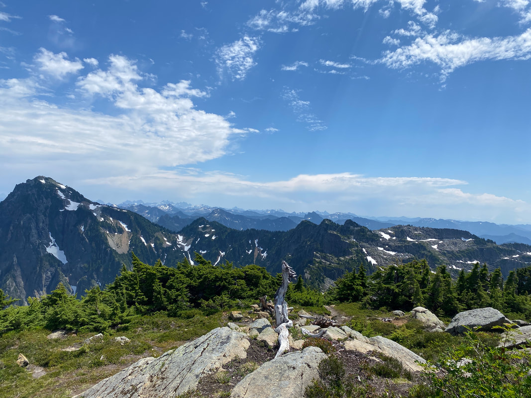
After a full day on the Olympic coast we headed down to Portland to meet up with some friends for the next two days before swinging north back towards Seattle and the Skykomish Valley. Our friend Sam had invited us to go climb Mt. Index with him. We had no idea what we were signing up for but gladly joined at the offer. Sam met us as the sun was setting and we started our drive high up the mountain side. We zigged and zagged up old logging roads, gained almost 2,000’ vertical feet in a couple of switchbacks. Eventually we found a little spot to pull off and sleep for the night, it was a pleasant slumber before the long day we didn’t know was ahead of us the next day. By 6AM we were on the trail and climbing quickly, the trail seemed to go straight up. It was a perfect Washington morning, low cloud cover, cool and moist. The trail climbed through thick under growth before going through different layers of old burn and logging zones. Each time we thought we were reaching the top, the trail seemed to climb higher. Eventually we did find a break in the climb with beautiful views out across the valley. The low cloud cover brought out the sky islands and it was a magnificent sight.
Once we got to the final chute up to Mt. Perdex I knew the day was done. A 100’ snow field laid between us and the summit, some of us had bought ice axes, some of us had brough microspikes but none of us had brought the right gear to climb that gulley. Sam, Lizzie and Emily tried to find a way around it to no avail, they cliffed out about 100’ to its side. Once we all regrouped, we quickly traversed and climbed up to Mt. Persis enjoying the summit views of Glacier Peak, Mt. Shucksan and Mt. Baker off in the distance before descending for an afternoon swim in the alpine lake. It was a nice day in the mountains even though we hadn’t gotten the peak we were aiming for. It was a beautiful minor summit and a beautiful afternoon swim. After a knee battering downhill, we arrived back at the car and were off for pizza and beer. A few days later Lizzie and Emily would leave back to their homes and I would work from Seattle for the rest of the week before one final adventure in the PNW, a visit to Kat on the PCT in Sisters, Oregon.
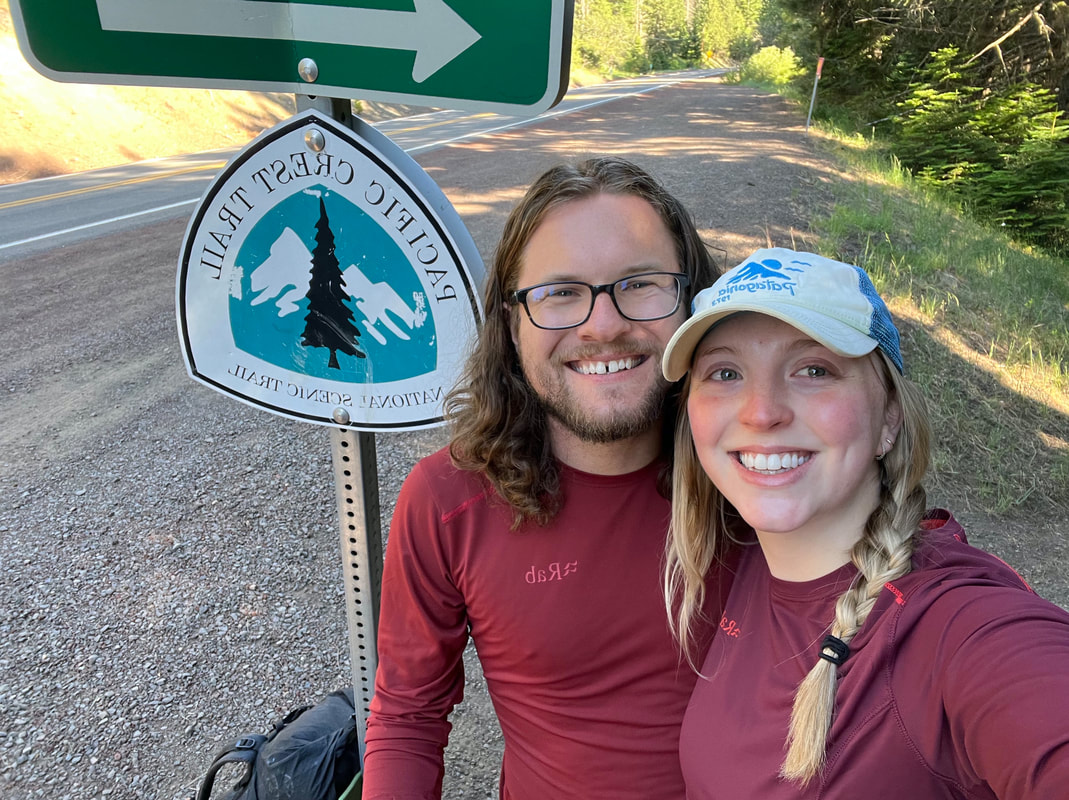
 In the two weeks that I had been wandering around Washington, Kat had already walked almost 300 miles to central Oregon. She was working her way through the beautiful Three Sisters Wilderness when I caught up to her near Santiam Pass. We got to enjoy a tasty lunch in Bend and a relaxing evening in Sisters, smelly Kat even got a nice warm shower before she headed back out to trail. Seeing Kat in Sisters was a nice crossroads for us, she was doing well on her journey north and I had done what I mainly came to the PNW to do and was ready to go home.  Kat and I hiked out to Wasco Lake just off the PCT and had one last evening together before she’d continue north and I’d head home to Colorado. We talked a lot about what the next few weeks had instore for both of us. We enjoyed some luke warm beers and a swim in the beautiful lake. I thought about how lucky we were that we had this moment to relax on each of our journeys, it was a nice way to cap off my trip. I’d wake up on Saturday and drive 18 hours home to Colorado Springs, a very long drive. I’m back now, and still pretty tired to be honest. As much as traveling is refreshing and a nice break, being home is also pretty nice. I learned a lot on this trip, to plan downtime, to pace myself, to understand the task at hand and how to complete it safely. Rainier was a pivotal moment for me and wandering around the PNW had me thinking a lot about where I want to end up long term. I’ve still got plenty of time to figure out what’s next but stay tuned for my last adventure of the summer, 11 days traversing the Wind River Range in Wyoming.
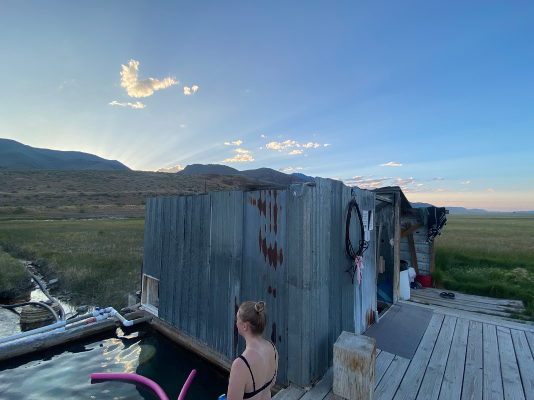
At the beginning of July, I wandered up to the Pacific Northwest to accomplish two goals. Goal one, drop my girlfriend Kat, off on the Pacific Crest Trail in Ashland, Oregon to finish the last 900 miles of the journey we started in 2021. Goal two, to summit Mt. Rainier, a dream that I’ve had since 2019 (at least). This would actually be my second time to the mountain with an intent to climb it, the first being back in 2019 when COVID and poor conditions made us scrap our plans. It’d been over half a year since I had gone on a major trip, the last being Kilimanjaro, so I was very ready to hit the road. Kat and I left Colorado Springs the weekend of the 4th of July and started a very long drive out to Oregon. We drove through the Alvord Desert and stayed at some hot springs I had visited on another trip in 2017, met some characters along the way, as one does on a road trip. We spent time talking, Kat spent time sleeping and I relaxed because as much work as driving can be, there’s something peaceful about being on the road, out of your status quo. After two days and 1,400 miles of driving we arrived in Ashland. Kat was somewhat hesitant to get on trail I think. Uncertainty of what lied ahead of her, fears of another injury and potential hike unfinished were heavy on her head, and honestly, they were on mine too because I wanted nothing more than to see her succeed. After some morning errands in town, I got her up to the trail at Callahan’s Lodge and we said our goodbyes. I drove some smelly hikers, a nice group of Brits, to town so they could zero, and found a nice spot for some trail magic. I was happy to be out wandering around on the PCT, not as a hiker this time, but as a friendly face to folks who I understood. Someone who traded stories, handed out snacks and cold drinks and encouraged them to continue onwards.
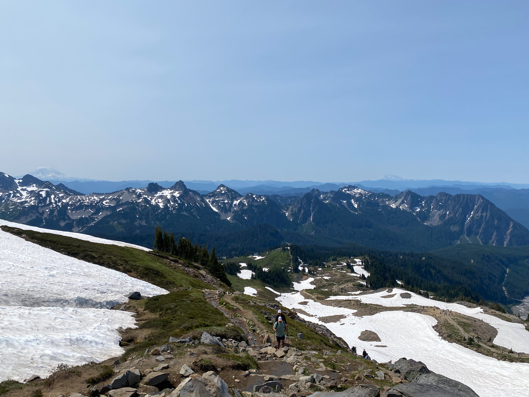
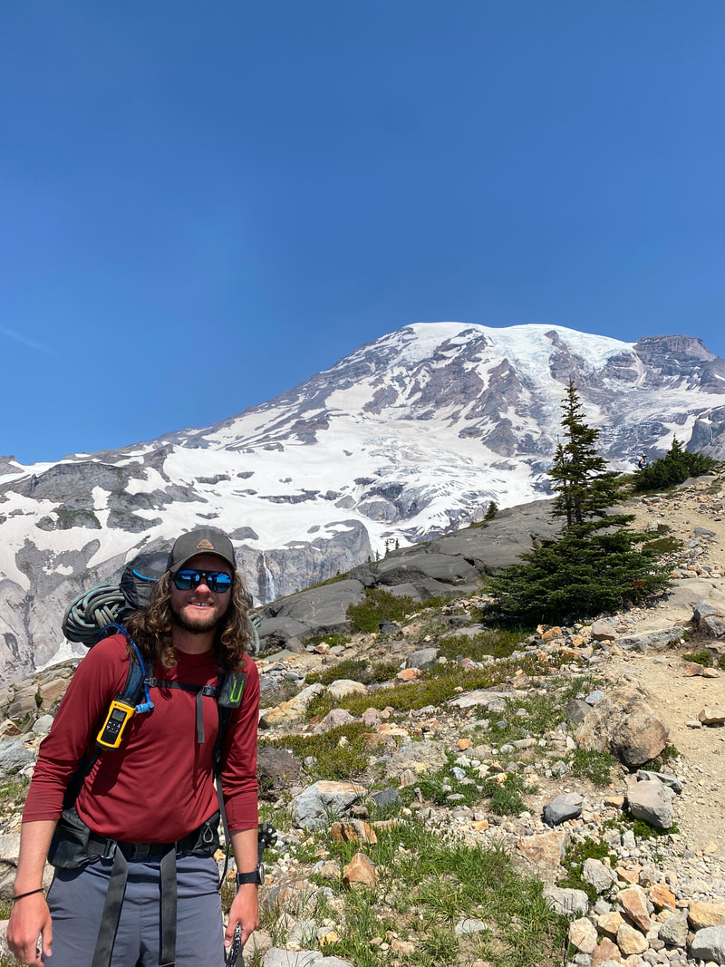
Eventually I had to pack-up my little trailside lunch spot and drive north to Seattle to rendezvous with my climbing partners, Emily and Lizzie. Over the next 24 hours, we all got into Seattle, stocked up on supplies and headed out to Mt. Rainier National Park. We’d been planning the climb for months but had no climbing permit. I’d managed to secure a camping permit for lower on the mountain but we still needed the climbing permits and hoped to get a camping permit for camp Muir, higher up at 10,500’ to reduce the summit day length. As we neared the park, we got trapped in some bad entry gate traffic for almost an hour and a half. We were lucky to get ahold of the Wilderness Permit Office, they informed us that there were plenty of permits left and to get to Longmire Ranger Station before close in order to get ours’ that day. Once we got through the gate traffic, we rushed to Longmire, I’ll admit, I drove a little faster than I should’ve but I was excited... The last barrier to our attempt was about to fall down. We got in, got our permit and were incredibility excited, three days and two nights on the mountain ahead of us, a perfect weather window and nothing but thrill. For the rest of that evening we’d rearrange gear, chat about our summit plan and eat some veggie tacos before nervously laying down for our last good sleep before the summit. The next morning was a short drive up to the Paradise Trailhead for a final gear check and then the start of our climb, a 5,000’ hike up to Camp Muir through tourist infested alpine day hiking trails and the Muir Snowfield. We hit trail around 10am and made good time on that first day, excited, fresh and happy to be there. Obviously, there was some nervousness but we chatted with folks who were on their way down and just about everyone told us we were in for a good time ahead. As the day went on, we got tired, it was hotter than expected and the sun beat down. By 3:30pm we had made it to Camp Muir and were setting up, melting water and starting to flush out gear for summit day. The plan was to wake up around midnight and cruise through the 4,000’ of vertical ascent between us and the summit by around 8-9am before hopefully returning quickly to camp to avoid slushy snow and changing mountain conditions in the heat of the day.
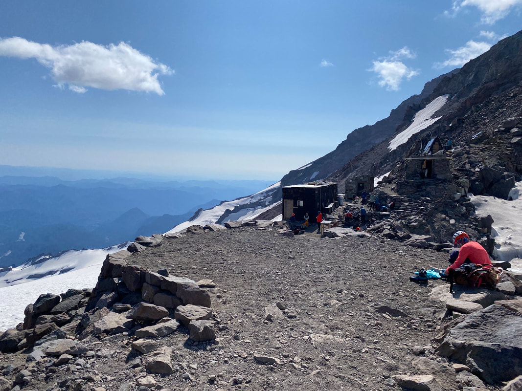
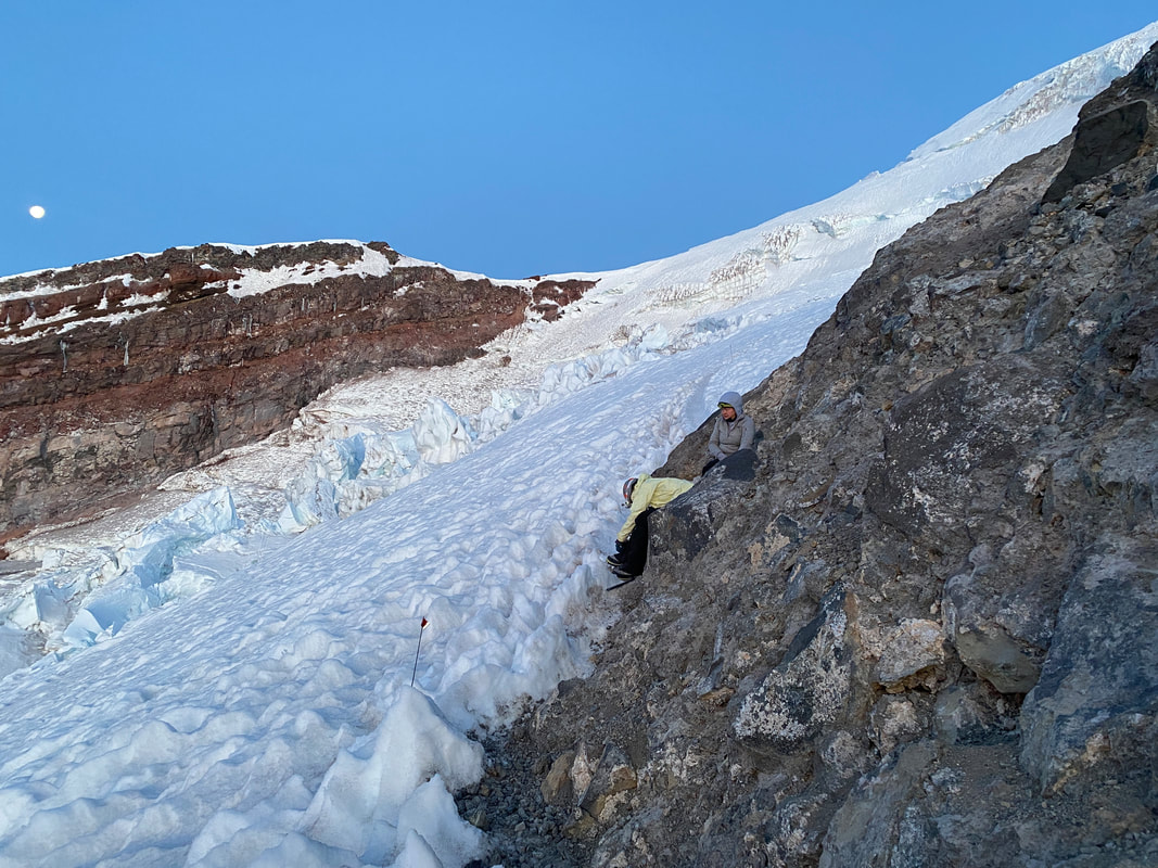
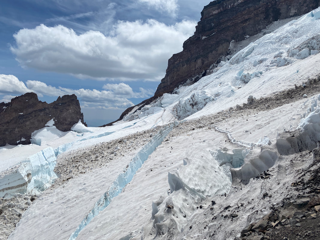
 Looking further up the route from Camp Muir, Cathedral Gap on the right. The NPS climbing ranger came around at dinner time and chatted with us. He gave us some pointers on what to expect, made sure we had the right gear to go up on the upper mountain and suggested that we start heading down by 10am if we were still on the upper mountain. After he walked away, we chatted for a bit. It was already almost 6pm, by the time we’d get to bed it would be atleast 7. There was a thought to take the next day off, stay in camp to relax, practice snow skills as a group and then head up the next day. I wasn’t sure that we’d have enough fuel to melt water for two more days and on top of that I’d likely have to ration food since none of us had really planned for two full days up there. We decided that we’d see how it felt at midnight and go from there. After about 4 hours of restless sleep, my watch buzzed, it was time to get moving. It was still warm, only down in the 40s, and the full moon was so bright you barely needed a headlamp. We checked in with each other one last time to make sure we all felt good with such little sleep and decided to go for it. By 12:45am we were off with the last of the teams to leave camp. Emily, Lizzie and I made good pace to Cathedral Gap, short roping a small rocky climb before entering onto the Ingraham Glacier and crossing to Disappointment Cleaver. There were a few crevasses we crossed via snow bridge and one ladder crossing you’ll get a picture of later but nothing was above our skill level. As we entered onto the Cleaver and short roped again our pace slowed, it was almost 3:30am and the darkness was starting to take its toll. Sleepy eyes wandering through the night with nothing more than a headlamp tends to make you drowsy after a bit. Short Roping: A mountaineering technique where you coil the rope and travel closer together to reduce rope drag on rocky surfaces.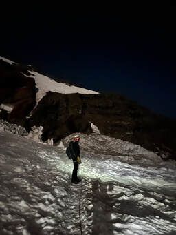 It took us just under two hours to climb 2,000’ up the Cleaver to Emmons Glacier. As we prepared to rope back up for the next section Lizzie told Emily and I that she wasn’t feeling well, tired and an upset stomach. As we sat, I said I wouldn’t be surprised if one of us threw up before the day was over from exhaustion and, sure enough, about two minutes later Lizzie lost her breakfast. She got some water down and another bar or two before we started talking about moving again. Lizzie said she felt good after she threw up but she needed to get some liquids back in her. So, after about a 45-minute break we roped up and continued the climb. By this point it was about 5:30am, we’d already been moving for 5 hours and there was still 1,800’ of mountain above us. The upper mountain was different than what we had gone through already, gradual switchbacks in the snow at first but then sections of steep terrain mixed in, quickly gaining elevation. Around 7am we came across a slightly technical crevasse that Emily and I maneuvered over with some big, almost ice climbing, moves but Lizzie got stuck. She couldn’t figure out how to get good purchase on her ice axe strike to pull herself up. The more the axe slipped, the more nervous I could tell she was getting about taking the two big steps needed. Eventually after some adrenaline and anxiety and loud encoragement between all three of us she got up and over.
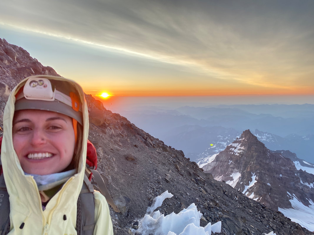
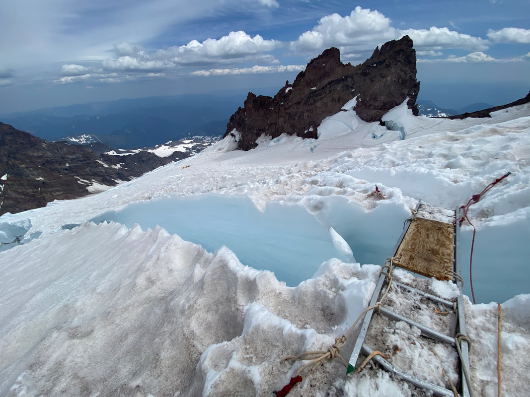
8:30am eventually arrived and groups were consistently passing us on their way down. They’d give us words of encouragement and let us know it wasn’t that much further. In my mind the fear of not summiting was starting to set in, we were moving slow, taking a break on every other switchback. Emily and I absolutely did not want to be the last ones on the upper mountain coming down incase of a fall. We decided to set a hard turnaround for 9:30am, if we weren’t looking at the summit by then, we were heading down. As we continued to climb higher, the terrain gave way a bit. Steep climbs turned to minor hills around big crevasses and rolling sections, each easier than the last. By around 9am we were standing in the summit crater, with two other teams, the small pinnacle of the summit 100 yards in front of and about 100’ above us. We dropped our packs, un-roped and raced across the cone to the summit. At 9:20am we were standing on the summit, 14,409’, taking photos and basking in the feeling of accomplishment with the other three teams up there with us. It had been an incredibly long morning, over 8 and a half hours moving to reach the summit and we had to do it all over again on the way down. There wasn’t much time for a break, it was late in the day now and the snow conditions were deteriorating rapidly, turning to slush right below our feet. As we got ready to head down Lizzie told me that she felt the worse she’s ever felt on a climb and alarms went off in my head. Suddenly we needed to get down quickly and with extra care, she was likely dehydrated from throwing up and us not being able to take many long breaks on the way up with the altitude on top of that. We flipped Lizzie into the middle of the rope team and started our way down moving as fast but also as carefully as we could. 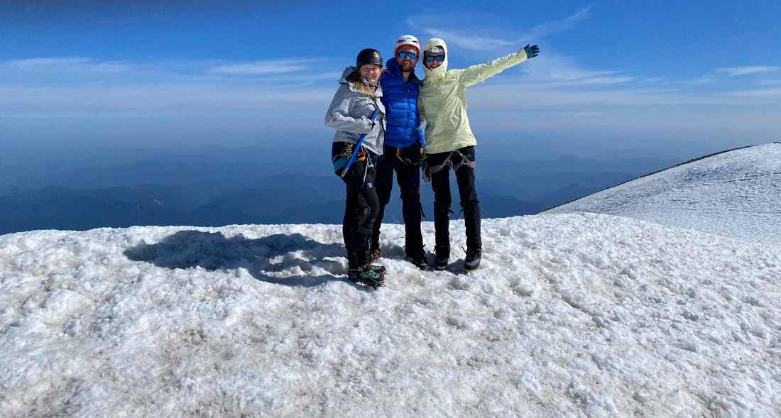 After about an hour we had already descended down over 1,000’ and Lizzie was feeling better. We were able to bypass some crevasses that had opened up across our ascent trail and make it back to the top of the Cleaver by 12:30pm or so. With a long break and some scrambling to wake us up, we got to the base of the Cleaver around 2pm. It had been a long day and we still had about a mile and a half to go back to the safety of Camp Muir. Back on rope, we crossed the bergschrund back onto the Ingraham Glacier for the final quarter mile of technical terrain before it was just a snow walk back to camp. We gingerly crossed a few snow bridges that, as I write this three weeks later, are most definitely melted out, making our way to the final crux, the only metal ladder of our climb. On the way up, the ladder wasn’t intimidating, the snow was solid, the deep void into the crevasse was dark so you couldn’t see your potential icy fate, we had fresh legs. On the way down, every time we crossed hazards, we’d been letting out slack to cross and having the other members of the team plant their ice axes in a snow seat or self-arrest position for safety. We assumed our positions and I was the first to cross, one rung step, two steps on the wooden plank, one more rung step, I was stuck…. Teetering on the last rung of the ladder bridge, I couldn’t move.
My harness was holding me back, tugging me in the wrong direction. I dared not to move and fall backwards into the void, but I couldn’t go forwards. I yelled at my teammates to step forward thinking I’d run out of slack and a second later I plunged off the ladder, face first, into the wet snow. A knot I had tied into the rope for crevasse safety (it will catch on edges to stop you from sliding) had caught on the ladder and was holding me back. As soon as Lizzie got it unstuck, I was free to move to safety. Lizzie and Emily quickly crossed, being very careful with the rope as they did. We passed Ingraham Flats Camp as clouds began to gather on the upper mountain, I was happy to be down where we were…. After another hour or so of walking we descended from Cathedral Gap, Camp Muir in sight the whole time, crossed the Bowling Alley with the sound of rockfall above us and collapsed in camp. It was past 3:30pm, we had taken almost 15 hours to complete the 8 mile, 4,000' round-trip journey.
That night we’d sleep well, waking up to the other teams leaving for the summit and basking in the pleasant thoughts and dreams that we had already done that and would be back at the car the following morning. Around 7AM we hit the trail and headed down to Paradise. I enjoyed the mountain and being in the alpine before arriving back to Panorama Point and tourist hell. I essentially sprinted the remainder of the way back to the car to be done with it. By the afternoon we were off and heading to Aberdeen, WA for hot showers, beers, a delicious dinner and a night in a bed. Lizzie, Emily and myself all came to the agreement that Mt. Rainier taught us more than almost any other climb any of us had done. The mountain was challenging, unforgiving and varied. There was more rock on Disappointment Cleaver than we’d expected, the day took longer than I’d expected and the mountain didn’t give itself up easily. I learned that heat truly is your worst enemy on a mountain like Rainier and that you absolutely need to keep a cool head up there (I lost mine a few times, and to my teammates, sorry for that if you read this!). I accomplished a goal, to lead a rope team on Rainier. Would I go up again? Had you asked me two weeks ago, no, now I’d have to think about it. For me, the biggest lesson learned was where my limit is. There are other climbs and dream trips I’d now be comfortable with doing and there’s now climbs and dreams that I don’t think I could ever do on my own without a lot of continued growth. The mountains are a place of beauty and a place of learning, I’m always honored when they present me a lesson. More about the rest of my two weeks in the Pacific Northwest in Part 2 – “The Road Trip” …
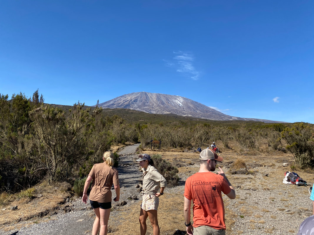
Kilimanjaro was a turning point and a big moment of growth for me as a traveler and a mountaineer. In January of 2022 I set my sights on Kilimanjaro. Post PCT in 2021 I wanted to line myself up for a big year in 2022 so I didn’t mentally tank after my months long adventure. In 2022 I had attempted the Presidential Traverse in New Hampshire, gone to Iceland to backpack the Laugavegur Trail and now I was heading to Tanzania to climb Kilimanjaro, the 19,431’ highpoint of Africa, and set foot atop one of the seven summits. For Kilimanjaro I opted to do it with a group, I felt that this was the way I most enjoyed traveling and would give me the most reward in this endeavor. I also knew that I had a lot of friends out there interested in the climb and bringing more people along was a great way to bring the cost down. Ultimately in July of 2022 we had a crew of 10 locked in and booked. I took charge of group travel logistics and booked everything in-country for the group; hotels, airport transfers, etc. It was awesome to take what I had done with trip planning domestically with UCMC and apply it to a trip like this, it was also a lot of pressure.
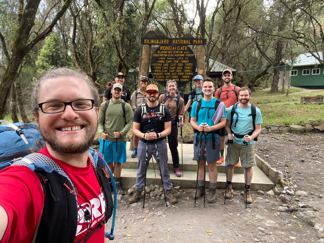
The group took off from 5 different airports in the US and arrived in 3 different groups in Tanzania on two separate days, I was the last to arrive. Having everyone finally in-country and ready to go was definitely a big weight off my shoulders as I often felt responsible for everyone at certain points along the way. Our hotel was nice by US standards and luxurious by Tanzanian standards. The first night we met with the guides, went over everyone’s gear individually and got setup to start out the next day. It was a light atmosphere and for the most part everyone was excited to get going. There were a few points during our pack shakedowns when people got a little heated with the guides for various reasons (guides wanting members to have additional layers for cold days, comments on not letting us carry our own backpacks and wanting us to carry lighter daypacks, etc.). What I will say is, the guides have your best interest at heart, they want to get you up the mountain because they want you to tip them well for it. That being said, when I stuck to my guns and said this is what I have, this is what I’ve done in this gear and this is what I’m doing on the mountain they let me run with what I wanted to do. On day two we left for the three-hour drive to the Rongai gate, we had opted for a route up the rain shadow of the mountain that would take 6 days to complete car-to-car, 5 days to the summit and an additional day to descend via the Marangu Route back to the road. When we arrived, we were met with our porter team and were immediately struck by their number. For our group of 10 the typical team on Kilimanjaro includes: 1 head guide, 3 support guides, 1 cook, 2 servers/camp assistants, and 3 porters per-participant. Needless to say, it was a village, 47 people in total on the first day. The porters carried food for us and themselves, cooking equipment, tents, our bags if requested and way more. This is the climbing style of Kilimanjaro both by local want and government decree (you cannot be in the national park without a guide), the thought is, this promotes climber safety and creates jobs for the local economy. 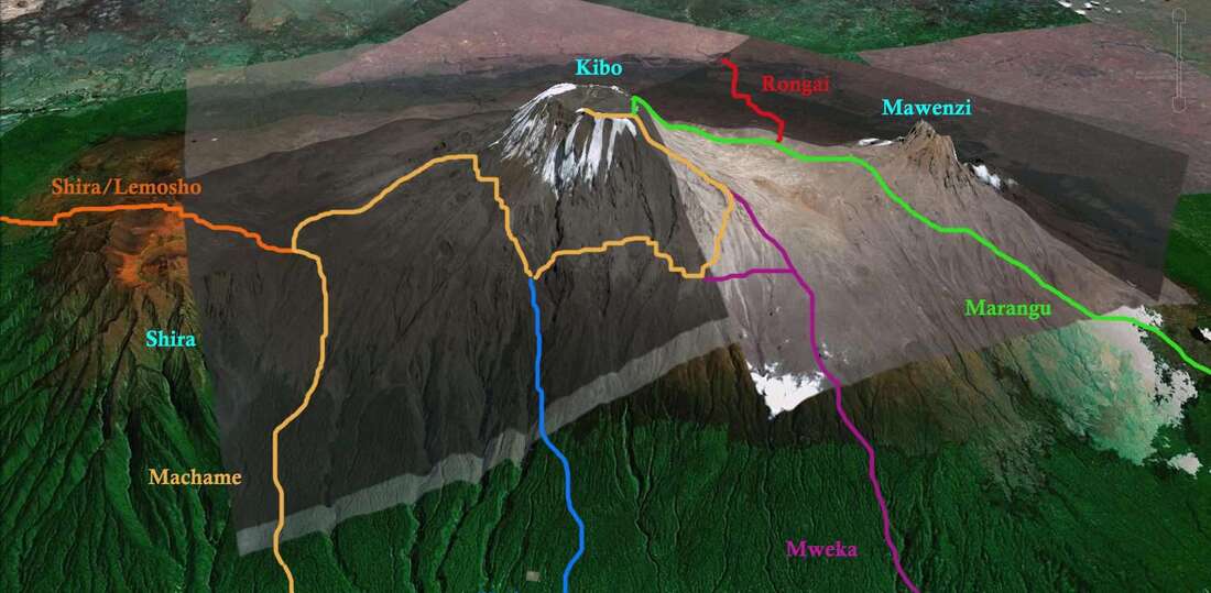 As we started up from the Rongai gate, day 1 on the mountain, we progressed through light rain forest and up to the start of the moorland, a brushy landscape just below the alpine. We would wander through it the next 3 days as we progressed through the next three camps from 6,500’ to close to 14,200’ at Mawenzi Tarn Camp staring at Kibo Cone alone the way and thinking about the final climb up to Uhuru Peak at 19,431’. In those 3 days we learned a lot, the guides taught us about the mountain, much about its flora and fauna, we traded stories about what life was like in our countries and shared pieces of English and Swahili, it was like a casual backpacking trip for the most part.
Learn Swahili
 Day three was a short day to Mawenzi Tarn Hut. As we climbed up towards 14,000’, the summit of Mawenzi faded in and out of the clouds. It was a beautiful mountain to look at. Mawenzi was the original highpoint of Kilimanjaro prior to Kibo erupting 250,000 years ago and it showed its age with a jagged ridge line and steep drop offs. Mawenzi, while lower than Kibo, is much more technical and rarely climbed. Our head guide, Adam, told us about a climber who got stuck on top of the summit for 3 days in an ice storm and had to eventually be taken down by helicopter. We spent the afternoon of day 3 lounging below the west face of Mawenzi and hiking around its valleys, it was a wonderful place to be. The peak faded in and out of the clouds and camp would occasionally fog in. In the evening it began to sleet, we all figured it would be a quick shower but it turned into heavy hail. As we sat in our tents to wind down for bed, Kat, Emily and Carly stated to yell my name from their tent. I tried to ignore it as long as I could but eventually put on my rain jacket and wandered out into the cold. Their tent was taking on water, the rainfly wasn’t a perfect fit. With how cold it was about to be that night we had to get it fixed fast before their sleeping bags got soaked, one of the guides and a few of the porters tried to help me stake it out but it was too late and water was dripping into their tent heavily. They separated into the other four tents and we all passed out for the night.  The morning of day 4 was beautiful, snow blanketed Mawenzi, the air was crisp and cold. We had a short day today on our way to Kibo Hut and we could see our high camp sitting at 15,200 just below the 3,000’ climb up to Gillman’s Point. The day was fun, we relaxed and chatted on the relatively flat walk across the saddle. The landscape was barren, nothing but rocks and the occasional bush on the walk across the alpine zone. As we reached Kibo Hut the sun faded in and out of approaching clouds, the temperature rose and fell rapidly, it was hard to keep warm or cool. When we reached camp, Andrew suddenly started to feel dizzy and tingly. He had slurred speech but was still coherent, he told us a similar thing had happened before when he got dehydrated. We got him in one of the tents, fed him some water and electrolytes and the guides gave him a little bit of oxygen just in case it had anything to do with altitude. We all tried to eat lunch but the altitude was affecting our appetites. After short naps and a relaxing afternoon, we were sitting in the dining tent eating an early dinner before preparing for the summit push. Although Andrew had mostly recovered from his incident by dinner, we think a hypertensive crisis brought on by altitude and dehydration but couldn’t confirm due to lack of a blood pressure cuff, he wouldn’t be making the summit push. Andrew made the call I don’t know if I could, opting to stay behind at Kibo Hut and play it safe. In mountaineering we call it “Summit Fever”, an obsession with reaching the top, a determination that can both aid you in your climb and kill you. Many people who get Summit Fever have pushed past their limits and found new limits, many people have died from their obsession and determination to reach a summit. It’s a constant thought on some summits where altitude, avalanches or other factors can put your safety at risk. Kilimanjaro is one of the least risky summits I have ever done but you never know how your body might react to elevation.
The nine of us attempting the summit would go to sleep for 4-5 hours before waking up at 11:30pm to start our summit attempt at 12am. The logic for the early start was that the group could move very slowly at elevation, about one mile an hour, this pace would get us up to the summit just before sunrise and down a few hours after in order to avoid any afternoon inclimate weather and the potential for getting stuck in the beating sun at a high elevation on the way down (Tanzania is just below the equator AND the sun is stronger at a higher elevation so it doesn’t take long to get burnt to a crisp here). Starting the hike was interesting to say the least, half of the group was still asleep, half the group was full of energy and ready to run up to the summit. As we lined up to leave base camp, a light snow began to fall. There was a full moon that faded in and out of the clouds. The snow would follow us up the slope to Gilman’s Point for the next three hours. We moved slowly, up a steep, switchback, scree slope. It wasn’t cold, but because of the moisture, it was hard to stay warm at times whiles moving so slow. Along the way, we would shelter in caves along the trail for water and layer breaks, at one point we got to a cave and I had a solid 2” of snow collected on my back and bag. To say the least, I was enjoying the morning, exhaustion from minimal sleep was sneaking in but I was in my happy place.
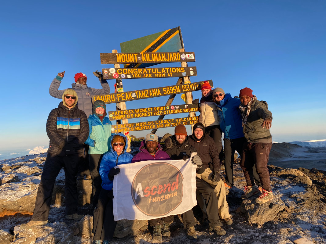
Around 17,500’, 2,000’ above base camp, one of our team member’s, Brian, started wheezing. He had had a cough from cold and dry air and we encouraged him to put a buff over his face to warm the air before it chilled his lungs but he didn’t listen, insisting he would get too warm. Brian started wheezing from thin air and strained air pathways; he took a huge gulp of cold air deep into his chest and blacked out. As I looked back down the trail at him, you could see his eyes get wide as he gasped for air. Brian never collapsed but his journey to the summit was done. Two of the guides rushed down to him and started to rub his chest to warm him up, as soon as he was coherent, he turned around and headed back to base camp with an escort. The remaining eight of us continued on our way up towards the summit, slowly but surely. The clouds faded away and the snow eased, you could see the crater slope below us and the broad saddle over towards Mawenzi to our east. The snow had changed everything, the landscape glowing under the fading moonlight was incredible. We neared 18,500’, just below the start of the summit ridge at Gilman’s Point. I hadn’t hiked by Tom much on the way up, but when we took a break just below the point, he said he was spent. He couldn’t control his heart rate, the climb up was getting more difficult for him and he said his breathing felt heavy. The rest of the group continued on for a break and a cup of ginger tea at Gilman’s Point just below 19,000’. Tom wasn’t far from Gilman’s and his escort would push him up there for a cup of tea just after we left to continue on to Uhuru Peak. While he didn’t reach the highest point on the mountain, Tom is able to say he summited Kilimanjaro via one of its many volcanic sub-peaks. As we left Gilman’s Point, I felt tired, my body was physically okay and my breathing was good but I was falling asleep. I felt so tired…. The 12am start was catching up with me, I was falling asleep as we walked towards Stella Point, about a half mile below Uhuru Peak. I was screaming in my head for the sun to come up, I needed that serotonin and adrenalin badly to push off my sleepy mind. Just after 6am, the sun rose behind Mawenzi, the Kilimanjaro Massif was blanket in light. I could feel my eyes widening and dilating, my senses were coming back, excitement grew in me as I realized we were nearing the summit.  We picked up the pace as we made our final approach, all of us were excited and more awake than we had been in hours. The atmosphere was jubilant, although, we were all spread out going through our own thoughts and emotions. This was the culmination of a week’s worth of travel, of a bit of walking and of a lot of anticipation. The sign for Uhuru Peak appeared over the final hill, as we walked across the summit plateau, I breathed a sigh of relief and let out a holler of celebration. I hadn’t fallen apart, I had crossed off a goal of elevation, I had made it to the top, 19,431’. As always, we took summit photos, celebrated, and tried to get some snacks and water in us before the walk back down. Myself, Carly and Trace were the first to take off on the descent accompanied by Chongigi. We moved quickly down to Gilman’s Point and then the scree slope towards Kibo Hut. At Gilman’s we all developed a light headache that would gain power as we continued down the mountain. The scree slope turned the descent into almost skiing down the ridge, descending almost 1000’ in 10 minutes, it was an insane pace down…. By 8:30am we were back at camp with raging headaches and severe exhaustion, all three of us glugged some water and passed out for a long nap while the rest of the crew descended down the mountain behind us. It was over, we had reached the roof of Africa, but we still had two more days of walking back to a road…
Around noon the guides woke us from our slumber to pack up our tents and scarf down some lunch before our 5-mile hike to Horombo Hut at 12,000’. The further we descended, the stronger I felt, my exhaustion had faded and I was just happy and humble to be where I was in the world, traversing a beautiful mountain landscape with some amazing people. Again, we chatted with the guides and quickly moved down the mountain. Now that we were heading down, they mostly let us go at our own pace and hike as we wanted. By 2pm we were sitting in camp looking out over northern Tanzania, Moshi, and the large lakes of eastern Tanzania in the sweeping plains below us. We joked and played cards as we relaxed after our long day and thought about what we would do with the rest of our time in Tanzania. As the sun set, we sat and watched it fall behind the mountain. The journey to the summit was over but there was still much more for us to do in Tanzania. On our last day on Kilimanjaro, we hiked through the rainforest, monkeys hung above in the canopy and a moist mountain breeze swept through the trees. It was a beautiful hike down the mountain as we headed for the Marangu Gate. Around noon we found ourselves back at the bottom of the mountain sitting around with a feast to celebrate the climb. After we tipped our porters and guide team we were back on our way to Moshi, hot showers and cushy hotel beds. We had chatted with one of our guides on the way back to town and he had told us he could setup a safari to Tarangire National Park to the west of Moshi for the following day so we happily said yes.
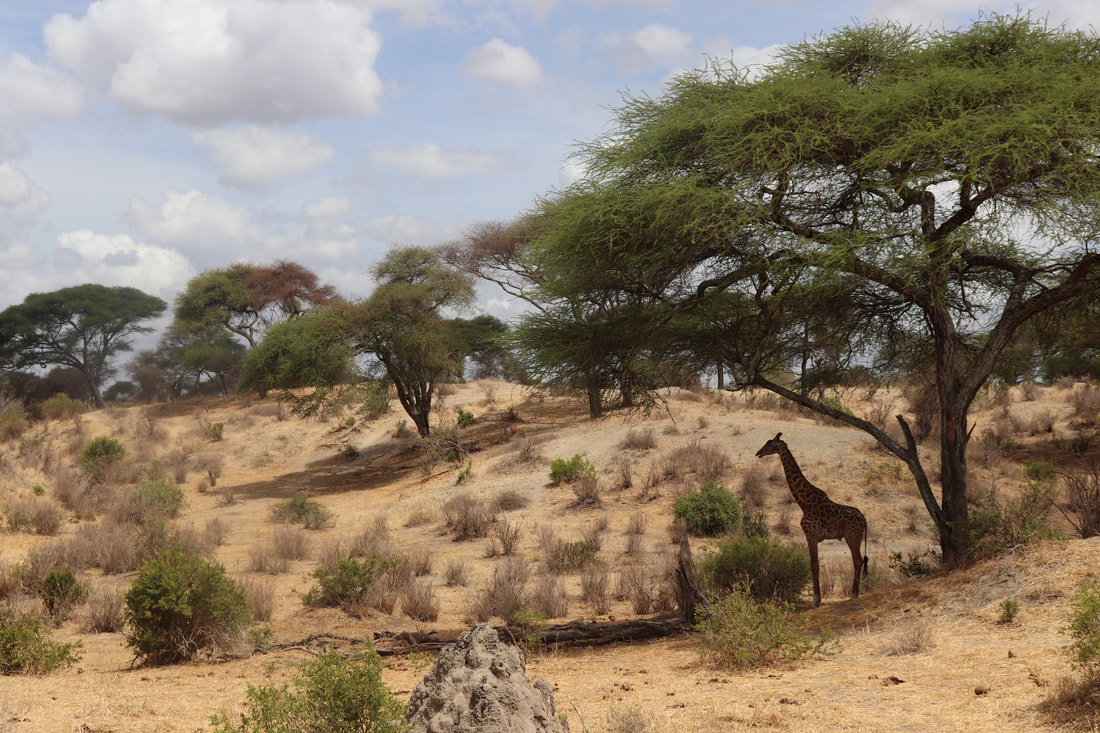
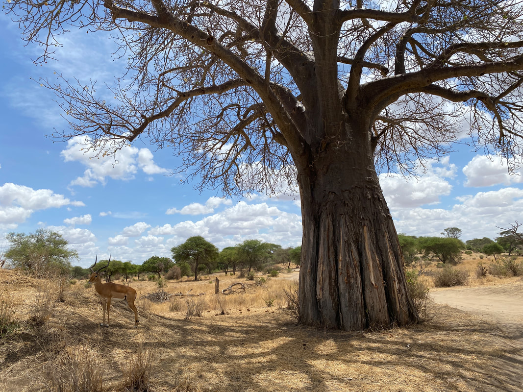
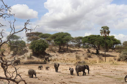
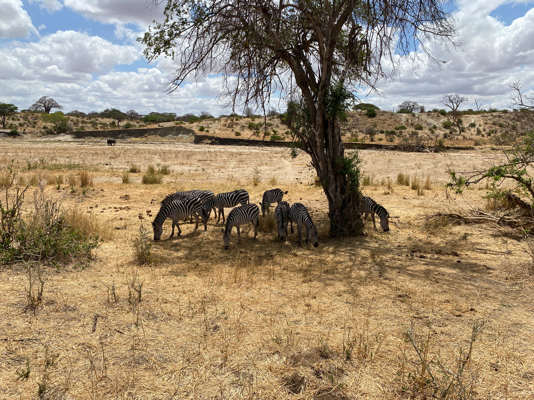
 For the safari we road in Toyota Land Cruisers and once you entered the driving area of the park, you couldn’t leave the car, they didn’t want you getting dragged off by wild animals. We saw more impalas, zebra and elephants than I ever thought could exist together. We watched monkeys steal food from people’s lunches. There were giraffes hiding under trees and wildebeests roaming around the plains. We got to see ostriches strut around the cars and meercats scurry across the road. Of course, the highlight of any safari, we saw a pride of lions lounging around in a tree avoiding the mid-day sun. It was the full experience and I was happy to check it off by bucket list. On the final day in country, I wandered around one of the markets picking up souvenirs for people back home. After 10 days in Tanzania, we were on our way home, with our various flights taking us back to our parts of the world. Kilimanjaro had opened a whole new set of goals in my mind, harder summits at elevation, new destinations at home and abroad.
On the near term list of goals is Rainier, Pico de Orizaba, hikes in the Himalaya and the Andes and more dreams than I have space in my head for. Knowing how my body will react to elevation opens the door to many more challenges and adventures. I’m excited for what’s next, I’m excited to see more of this world and stand atop its highest points, I’m excited to push the boundaries of what I know.
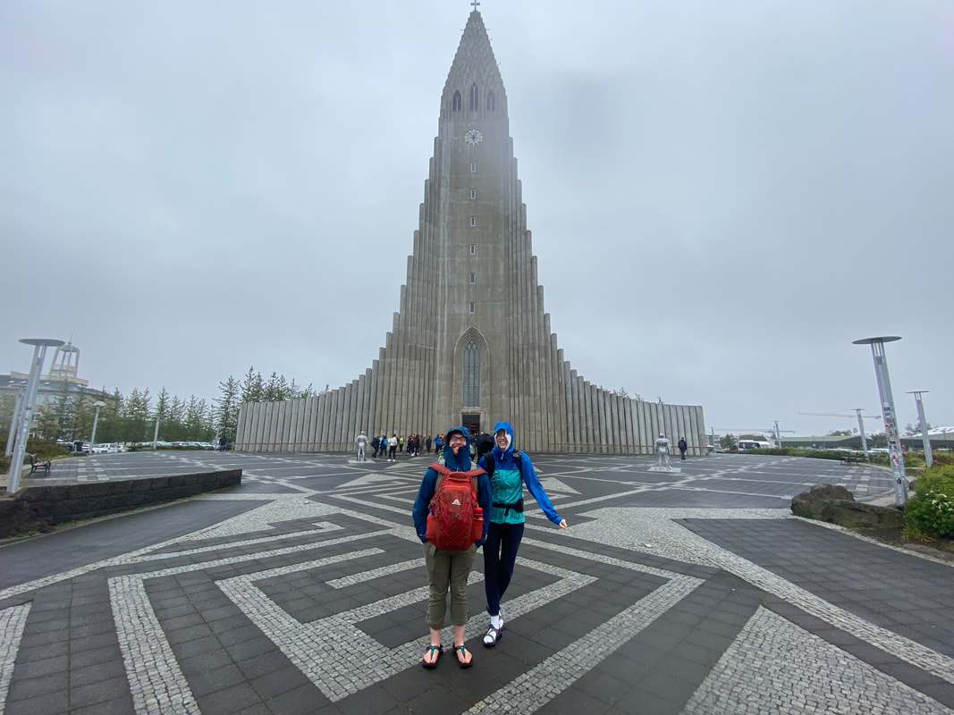
I’ve been home for almost two months and it feels more like a decade. This one took a long time to write, life lately, moves fast, its busy in good and bad ways. Iceland was an amazing time; I don’t think I could have asked for it to go much better but I do wish I had been there longer. We flew out of Minneapolis late on Wednesday the week of July 4th after a day of work and with a short nap over Greenland, woke up at 6AM landing at the main airport in Keflavik. It was a rainy windy day and after 6 hours in the air, they were only able to unload half the bags off the plane before everything was shut down for almost two hours. We sat and waited for Joe’s bag while Kat and I silently debated slipping off on a bus to Reykjavik.
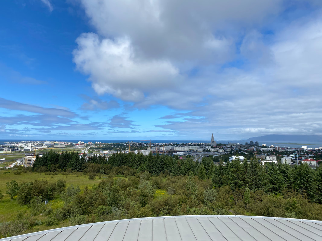
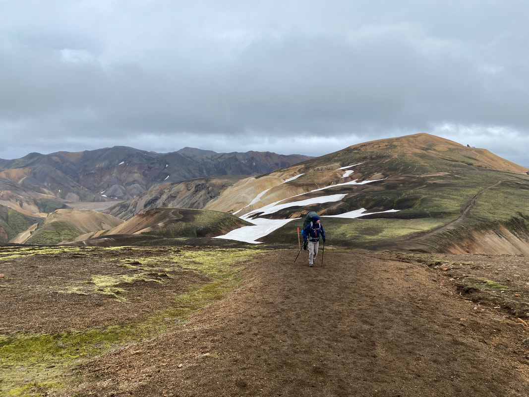
Slowly we moved towards the airport exit and eventually we were on a bus driving along the highway into the city. The air was cold, a bit of a breeze and light rain, it felt like fall, a beautiful break from the July heat back home. Joe, Kat and I would spend the next two days wandering around Reykjavik as we waited for more friends flying in from LA. We hung out in our hostel, explored museums, wandered around the shops downtown and enjoyed the first vacation each of us had had in a long time. The city was a perfect escape, slow and sleepy but enough to keep you entertained. On Friday our friends arrived, their journey was as eventful as our’s. Bobby was in full blown vacation mode, poppin drinks and having a great time. Alex and Arianna were in a much more relaxed mood but ready for an adventure. I was just happy everyone was in the same country and we’d be walking into the highlands of Iceland the next day. As we caught up in the hostel bar, we found out there would be a music festival there the next night and of course, tonight was opening night so it was bumpin all night long, getting to sleep wasn’t easy. We woke up early and stumbled our way to the bus station, it would be a common fixture on our travels around the island for the next week. We stashed our extra gear in the luggage lockers and loaded up on the modified 4x4 bus that would take us overland to Landmannalauger. This 50-passenger tour bus had wheels almost as tall as me and suspension that would probably shoot you to the moon if you bounced on it just right. We drove through rivers and down backcountry roads I don’t even know if I’d take my own SUV down to Landmannalauger. It was a cold and breezy morning, we got our bags setup and started off towards the first hut we’d stay at, Hrafninnusker. 
together and move forward in the mist. At one point the group was stretched out on a half mile long snow patch, I had lost track of the trail and couldn’t see the back of our group. I let Kat go on in what looked to be the right direction, loosely following a Swiss couple and waited for the rest to catchup. Arianna was soaked, the mist had drenched her hat and gloves, she was shivering, wanting to sit and rest. We kept pushing her forward and eventually made it to the hut. In hindsight, she most definitely had hypothermia setting in from the wet and cold so we had made it just in time before there was trouble. We sipped on tea and warm drinks while the only sunny patch of the day showered us in warmth. Eventually the clouds came back and the rain set in, it’d be an early night in the tent.  The next day was just as wet, cloudy and challenging in the morning. We packed up looking at the vast snowfield we had to cross as the clouds pushed at the upper bowl of the mountains. As we set off, the clouds pushed over the ridge and the valley clouded out, we pushed on. We’d traverse over windy ridges and passed massive snow caves; we’d have a close call that day with a fall by Alex into a patch of sharp rocks and falls by Kat and Arianna down some steep muddy slopes, it rained on us for over an hour. By the time we reached Alftavatn we were all cold and soaked to the bone but it was incredibly early in the day. I wanted to hike on to the next hut which would give us more time for additional adventures after this, but we made the best of our early day, relaxing, playing cards in the small café, drying clothes and when the clouds cleared in the afternoon, we explored the ridges around the outpost. It was one of my favorite afternoons of the hike.
The following morning, we were up early again hiking towards Emstrur. It was a short day with plenty of glacial river crossings but we had a lot of fun. The broad volcanic and glacial valley we hiked down was basked is sun all day long, it was beautiful. On this section of trail Joe and I spent the day trying to find the place Joe, Emily and Bryan had taken one of the famous RRT photos in (checkout the bathroom panorama next time you’re in the shop). We hunted for the spot taking picture after picture, it was fun, the group mood was light and joyous after two difficult and rainy days. I was happy to be on the trail and enjoying the trip that day.  Learn Icelandic |

 |  |
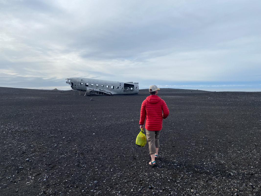
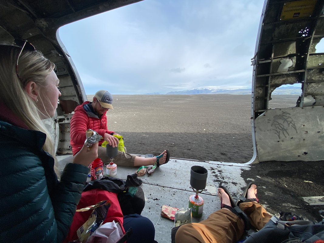
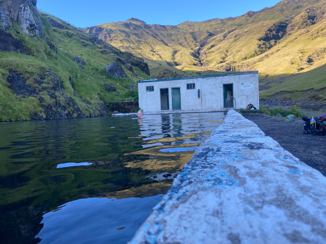
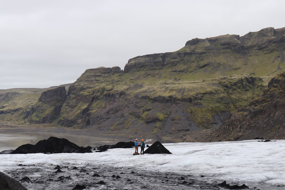
We took a bus from Skogafoss to Hella and then I ditched the rest of the crew to go and pickup our rental car from Keflavik. It was a long adventure wandering around the cities and traveling along the Ring Road but it was nice and relaxing. In the early evening I got back to Kat & Joe, Bobby, Alex and Ariana had gone their own way to explore and have a little more touristy of a trip end. Kat, Joe and I camped, explored off the beaten path hot springs, hiked across glaciers, ate breakfast on an abandoned US military plane and enjoyed kicking our way around the southwest part of Iceland the last few days of the trip.
 |  |
The group eventually ended up back in Reykjavik together, a final night of wandering about, sharing stories from our time driving the island separately and drinks and dinner. It was a good evening until Ariana, who has a lactose allergy worse than just intolerance, got a bite of yogurt in her dinner and had to run off and get stuck in her hotel bathroom for several hours. It was an eventful end to an eventful trip.
On the final morning I woke up early and drove Joe to the airport and then returned to Kat at the hotel. We caught up with Bobby for a cup a coffee and a little breakfast before packing up our room. Kat and I did one last walk through Reykjavik before returning to the airport early for our flight. We had plenty of time to explore the airport and grab some final treats from the Duty Free. After another 6-hour flight we arrived back in Minneapolis, tired and full of stories. I was so tired that I accidentally grabbed the wrong bag off the luggage rack and spent another two hours trying to get back into the international terminal to get the right one. Eventually we made it home and shared stories with Kat’s parents before returning to Cincinnati the next day.
On the final morning I woke up early and drove Joe to the airport and then returned to Kat at the hotel. We caught up with Bobby for a cup a coffee and a little breakfast before packing up our room. Kat and I did one last walk through Reykjavik before returning to the airport early for our flight. We had plenty of time to explore the airport and grab some final treats from the Duty Free. After another 6-hour flight we arrived back in Minneapolis, tired and full of stories. I was so tired that I accidentally grabbed the wrong bag off the luggage rack and spent another two hours trying to get back into the international terminal to get the right one. Eventually we made it home and shared stories with Kat’s parents before returning to Cincinnati the next day.
 |  |
Since Iceland I’ve moved from Ohio to Colorado, I’ve climbed more mountains, went backpacking in new places and found a new home to explore. I’m settled and full of a readiness for the next adventure. In November, myself and a group of 10 will be heading to Tanzania to climbing Kilimanjaro, the 19,341’ roof of Africa and I’m sure more shenanigans will spring up with world renown mountains now in my backyard. I’ve got a lot more excitement coming up and I’m looking very forward to it.
 | "A good beginning makes a good ending." |
Five years ago this May, I traveled west for the first time in my adult life, on a journey to Zion and Great Sand Dunes National Parks. It was my first big trip, my first true adventure, it planted a seed. I still remember hiking up Angel's Landing and staring off into the valley below, I think every time I've found my way back there the meaning of that view has changed. Since that first time in the deserts of Utah I've spent half of a decade exploring North America, growing my love of the outdoors and trying to answer the question, "What's next?". My cushy reality is that not much has really changed for me since I graduate college two years ago. I live in the same house, drive the same car, spend my time doing pretty much the same stuff I've been doing for years and in 7 months when I get done walking, all of that could change. I'll be technically homeless, my life will be scattered and my perception of what it means to me will probably be altered forever.
My response to not yet knowing my answer to what's next, I've decided, is going to be to leap wholeheartedly and unequivocally into this next phase of my life. I've spent the better part of these five years planning for the next thing. I've planned for the next trip, the next financial hurdle, the next step I needed to take to go and hike the Pacific Crest Trail and have a 99.9% chance of success, the next whatever it was. I planned and planned and planned and it left me with a great set of skills and a great understanding of the world but it also left me with the problem that I always feel like I need to have a plan.
I'm not talking a rough idea of a plan, I'm talking down to the gnats ass planning. The type of planning where you know exactly how many steps it is from Point A to Point B before you even walk them. That type of planning can't happen while I'm on the PCT, it will be this wild adventure, full of unknowns and I desperately am trying to accept that before my world gets rocked by a lack of control in anything other than moving my feet and going North.
On that first big trip out west, we had planned to hike Zion's West Rim and summit Mt. Herard above The Great Sand Dunes, none of that happened. We couldn't get permits, the snow was still too deep and we had no idea what we were doing, we came up with a plan weeks before and just ran with it. That trip in 2016 was and is still one of my favorite trips because nothing went according to plan and we still had a wonderful time. I don't know if its because my expectations were lower back then, or I was more accepting of adjustments to plans, or what, but that's where I want to get back to during my 5 months on the trail. My goal is to accept the rhythm of this journey I'm about to set off upon. My goal is to grow myself by trying to shed some of my less positive traits. My goal is to get lost and decide what my passion really is because at the end of the day that will drive me in everything else.
At the end of the trail, part of me thinks I'll turn around and go back south along the AT so the journey never ends. Another part of me thinks I'll find a place along the way that's just too good to leave and find my way back there. There's a teeny tiny part of me that thinks I might get sick of being outside for awhile, and I'll hang my pack up and settle back down to a desk in Cincinnati for a bit. Another part of my mind has its sights set on the idea of a slice of land somewhere in the woods of the Pacific Northwest with a couple of hand built cabins where friends and family can come and go as they please and what I do can change by the day. These are just a few of my dreams and guesses at what life in 12 months looks like and honestly, I'd be excited to stumble into almost any of them.
The question I hope to answer along the PCT in the next several months is "What do I actually want next?"
As of this morning I put my two weeks notice in at my job, I’ve determined its not part of what’s next for me and that first step was terrifying but exhilarating. In 73 days I’ll set foot on the PCT, in ~223 days I hope to cross the Canadian Boarder at the end of my hike, after that I hope to be happy and find the place, the job or the purpose I’m looking for.
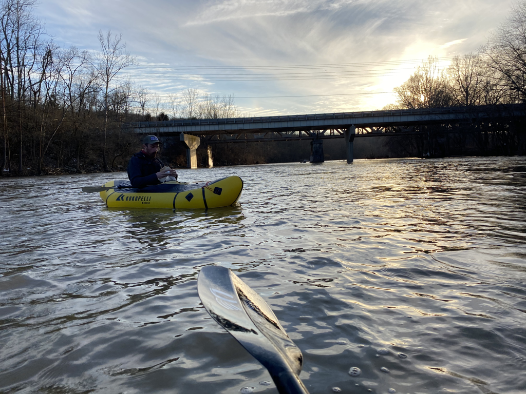
My buddy and I Run Packrafting the Little Miami River last night
“The unexamined life is not worth living”
- Socrates
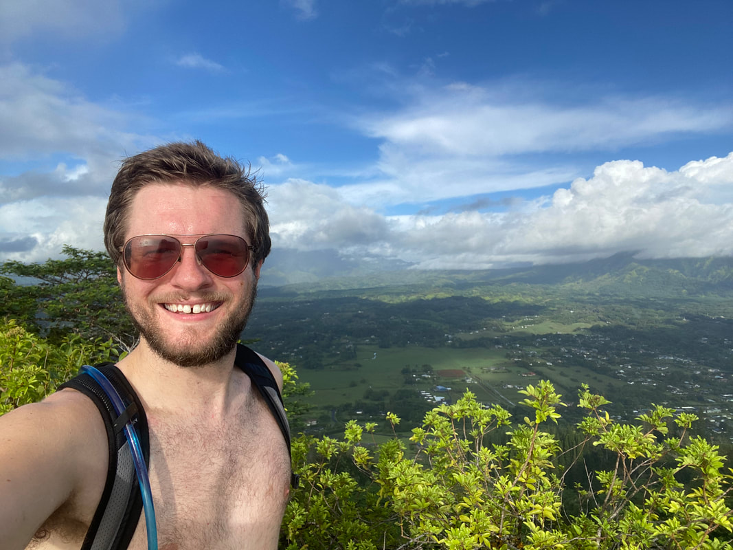
Its taken me awhile to write about my trip to Hawaii (Kauai). Part of that was that I shared a lot of the journey on Instagram while I was there. Traveling alone gives you a lot of time to reflect while you’re on the journey so there was less of a want to digest the adventure when I got back. Instead of sharing my travels on the island, I want to share my thoughts. I’ll still give you a little synopsis, I flew into Hawaii a few days after they had lifted their COVID travel restrictions and had to have a negative test when I landed. The consequence of not having that test on time would’ve been having to quarantine in my hotel until I received my results, a significant expense with my entire plan for my time on the island thrown off. Luckily, I received the results right as I landed, it was a stressful flight.
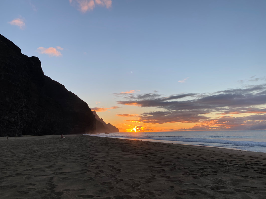
My 7-day journey was amazing, I spent 5 days sleeping in a hammock on the Kalalau Beach, I explored sacred valleys, packrafted the coast and several different rivers. I made new friends that made the trip even more enjoyable (thank you for your company and friendship Tim, Caitlin, Mitch, Zach, Johnny and Devin). I spent a lot of time thinking about life and talking with others about why we were all where we were, each of us having our own unique story for why we were out on the Na Pali Coast. Some were taking a break from life; others were searching for something and some were out there dreaming of something else. It was comforting knowing that I was with good people and we all seemed to have common ground of coming to where we were to escape and reflect. I had a good community for those five days, and I was the furthest thing from being alone.
My 7-day journey was amazing, I spent 5 days sleeping in a hammock on the Kalalau Beach, I explored sacred valleys, packrafted the coast and several different rivers. I made new friends that made the trip even more enjoyable (thank you for your company and friendship Tim, Caitlin, Mitch, Zach, Johnny and Devin). I spent a lot of time thinking about life and talking with others about why we were all where we were, each of us having our own unique story for why we were out on the Na Pali Coast. Some were taking a break from life; others were searching for something and some were out there dreaming of something else. It was comforting knowing that I was with good people and we all seemed to have common ground of coming to where we were to escape and reflect. I had a good community for those five days, and I was the furthest thing from being alone.
 |  |
 |  |
I’ve always been acutely aware that the day would come when I would no longer have the groups of people to travel with that I’m used to. I would either out grow them in the difficulty (and expense) of trips I’m looking for, our schedules wouldn’t make sense anymore or all of the other complications of life would just separate what we could get away with. I’ve known it was coming for years and it finally happened on this trip. It was a good feeling to know that I could still go out and do what I love without needing others around for confidence, company or enjoyment. I was able to enjoy every moment, I had so much more time to reflect and relax, I was on my own schedule, at my own pace (which was fast) and I didn’t have to consider other’s wants. Some of those things are positives, but others I worry could become negatives. Without others, who’s there to push you? If you’re flying through something because you can, what if you miss the enjoyment of it trying to simply get it done? There’s an argument that can be made for traveling with others and there’s also one for going solo and I don’t think there’s really a right answer for me.
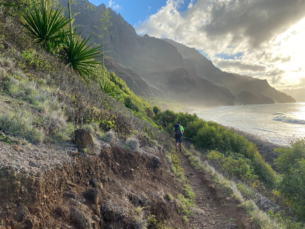
I will say, my greatest moment of loneliness was on the hike out from Kalalau Beach. I had left at 6AM to avoid the heat of the day and all the friends I had made were going to pay for a boat ride back out instead of hiking (I’m a cheap ass). About 3 miles into the hike there’s a section of trail that is a sheer drop down to the water and nothing but fluted pali (volcanic rock) to the other side. As I climbed over a few sections I had a quick moment of realization that if anything happened to me no one would know, and no one would be looking for another few days. I accepted that, but it really shook me, I never realized how protected traveling in a group had made me feel. The reality is that this isn’t the last time I will do something like this on my own, but also, I know the majority of my trips will still involve friends, because what I do enjoys company. One of my fears will always be not being able to share adventures with my friends. That shared experience is what often drives me and creates the bonds that keep me close to the people who keep me going.
I will say, my greatest moment of loneliness was on the hike out from Kalalau Beach. I had left at 6AM to avoid the heat of the day and all the friends I had made were going to pay for a boat ride back out instead of hiking (I’m a cheap ass). About 3 miles into the hike there’s a section of trail that is a sheer drop down to the water and nothing but fluted pali (volcanic rock) to the other side. As I climbed over a few sections I had a quick moment of realization that if anything happened to me no one would know, and no one would be looking for another few days. I accepted that, but it really shook me, I never realized how protected traveling in a group had made me feel. The reality is that this isn’t the last time I will do something like this on my own, but also, I know the majority of my trips will still involve friends, because what I do enjoys company. One of my fears will always be not being able to share adventures with my friends. That shared experience is what often drives me and creates the bonds that keep me close to the people who keep me going.
 |  |
What drove me to Hawaii was definitely a combination of hyper activeness and probably a little bit of depression. I’ve been fortunate that I was able to travel as much as I did, still be employed and all the other good things that happened to me during COVID, but the periodic separation from my communities definitely took a toll on me (like it has on so many others while they’ve tried to isolate). I find that when I feel stagnate or stressed or any combination of negative things my mind likes to play tricks on me. My solution to whatever crappy or down feelings I have has always been to travel. I don’t travel to escape, I do it to pause and evaluate and that’s definitely part of what drove me to Hawaii, the completion of a decades long goal (visiting all fifty states) and the chance to pause and reflect.
One of the things I thought a lot about while in Hawaii was my fears, you’d think in such a beautiful place those would be the furthest thing from my mind… My fears are of the future, of inevitable change in my life and of having my goals that seemed like they were lifelong goals, come to an end and be complete. I have this problem that I always need another goal in front of me or I feel as if I’m living my life without meaning or purpose. In my mind (however flawed this may be), if I’m lacking a goal, I have no purpose and if I have no purpose, what’s the point to going to work every day and doing all the other things that are so mundane? My goals are what keep me going at my lowest and they’re the things I hang on to in my toughest moments. For the past six years or so, my goals have been to graduate college and get a job, to finish visiting all fifty states and to hike the Pacific Crest Trail in 2021. Most of those goals are now complete with only the PCT remaining, and after that I’m goalless and that scares me. What do I do next?
 |  |
Don’t get me wrong, there’s plenty I want to do, but nothing seems like a big goal, nothing seems like a great item to pivot and steer my life towards. I’ve thought about pivoting my goals from my travels to developing my life (better car, maybe buy a house, all the adult stuff), but I don’t know if those goals will make me feel fulfilled. I’ve contemplated going all in on my hobby (Cincinnati Mountain Guides has a nice ring to it right?), but that seems like a big leap of faith.
Myself and friends like to talk about our “lifestyle” and there’s the ever-present question of going all in on it. It’s a lifestyle of travel and adventure, its doing what you want every day and enjoying every moment of what you do. Its being a van lifer, or a climbing dirt bag, its renovating a bus and living your life on the move. We fancy ourselves as nomads and we have grand dreams of what life could be like and I’m stuck between wanting two extremes. I don’t think I’ll wander off just yet, but I don’t think doing what I’m doing now is sustainable for me for much longer. The truth is, I don’t know what I want.
I don’t necessarily think I need to know what my next goal is just yet, but I constantly find myself in fearful anticipation that it may not be this easy path that just lays itself out in front of me. Thinking about all of this while in Hawaii got me to settle with the fact that I may not have this moment of realization that this one thing or this certain path will make me happy long term, and that’s the reality of life, there’s a lot of unknown. At some point in the next 10 months, I’ll have to make a decision though, what do I do next?
Sitting with my hiking partner Will, and talking about our plans for the PCT a few days ago made me realize that we’re both in the same boat walking into this. We’re ready for this years long goal to come to a close, but we’re uncertain about what waits on the other side. I’m excited I get to make this journey with such a good friend and I’m curious what we find while we both search for what’s next out there.
 | “For me the magic of Hawaii comes from the stillness, the sea, the stars.” |
Every trip starts with a little bit of dreaming and then reality sets in.
 |  |
The idea to hike the Uinta Highline Trail got in my head after watching a documentary about of group of guys who did it back in 2018. Seemed like a fun time, 103 miles in a little over a week. Seemed extremely doable too. I figured if you averaged 2 miles an hour each day and your big days were about 16 miles you could complete the whole thing in a little over 8 days.
Plan
| Sun. 8/16 11 miles | Mon. 8/17 9 miles | Tues. 8/18 16 miles | Wed. 8/19 16 miles | Thurs. 8/20 8 miles | Fri. 8/21 10 miles | Sat. 8/22 16 miles | Sun. 8/23 8 miles | Mon. 8/24 10 miles |
We drove out to Utah Saturday morning and arrived at Hayden Pass early Sunday to pick up our friend who had drove down from Montana. The plan was to leave her car at the west end and start hiking to it from the east trailhead at McKee Draw. We got her and got to McKee by 8AM then hit the trail running.
We were all excited to be out there and the first few miles were beautiful. The trail weaved it’s way through pines and aspen trees, we spotted deer, all sorts of birds and of course had a few cows to share the trail with. We covered the miles fairly quickly but got lost along the way a few times. Occasionally the path would disappear in a field of fallen trees and we’d spend the next 15 minutes relocating the trail. It slowly became exhausting. After an 11 mile hike on only a few hours of sleep we decided to call it a day. Unfortunately, we hadn’t found water... We ended the day with a little over 2 liters of water each, not very much for a full day ahead plus making dinner. The next reliable water source was at the end of the next day.
We woke up early on the second day hoping to crush some miles and get to the water before the heat of the day. It was a rough morning and we were all aware of our need of water. We moved fast and then slow and then fast again as our sense of urgency changed throughout the hike. After a very long 10 miles we crossed the Old Carter Military Road and saw the first water for miles. Unfortunately, it was devastated by cow patties everywhere... Long Park Resivour was only a mile off from here so we knew we weren’t out of it yet. After a debate about the best way to get to water and an extremely friendly hunter offering us Powerade and water, we bushwhacked our way off trail to the road down to the reservoir. As we walked the road a truck drove by and asked us where we were heading. We told them we needed water and were heading up the mountain bypassing a 2 mile section of the Highline. Graciously, they gave us a ride up the mountain to an even better water source. This man, Quinn, and his family will forever have my gratitude for their help when we were so close to calling it quits.
After filling our bellies with water and having our spirits greatly lifted we continued another half mile up the road to camp near a beautiful alpine lake (semi-alpine I guess). It was a welcome end to a long day. Quinn stopped by again at one point to take some trash off our backs and offer us a few cold beverages, again, forever grateful for this mountain man. We traded stories about our mountain adventures. He said he was jealous of our journey and we, in turn, were jealous of his family and ease of access to such beautiful mountains to enjoy. It was a perfect ending to a long day.
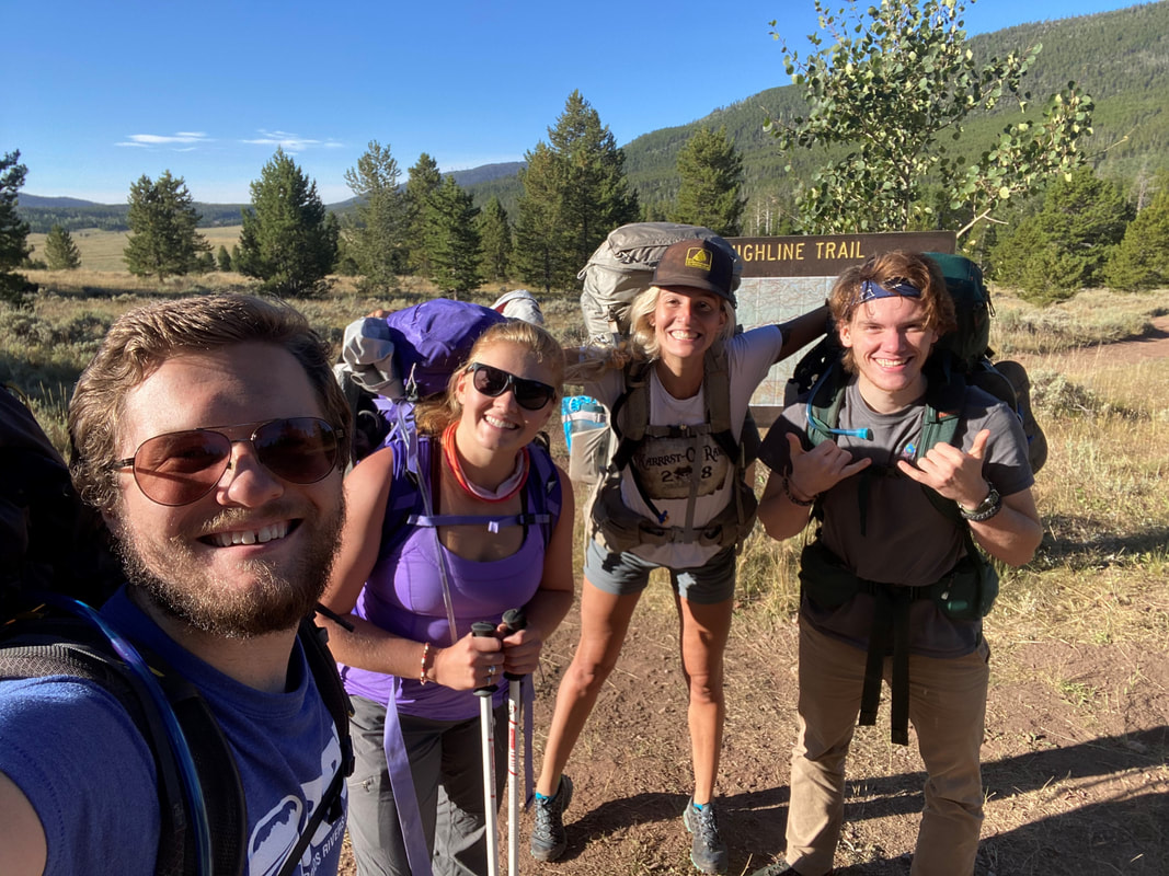 | 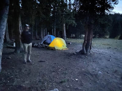 |
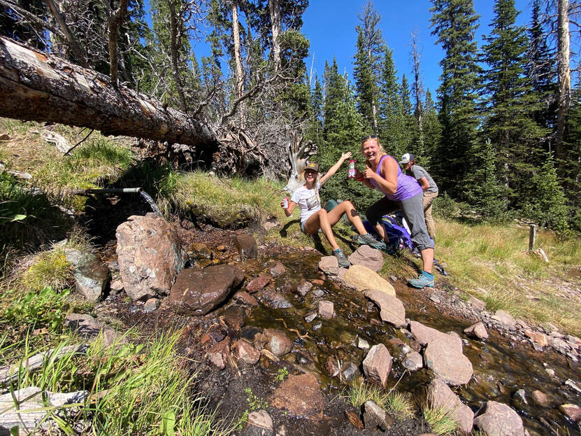
 |  |
The third day we planned to get up early, it was the first day we would spend in the alpine. We had three passes to cover for the day, Leidy Pass, Gabbro Pass and Deadman Pass. They were tough, 3 big gains in one day, but it was a beautiful morning. We were all excited to be above treeline finally. Every view was beautiful and the landscape was rugged. We came across another thru-hiker early on in the day, he was moving fast, but it was nice to know we weren't the only ones out there. Before we knew it we were up and over the first two passes, working our way down from Gabbro Pass to Deadman Lake where we enjoyed an early lunch as the clouds began to gather overhead.
I won't lie, not a huge fan of afternoon storms, especially not being in the alpine during afternoon storms. I sat by the lake nervous and ready to get moving at a moments notice as we ate lunch. It looked like the storms would hold off, but I was still on edge after my last time being in a pass with thunderstorms (lightening strikes within 20 feet at 12,000' in the Wind River Range). Again, we quickly made our way over the next pass and began working our way down as it began to lightly rain. I decided to move towards treeline a little faster and before I knew it I could hear thunder in the distance. Luckily it was coming from the other side of the pass so the storm had already passed us. We got down, regrouped and continued on, it was getting late in the day...
I won't lie, not a huge fan of afternoon storms, especially not being in the alpine during afternoon storms. I sat by the lake nervous and ready to get moving at a moments notice as we ate lunch. It looked like the storms would hold off, but I was still on edge after my last time being in a pass with thunderstorms (lightening strikes within 20 feet at 12,000' in the Wind River Range). Again, we quickly made our way over the next pass and began working our way down as it began to lightly rain. I decided to move towards treeline a little faster and before I knew it I could hear thunder in the distance. Luckily it was coming from the other side of the pass so the storm had already passed us. We got down, regrouped and continued on, it was getting late in the day...
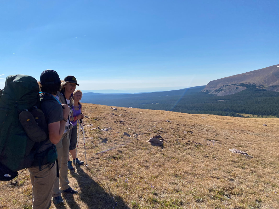 | 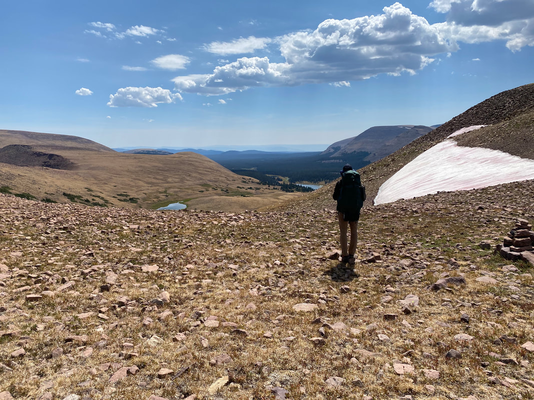 |
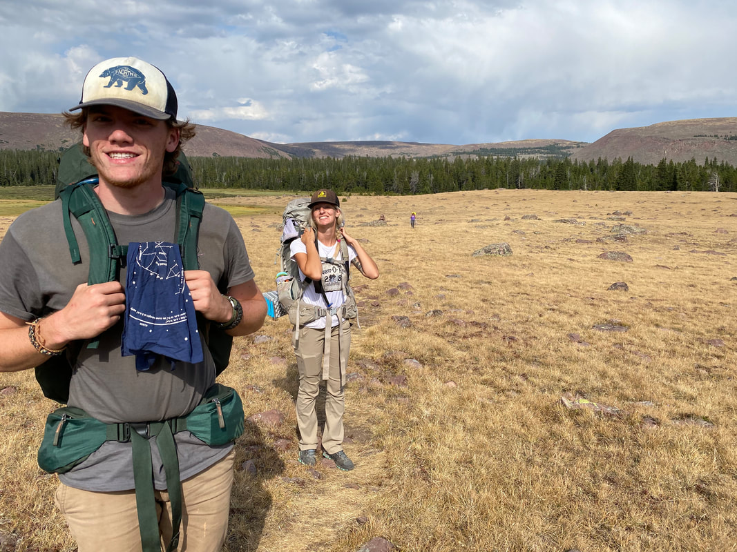
We all knew from the beginning that there were going to be long, hard days on this trip. There wouldn't be one or two of them, there would be several of them. Going in, I had total confidence in this group, every one of these guys is tough, they all have some awesome adventures, climbs and hikes on their resumes and none of them are quitters. As the day drug on we got slower and slower, and it became apparent to me that we couldn't sustain this pace and still finish anywhere near on time. I wasn't 100% sure what was happening yet but we took a break to refill water and I brought up the idea of bailing out and said my concerns to the group. One of our party was having issues with their shoes and because of that they weren't feeling great about a fast pace. Nothing monumental, but enough to make them not enjoy the hike and enough to give the rest of us an unfun advantage pace wise. I understood this but I hoped this would improve. We continued on to Chepeta Lake to camp for the night, slow and stead, passing a moose, several deer and some other thru-hikers finishing the last 3 days of their week long journey on the Highline. I dreamed of the emotions they must've been feeling.
When we arrived at Chepeta Lake it was approaching 6:30 PM, a long day of moving. There was one truck in the parking lot and my mind had leaned farther and farther towards giving up on the Highline. I regret some of the way I handled the situation but right then and there, with that singular truck our best way back to the car I stopped walking, looked at everyone and said I want to be done with this hike. I didn't feel great about those words, but almost every bone in my body was telling me it was the right call. There was obviously some pushback to this idea, none of us are quitters. No one wanted to go home and say they failed. We, as a group, opted to mull the options over that night and hope that if we decided to bail there would be other chance to hitch a ride back to our car in the morning. It was a solemn night in camp, we talked sparingly and everyone had different thoughts on their mind. I didn't sleep much that night, preparing for either option the next morning. The thoughts of how do we finish this hike on one side of my head and how do we get to our cars 3 hours away on the other.
When we arrived at Chepeta Lake it was approaching 6:30 PM, a long day of moving. There was one truck in the parking lot and my mind had leaned farther and farther towards giving up on the Highline. I regret some of the way I handled the situation but right then and there, with that singular truck our best way back to the car I stopped walking, looked at everyone and said I want to be done with this hike. I didn't feel great about those words, but almost every bone in my body was telling me it was the right call. There was obviously some pushback to this idea, none of us are quitters. No one wanted to go home and say they failed. We, as a group, opted to mull the options over that night and hope that if we decided to bail there would be other chance to hitch a ride back to our car in the morning. It was a solemn night in camp, we talked sparingly and everyone had different thoughts on their mind. I didn't sleep much that night, preparing for either option the next morning. The thoughts of how do we finish this hike on one side of my head and how do we get to our cars 3 hours away on the other.
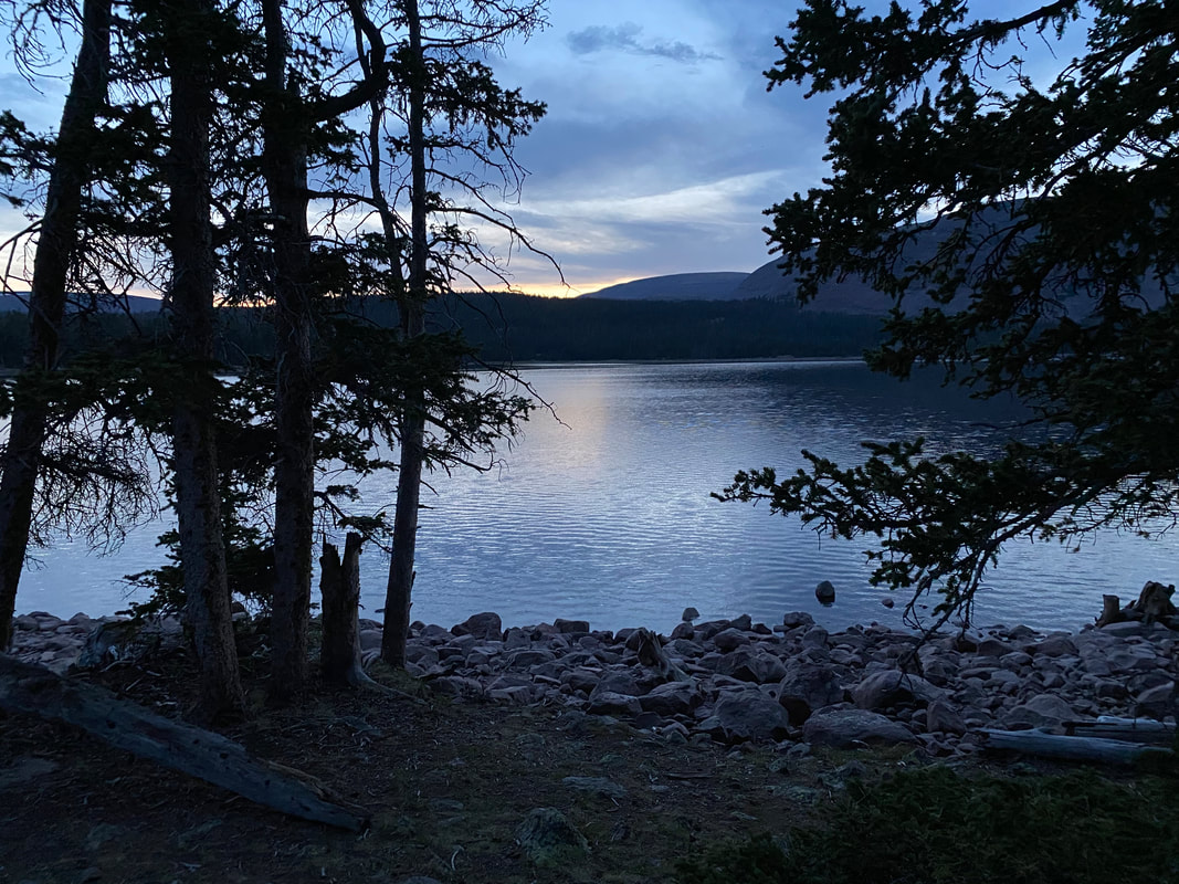
The morning was cool, with the sky already overcast, ready for the afternoon thunderstorms we expected most of the trip. We had one last discussion and decided that this journey was over. It was a tough call to make. Two of us decided we'd get walking and work our way down the road to cell signal and get back to one of our cars. We figured we could get there by dark at least.
Long story short, we made it about 7 miles down a 20 mile dirt road before we got a hitch with some awesome people. It didn't hit us until we were halfway down the mountain that it was over. As we watched the high peaks fade away and the forest turn to desert we contemplated what we had decided to do. We rode in the back of their truck with their dog Mattie and they graciously took us all the way down to the town of Whiterocks where we waited for another ride to get us back to McKee Draw. The cab that picked us up was operated by two natives from the Uinta and Ouray Reservation, they were a funny pair. They were confused how we ended up in Whiterocks without a car, they had stories to tell about the entire area and they were fun to be with. Their stories removed my tensions, the pair were welcome comedic relief. Before we knew it after hours of riding in cars and waiting around we were back at my car heading for pizza, drinks and to pickup our friends still waiting at Chepeta Lake. We watched a storm work its way over the range and knew they were probably sitting in it up there.
Soon enough we were heading back up the road towards the lake, packing up and heading back down yet again to go get the other car. It was an equally long day of moving once we finally arrived at a place to sleep.
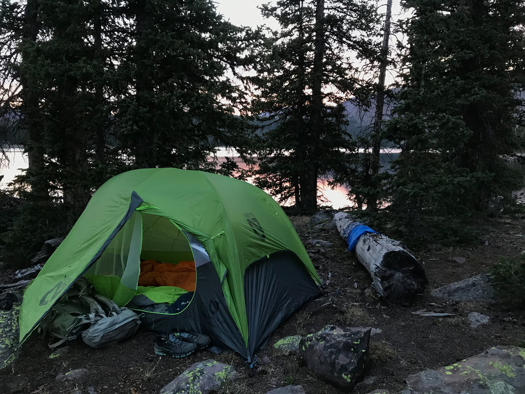
Kings
Once we got down and re-evaluated how we were all feeling and what we felt was possible we decided to give King's Peak a shot. Kings is the highest point in Utah at 13,528' and its pretty isolated, 14 miles one way to the summit. We figured with lighter packs, improved morale and some footwear changes we could easily cover the distance in two days. 8 miles in to setup a sort of base camp, early morning, 6 miles to the summit, then 14 down and back to the car. Piece of cake.
We got a bite to eat, grabbed a couple odds and ends from the store then headed to the trailhead. Of course, as soon as we got to the trailhead around 2:30, it started pouring down rain... Luckily, the rain quickly moved on and it was a beautiful afternoon in the mountains, it felt almost like fall. We talked and laughed and joked as we hiked up to Dollar Lake. It was a pretty hike, interspersed between alpine meadows, dense pines and groves of aspen trees. Eventually we made our way into the alpine and could start to see Kings Peak off in the distance. We spent that evening camped near Dollar Lake with many other groups around, almost all getting ready to hike Kings the next day.
We got a bite to eat, grabbed a couple odds and ends from the store then headed to the trailhead. Of course, as soon as we got to the trailhead around 2:30, it started pouring down rain... Luckily, the rain quickly moved on and it was a beautiful afternoon in the mountains, it felt almost like fall. We talked and laughed and joked as we hiked up to Dollar Lake. It was a pretty hike, interspersed between alpine meadows, dense pines and groves of aspen trees. Eventually we made our way into the alpine and could start to see Kings Peak off in the distance. We spent that evening camped near Dollar Lake with many other groups around, almost all getting ready to hike Kings the next day.
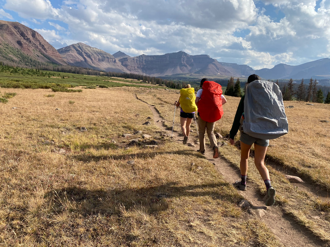 | 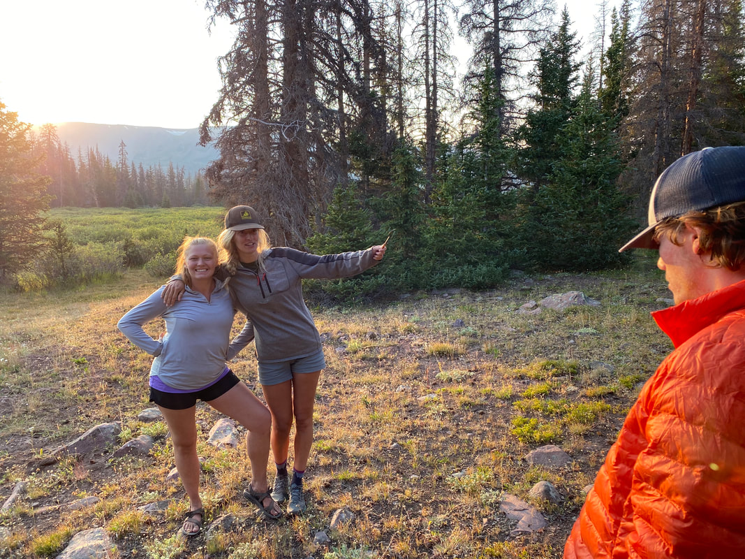 |
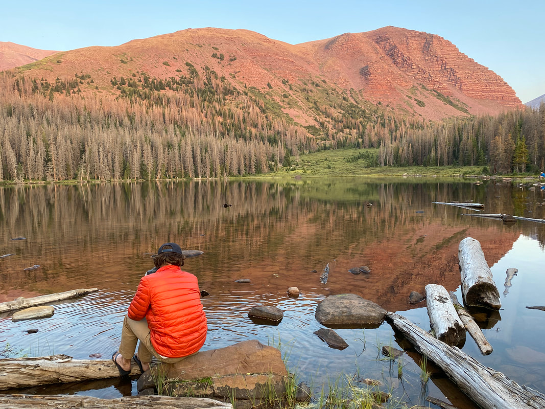
Friday morning we were up and on the trail around 4AM, early start for a long day. We quickly worked our way up to Gun Sight Pass before sunrise as the alpenglow began to light up the tops of the mountains around us. It was a cool morning, with a nice breeze that kept us moving. We would occasionally stop to take a break in the dark but the wind would get us moving again to warm back up. Near the top of the pass we ran into a pair of brothers heading the same way as us, backpacking a loop around the pass. It was nice to know we weren't alone up there that early.
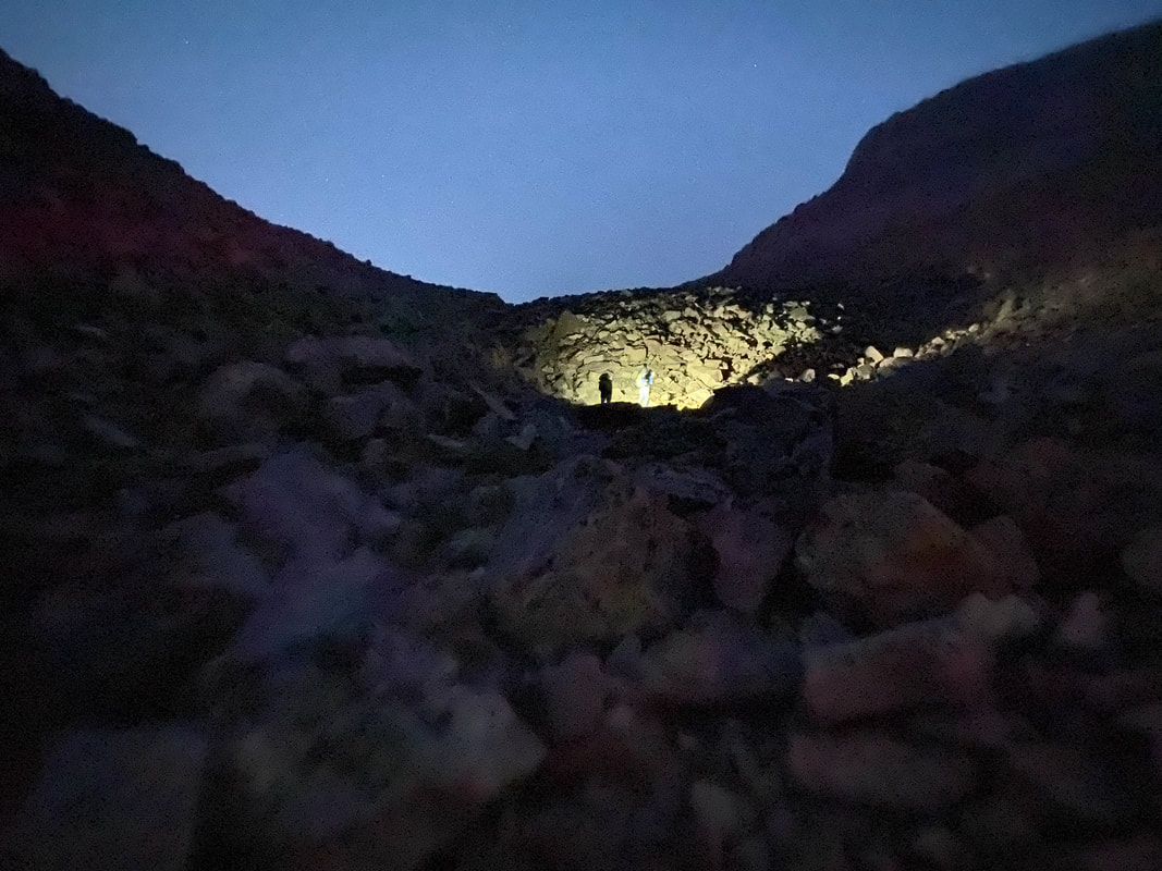 | 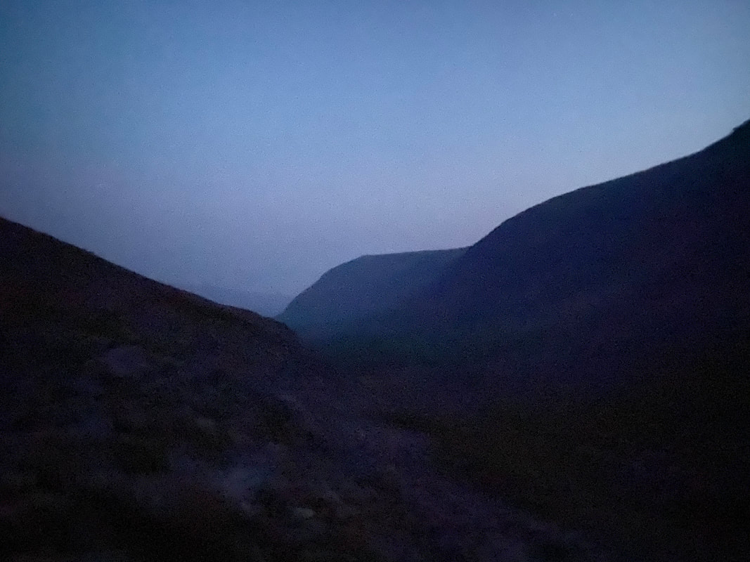 |
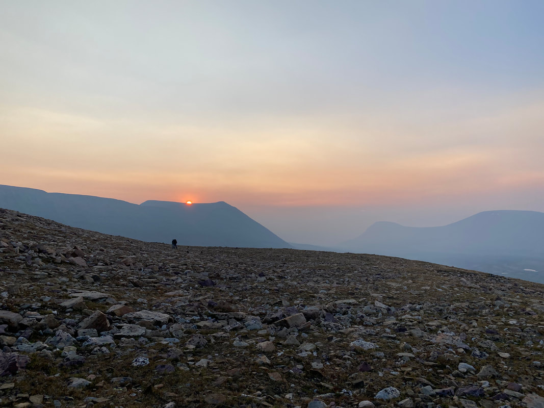
As we crossed over into Anderson Pass the sun was racing to the sky, it was looking to be a beautiful day and a beautiful summit. The two brothers were just ahead of us, heading for the saddle up to Kings Peak. We were going a steady pace, enjoying the morning and taking in the views. About halfway up to 700' rock hop to the summit we ran into a mother and her two kids who had been attempting the summit. Her son had made it to the top but her and her daughter decided that they had gotten what they wanted and were turning back a few hundred feet below the summit. A bit of a shame since they were really really close.
We continued up the ridge, getting closer and closer, finding a bit of snow right below the final little climb up to the top of the ridge. Kings is a series of towers that each look like they were stacked there a long time ago and were just waiting to fall over into the valley. We were at the final tower.
We continued up the ridge, getting closer and closer, finding a bit of snow right below the final little climb up to the top of the ridge. Kings is a series of towers that each look like they were stacked there a long time ago and were just waiting to fall over into the valley. We were at the final tower.
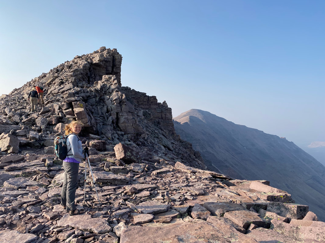
As we climbed up onto the summit plateau, the two brothers we'd been playing leapfrog with were climbing down. We'd have the entire top to ourselves.
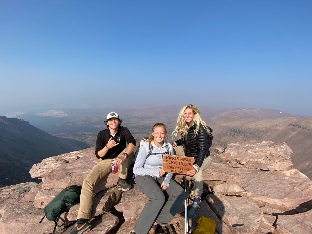 | |
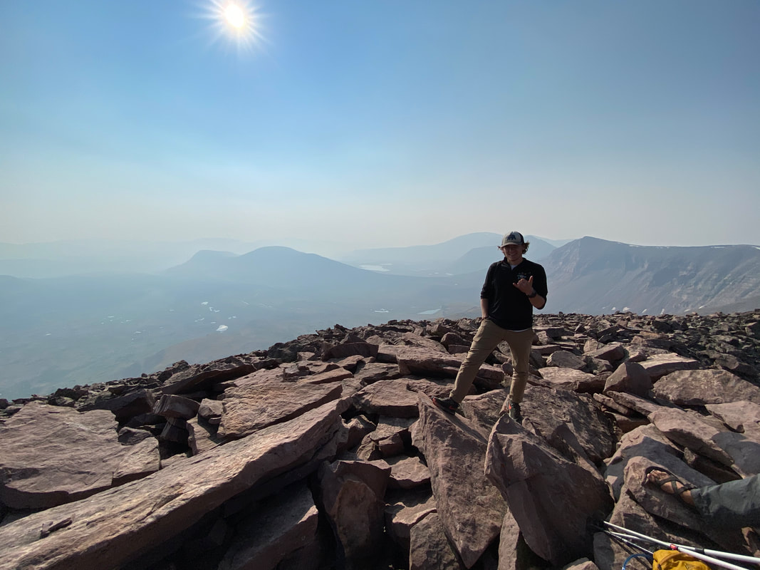
It was a good feeling to be up there, to be at the top again. I had had it in my mind that this was a consolation prize with not getting the Highline done but that was me loosing focus and feeling bad about myself. I don't do these things to say I did them, I don't hike 100 miles to say its done, I don't climb a peak to say I bagged it, I don't paddle a river to say I've done the whole thing. I do it because I enjoy the beauty of it.
I enjoy being in the mountains and wild places, I enjoy the journeys I have in these often remote locations and I thoroughly enjoy the sights I get to see along the way. At the end of the day, that's a big reason I do all this, I do it for the views... I've seen a collection of things that a fraction of the world will ever get to see in their lives and that collection only continues to grow with each journey. The crazy thing about it is that my collection is a drop in the ocean compared to what else it out there to experience. At the end of the day I realized it wasn't about completing the trail, it was about the stories and the places that I brought back with me after it.
After summiting, we made our way back to the tents and then to the car. I was happy we had gotten up early with the parade that was coming up the mountain as we descended. We had the unique experience of enjoying a pretty popular summit all by ourselves with extremely wonderful weather (minus the wildfire smog). It was a long couple miles back to the car. The day seemed to be continuous monotony of walking.
Eventually we made it back to the car with some very sore feet and a hankering for Mexican food. Luckily there was a town about 30 minutes away with just the kind of grub we were looking for. We filled our bellies and drove another hour or so to camp near Flamming Gorge. It was a warm evening and we were all a mixed of tired out and pumped up. Excited about what we had been able to do with the change of plans but tired from all the moving. We slept well that night.
In the morning, we woke up and moved around lazily trying to get the car halfway cleaned up for the drive back home. We said our goodbyes to our friend from Montana and headed back east. It was the usual boring drive and we made it home the next afternoon.
This trip got me to remember, don't go into the mountains without some wiggle room in your plan. Don't bite off more than you can chew, but if you do eat as much as you can. Last but not least, pack less food, you probably won't starve and your back will thank you for it.
My next big journey is most likely the PCT in 2021 if it doesn't get canceled due to COVID. I'm excited and I'm kind of happy we didn't get the Highline. It showed me the things I'll have to be open to if I want to complete the PCT, it also showed me that sometimes you need a zero day to get you going again. I'm looking forward to me next adventure in the mountains, it'll be the culmination of years of dreaming...
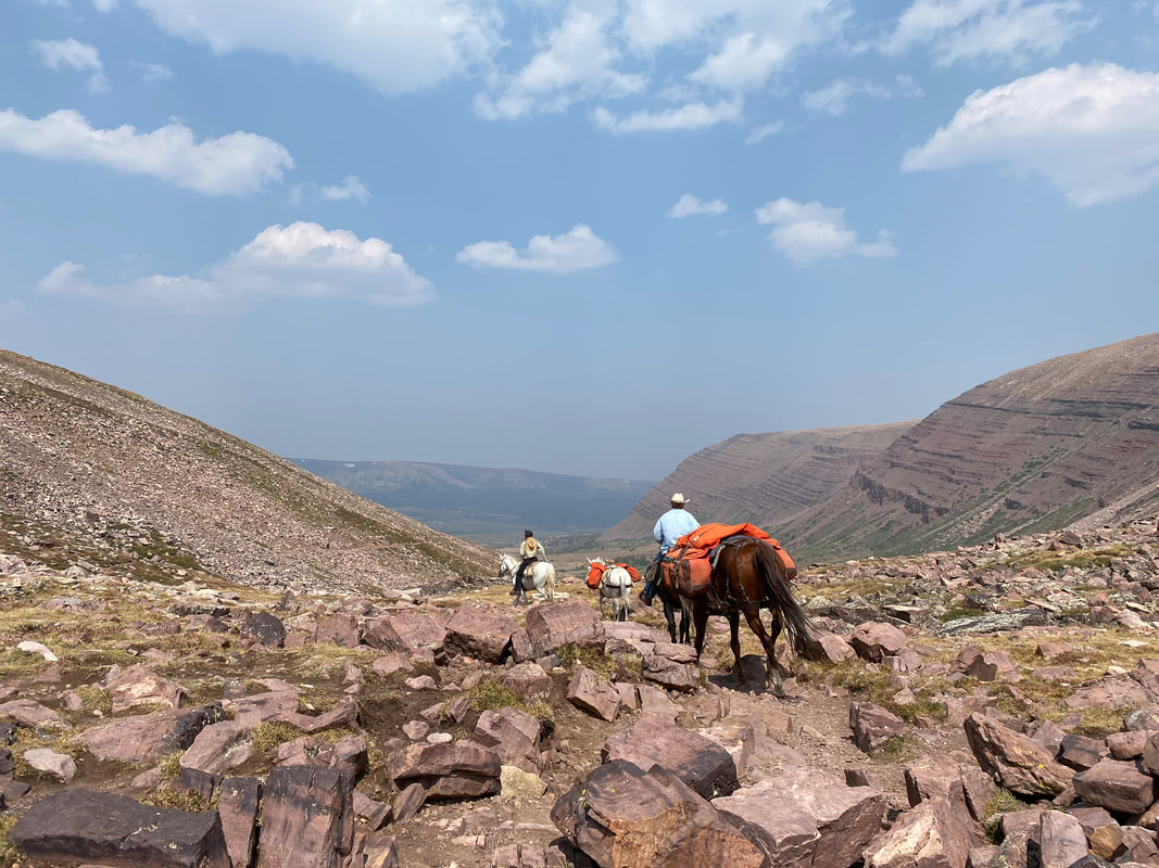 | "Life begins at the end of your comfort zone" |
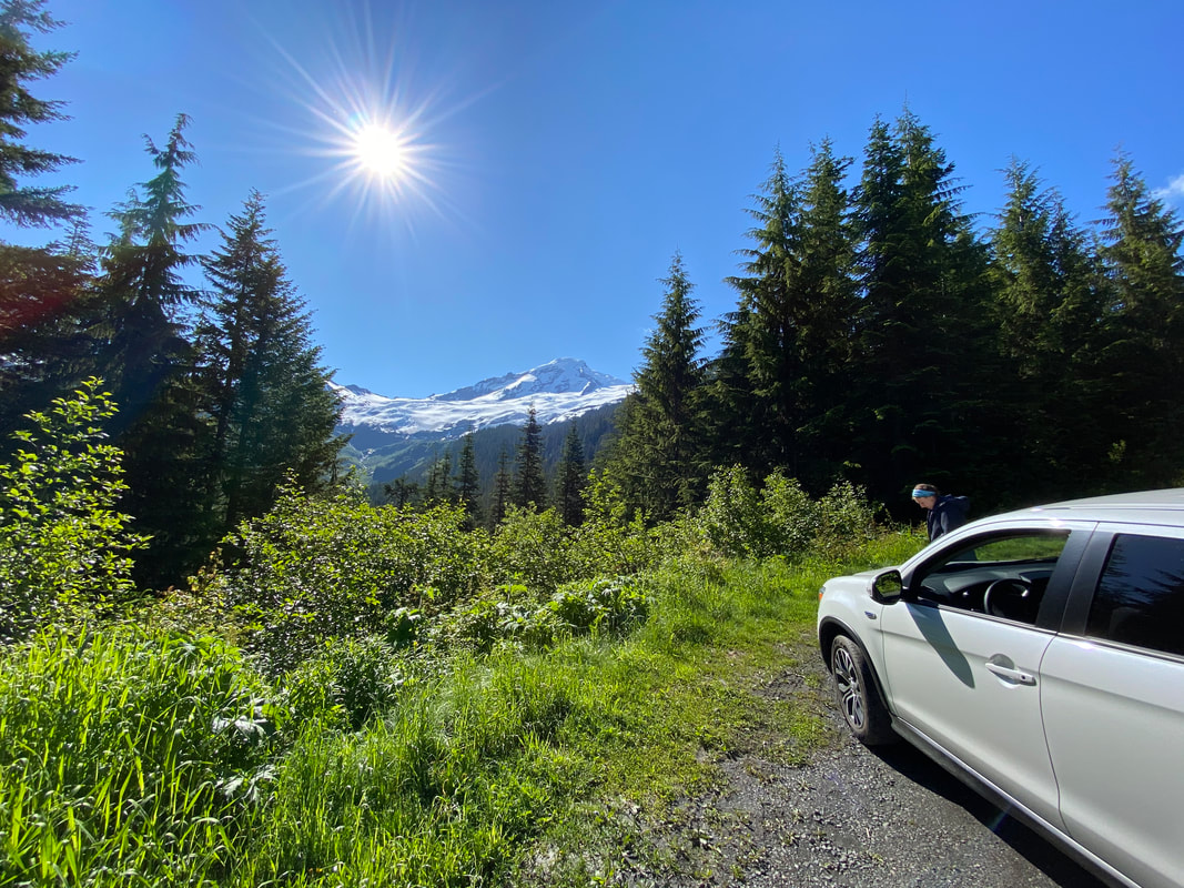 | The big mountains have captivated me for a long time. My first journey into the tall places was a little over 4 years ago with the climb of my first Colorado 14er (Mt. Elbert, 14,439). The view from the top was wonderful and it was enough to keep me coming back. Over the past several years I’ve climbed higher class routes, added backcountry peaks to my resume and completed winter ascents in the West and along the East coast. It’s been a wild |
ride, but it got me looking at the glaciated peaks of Wyoming, Montana and the Pacific Northwest. I spent time trying to understand the technical aspects, talked to friends who had been out there and tried to figure out what mountains would constitute a “beginner friendly” glacial climb.
I was lucky that I also had other friends that had the same draw as me, they had a hankering for the big mountains, and wanted to step it up a notch. I found a younger UCMCer, my friend Emily, that wanted to learn some glacial skills too. We found a course up in Bellingham, Washington on Mt. Baker that offered a few days of snow skills, glacier rescue and ice climbing. Sounded like the perfect thing for us, knowing a little already and wanting to grow our skills. We originally planned to do the course in May, but unfortunately had to delay due to COVID. Luckily, we were able to reschedule for July, so we booked plane tickets and were off.
We left Cincinnati on the 4th of July, great day to fly, especially during a global pandemic, and arrived in Seattle in the early afternoon. Getting the rental car was a small adventure in and of itself, but after some waiting and almost settling for driving a Ford Fusion, we got our SUV and were heading North. The drive up to Bellingham was refreshing, it was nice to be out of a plane, it felt great to be moving and the day was beautiful. Eventually we found our way up to Larrabee State Park and enjoyed a little walk up to a lookout over the coast. The view was wonderful, and it felt great to be out again. After so many trips had been canceled or postponed because of COVID, finally being on another big one was a great feeling.
After enjoying the coast, we found our way into Bellingham, got setup at our hotel and found the last local restaurant in town open on the 4th of July for dinner. Some delicious perogies and a beer later we were packing bags back at the hotel getting ready to meet our instructor at the American Alpine Institute (AAI) in the morning. We got there, bright and early at 7AM to meet up with Lani, our 26-year-old, mountain climbing guru. With a quick hour of pack shakedown and grabbing some final supplies we were driving up towards Mt. Baker to begin our fun.
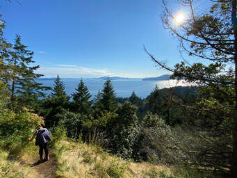 | 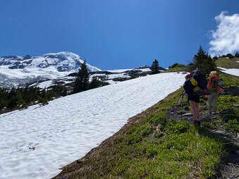 |
The hike from the parking lot up to the base of Hogsback near the Coleman Glacier was a steep one. We went up 2,000’ in a little over 2 miles before finding camp on the snowfield near 5,500’. As we unpacked, we talked about our plans for the next few days and decided that we’d trying to go for a summit the next day since the weather looked best and Lani felt that Emily had enough experience to do it that soon coupled with a low risk of crevasse issues. I started trying to get all my gear together and realized I left my shell jacket in the car, my stomach sank…
This was definitely my worst “Oh Shit” moment of this trip, but I figured it wouldn’t kill us, I just needed to go for a long walk down and back. After letting everyone know about my mistake, Lani said she’d go get it since letting me wander off down the trail on my own was off limits on a skills course like this. A little bummed, but very appreciative, she went down and returned about two hours later during which Emily and I practiced wearing crampons again (after a few month break) and tying some different knots for rescue. We spent the evening practicing self-arresting on some low slopes and got to bed early, we planned a 2AM alpine start to avoid soft snow when coming down the mountain.
I woke up a few times throughout the night as other teams passed by us. The first around midnight and the last around 1:30AM. Eventually it was my turn to get out of the tent, so I booted up in the cold morning and watched the 1:30AM team’s head lamps disappear into the night going over Hogsback 1,000’ above us.
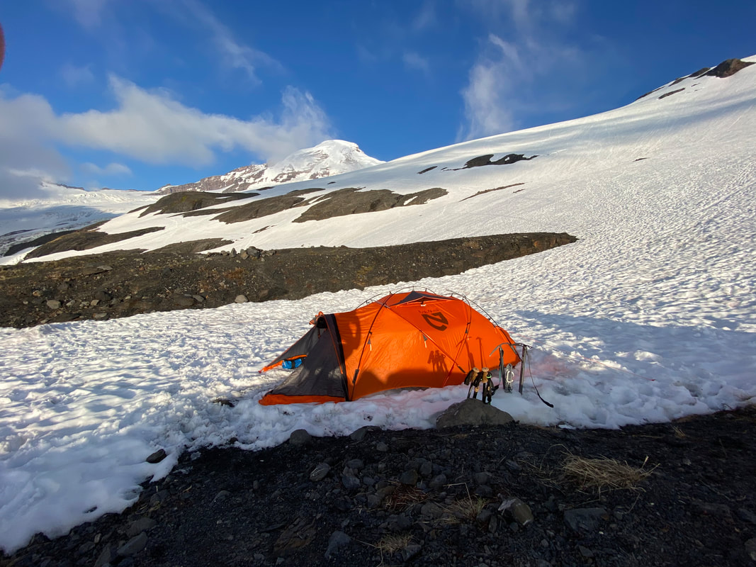 | 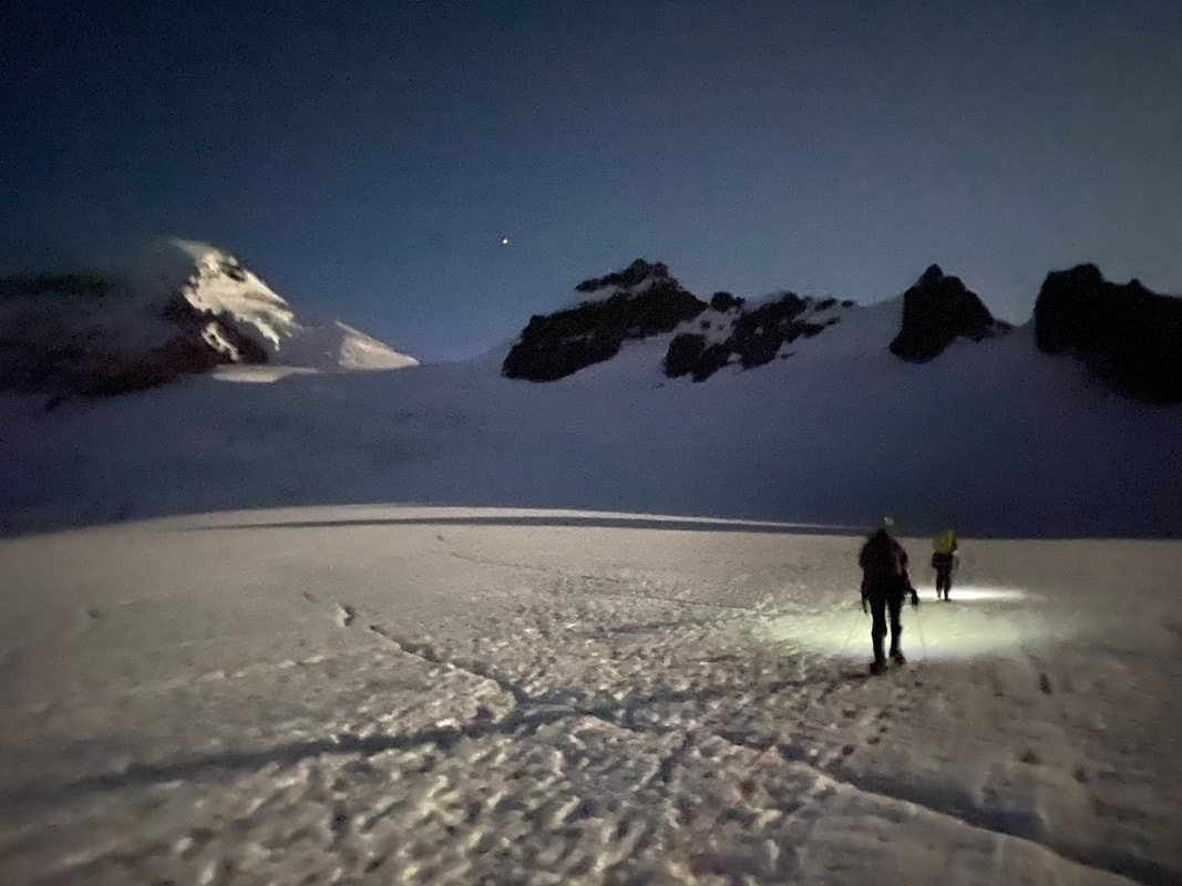 |
We quickly got roped up and, on the move, ascending to the upper glacier at 7,000’. The ground was still well frozen, and you could see small crevasses dotting the ground as you walked. The air was still, and the moon made it look as if a giant flood light was shining down from Colfax Peak. Our view of the summit 3,000’ above us was beautiful, clear with light fog dancing around in the breeze, we were confident it would clear by the time we made it up to 10,700’ at the top. After about 2 hours of walking we reached 9,200’ at the base of Pumice Ridge, the steep climb up to the even steeper Roman Wall, the last obstacle before the summit plateau.
We passed the group of 5 I had watched disappear over Hogsback several hours before and continued towards the top. Our pace began to slow as we became tired and Emily became less sure about her footing. We were obviously being cautious, but our proximity to the top had me excited and moving fast, which was probably a pain in the ass with all the slack I was giving Emily. After about an hour and a half switch backing our way up the steep rib, we reached the summit and could see the small 50’ or so summit “knob”. The group we had played leapfrog with gladly took our picture in exchange for theirs. It felt great to be up there, the wind was strong, but not brutal and after spending so much time in the shadow of the mountain, the light gave me new life. It was probably a brisk 20 degrees with wind chill, but Emily and I didn’t mind. We were enjoying being at the top of the world again. I could tell on the other hand that Lani was ready to go down. She obviously was thinking about the rest of our walk down unlike us.
We passed the group of 5 I had watched disappear over Hogsback several hours before and continued towards the top. Our pace began to slow as we became tired and Emily became less sure about her footing. We were obviously being cautious, but our proximity to the top had me excited and moving fast, which was probably a pain in the ass with all the slack I was giving Emily. After about an hour and a half switch backing our way up the steep rib, we reached the summit and could see the small 50’ or so summit “knob”. The group we had played leapfrog with gladly took our picture in exchange for theirs. It felt great to be up there, the wind was strong, but not brutal and after spending so much time in the shadow of the mountain, the light gave me new life. It was probably a brisk 20 degrees with wind chill, but Emily and I didn’t mind. We were enjoying being at the top of the world again. I could tell on the other hand that Lani was ready to go down. She obviously was thinking about the rest of our walk down unlike us.
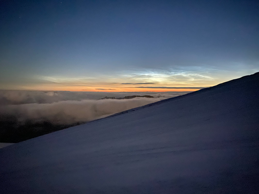 | 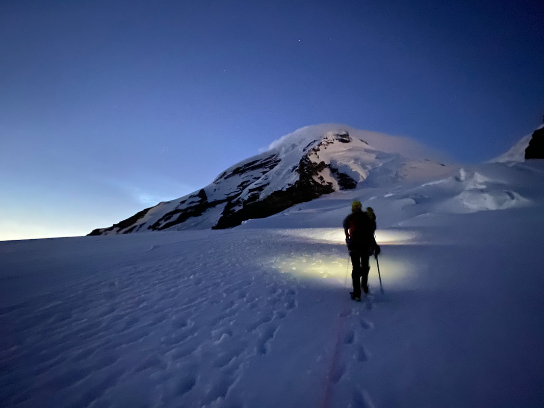 | 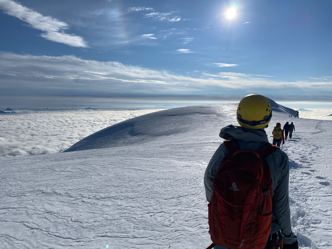 |
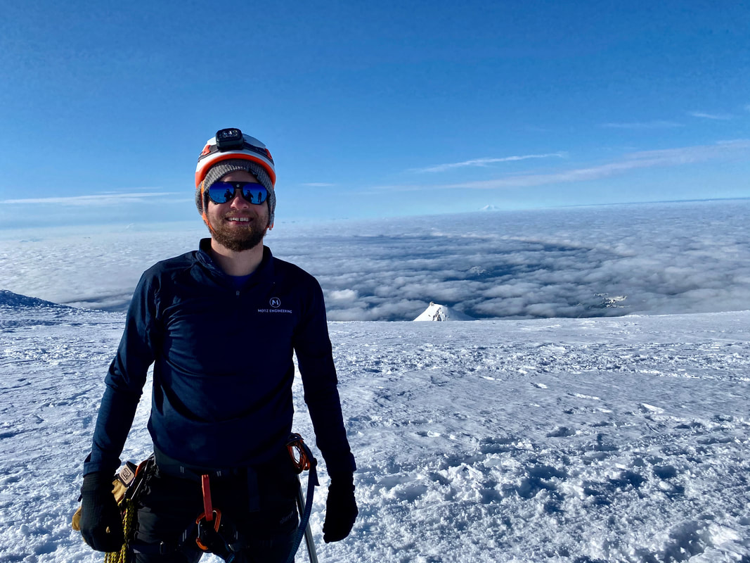
As the three of us began walking down the ridge, our pace slowed. Emily was getting tired and unsure of her footing, on top of that, during her last climb she had been in an avalanche, so the steep terrain was playing tricks on her head. After some encouragement we descended 1,000’ down the Roman Wall and found a sheltered spot in the sun on Pumice Ridge for a break and a snack. We watched as other climbers streamed by us heading for the summit and were happy to be on the way down. Our group quickly made it down past the bergschrund, snagging a quick photo of the massive hole waiting to open up before reaching the flat plain above Hogsback. The clouds began to envelop us as we continued to descend. We glissaded down and arrived back to camp a little before noon. I was tired, so I spent a little time moving around my things and before I knew it, I was asleep on the rocks next to the tent. It was a much-needed nap, I woke up to the other teams coming down Hogsback, appearing out of the fog. Eventually the other tents around us began to get packed up and as night set in, we were the only ones left. Alone on the snow.
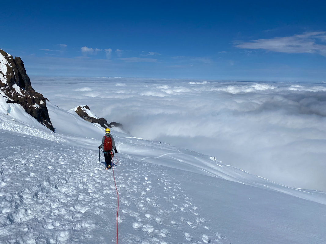 | 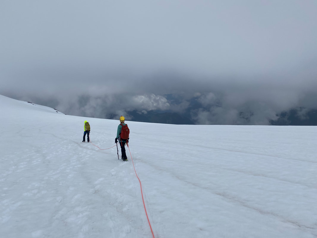 |
| In the morning it was raining, a soft Northwest mist, it sounded pleasant on the tent. We packed up camp and moved 1,000’ down to below tree line and spent the day practicing knots and crevasse rescue techniques. This was the learning part of our trip after the fun summitting part. Lani spent the next two daysteaching Emily and I how to properly ascend and descend ropes, how to haul each other out from a crevasse fall and how to travel on a dry glacier. We spent a day ice | 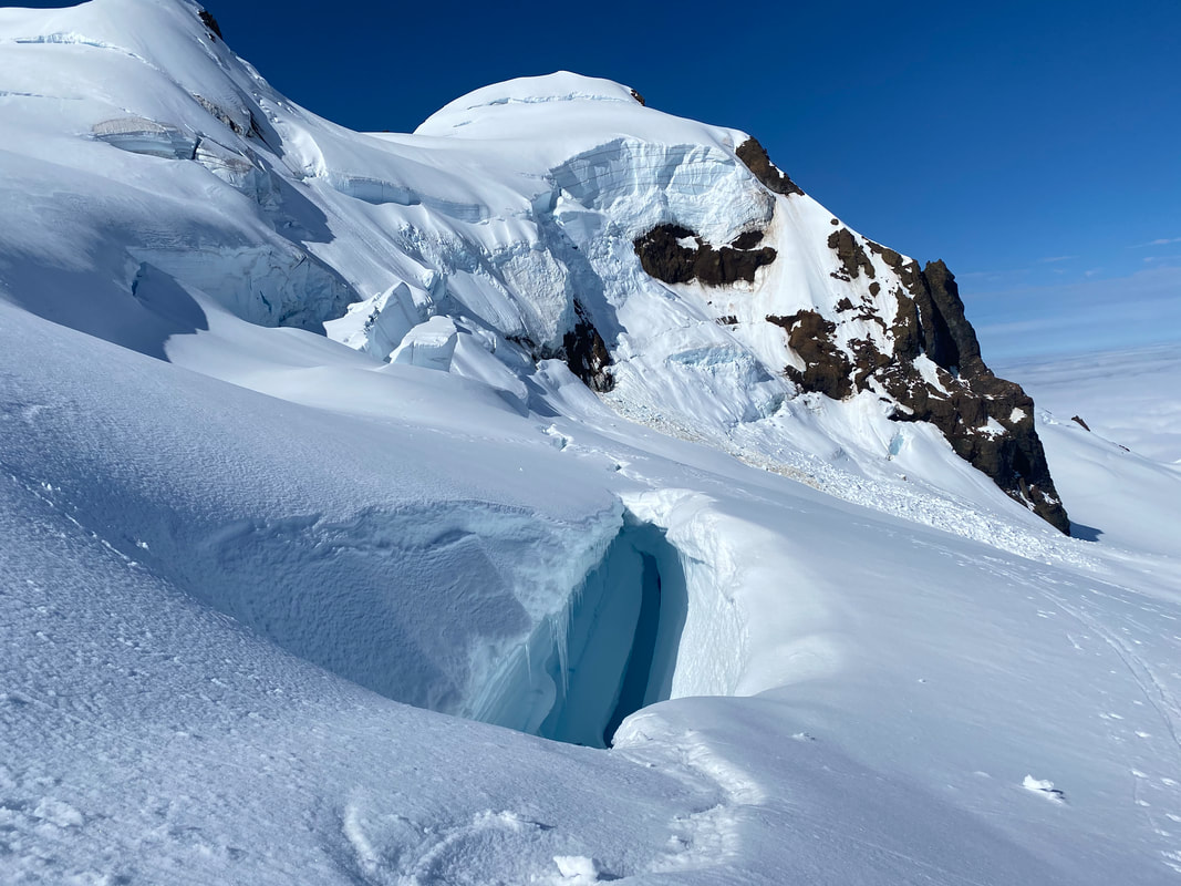 |
climbing, lowering into and climbing out of crevasses and practiced building ice anchors. I learned a lot in those few days, and they got me excited for climbing again. I came out of the course wanting to climb bigger mountains and continue to grow and push my skills.
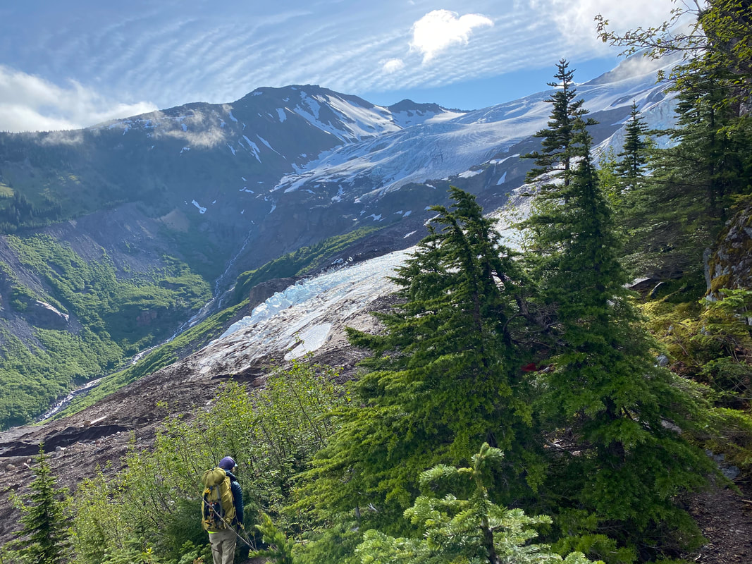 | 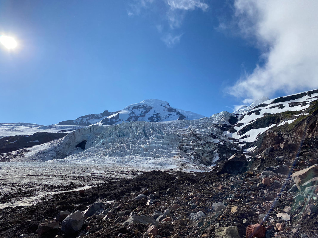 |
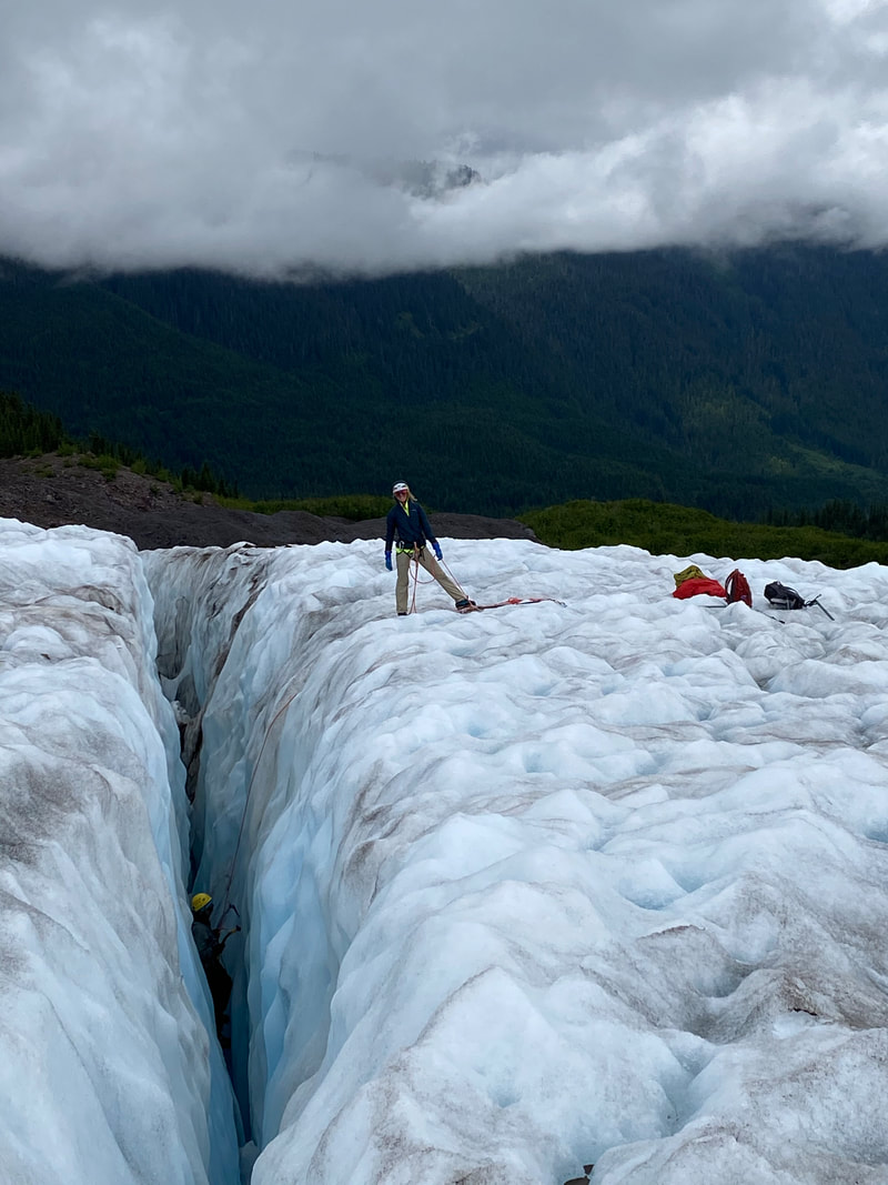
On our fifth and final day we woke up to rain yet again, we quickly packed up and began our way back down to the car. It was kind of sad to say goodbye to Lani, Emily and I had both enjoyed her company and knowledge during our days out in the backcountry, but we knew we still had more trip left and still wanted to get in another climb.
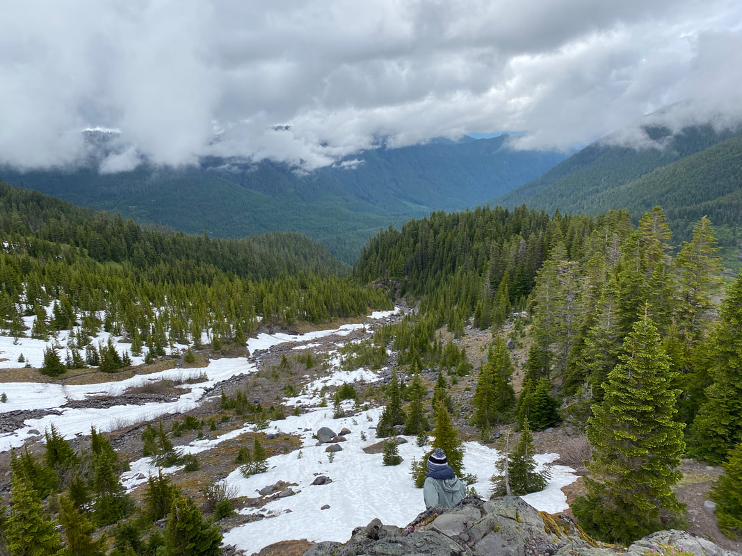 | 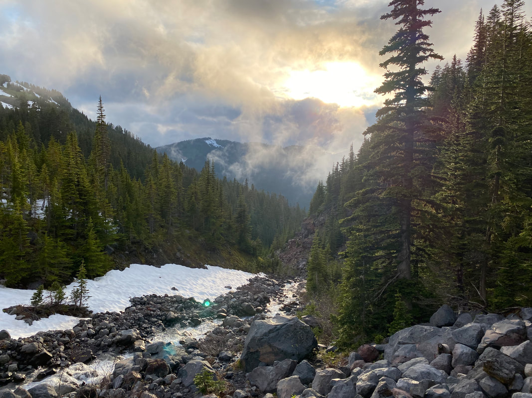 |
Some of our friends were down south near Mt. Rainier and we had talked about making a summit attempt with them before we flew out from Cincinnati, but we had both heard that the upper mountain was a mess this year. There weren’t many parties finding the way to the top and with fewer climbers the route wasn’t as visible. On top of that there had already been two groups that needed rescuing since the mountain had reopened in mid-June. We also couldn’t get permits to stay at Camp Muir which meant we’d have to do the whole thing in a day, it was an unobtainable goal for us. Nonetheless, Emily and I headed south and grouped up with our friends, spending a night trading stories about our climb of Baker and their time on Hood.
The next day they wanted to day hike to Camp Muir and we wanted to head out onto the Olympic Peninsula, so we gained our friend Lizzie in our group and the others went off on their journey. We arrived at the trailhead we wanted around noon, a little late to start the climb up Mt. Stone, but we still figured we’d go for it.
The trail began up from the parking area, snaking its way along the ledges above the valley floor, slowly gaining elevation to 2,300’ before rising sharply from the boarder of the National Park up 3,000’ over just two miles. It was a butt blaster of a hike, but we were all enjoying the challenge. The higher we rose the better the views of the surrounding area we go. Eventually our route left the well-established trail and we were working our way up a steep ravine next to a waterfall. Around 5,500’ we came out of the trees and were greeted with magnificent views of Mt. Skokomish and Mt. Pershing, Mt. Stone still towered 1,000’ above us and it was getting late in the day. We set a turnaround time of 4:30 and continued up the loose scree slope. As we neared what we were going to call our “summit” (the actual summit was unobtainable at that point due to our late start), the steepness and the terrain got the best of us, so we decided to turn back at around 6,150’. It was a good call; we were all getting tired and we knew we’d be pushing it to get down before it got dark or we ran out of snacks and water.
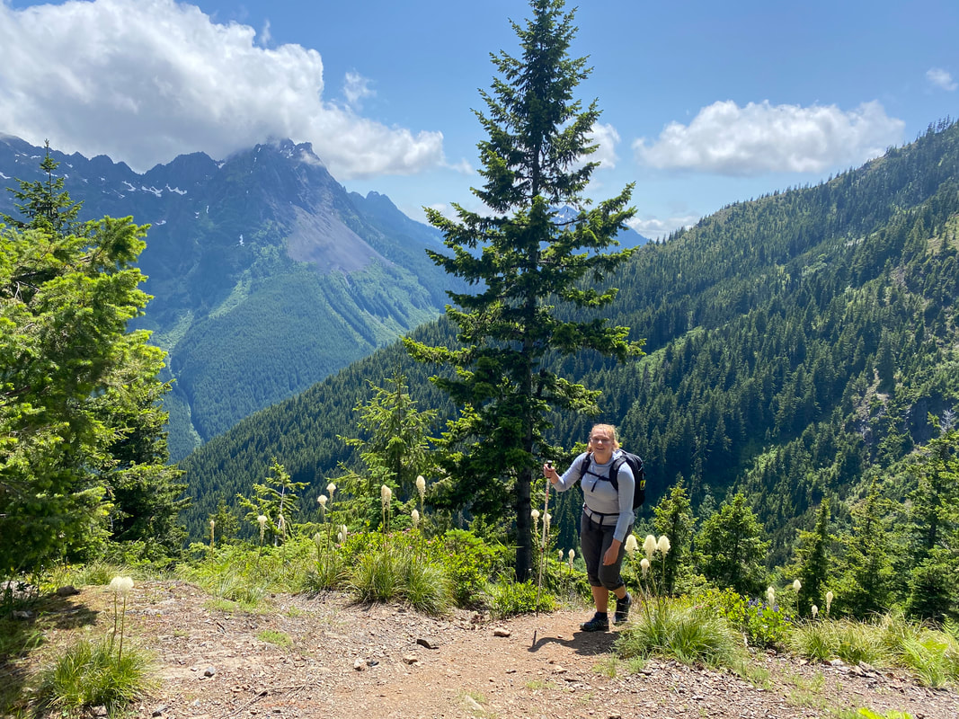 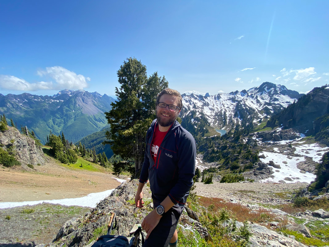 | 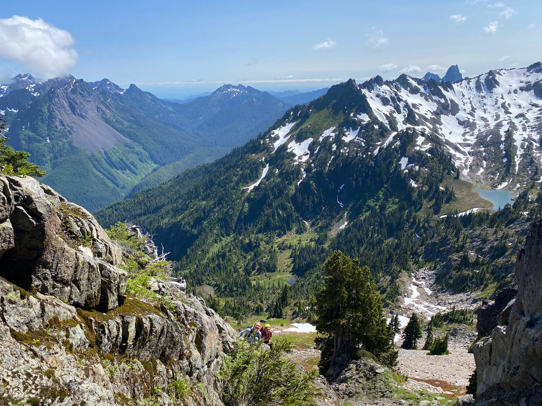 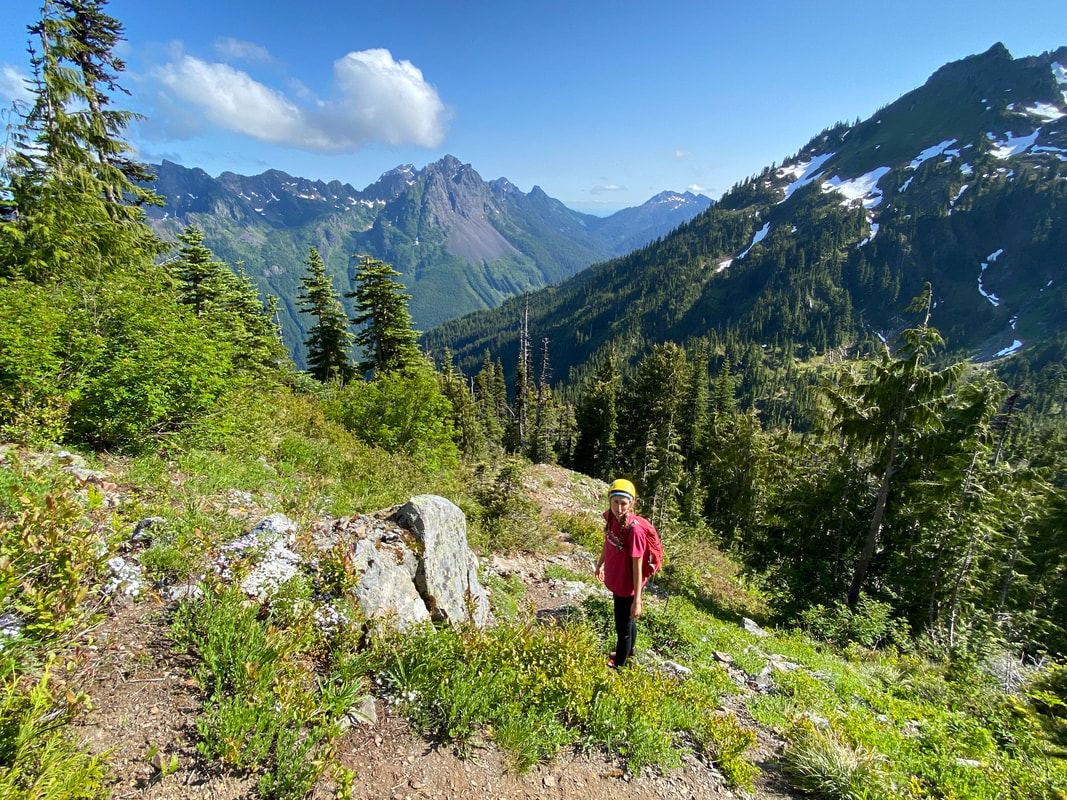 |
The way down was as challenging as the way up, everything you stepped on wanted to slide. Several times one of us would knock a rock down and it would tumble down 100’ below us. We took our time and worked our way down to more stable ground. Before we knew it, we were back on the well-marked trail heading back to the bottom. The trail was a knee breaker and we all felt tired on the way down. After about two and a half hours of running down the side of the mountain and running out of water we finally arrived back at the trailhead. Luckily the spot we wanted to setup camp wasn’t far, so we walked a little way, got our cozy spot in the trees and got a fire going. It was relaxing to hangout by a campfire for the first time on this trip and not have anything to worry about doing the next day. Lizzie fell asleep as Emily and I worked on drying out gear and talked about the trip so far. It was a relaxing last night in the woods.
When we work up in the morning, we caught a ferry to Seattle and spent the next two days exploring the city. Another relaxing end to a very busy trip. We spent a lot of time talking about our next climbing pursuits or our next trips and we also spent a good bit of time just enjoying each other’s company during a much-needed break from all of our busy lives. A day later we were all boarding flights home and before we knew it, we were back to the rat race.
Even though I’m back, the mountains are still calling my name…. Until next time.
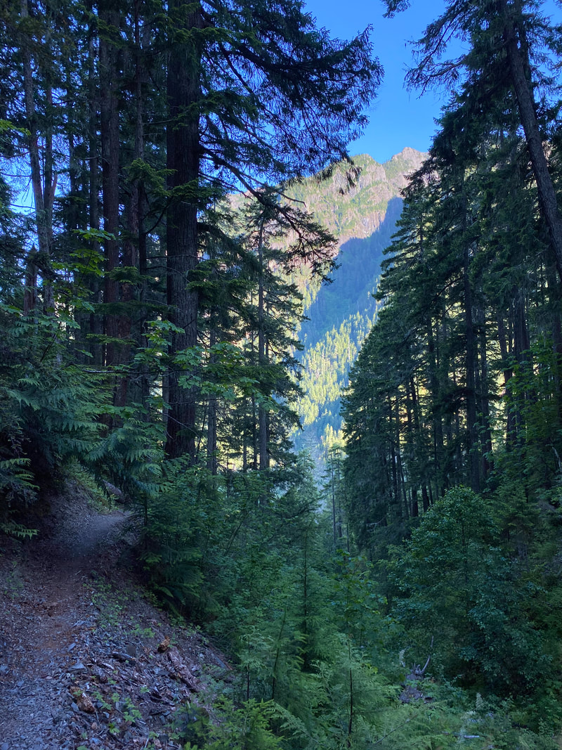 | "Life is either a daring adventure or nothing..." |
I don’t typically write about my weekend trips, especially not to Red River Gorge, but this one has a special place in my heart. It’s my first time going on a packrafting trip since Alaska.
I had been down to RRG the week before to trail run and the river looked particularly inviting. After a morning splash and a swim at Jump Rock, I knew what I wanted to do the following weekend, I was going to packraft the Red River. I had taken the boats out on day paddles but nothing real solid since Alaska. So, the idea was in my head and I was off.
I had a few challenges, the first of which was, I’ve never paddled the Red River in my life. I knew the upper Red in the Clifty Wilderness could be pretty dicy in lower water (technical Class II) and in high water it was a Class III-IV run, so I didn’t want to mess with that too much. I also needed a partner cause paddling alone isn’t safe (never done that before...). In all reality I wanted some good company and didn’t really want to try something new alone.
After a few days of asking around I found my friend Lindsey who was super willing and able for this journey, so we were off. The night before we went down it poured in The Red and I knew the trails were going to be a mud bath, but luckily this also meant the river was at a perfect 4.5’ which would be excellent for paddling.
On Friday, without much fuss, we met up in Cincinnati and made the short drive south. It was an uneventful drive, with a little traffic and a stop for some fried chicken (much needed). After about two and a half hours we were at the trailhead, ready to go. Starting down Bison Way, it was a muddy, hot mess but we were both optimistic about the journey ahead. We didn’t run into many other backpackers as we headed out towards Lost Branch, a few groups looking for a home for the night, but for the most part the only noises were the birds, the river below and our occasional chatting. Eventually, after about an hour and a half of trudging through the afternoon heat, we arrived where we wanted to camp for the evening. Unfortunately, another backpacker had already setup his hammock and nabbed the spot I wanted by the river, so we settled for another spot hidden in a valley back along a tributary. We quickly setup camp and gathered some soggy sticks for a small fire as the darkness and a light fog settled in for the night.
I woke up around 3AM to a bright full moon, the temperature had dropped, and I was freezing my ass off (smart moving camping by the water...). I listened to the trickle of water in the creek and let it lull me back to sleep.
When I woke up, the morning was already warm, our valley was shaded but I could tell how hot a day it was going to be by the stickiness in the air. We got up and moving early, about an hour before we planned (the nice thing about a small group). The day started with a creek crossing and then a decent sized river crossing, one after the other. We ran into some trail runners, who sounded like they were having a great time as they passed by, they were the last people we’d see for several hours. We changed into dryish socks and shoes and began the long slog up out of the valley onto the ridge. It was a 2 mile mud slide up 500’, a great way to start the day, luckily, the heat was still holding off.
It was a good hike; Lindsey was proving to be a great partner and we were crushing it with our pace. As we neared the end of the hike, we peeled off onto the Eagle’s Nest loop, an unmarked and unmaintained route in the Clifty Wilderness. The trail was overgrown, covered in downed trees and full of spider webs, just the kind of hike I enjoy. It took some route finding and a good bit of patience, but we bobbed and weaved our way along the forested ridge through dense pines and small creeks until we eventually arrived at a steep downhill. We almost kept going, but my curiosity luckily got the better of me. We dropped packs and hiked up a the faint trail few hundred feet to a spot I had never visited before, the Eagle’s Nest. It was an awesome overlook with views off deep into the Clifty Wilderness and a few exposed ridges that seemed ripe for exploration. Lindsey and I enjoyed the views along with a few other hikers we discovered up there before heading down the muddy and scree covered cliff towards the Red River.
It was a good hike; Lindsey was proving to be a great partner and we were crushing it with our pace. As we neared the end of the hike, we peeled off onto the Eagle’s Nest loop, an unmarked and unmaintained route in the Clifty Wilderness. The trail was overgrown, covered in downed trees and full of spider webs, just the kind of hike I enjoy. It took some route finding and a good bit of patience, but we bobbed and weaved our way along the forested ridge through dense pines and small creeks until we eventually arrived at a steep downhill. We almost kept going, but my curiosity luckily got the better of me. We dropped packs and hiked up a the faint trail few hundred feet to a spot I had never visited before, the Eagle’s Nest. It was an awesome overlook with views off deep into the Clifty Wilderness and a few exposed ridges that seemed ripe for exploration. Lindsey and I enjoyed the views along with a few other hikers we discovered up there before heading down the muddy and scree covered cliff towards the Red River.
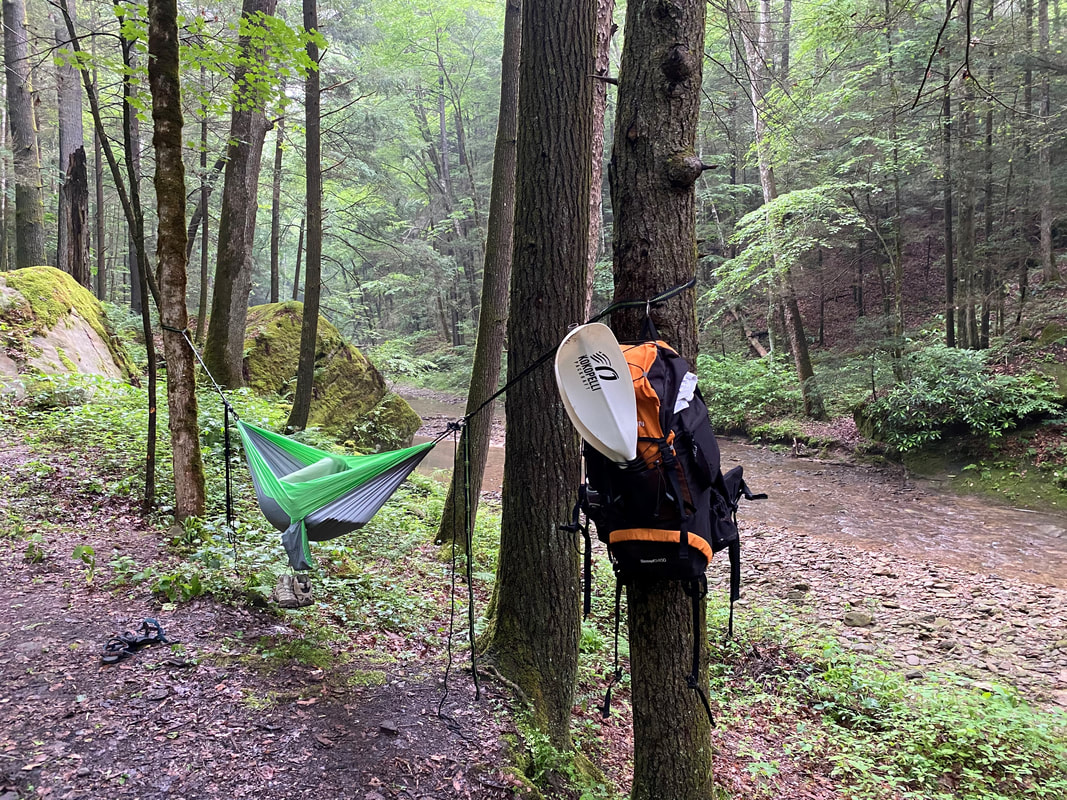 | 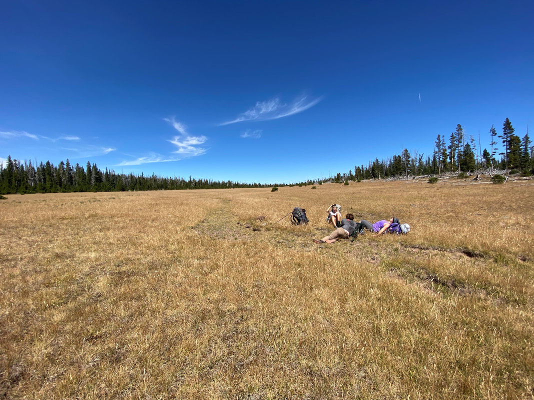 |
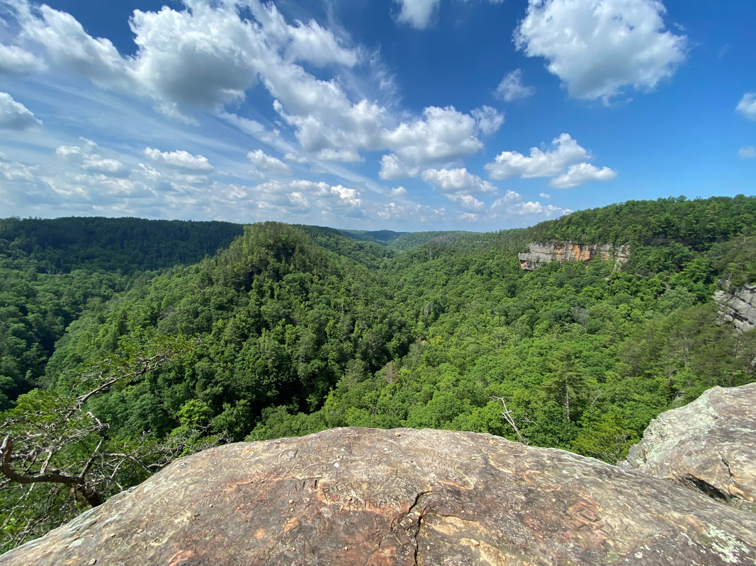
We got to the river a little after noon and grabbed a quick snack before inflating the Kokopellis and getting on the water. We put in on a sandy beach about a mile upriver from the boundary of the Clifty Wilderness at the HWY 715 bridge. Having never paddled this river, I was a little nervous, I knew the section down river from the bridge was gentle and flat but everything that I had read about the section through the wilderness was that it was rocky, technical in low water and the steep gorge walls on either side of the river make it extremely difficult to bail out once you’re on the water. We were only taking all our gear down the river, what could go wrong?
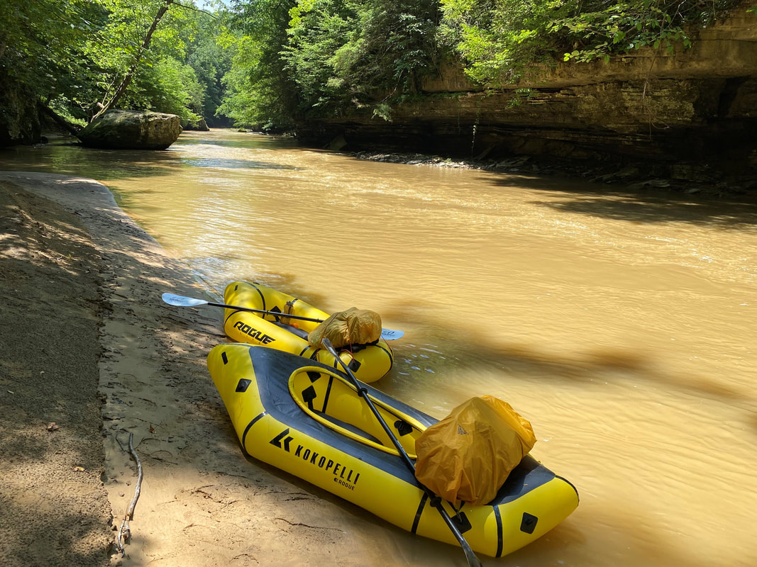
About sixty seconds into being on the water I realized that Lindsey barely knew what she was doing with a kayak paddle and was probably somewhat scared of damaging my boat. We floated and went through the motions for a bit before I noticed a bit of noise on the water ahead. Turning around to look there was about a 5’ section of river between two tight boulders that looked very shootable but if you messed up there were some nasty strainers on the other side of the rapid. I made the smart call and portaged onto the rocky shore next to it, we walked the boats down river a bit and got back on the water. Better safe than sorry right?
The rest of the paddle went wonderfully, we passed by day paddlers and enjoyed a nice drink in the sun. We both got a little too tan and had a very relaxing afternoon compared to our muddy and sweaty morning of walking. All in, it took us about 2 and a half hours to go around 7 miles down river to the Sheltowee Suspension Bridge. I hauled our packs up from the river to one of my favorite hidden campsites and then we continued another 1/4 mile to Jump Rock. I’ll give you a warning, if you’re worried about COVID-19, don’t go to Jump Rock in the afternoon… The place was packed with locals and weekend warriors alike, it felt nice to swim in the water and jump off the 15’ cliff at the end of a very long and rewarding day. It felt especially great to be back, having thought up this trip in this very spot a week before. I yelled at everyone to pick up their goddamn trash, we relaxed on the sandy beach for a bit and then eventually packed up the boats and walked up to our camp. We spent a nice evening by the fire, this one much better than the first night. Eventually the night cooled down and we both wandered off to bed. I laid in my hammock and watched the few stars I could see through the trees as I drifted off to sleep. The next day we packed up and road walked back to the car, a very anticlimactic end to our journey. We drove the long way around leaving the Gorge and I showed Lindsey some of RRG she hadn’t seen before. It was a tiring and relaxing weekend. I came out of it with a small hole in my left heel, thanks to a blister I ignored, and a very relaxed demeanor.
The rest of the paddle went wonderfully, we passed by day paddlers and enjoyed a nice drink in the sun. We both got a little too tan and had a very relaxing afternoon compared to our muddy and sweaty morning of walking. All in, it took us about 2 and a half hours to go around 7 miles down river to the Sheltowee Suspension Bridge. I hauled our packs up from the river to one of my favorite hidden campsites and then we continued another 1/4 mile to Jump Rock. I’ll give you a warning, if you’re worried about COVID-19, don’t go to Jump Rock in the afternoon… The place was packed with locals and weekend warriors alike, it felt nice to swim in the water and jump off the 15’ cliff at the end of a very long and rewarding day. It felt especially great to be back, having thought up this trip in this very spot a week before. I yelled at everyone to pick up their goddamn trash, we relaxed on the sandy beach for a bit and then eventually packed up the boats and walked up to our camp. We spent a nice evening by the fire, this one much better than the first night. Eventually the night cooled down and we both wandered off to bed. I laid in my hammock and watched the few stars I could see through the trees as I drifted off to sleep. The next day we packed up and road walked back to the car, a very anticlimactic end to our journey. We drove the long way around leaving the Gorge and I showed Lindsey some of RRG she hadn’t seen before. It was a tiring and relaxing weekend. I came out of it with a small hole in my left heel, thanks to a blister I ignored, and a very relaxed demeanor.
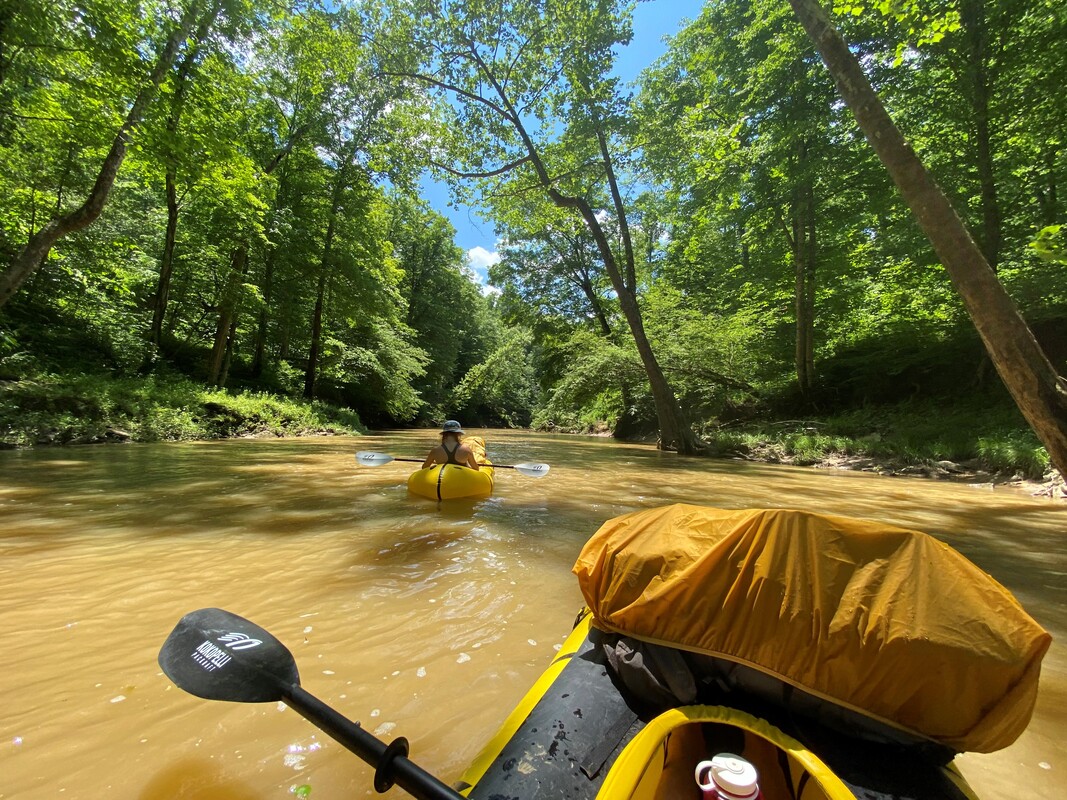 | 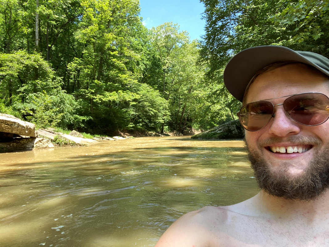 |
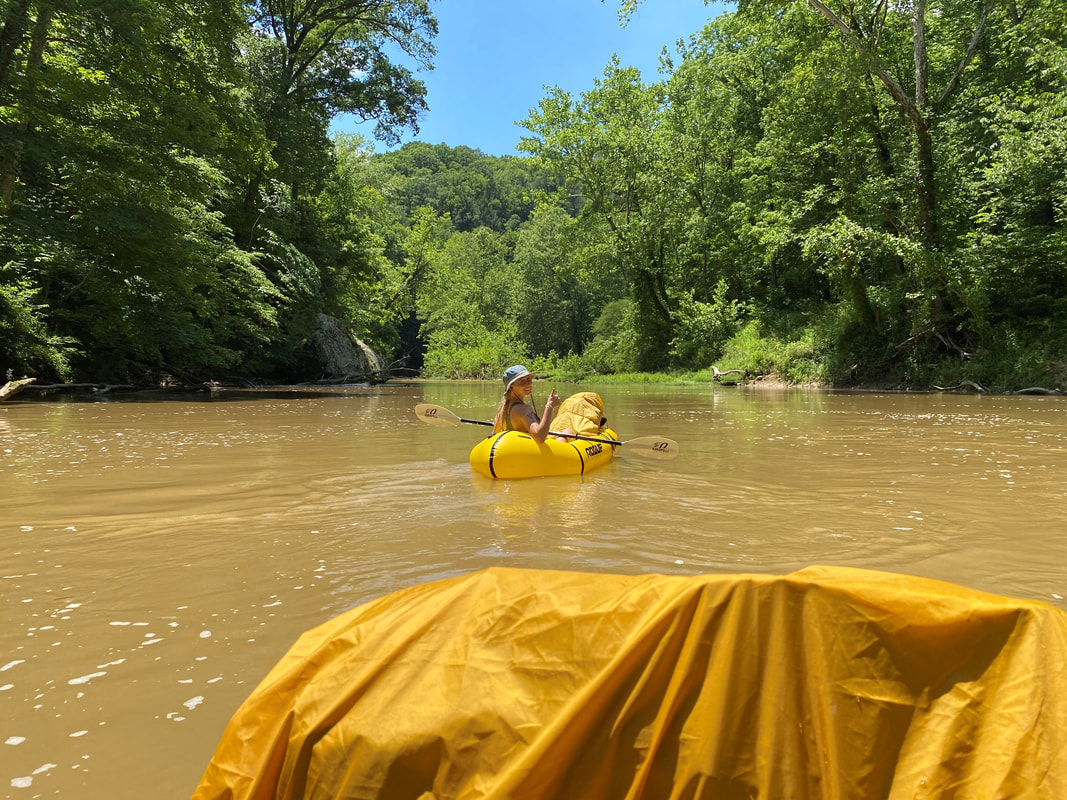
I’ve spent the last few weeks feeling penned up, none of my big trips I planned so far this year have happened. My urge to travel continues to get crushed by various complications and I’ve been filling my time with nonstop local paddling instead. Even though it was just a trip to The Red, it filled that growing hole for now. It was also an amazing feeling to go packrafting again, I hadn’t had a chance for an overnighter with the boats since Alaska. Having these things has truly changed the way I look at maps and led me to think about packrafting trips in Wyoming, Utah, and Hawaii, all with their own amazing possibilities. Luckily, I have some big things coming up for July and August, I can only hope that everything goes according to plan this time around.
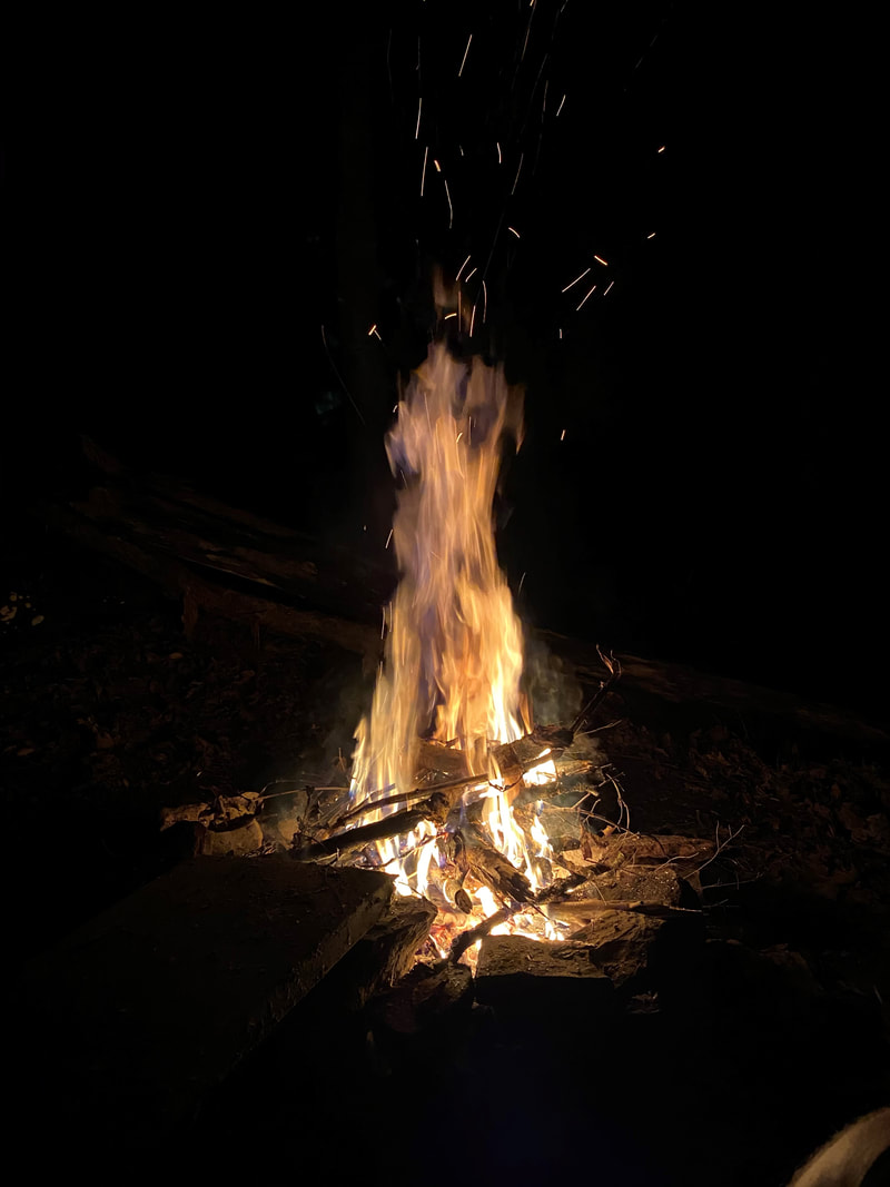 | "Travel is about the gorgeous feeling of teetering in the unknown." |
I think I've wrote this in my head about a dozen times, I figured it was time to put fingers to keyboard. I plan to hike the Pacific Crest Trail starting in May of 2021 as many of you probably know. I plan to start that journey a little less than a year from now. Part of my preparation for that is trying to wrap my head around every aspect of the journey as best I can.
I spend a lot of time writing mostly about the exciting and happy moments during my trips. Every once in awhile there's a scary moment, or a challenging point but for the most part, after they happen, my journeys almost always pan out to happy memories and lessons learned. I finish one trip and move on to the next adventure.
For almost five years I've been obsessing about doing a long trail, a thru-hike. My first thought was the Appalachian Trail right after college, but that didn't fill the void. Eventually, after not much thought, I ended up with an obsession to hike the Pacific Crest Trail from Canada to Mexico. The trail covers 2,653 miles across California, Oregon and Washington ending several days into North Cascades National Park at the Canadian boarder. The trail ranges from 13,153' at Forester Pass in the Sierras to 140' at Cascade Locks near the Columbia River. I've thought about every little detail of the trail, heavy snow in the Sierra, blistering heat in the Mojave, nonstop rain in Washington and the possibility of falls, injuries and failure on the trail. None of those possibilities or scenarios scare me, because I've come to terms with them.
Anyone who knows me knows I like to binge TV and movies. My latest victim is a YouTube series called "The Fifty". "The Fifty" follows Cody Townsend as he tries to climb and ski down the Fifty Classic Climbs of North America. These mountains are massive, they're beautiful and they can be dangerous and deadly. Cody spends a lot of time during the series talking about measuring risk, and being in control. He's not someone like Alex Honnold or Tommy Caldwell who tend to appear fearless, he admits his fears and wears them on his sleeve. A big part of his process is thinking about the things that can go wrong and being as in control of the situation as possible. When he rips 4,000' down the side of a massive mountain, the guy has to be sure he knows what he's doing and throughout his journey he's had his moments where he's made the tough call and turned back.
The fear that sat in my mind during the past several months was that all of my upcoming trips would be canceled. Luckily I came to terms with that because fear became reality and none of them are happening. No Mt. Baker, no Havasu Falls, no 14ers, no South America. I affectively need to re-dream my year now. I've accepted that, I'm planning and I feel good about it, this was a tiny fear, barely present. The reality is that fear is something that's ever present in our lives, it hides in the back of our heads and often, our fears present themselves at the worst times. I believe the only way to beat your fears is to confront them before they confront you.
My greatest fear that has burrowed its way into my skull over the past six months isn't failure on the PCT, its not a delay because of CoVID, oddly, my greatest fear is finishing the trail. Weird, right?
 | 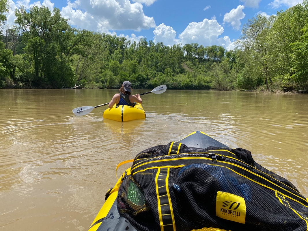 |
The past 20 or so years of my life have been planned out for me, go to school, graduate, go do some more school (yes I got to decide some of that but just barely), get done with that and get a job. Maybe the last four years of my life have been entirely decided by only my decisions but even then there was still a path and a reason for what I've been doing. I've been working so I can hike the trail, when I get paid I think about how much needs to pay bills and how much I can hide away for the trail, when I exercise my reason is to get in shape for the trail. A lot of what I do has been for the trail. What do I do when I get done?
Do I just continue the trend and go find the next adventure, settling back into where I was before my journey? Do I change my life and try something new? Maybe I'll have fell in love with a place during my long walk and stay there? Will I be so sick of walking after five months that I'll never do anything like that again? Will I be so consumed about the idea of being outside away from everything that coming home and sitting down on the couch becomes something that makes me feel uneasy? Will the mundaneness of life be something I can't put up with so I wander off into the woods never to be heard from again? Okay, the last one was a joke (kinda), but you get the point, I don't know what comes after.
I'm fearful of the end of my carefully built path, I'm fearful of accomplishing my greatest goal and not knowing what the next one is. Is that dumb? I mean, in all honesty, I'll dream up the next great adventure while dehydrated in the desert or lightheaded at the top of Mt. Whitney but until then, the idea of crossing the finish line into Canada will continue to give me the jitters in so many different ways.
I think this bothers me so much because I'm terrified of finally growing up. In my mind, when I finish the PCT, that could be my greatest journey (really don't want to peak young). I still want to run away every weekend and travel. I would, will and have told work I'm leaving early to go paddle or go on a long weekend trip. My priorities in life feel different from other's that I spend time around. They get busy with work, are focused on money or working on relationships and just in general have different pursuits. I would rather spend the day suffering through a climb than sitting on a beach. I would rather walk through the rain all day then sit at my desk. I'm a little weird...
I watched a movie recently called "Dirtbag: The Legend of Fred Becky", Fred Becky was probably one of the greatest climbers of all time. He spent his life climbing first ascents around the world starting at age 13, he wrote the guidebook on climbing in the Pacific Northwest and the man had a passion that he let nothing get in the way of, he kept climbing until his death at age 94, the man has a friggen mountain in Alaska named after him... I fortunately/unfortunately will never be able to live up to the accomplishments of Fred but the idea of how he lived his life always gets me thinking. Always in pursuit of the next journey, uncompromising in his dedication to living the life that he wants. At the end though, what's left?
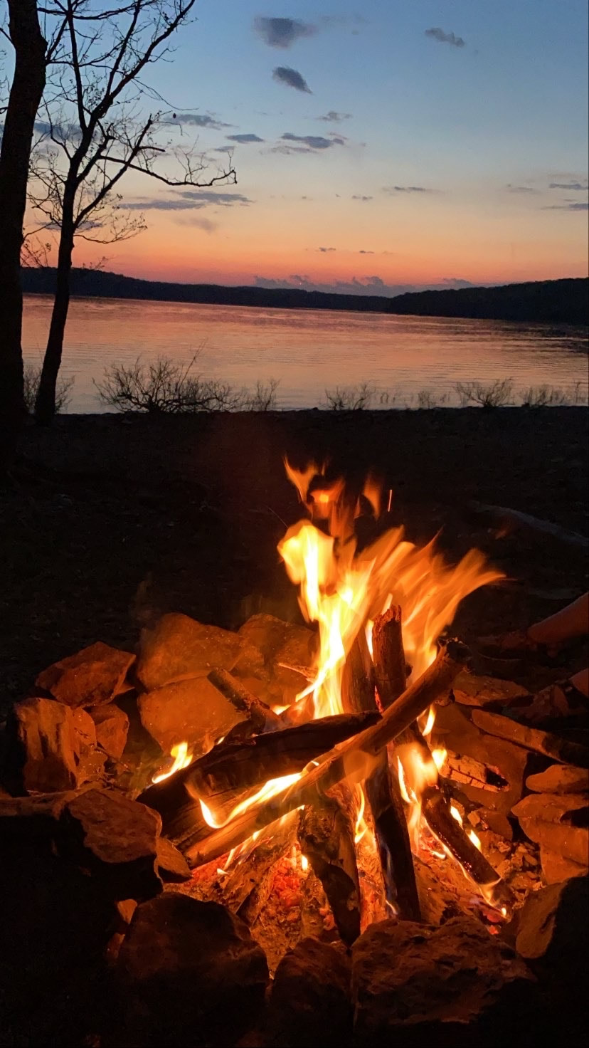 | "There's so much aversion to risk taking... You have to take risks if you want to learn anything about yourself. We should wanna expand the self imposed walls we put around ourselves." |
Its no secret, I like to travel, and I travel in different ways than most people. I like to not shower for days, my favorite hotel is my tent and my idea of getting to my destination is a 24 hour car ride instead of a 4 hour flight to save a couple bucks. I've spent the past 4 years consumed by a constant urge to go and picked up a lot of my good habits (and also some bad ones) along the way. During that time I've had the opportunity to be a part of some truly amazing communities, make life long friends and see things that few others will ever get the chance to see. I've found a lifestyle that I never knew existed and I've been able to figure out what I want from life (or at least part of it). On top of all that, I've had the chance to teach others what I love to do and show them that they can accomplish almost anything. I also get that not everyone understands the way I live my life, constantly thinking I'm burning through money (camping is free and gas is cheap), thinking I'm crazy for some of the things I do (-32°F isn't that bad as long as its not too gusty), and not taking much time to relax and go on a beach vacation (there's beaches in the woods where no one else goes...).
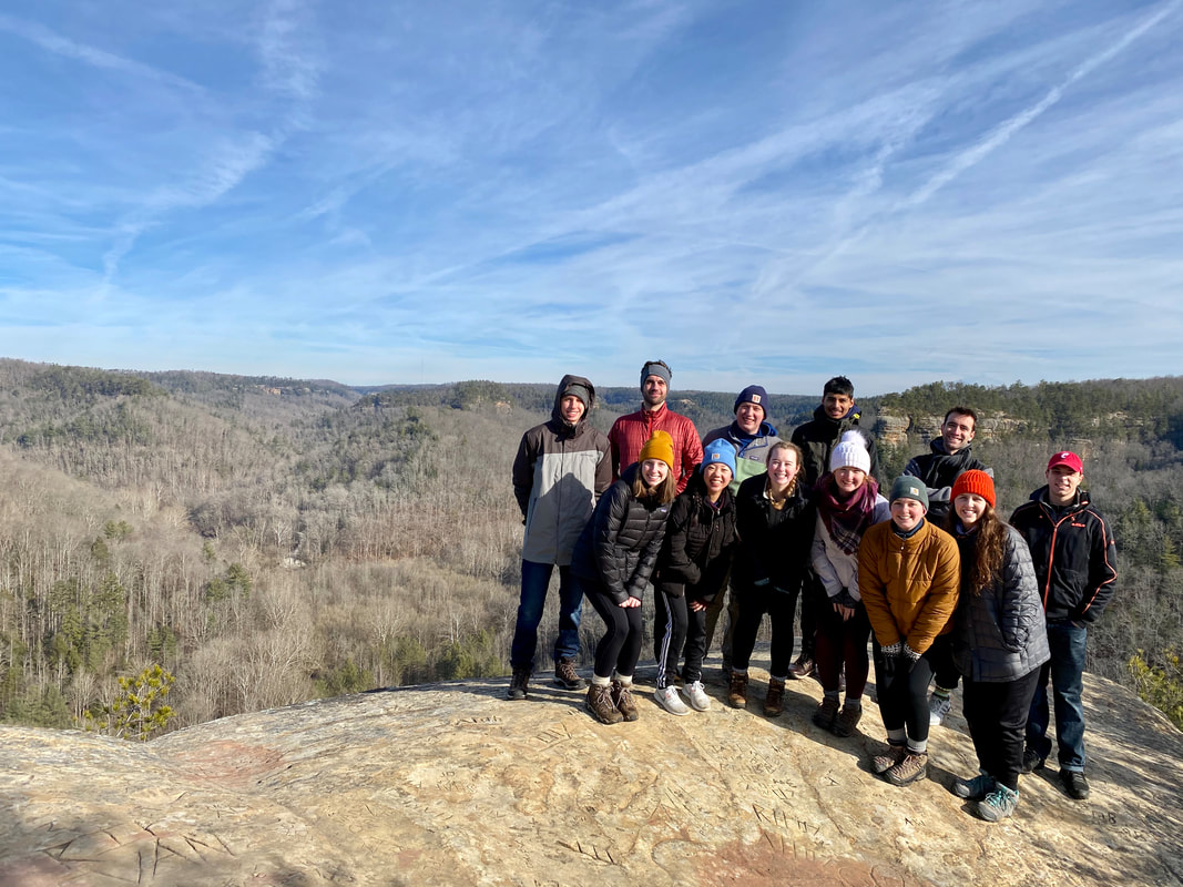 | 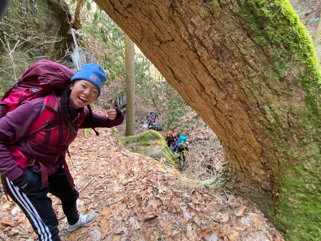 |
I think the top two questions I get asked by people who don't get it are:
1. When are you going to hike the Appalachian Trail?
2. Do you think you'll ever climb Mt. Everest?
I internally die of laughter every time I get asked one of these... The AT definitely has some beautiful sections and completing the entire thing is a hell of an accomplishment but I have other goals in mind first. As for Everest, I'm not sure thats something I'll ever do. Yes, its the tallest peak in the world, but climbing the tallest and biggest isn't my goal. I'm also not trying to be a tourist at 8,000m, I want to have earned my right to be there. My goal when I pick a place to travel to, a mountain to climb or a trail to hike is to find somewhere remote, memorable and utterly breathtaking. I want to climb the little peaks that no one else touches, I want to be the first person on a remote section of trail in months, and I want to touch all the little things that everyone forgets exist. My motivation during my traveling is often to escape my life, not just to a different city or state but to a different world, less developed and less complicated.
I won't lie, I've graduated college but I'm dreading the day I have to grow up and do the things everyone expects me to do in life. I got a job, isn't that enough? My goals aren't usually career oriented, their life oriented. I'm focused on making memories, seeing new things and creating friendships that I will always have. Everyone has their own ambitions, and mine involve being a dirtbag, walking for days on end and putting off growing up as long as I can.
Ultimately in the next five years I want to climb 2 of the 7 summits, I want to visit all 50 states (2 away), I want to see the Katmandu Valley with my own eyes and I want to finish the first leg of my triple crown. These are big goals, and they're piled on top of an ever growing list of things outside of traveling that I want to accomplish. I firmly believe that having these goals sets me apart from a lot of others. I've seen too many people get bogged down by life or settle for what comes easy, but I love doing the hard things no matter how much they hurt. I love searching out new journeys, even though they make me daydream and get lost along the way sometime and I think that these things will lead me to some great places.
My goals for the next two years are luckily, pretty simple, I want to be debt free (college ain't cheap), I want to pass my first engineering licensure exam, I would love to get to all fifty states (Hawaii I'm looking at you...), and I'm dead set on completing the Pacific Crest Trail. Luckily I've got an awesome employer and I'm pumped to announce that I intend to complete all of these before 2022. As of three weeks ago, I can say without a doubt, I'll be hiking the Pacific Crest Trail starting in May of 2021! The PCT has been a dream of mine for years and I'm excited that I finally have a concrete opportunity to do it. It will take me close to five months to complete the entire trail and I'm equally excited that my good friend Will Babb will be joining me for the journey. If you want to see what we've planned so far and eventually follow along on our progress, you can do all that right here by going to "The PCT" page.
Its been a long road coming and I'm not fully sure what I've given up and what I've gained to get to this point in my life (my stumbles along they way are countless), but I know I'm happy for now and I'll keep looking for happiness as I continue to explore and learn throughout the rest of my life.
| | "That's the real trouble with the world, too many people grow up..." |
Going on the first adventure of 2020, only took me a few days... I'd been planning this one for months though, getting out to Colorado again and climbing some snowy mountains has been in the back of my mind for years now. The weeks leading up, I obsessed about routes, weather, avalanche conditions and all the other things you actually have very little control over. When the week of the trip hit, I oddly found myself in a funk. The most experienced climber of the group bailed out on Monday and I started having weird shoulder pains on Tuesday. I shrugged it off, still excited, celebrated New Years and packed for the trip. As it got closer to leaving on Saturday I could feel my "funk" start to go away, but unfortunately some of it was still hanging on.
"In the mountaineering parlance of the Western US, a fourteener is a peak with an elevation of at least 14,000'. There are 96 fourteeners in the United States. Colorado has the most (53) of any state"
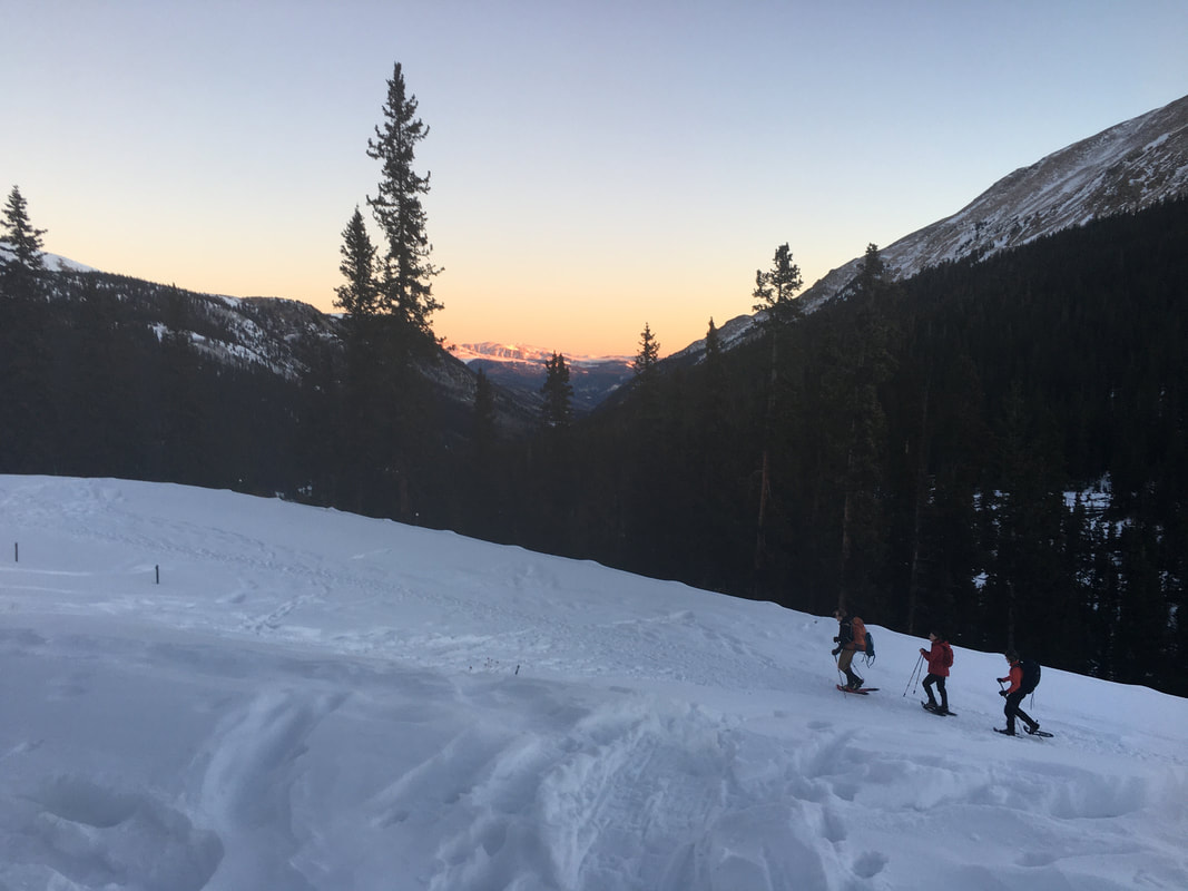
We left at 3 AM on a Saturday morning with the intent to be in Colorado Springs in the evening to spend the night with some friends. On the car ride out, I started to notice the conditions on Bierstadt were already changing, with high winds, colder temperatures and potentially snow forecast for our prospective summit day. I tried to put my thoughts to rest with a combination of laughing with Dalton and Toren, playing "My Cows" and enjoying being on the road, but that didn't help much. I made the call in the car to push our summit day up, plans were already changing. On top of that, an hour outside of Colorado Springs I got a fever and almost passed out, the trips was going swimmingly... After getting to our friend's house and throwing down a few slices of pizza we all got to bed to be ready for our 4 AM start the next day.
In the morning, the sky was clear, and after a windy, restless night, the air was calm. Our group quickly covered the two hour drive to Guanella Pass and before I knew it, I was standing at 10,000' putting on snowshoes, heading up the snow covered road. We gradually hiked up, making it to the top of the pass in just under an hour. Toren, Dalton and I setup camp, planning to stay the night after summiting to acclimate as Olivia and Ike continued up the mountain with a head start, we were near 11,500'.
After we setup camp, and gathered together our summit packs we started into the willows up the west slope. As you head up Bierstadt in the warmer months, you travel through about a mile of thick willows and mushy marshland. Luckily, as we headed up, the boggy ground was frozen stiff and the willows had a clear trench worked in by other climbers. We quickly progressed up above the swamp to 12,500'.
I could feel the altitude wearing on my body. My chest was tight, it was hard to breath, the cold winter air bit at my lungs but upward we went. Gradually we closed in on 13,500' with a final 500' vertical push to the summit. This would be the only semi-exposed part of the climb, the east face was shear and the final pitch was blanketed in two small snow fields. As we rested behind some rocks before the push, a pair came down and said it was brutally windy up there. We weren't discouraged being so closed, but we knew it would be a quick up and down. Toren and I set off, climbing up, I felt like he was sprinting ahead of me, excited for the 14,060' summit. After a few short minutes we reached the top and took in the panoramic views of nothing insight but an endless expanse of mountains. Quickly, we were chased down by the wind as our friends made the final push up behind our descent.
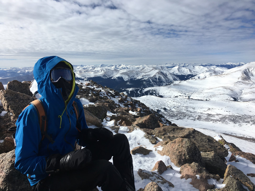 | 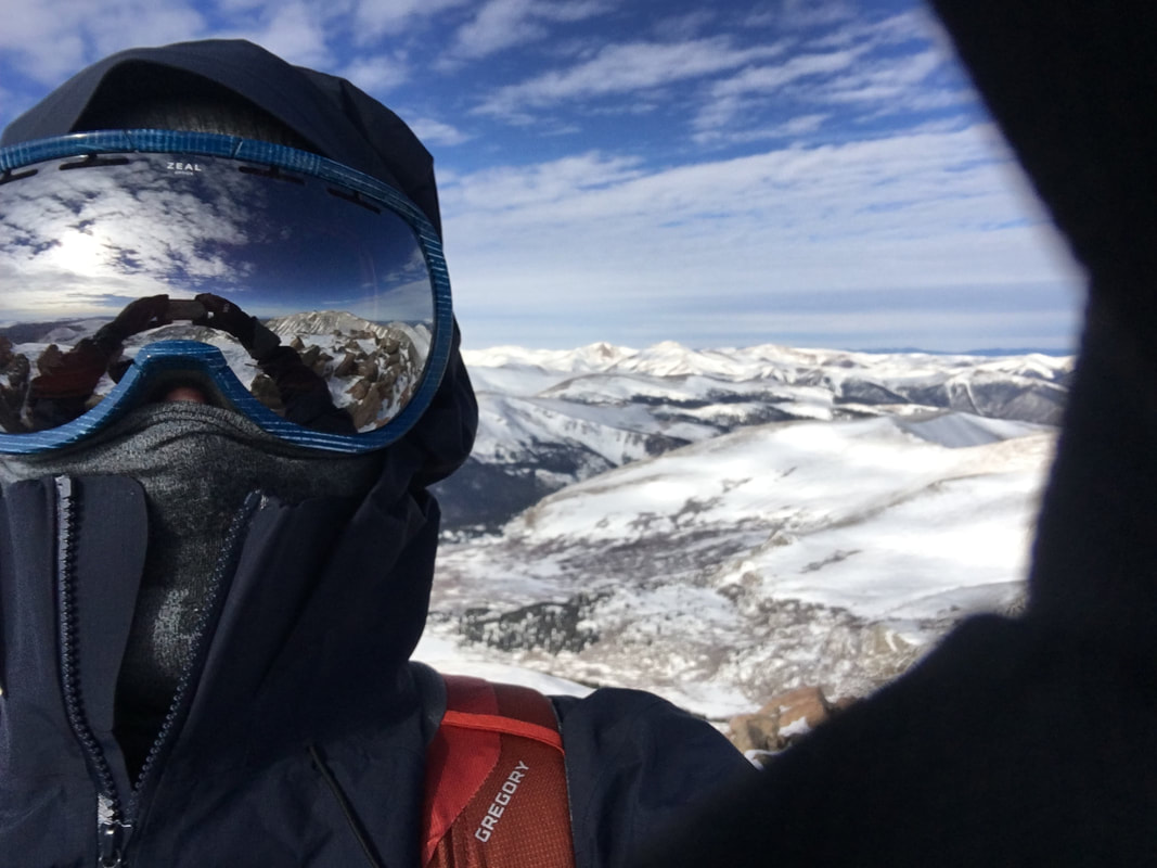 |
We trotted down the mountain. I could feel the air warm, and my body slowly regaining its posture. I was exhausted. Having not felt well the day before, I was at a major calorie deficit and dehydrated, not good things for being in the mountains. The lower we descended the more I could feel muscle fatigue and the other affects of the past 48 hours setting in. I needed a nap...
Eventually we all made it down to 11,500' where we had setup basecamp. We traded stories of our somewhat separate trips up and down as we got a much needed snack. Eventually Olivia and Ike continued down the mountain, back to the car and headed home to Colorado Springs. Dalton, Toren and I got that much needed nap. After brushing off our alarms for close to an hour we finally arose from our slumber. I sat up, threw up and continued heaving out the tent door... I either had altitude sickness, or food poisoning or a combination of the two. Even if it was just food poisoning, being up at 11,500' was not making it better, both ends of my body felt like they wanted to explode...
We made the smart call to go down. As we packed camp, I was furious at my body for not keeping up. Once back at the car, I sunk into my seat, defeated and feeling like trash. We started off towards Colorado Springs. About halfway down Guanella Pass we ran into some skiers that had locked themselves out of their car and needed a ride to their key. Dalton and Toren obliged and helped them with a ride. I like to believe that that was our payment in good karma for the rest of the trip. After a few hours shuttling and then being stuck in Sunday ski traffic we arrived back in Colorado Springs and I was quickly in bed.
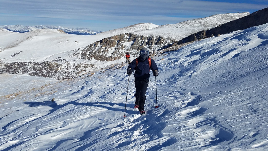
Acute Mountain Sickness (AMS)
"The negative health effect of high altitude, caused by rapid exposure to low amounts of oxygen at high elevation. Symptoms may include headaches, vomiting, tiredness, trouble sleeping, and dizziness."
The next day I had a decision to make, pull it together and head towards DeCaLiBron for our 4 summit day or wimp out and give into my body... I told my body to f**k off. Dalton and Toren, as they would many more times on this trip, encouraged me to go for it. By sunset we found ourselves at 12,000', snuggled up in our 4-season mountaineering tents and 0-degree sleeping bags as the wind whipped off the summits outside.
Around 9 PM Ike arrived at our camp, waking me up from what had been a pretty good nap. I was happy though, him being there gave me a bit of comfort, after all, he's been there on most of the big ones. After getting settled in, we again dozed off to sleep to the sound of howling wind outside.
My watch began to vibrate at 6:30 AM, it was still dark. I began moving around looking for breakfast and water, knocking frost of the top of the tent. The wind had settled, but it still kicked up here and there. As the sun started to rise up through the gulch we reluctantly put on our cold boots and started up the south slope of Mt. Democrat from Kite Lake.
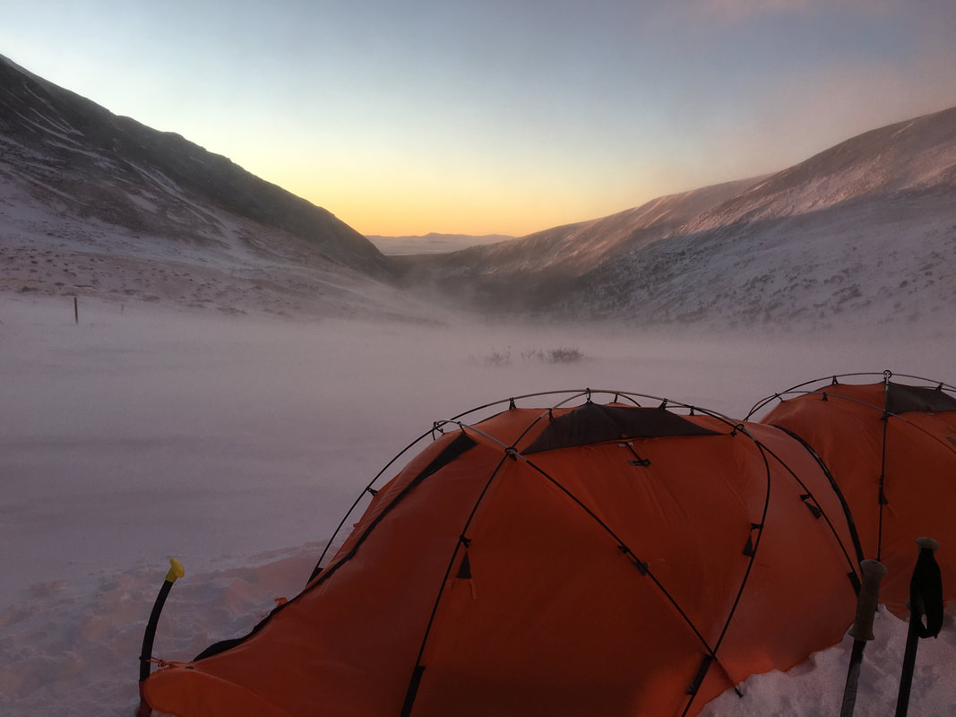 | 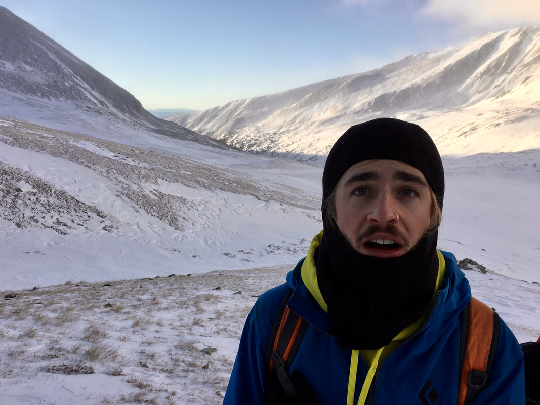 |
Ike had been smart and brought snowshoes, Toren, Dalton and I thought we were better off without the weight. For the first mile we post-holed up the slope, trying to gain the high ground. Ike moved like a superhuman and we moved like sloths. As we progressed up to the ridge between Democrat and Cameron we crossed a few different avalanche zones. We always made sure to spread out and take it slowly, one at a time, but the suspense as each one of us would cross was palpable. Eventually, we made it up onto the saddle and excitedly started up the east ridge of Democrat. It was a windy push, with strong gusts coming over the north ridge. We were completely exposed since we didn't want to go over to the snow covered south slope. The wind was punishing and after we would all talk about how this was the first time we all collectively thought to ourselves about abandoning the day. The group persevered though and we reached the 14,152' summit before 10 AM, we still had a full day ahead of us.
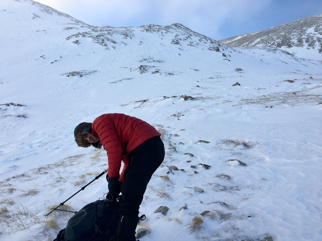 | 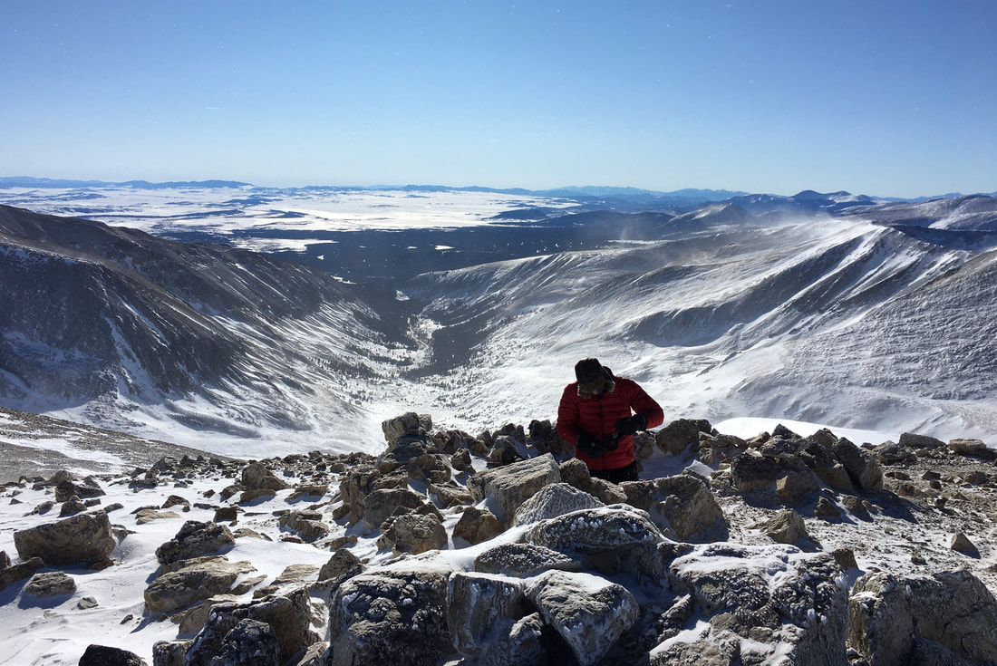 |
After losing the saddle back towards Cameron, we grabbed a snack and felt rejuvenated by our speedy pace. As a group we agreed to push on to the other summits back above us. Again, we quickly regained the ridge going up to Cameron and bagged the sub-peak at 14,238'. Dalton and I were beginning to feel the affects of the wind and the day, we were becoming sluggish as Ike and Toren continued to push on. As we traveled across the flat saddle towards Mt. Lincoln Dalton and I started to doubt ourselves. We could see the peak in the distance, but we were worried about getting too fatigued after our long ascent and knew we still had the journey back. Halfway up the summit push we were pushed back by the wind and Toren and Ike carried forward. We found shelter as they bagged the summit and beat ourselves up. Dalton was already trying to think when he could come back next when Toren got back and told us it wasn't that bad and that we should go for it.
Full of excitement, Dalton and I dropped our packs and pushed over to the 14,286' summit. It was surprisingly easy and it was also surprisingly rejuvenating. We crossed over the furthest part of our route, we had all bagged 3 of the 4 and we were about to be on our way down. Slowly, we crossed another avalanche zone before continuing on to Bross at 14,172'. At the top, we sat for a second and celebrated. Something we had doubted doing that morning had just been completed. The group began down the summit back towards Kite Lake, all feeling tired, but all happy inside. We did a combination of rock hopping down the scree slopes and glissading down the couloirs to get back to camp. After an uneventful descent, we were back to camp.
The plan was to do Quandary the following day but I knew I would probably be too tired still and severely wanted some rest. I convinced Dalton and Toren to go to Leadville that night and stay at the Inn the Clouds Hostel for the next two nights to rest up before we finished our journey. Out of all the decisions I made I think this was the only one I regret.
 | 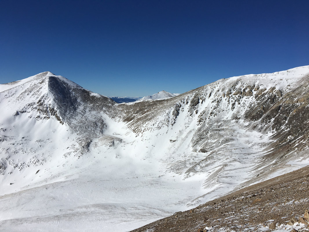 |
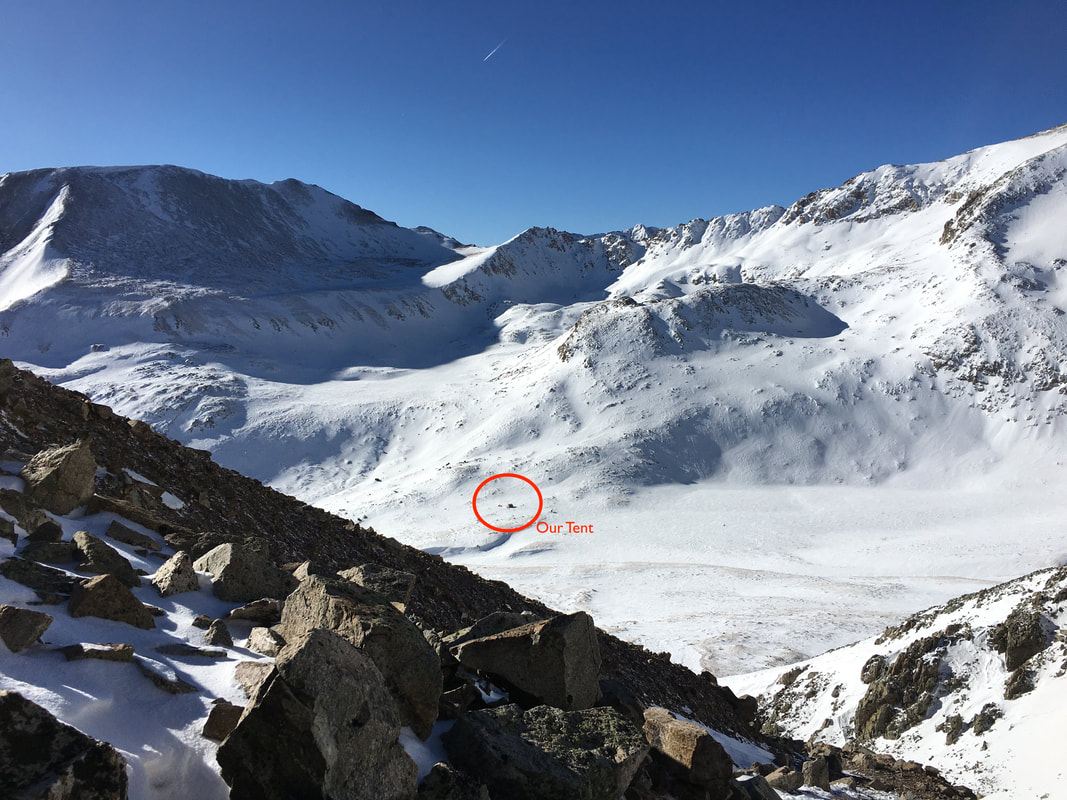
Glissade
"The act of descending a steep snow- or scree-covered slope via a controlled slide on one's feet or buttocks. Typically done with the support of an ice axe."
We spent the night in Leadville getting delicious food at Tennessee Pass Cafe, enjoying a beer at Periodic Brewing (the highest microbrewery in North America) and relaxing at the hostel. The next day we poked around the local gear shops, played in the snow, having some great pizza from High Mountain Pies and taking full advantage of a much needed day off. On Thursday we were going to be heading up Quandary to bag our 6th peak so we got to sleep and prepared for an early morning.
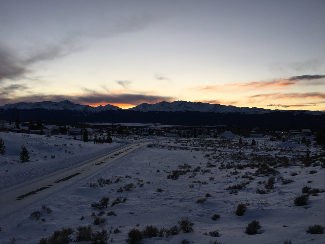
As we woke up in the morning and went out to the car there was a light dusting of snow and the air was bitterly cold. We had an hour car ride, so I was hoping that as the sun came up it would reveal clear skies, it did. Sitting in the parking lot just before 8 AM, we geared up, got out and started up the easy but steep slope. The trail was well packed below treeline, the group made great time. Before I knew it we had reached tree-line and were heading up slope with no signs of a trail, everything was windswept. As we pushed onward, it was a posthole fest up to 12,500', but we did it.
We continued to gain the ridge, closing in on 13,000' and the final summit push. On the other side of the mountain, we could see a massive cloud blowing in. The winds were 50-60 mph with higher gusts and the light powder from the night before would blow against the smallest bit of exposed skin like shards of glass. It was a brutal and dangerous slog. Every time we stopped I thought about how long we could continue up into the -36°F weather with this kind of wind and what would happen if we found ourselves in a whiteout.
We continued to gain the ridge, closing in on 13,000' and the final summit push. On the other side of the mountain, we could see a massive cloud blowing in. The winds were 50-60 mph with higher gusts and the light powder from the night before would blow against the smallest bit of exposed skin like shards of glass. It was a brutal and dangerous slog. Every time we stopped I thought about how long we could continue up into the -36°F weather with this kind of wind and what would happen if we found ourselves in a whiteout.
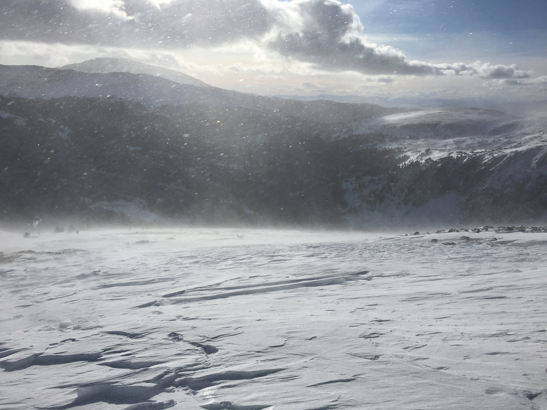
I made the hard call and turned us back. Dalton understood what the issues were, Toren wanted to go on but reluctantly understood and I felt defeated by my own decision. I honestly believe the hardest decision you can make when mountaineering is to turn back. You abandon the summit, you abandon your goal and you go down. It takes a lot out of you to put in that kind of work and quit.
As we drove off I thought of all of the things that could have gone differently. Would the conditions have been better the day before? If we got a later start, would that have helped? Should I just have kept pushing onwards? It sits on your mind...
We left central Colorado and headed towards Rocky Mountain National Park in the Front Range for an overnight snowshoeing in the backcountry. When we got there the Rangers said we'd be the only people out, it was the height of the slow season. It was a fun couple of hours as we headed up to Glacier Gorge, enjoying the winter weather and making the most of the end of our trip. The snow blanketed everything and made the valleys beautiful. Longs Peak was socked in by snow, but it loomed above us as the night set in. It was an enjoyable end to a very memorable trip.
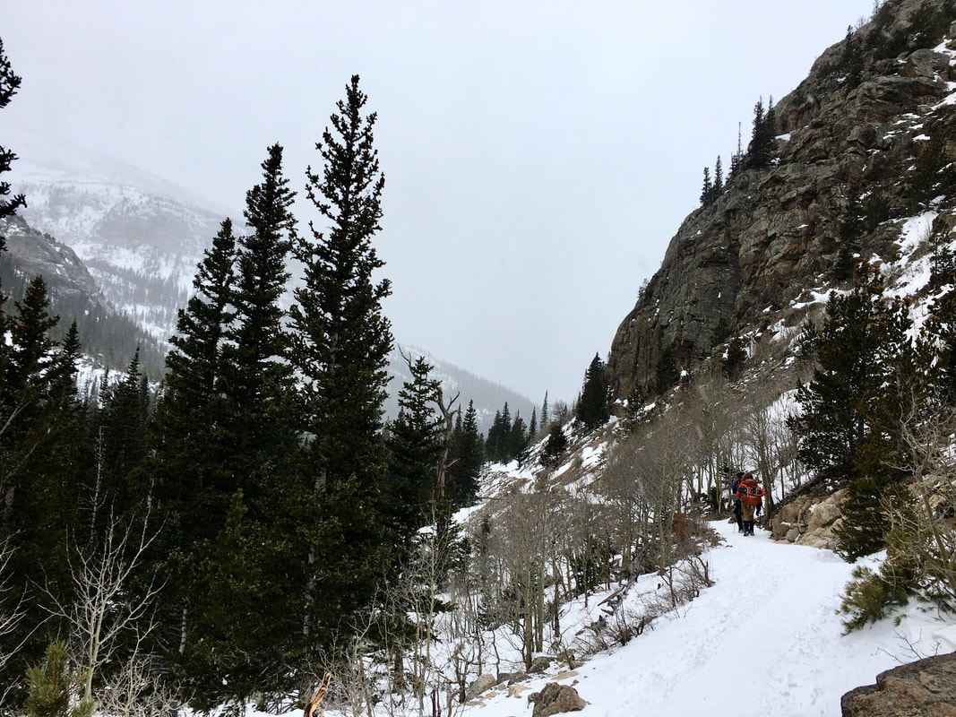 | 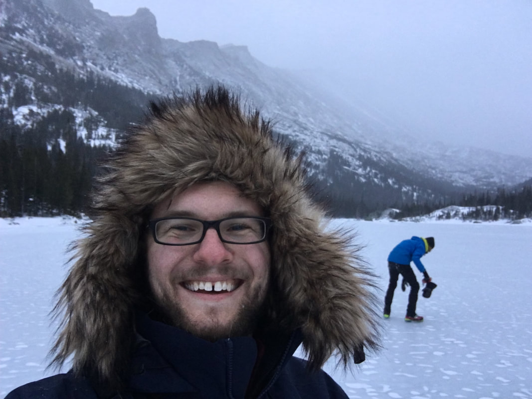 | 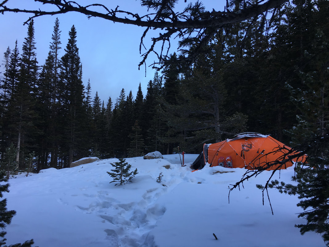 |
After RMNP we got food, went back to Colorado Springs, visited Garden of the Gods and had one last night in Colorado before heading home. I was proud of our successes, 5/6 peaks bagged, but I was lost in thought for a lot of the rest of the trip. This was my first trip, planned and executed after college, it pushed the limits of what I knew and it confirmed a lot of things that I was thinking. For the longest time I thought I got lucky and skipped the whole being lost after graduation thing, but my mind definitely wandered around on this trip.
I spent a lot of time trying to decide what I want in life. For the better part of the past three years I've been obsessed by the idea of hiking the Pacific Crest Trail, for the past two years I've been obsessed with trying to go on bigger and bigger trips and for the past year I've been so busy trying to make that all happen that I got tunnel vision. My goal coming out of this is to refocus, to be sure I'm moving towards what I want in life and make sure that at the end of this I'm not left more lost than when I began this journey. Its a big plate of things to work on, but luckily I have a lot of time...
I spent a lot of time trying to decide what I want in life. For the better part of the past three years I've been obsessed by the idea of hiking the Pacific Crest Trail, for the past two years I've been obsessed with trying to go on bigger and bigger trips and for the past year I've been so busy trying to make that all happen that I got tunnel vision. My goal coming out of this is to refocus, to be sure I'm moving towards what I want in life and make sure that at the end of this I'm not left more lost than when I began this journey. Its a big plate of things to work on, but luckily I have a lot of time...
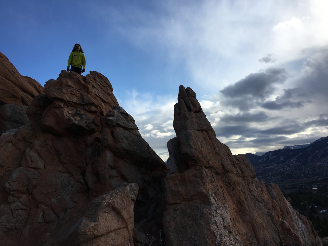 | "Only those who will risk going too far can possibly find out how far they can go.” |
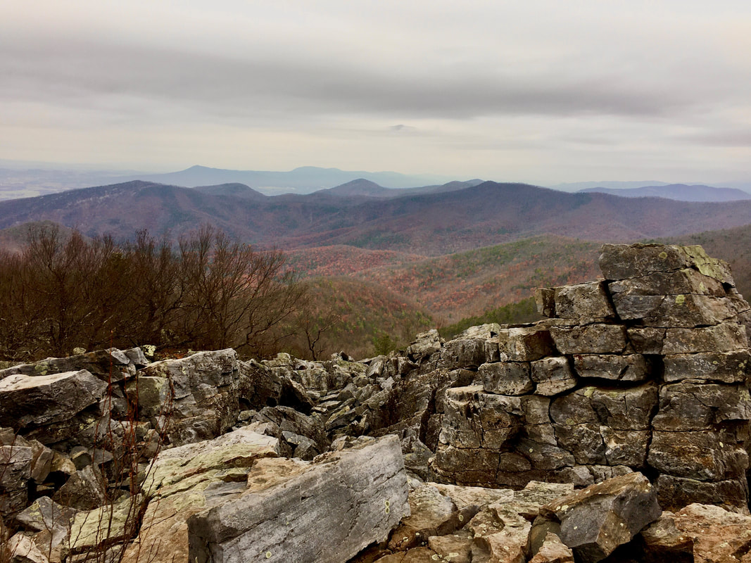 Black Rock Summit
 I was up and on the road by 5AM, it was rainy, I wasn't super excited about the drive but I was excited about getting back out, it had been over a month and a half since my last trip. Luckily I had Wicket to keep me company too.
Over the weekend, I drove out to Shenandoah National Park to meet up with my old roommate Bobby who now lives in New England. Somehow we decided Virginia was the middle between us, not sure how that worked out but its better than Pennsylvania I guess...
We met up in the north of the park at the Dickey Ridge Visitor's Center around 2PM, after a long drive we were all ready to stretch our legs. Bobby and I went inside to get permits and the lady at the desk looked at us like we were crazy, "You're going out this weekend? You know its supposed to snow and rain tomorrow night?" I assured her we knew what we were doing, got the permit filled out and headed south towards the trailhead. It took over an hour to get from the north end of the park to our trailhead at Brown's Gap, this park is long to say the least, but the views along the drive were beautiful. We got to the trailhead a little after 4:45, with the sun set at 5:15 we didn't have much time left before we'd be hiking in the dark. As Bobby got his pack rearranged and I got Wicket's pack on him and mine on me I noticed Wicket staring off into the woods. I assumed it was a deer or squirrel as usual and kept going about what I was doing, when I looked up again there were 3 black bears walking down the hill towards us. I definitely had an "oh shit" moment and quickly grabbed Wic before giving them a friendly greeting to go away. The mama and her two cubs, all no bigger than Wicket quickly got the message and continued on their way. That would be all the excitement for the day, we hiked 4 miles towards the setting sun before setting up camp in the dark on a ridge near Austin Mountain.
In the morning we awoke to cold frigid air and that feel of dread getting out of your sleeping bag. At least one of us was enjoying the cold air...
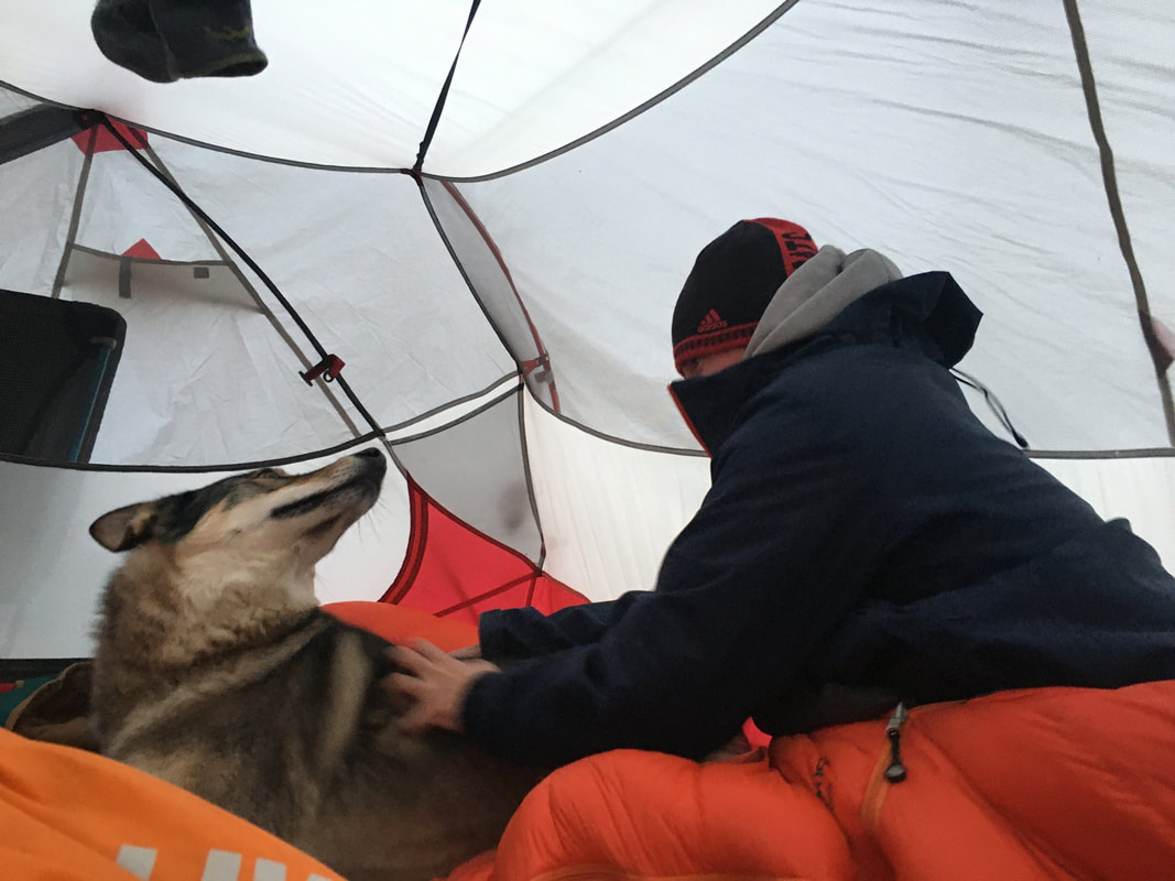
Wicket enjoying his down bed and the cold winter air
I knew today had to be a fast paced day, freezing rain was forecast to start around 1PM and we had 9 miles to cover with 2,300' of elevation gain between miles 3 and 5, hopefully the views would be worth the pace. We ate breakfast, packed up and hit the trail. We were instantly heading down a rocky mountain side with enough loose rock to break quite a few ankles... About halfway to the valley floor I again noticed Wicket staring off into the bushes in front of me. I took a quick break to let Bobby catch up and looked off down the ridge. About 20 yards off, sneaking around in the bushes was another black bear, checking us out trying to stay hidden. As soon as he noticed Wicket and I looking at him we could hear him bolt off down the hillside. We continued on our way until we reached the valley floor and a nice break from the pounding of the steep downhill.
Soon enough we started gaining back the 1,300' we had gone down as we headed up Furnace Mountain. We played leapfrog with a couple of day hikers, but for the most part quickly found our way to the "summit". It wasn't a bad view, but I learned three things about Shenandoah, the views are always better in the fall, the summits aren't really summits and the temperature changes every 5 minutes. We enjoyed a quick break up top before heading on our way.
Soon enough we started gaining back the 1,300' we had gone down as we headed up Furnace Mountain. We played leapfrog with a couple of day hikers, but for the most part quickly found our way to the "summit". It wasn't a bad view, but I learned three things about Shenandoah, the views are always better in the fall, the summits aren't really summits and the temperature changes every 5 minutes. We enjoyed a quick break up top before heading on our way.
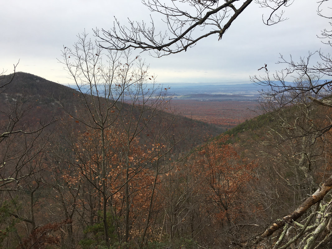
Furnace Mountain "Summit"
We ran into a few more day hikers on our way to Trayfoot Mountain, one guy excitedly said "Oh Cincinnati people, I love Rhinegeist" which spiraled into a 15 minute chat about beer and OTR. Eventually we didn't see anyone else and were alone and on our way again. A few miles later we hit the summit of Trayfoot Mountain, another unexciting peak, before continuing on to Blackrock Summit and hopefully a good view.
Suddenly the trees opened up into a boulder field and we found the best overlook of the trip as we reached the AT.
Suddenly the trees opened up into a boulder field and we found the best overlook of the trip as we reached the AT.
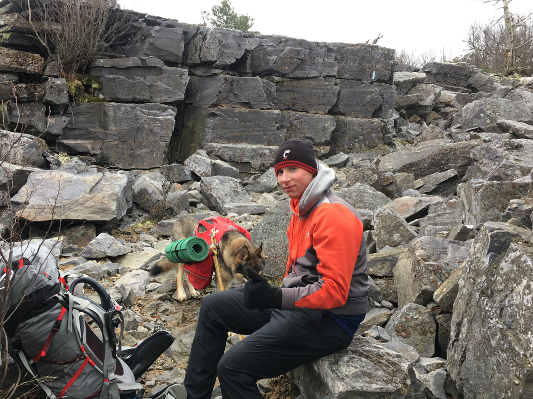 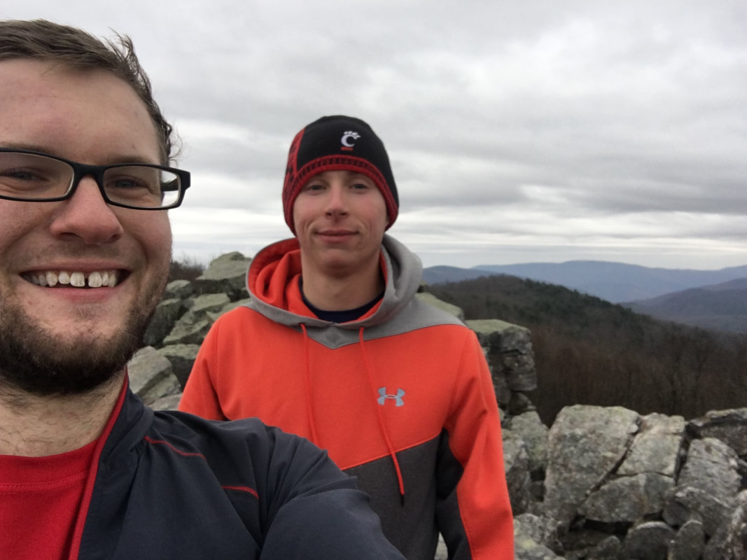 | 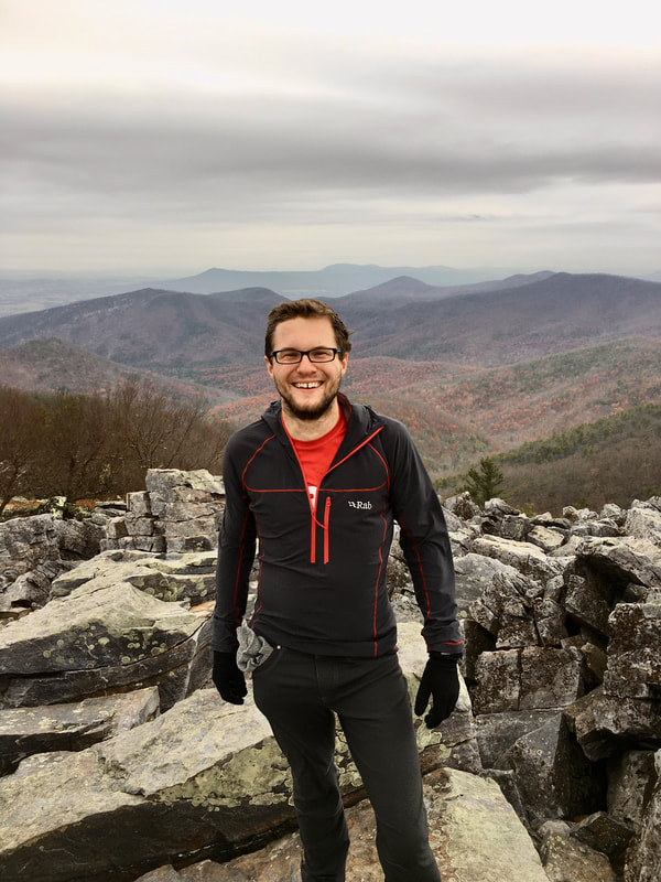 |
It was nice to finally see where we had been going, the entire route around the valley was visible from the top. We took in the sights before getting off the windy ridge and heading south towards Blackrock Hut for the night. After a quick mile we reached the hut and found another backpacker who was thru hiking the entire park. He was in his early 50s and like us, was trying to find shelter before the rain, luckily it was 2PM and we hadn't felt a drop yet. We sat and talked with him as we made dinner, he had hiked all over on the AT and helped with conservation efforts on the trail. He talked about how backpacking had always been a passion of his but his wife and kids weren't into it as much. He knew almost as much about gear as I did too. We chatted for about an hour about different things, he encouraged us to follow our dreams while we were young and said age has a way of taking away your free time. Eventually it began to rain so we said goodnight, headed up to our tent and played cards, Wicket was out like a light and as it grew darker Bobby and I dozed off too.
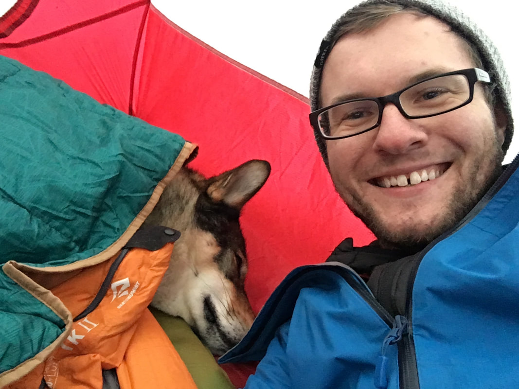 Sleepy Wicket | 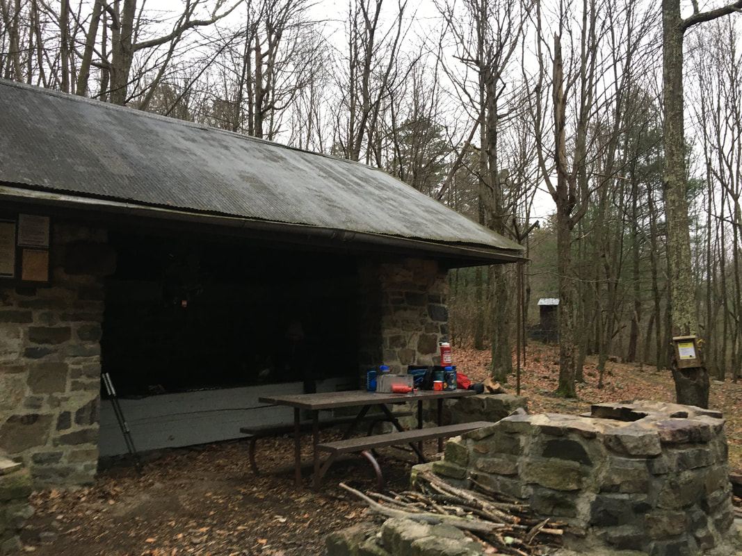 Blackrock Hut |
The next day was cold, wet and windy. We had a short 3 mile hike out to the car so we skipped breakfast, ate some bars and got on the trail. Within an hour we were back to the car and our journey was coming to an end. Bobby and I bullshitted a good bit as we drove back towards his car. We talked about how lucky we had been for a good weekend and guessed at ideas for where we could meet up again. Eventually we got to his car and he went his way and I went mine, starting the 8 hour drive home.
I spent my time in the car, and really the last few days, thinking about this weekend. Not just that it was nice to get out and nice to see a friend I hadn't seen in awhile but that it felt great to be out there and I actually have a lot of friends that I need to catch up with more often. During this trip and that drive I thought about what I wanted from life in the short term; I want to catch up with my close friends more often than I do, I want to get out on more little weekend trips, I want to talk to more new people like the guy we met at Blackrock Hut and I don't want to fall into the easy motions of life (go to work, go home, sleep, rinse and repeat). I've always been a planner, my goals are what guide what I do and I'm fixated on the PCT at the moment but I can't let that be the only thing guiding me. We'll see if I stick to what I say... Until next time!
I spent my time in the car, and really the last few days, thinking about this weekend. Not just that it was nice to get out and nice to see a friend I hadn't seen in awhile but that it felt great to be out there and I actually have a lot of friends that I need to catch up with more often. During this trip and that drive I thought about what I wanted from life in the short term; I want to catch up with my close friends more often than I do, I want to get out on more little weekend trips, I want to talk to more new people like the guy we met at Blackrock Hut and I don't want to fall into the easy motions of life (go to work, go home, sleep, rinse and repeat). I've always been a planner, my goals are what guide what I do and I'm fixated on the PCT at the moment but I can't let that be the only thing guiding me. We'll see if I stick to what I say... Until next time!
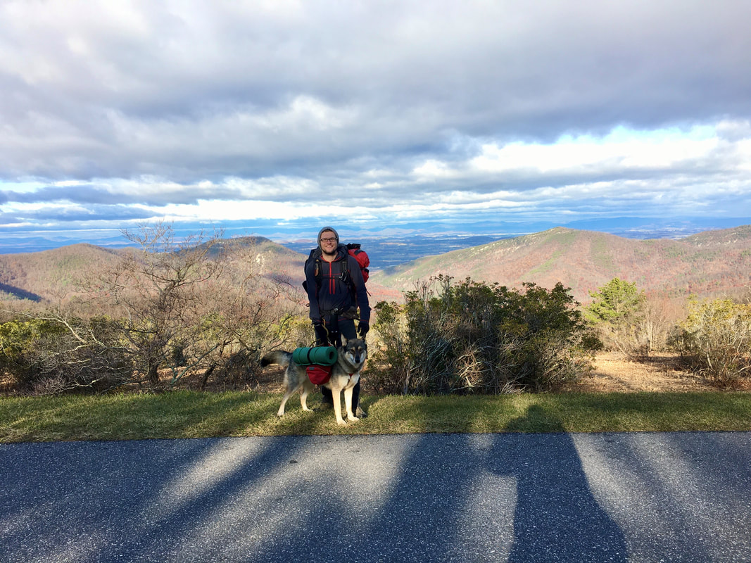 | "If you drive to, say, Shenandoah National Park, or the Great Smoky Mountains, you'll get some appreciation for the scale and beauty of the outdoors. When you walk into it, then you see it in a completely different way. You discover it in a much slower, more majestic sort of way." |
Its been a busy year for me, I graduated college, I got a new job, I had a lot of fun and I traveled all over the place... This year between driving, flying, boating walking and every other method of transportation I traveled 25,000 miles... Just to put that in perspective, the circumference of the earth is 24,901 miles and the average American travels less than 15,000 miles a year (thanks for the fact AAA). So I walked the Earth and I'm not your average American...
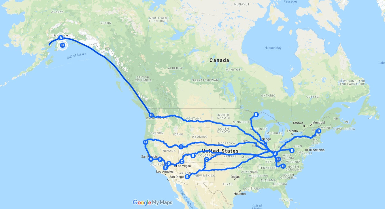
I went canoeing in the Boundary Waters, mountaineering in New England, whitewater rafting in Pennsylvania, backpacked all across the west, packrafted in Alaska, revisited some of my favorite places and found some new favorites. I created friendships that will last a lifetime and I went on adventures with people that changed the way I look at the world. Its been a truly amazing year, and I'm sure I still have even better years to come. For sure I had my ups and downs and just like anyone else I had my struggling moments in life, but I like to think about the happy things...
I just want to take a second and thank everyone who has traveled with me, everyone who has been around and enjoyed a story, had a drink at the bar with me or been lucky enough to go on an adventure. Thanks to my friends and family for being awesome and not giving up on my ass yet. Also, thanks to everyone who reads these blogs about my journeys, without you I think I would have given up on writing these a long time ago... Seriously, they take a lot of time.
I just want to take a second and thank everyone who has traveled with me, everyone who has been around and enjoyed a story, had a drink at the bar with me or been lucky enough to go on an adventure. Thanks to my friends and family for being awesome and not giving up on my ass yet. Also, thanks to everyone who reads these blogs about my journeys, without you I think I would have given up on writing these a long time ago... Seriously, they take a lot of time.
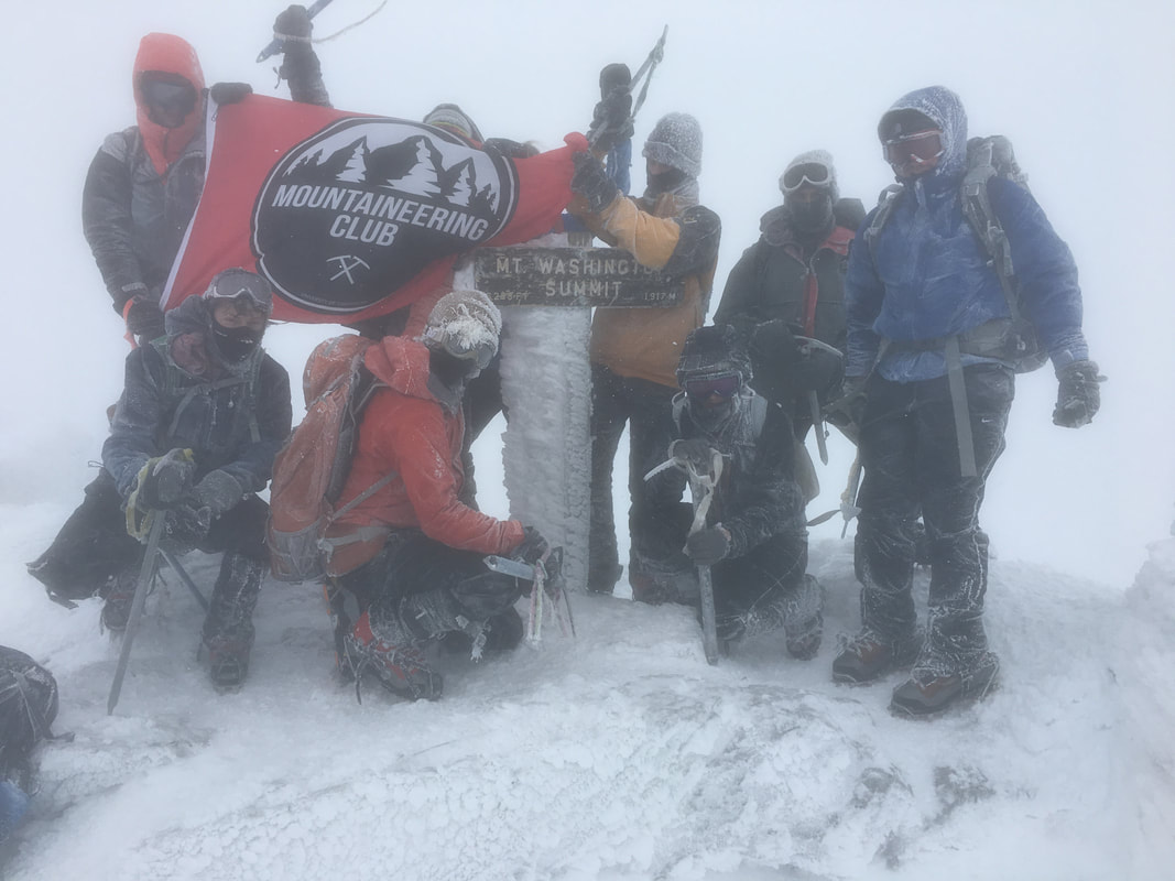

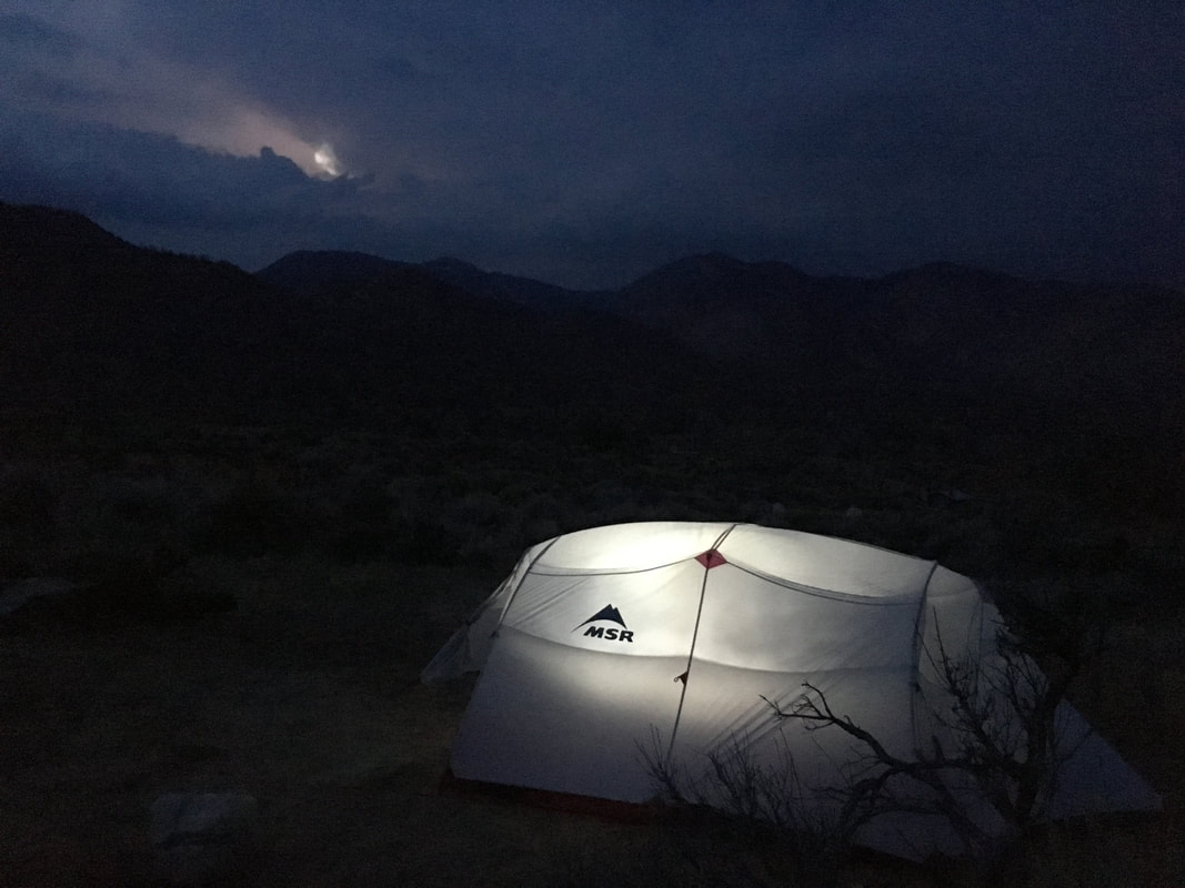
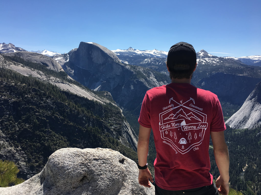
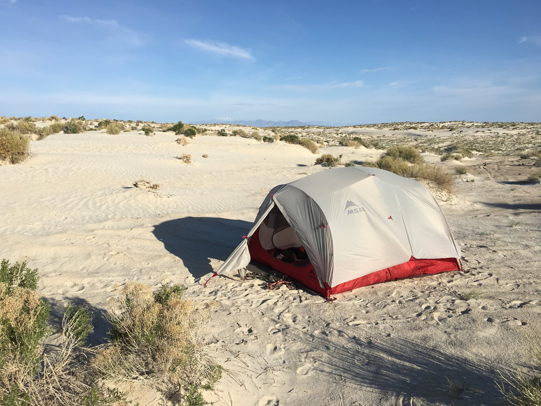


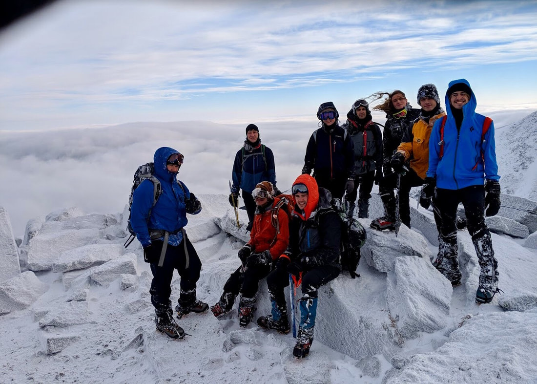

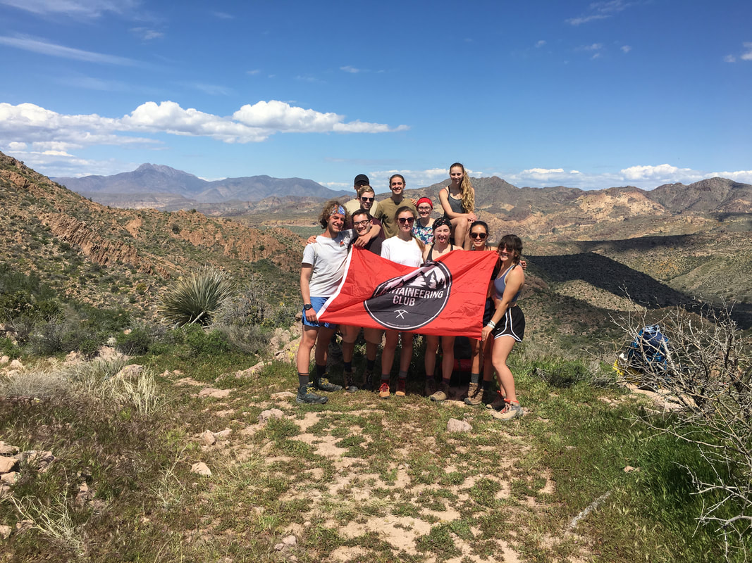
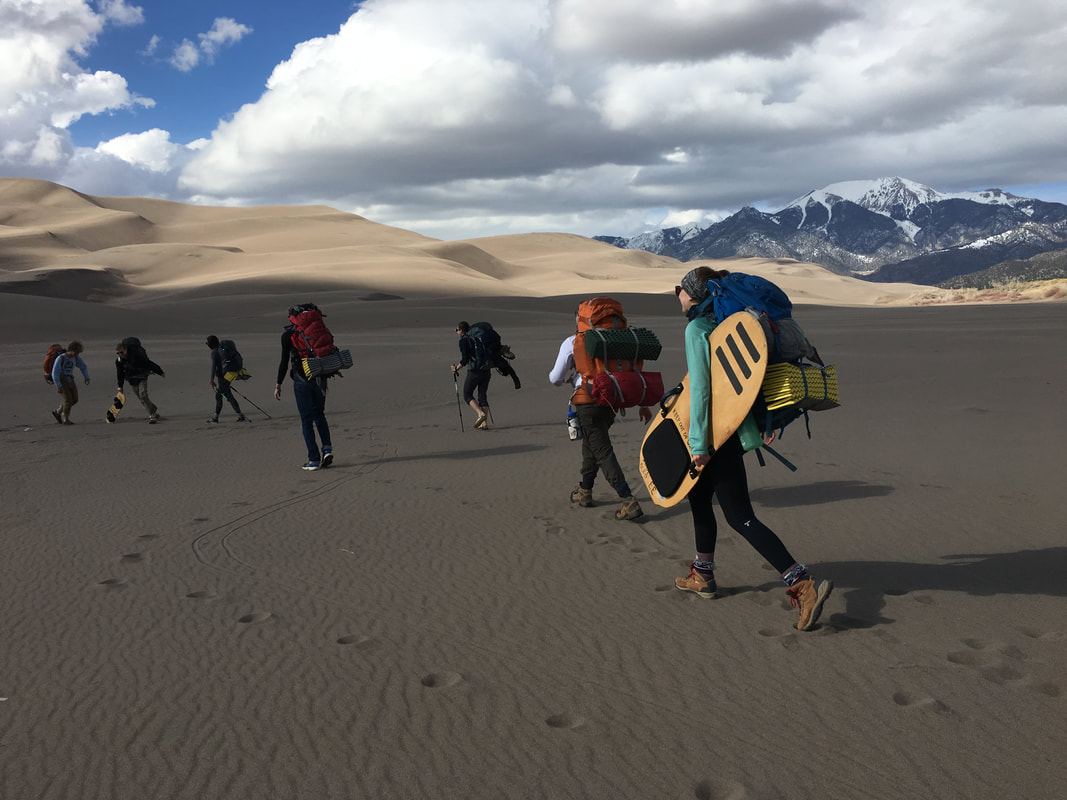

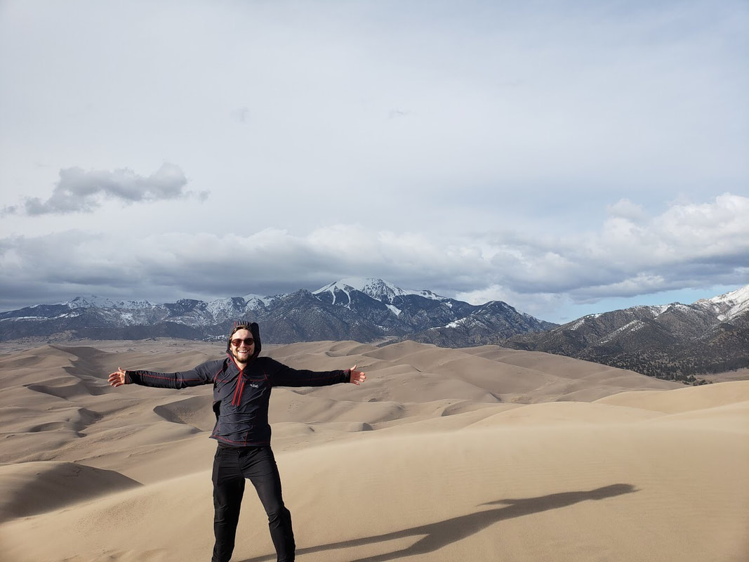
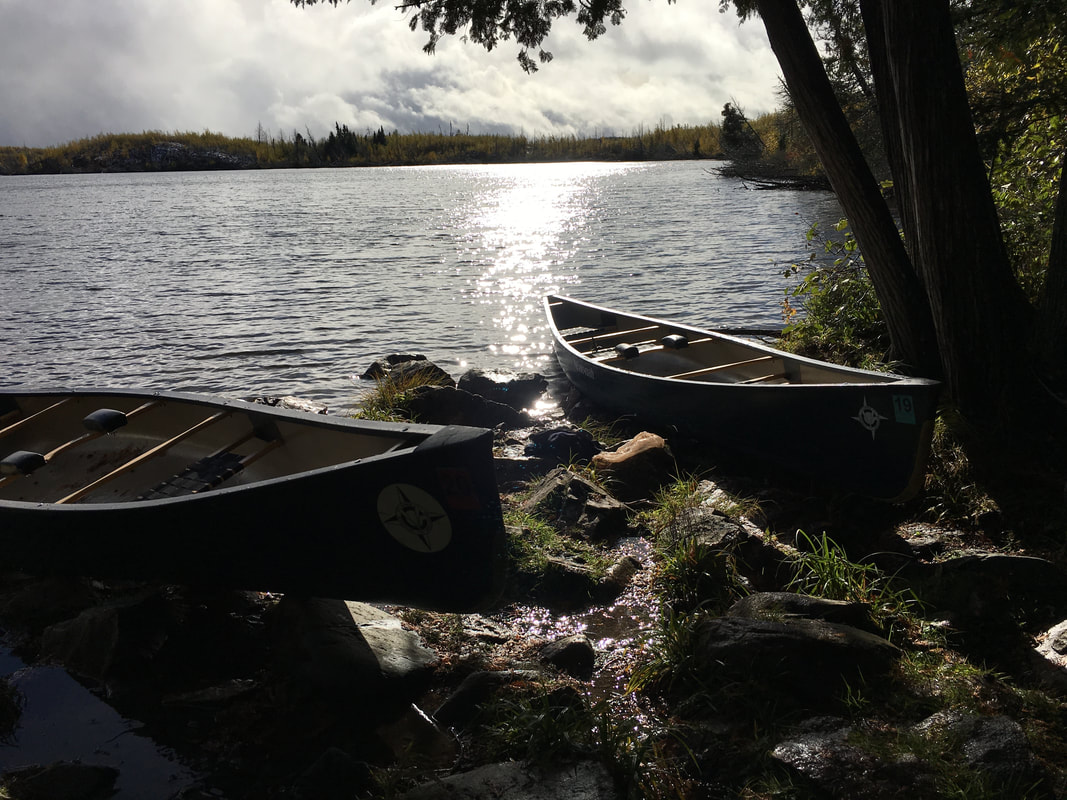

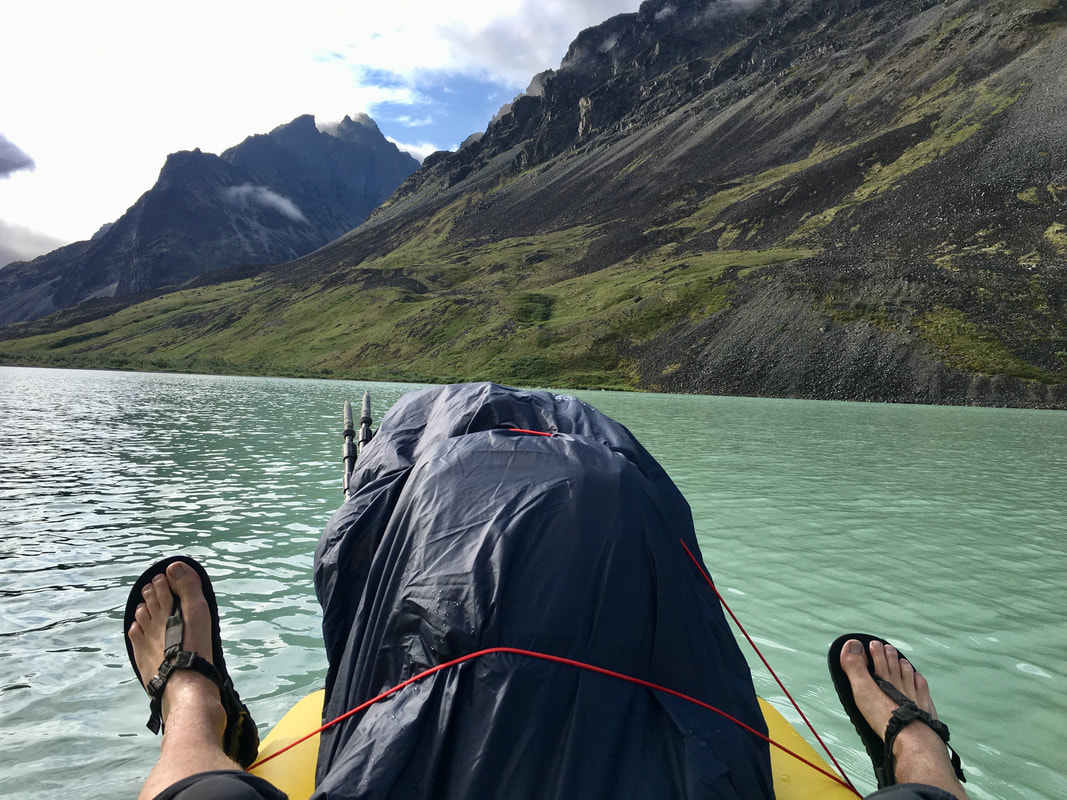
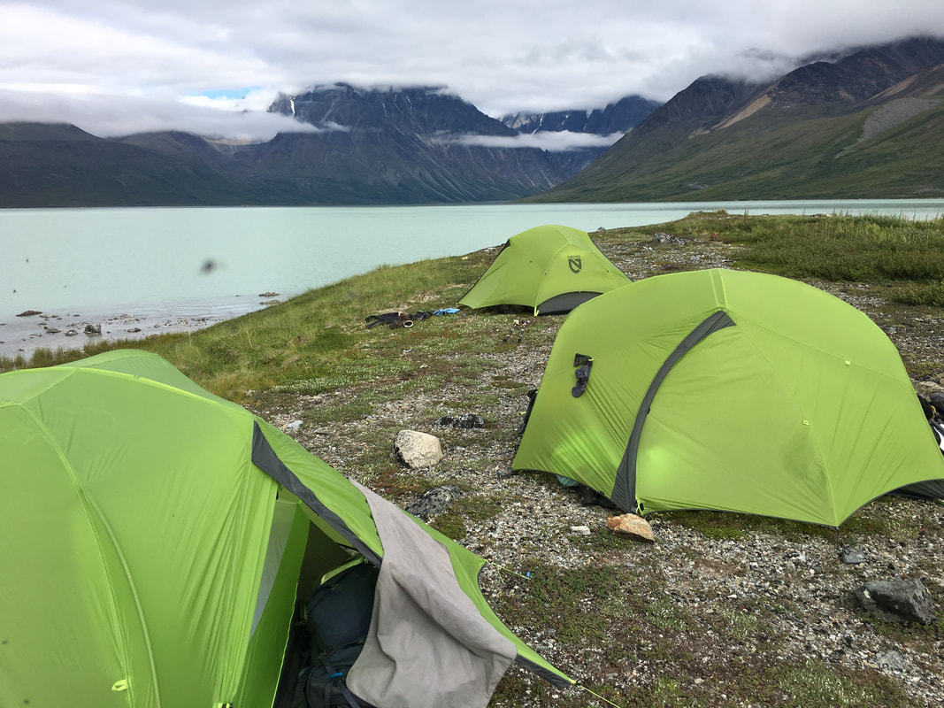
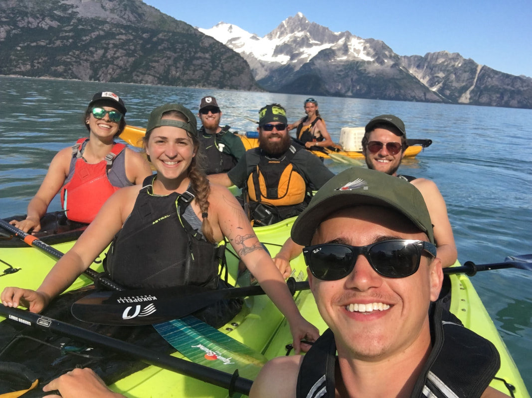
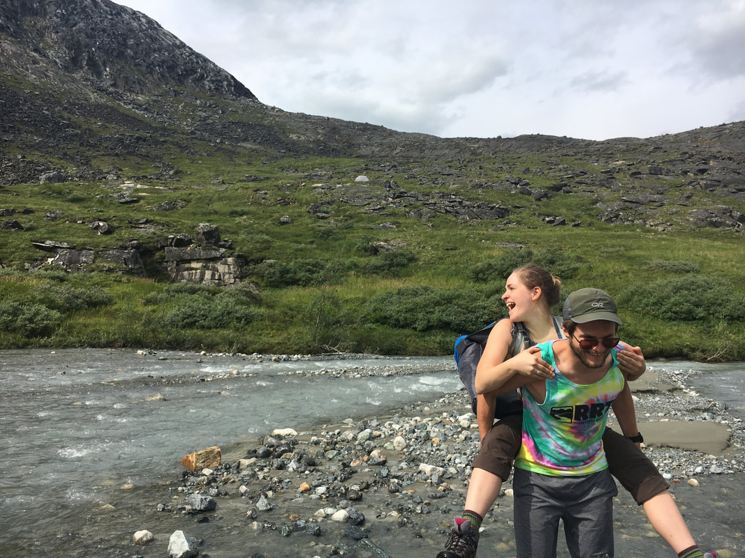

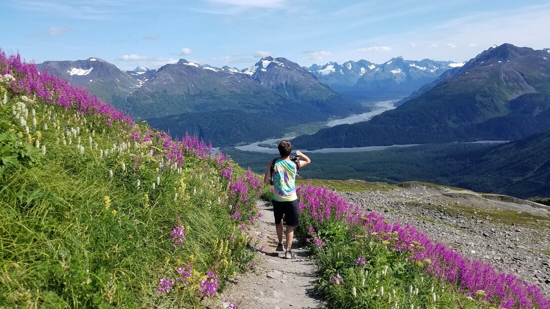
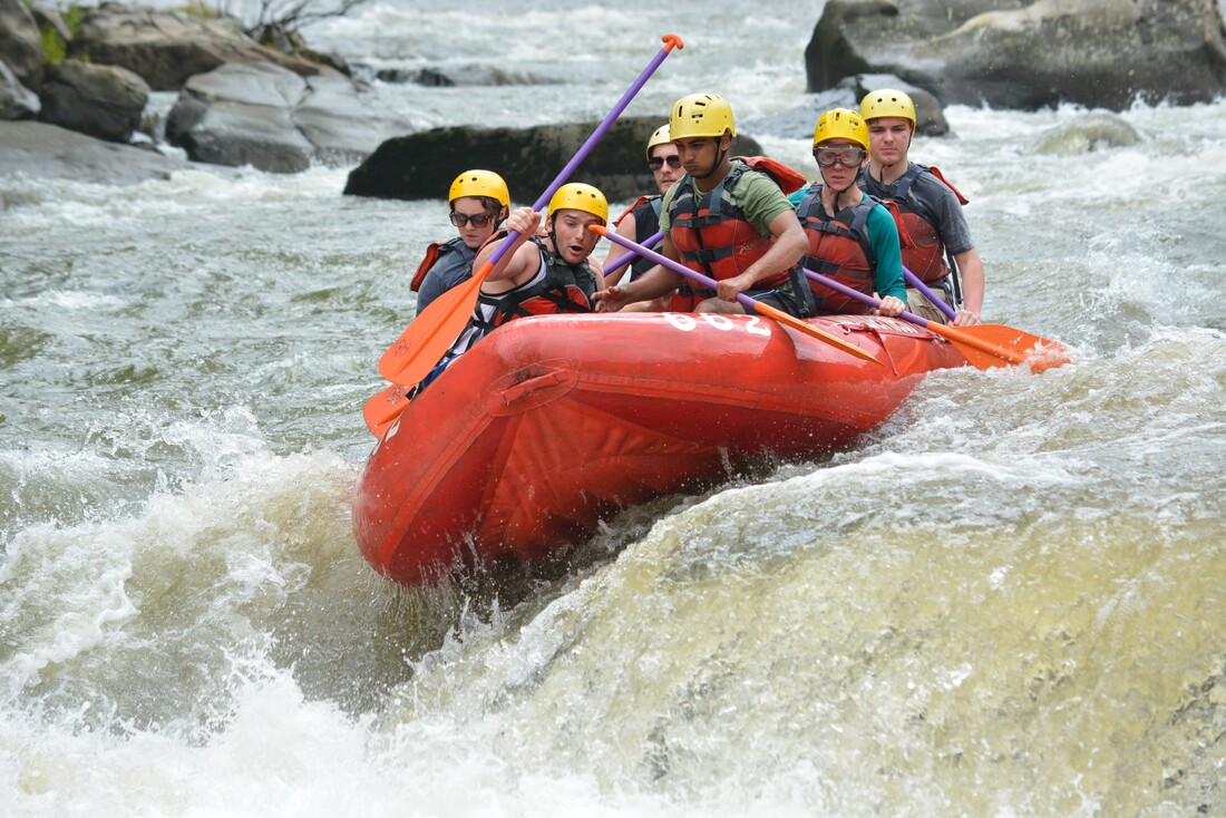
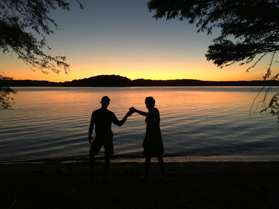
"There's so much aversion to risk taking. You have to take risks if you want to learn anything about yourself. You want to expand the self imposed walls we put around ourselves..."
- Hilaree Nelson
I actually started this post before I even left for the trip...
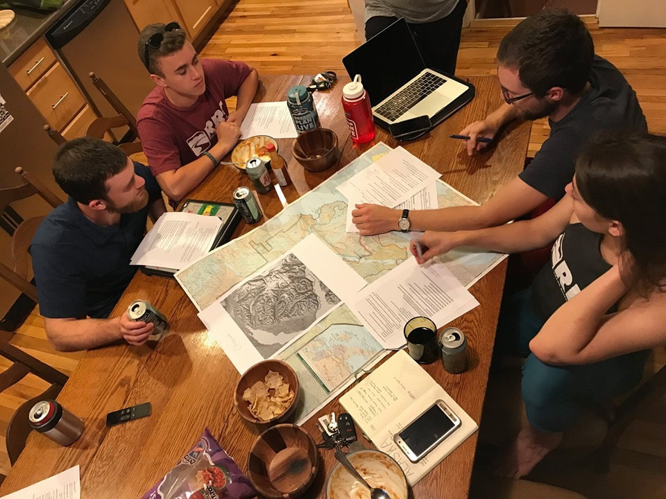 | 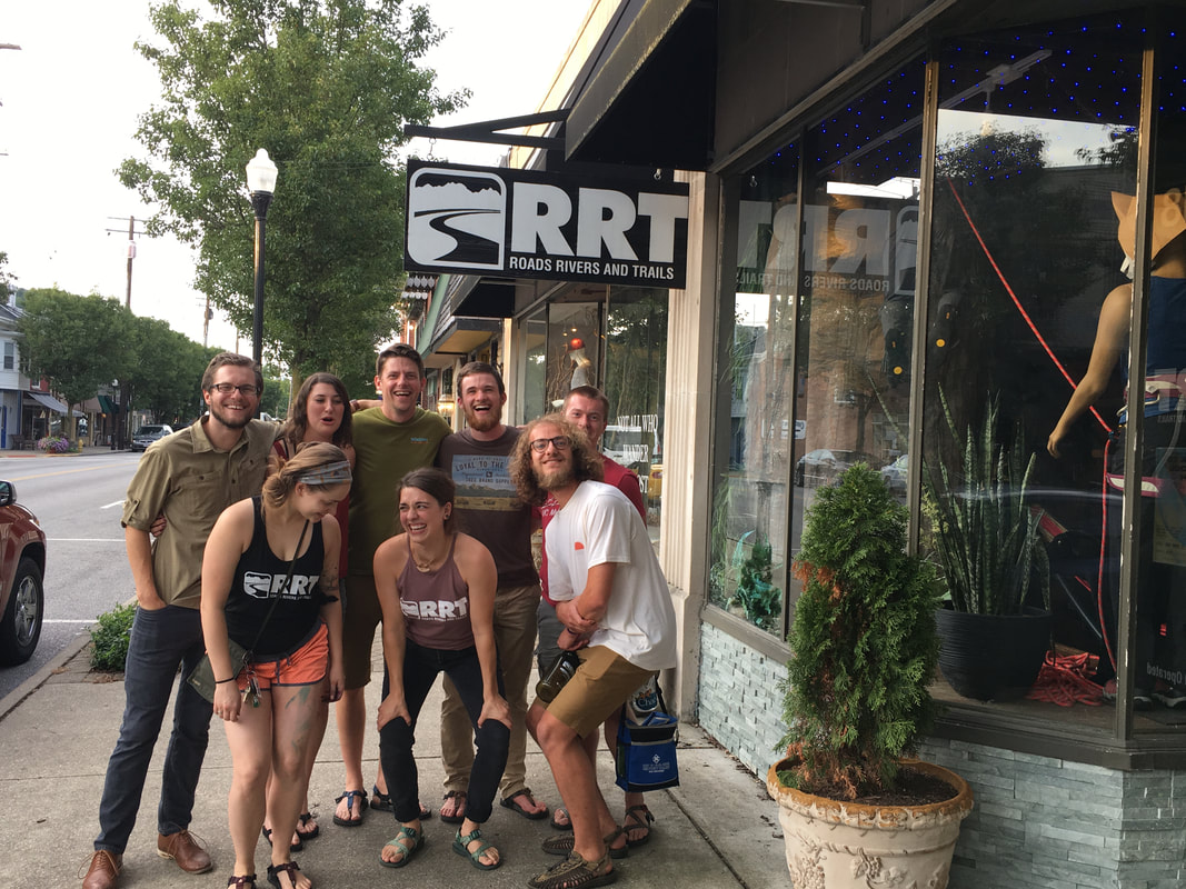 |
The thought for this trip came out of a few things for me, first of all was the community that I'm surrounded with at Roads Rivers and Trailswhere we constantly push each other to go further and second was probably a want to do something I have never done before. For me the obvious choice of somewhere new to go was Alaska... Since I took my first big trip west over three years ago I've covered 47 of 50 states (all by car), the only ones I'm missing are Hawaii, Washington and Alaska. The initial idea started as a chatter, "Hey, let’s go to Alaska", we would say to each other and when Joe came around the shop he would jokingly ask “When are we going to Alaska?” So, in the fall of 2018 we sat down for the first time and discussed the possibility of our journey. The original group consisted of 11 people that wanted to go on two different trips, one going to Lake Clark and the other going to Gates of the Arctic National Park. We talked and talked for several months, we planned and planned and along the way we lost people and widdled down our group and our trip. In the end, we wound up with 6 people agreeing on 6 days of backpacking in Lake Clark with 3 days of sea kayaking in Kenai Fjords National Park and all sorts of other adventures sprinkled in there.
We bought plane tickets that December and began a 7 month process of building an amazing journey. Between booking float planes, guides and hotels as well as looking over all the routes and making sure everything we wanted to do would fit I probably obsessed over this trip for way too long. It didn’t kick in that I was even going on this trip until I sat down in the float plane at 11AM and took off from Lake Hood Sea Plane Base in Anchorage.
We bought plane tickets that December and began a 7 month process of building an amazing journey. Between booking float planes, guides and hotels as well as looking over all the routes and making sure everything we wanted to do would fit I probably obsessed over this trip for way too long. It didn’t kick in that I was even going on this trip until I sat down in the float plane at 11AM and took off from Lake Hood Sea Plane Base in Anchorage.
The Trip
Lake Clark National Park
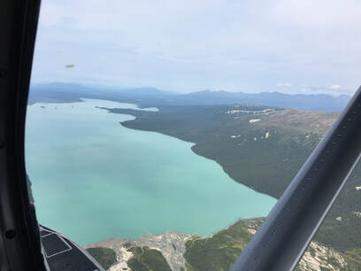
We left Cincinnati early on a Tuesday and flew to Seattle for a short layover before arriving in Anchorage around noon. We spent that first day gathering supplies, resting at the hotel and going over gear, that first day was also full of mishaps… Before we left Cincinnati Joe had been stung by a yellow jacket and had a lump the size of a baseball, Mason was covered in dots which were supposedly poison ivy and Emma spilled hot chocolate all over her hiking clothes making herself the perfect bear bait. We undoubtedly were off to a great start, but luckily everyone pulled through which would happen many times along this trip.
By 11AM on Wednesday we had met the pilot, loaded up the plane and taken off for Lake Clark National Park. We were quickly flying over the Cook Inlet, on our way deep into the Alaskan bush. We flew over alpine glaciers and alongside mountain peaks deep into the Alaska Range. The peaks were impossibly jagged and every valley would just lead on to a dozen more. The mountains seemed to go on endlessly in every direction.
We came out low over Telaquana Lake and its bright blue water excited me for our final destination. The plane banked to the south and flew over the highlands before coming upon Turquoise Lake, our drop off point. You could see the water approach as we went down to land and soon enough, a small bump and a rush of water on the floats slowed us down to a stop near the east shore. The glacial beach in front of us stretched on for almost a mile in each direction and the peaks behind it perfectly framed the scene. We setup camp as our pilot took off, once he was off the lake he was gone in the blink of an eye and we were alone. For the rest of the day we walked back miles and miles along the glacial river that formed the basin we were camped in. We crept closer and closer to the great glacier hiding back in the mountains. After several hours of hiking, a few wet boots, and a first day filled with blueberries and laughs we reached the moraine and could barely see the glacier still a mile off. We decided to turn back because of how late in the day it was, this wasn’t to be our glacier. In the evening, as we ate, we talked about how surreal our new surroundings were. We enjoyed an evening with good weather, decent food and great company.
The next day we awoke to a light rain that quickly tapered off. This was our day for day hiking in the valley, but the peaks were socked in and we had already bailed on the glacier once. Today was a camp day. Will and Olivia climbed up to the highest towers they could above camp while the rest of us lounged around in the on and off rain. After a few hours though, the rain subsided and we broke out the packrafts for a little afternoon paddle. Being on that lake in a boat was an out of this world feeling… Joe and I paddled up the shore and around a small fraction of the lake before returning and letting the others get a chance to get out. It was a fun and lazy afternoon topped off with a nice fire on the beach before we all crawled into bed. It was a good day but I was getting ancy to move.
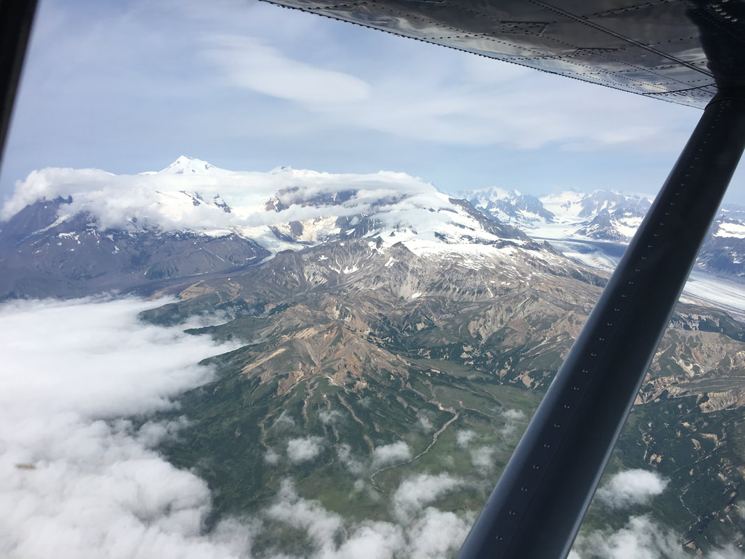 | 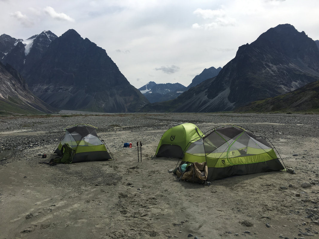 |
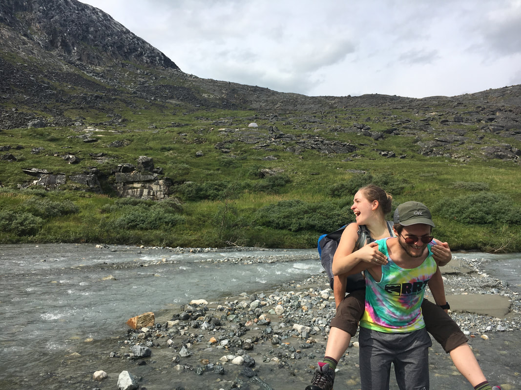 | 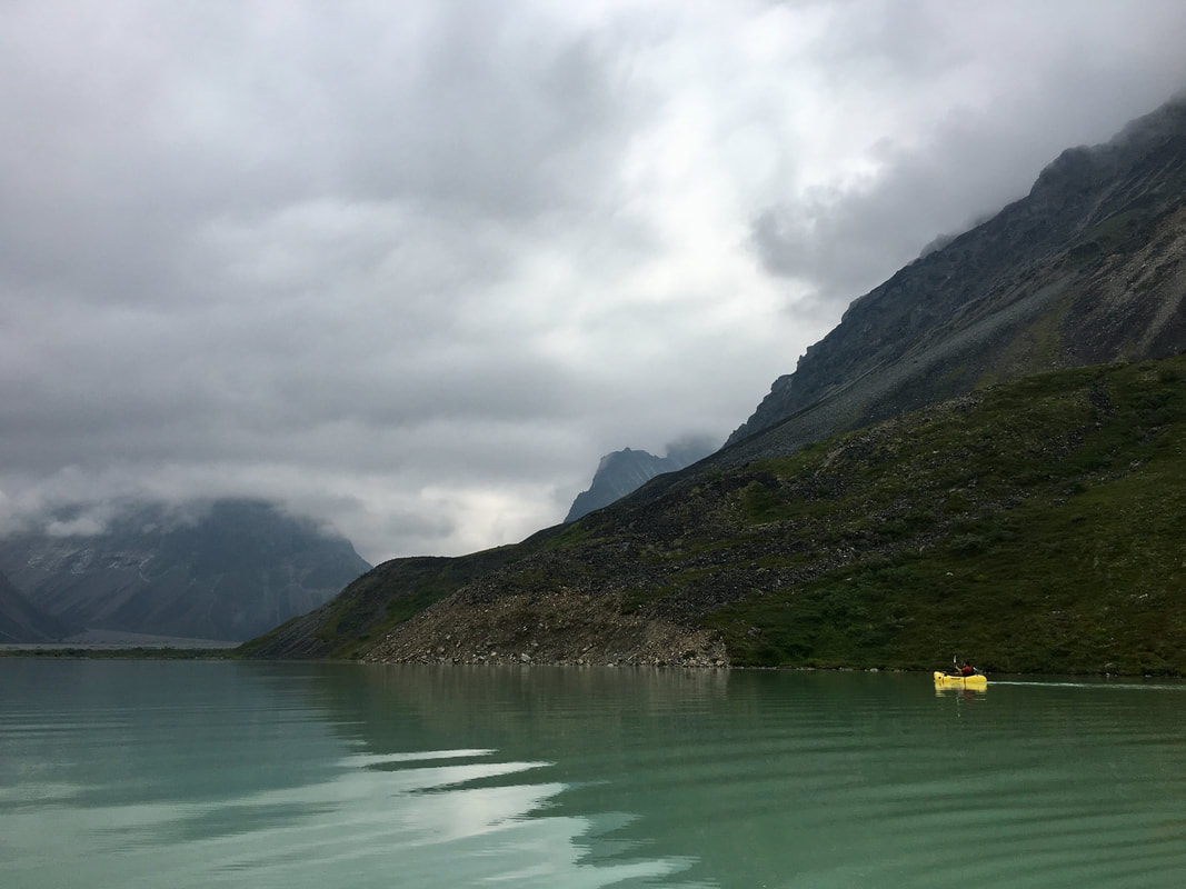 |
On Friday we finally had our first day of backpacking. The goal was to go a nice easy 4 miles to the west end of Turquoise Lake to get ourselves situated for a long day pushing up and over the highlands to another valley and yet another beautiful lake. Joe, Will, Emma and Olivia began the hike up and along the rocky, bushy shore and Mason and I paddled in our Kokopellis on the lake below them. We were all crushing the miles, although, packrafting was admittedly much easier than hiking and bushwhacking… Mason and I continued paddling west along Turquoise Lake until about a mile from where we were planning on camping when the wind picked up and started throwing whitecaps into the boats. There wasn’t much we could do at that point besides pack up the boats, link up with our friends and get to walking just like them.
As we approached where we wanted to camp, we realized a group had already beaten us there and was taking up the entire beach. Some colorful words and ideas may have gone around the group when we realized we might need a new plan. Eventually, after hiking through fields of blueberries, willows over your head, hidden streams, tussocks and a ton of mosquitos we found our way onto the next beach. Luckily, being the resourceful and smart people we are, we found a nice spot for the tents and the kitchen just to the other side of our guided friends. The rest of the day was spent exploring the beach and relaxing after a long day of moving, little did we know what the next day had in store for us.
As we approached where we wanted to camp, we realized a group had already beaten us there and was taking up the entire beach. Some colorful words and ideas may have gone around the group when we realized we might need a new plan. Eventually, after hiking through fields of blueberries, willows over your head, hidden streams, tussocks and a ton of mosquitos we found our way onto the next beach. Luckily, being the resourceful and smart people we are, we found a nice spot for the tents and the kitchen just to the other side of our guided friends. The rest of the day was spent exploring the beach and relaxing after a long day of moving, little did we know what the next day had in store for us.
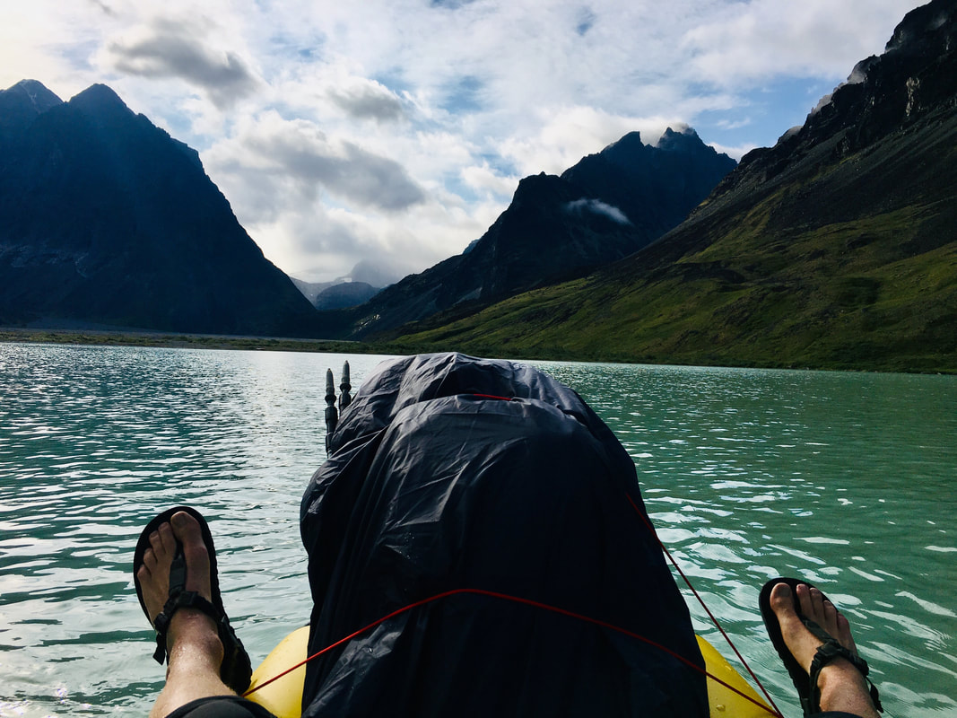 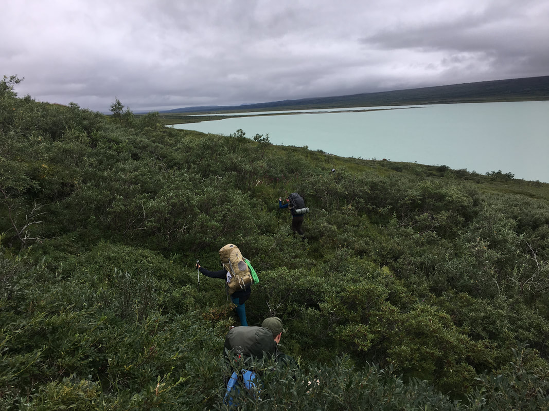 | 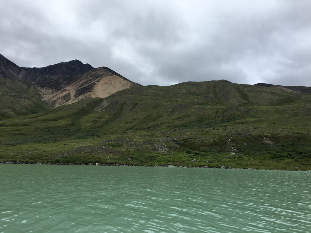 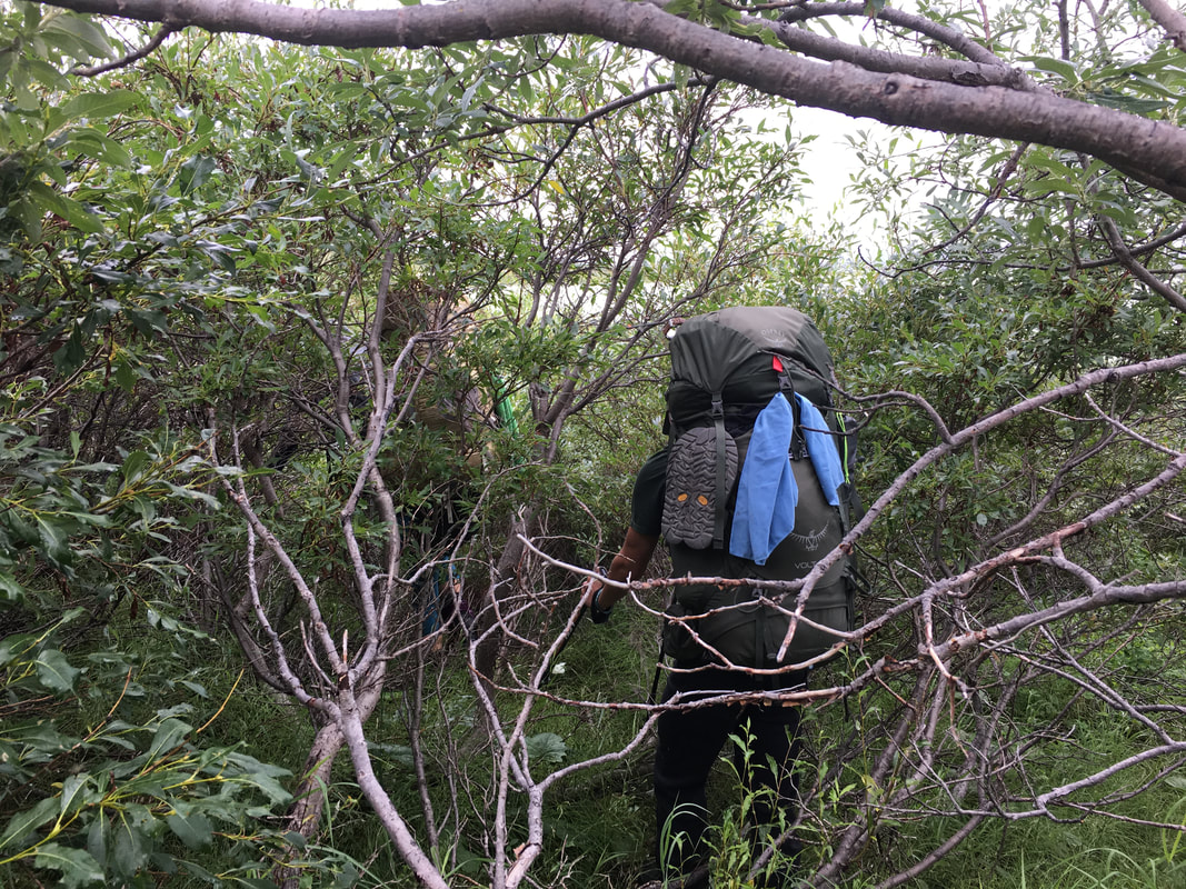 |
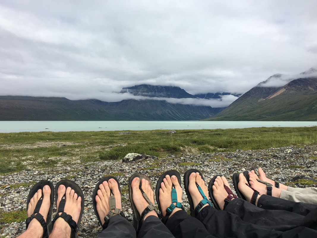
On our fourth day we awoke to calm skies and a clear view down the lake to where we had come from the day before. We quickly packed up and were looking at the climb in front of us. We had to go from the surface of the lake up 1,500’ to the top of the ridge before entering the highlands and starting the “easy” part of our day. With fresh legs we quickly covered the distance, as we neared the top Mason, Will and I pulled ahead of the rest of the group before arriving at our marker for a rest. As we sat there we took in the views of the lake and watched a plane fly in and out picking up the others who had camped on the beach. I stared down at the bright blue water before hearing Will say as calmly as possible “Hey look, a bear”. I looked down into the valley and off into the distance not seeing it before noticing that he was pointing to the ridge we were on and the young grizzly was about 100 yards out… I dropped a few f-bombs for sure before the three of us grabbed our packs and grouped together with the bear spray ready to go. We made some noise to let the bear know we were there and not to mess with us, but he continued to approach. He was downhill from us, so we had the high ground luckily, but he had the route to get between us and the others… We continued to make noise to try and scare him off but he was still curious with us as he ran up to about 50’ away. He was about to get between our two groups. We started to move sideways with him, not giving any ground and not getting any closer all while going towards Emma, Joe and Olivia just down the ridge. Suddenly, he stood up, looked around one more time and bolted down towards the lake, covering what took us a half hour to do in about a minute. That was definitely the most never racking bit of the trip, but it wouldn’t be our last bear of the day. We all regrouped on the top of the ridge, got a drink and a snack then continued up into the highlands together.
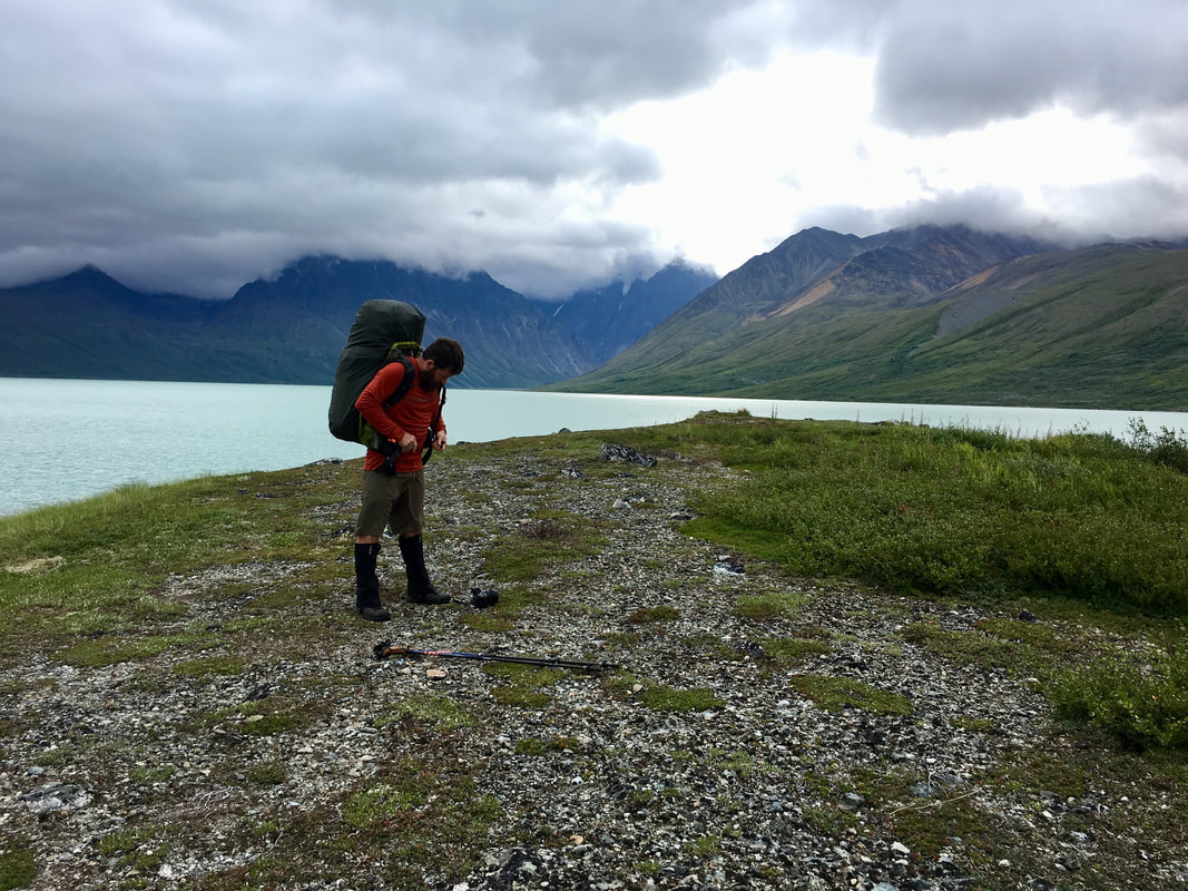 | 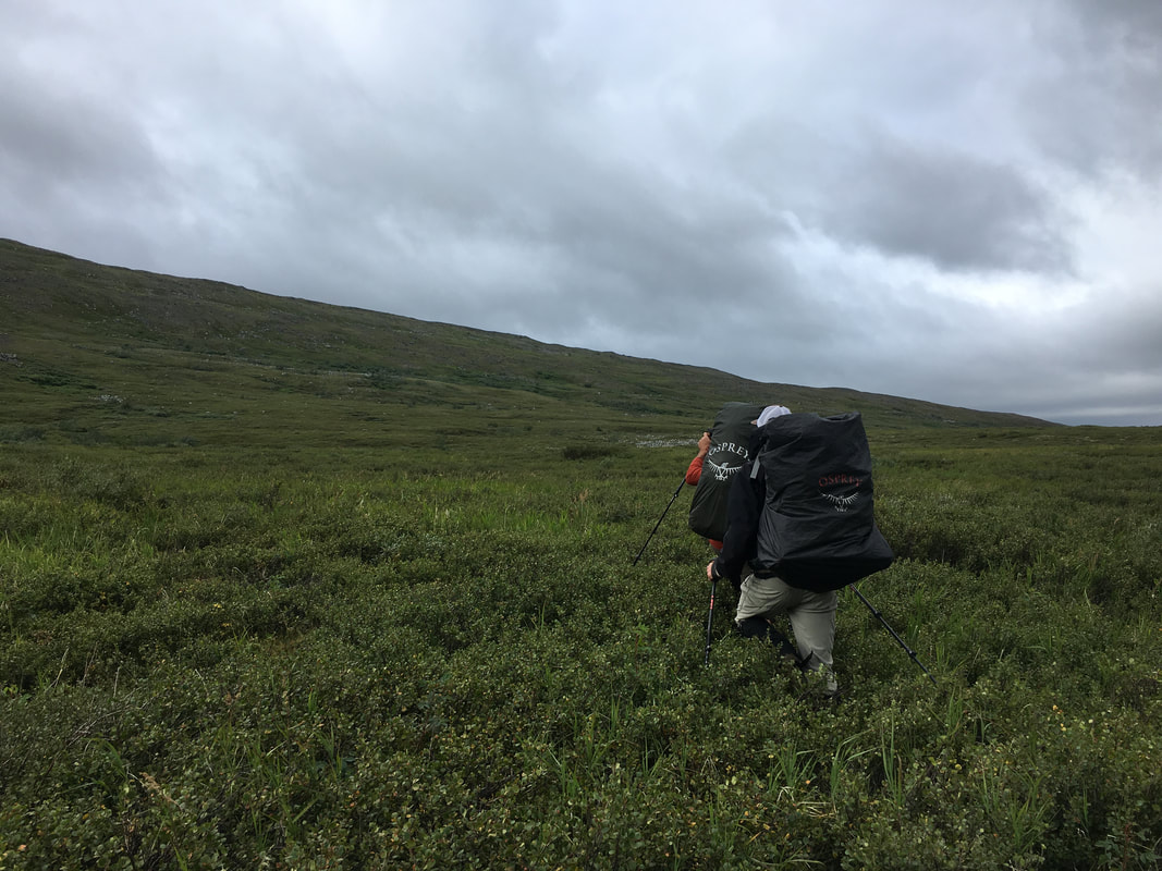 |
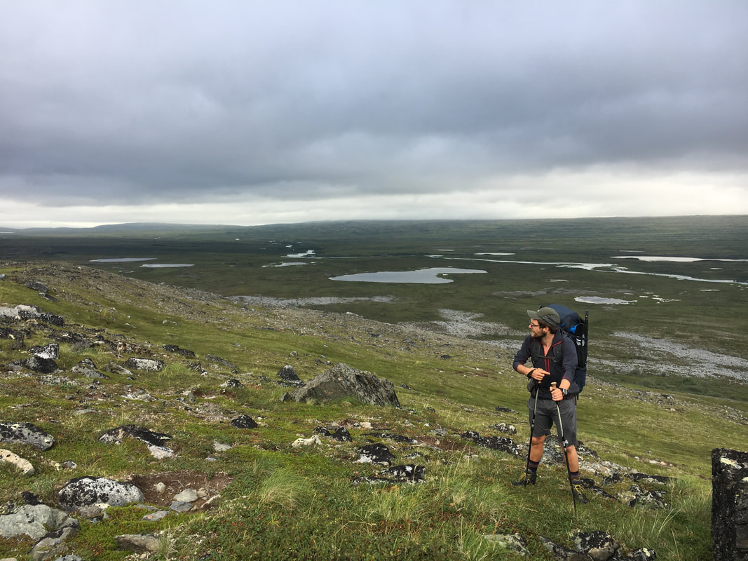
The rest of the day we spent as a group. Joe and I worked the route and everyone else supplied endless laughter, singing and stories. About halfway across as we were charting our next marker we spotted two more bears, a mama and cub. They were a quarter mile off and enjoying some berries on the ridge. We debated routes and decided it would be best to give mama bear a wide berth and go a little off course to avoid her. As we crossed two rivers, we lost sight of the bears but spotted a group of hikers off in that direction and began to think they had scared her off our way. We quickly got our boots back on after the crossings and quickly worked our way to the high ground. There was no bear to be seen once we reached the next flat meadow. We continued on, spotting several “rock bears” along the way. As we go closer and closer to Lower Twin Lake I could feel myself getting tired and ready to make camp. Eventually we made our way to the final crest overlooking the lake, there were still miles between us and the water. I sat on the ridge looking off into the distance, looking for flat land to camp or the best route straight to the lake. The quickest route was straight down a scree filled slope, so that’s the way we went, sliding down the side of the mountain towards a small lake. As we reached the unnamed lake, I began to think about how nice of a campsite it would make tucked up into the mountains right as Emma called out three more bears on the ridge above us…
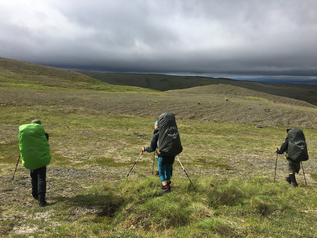 | 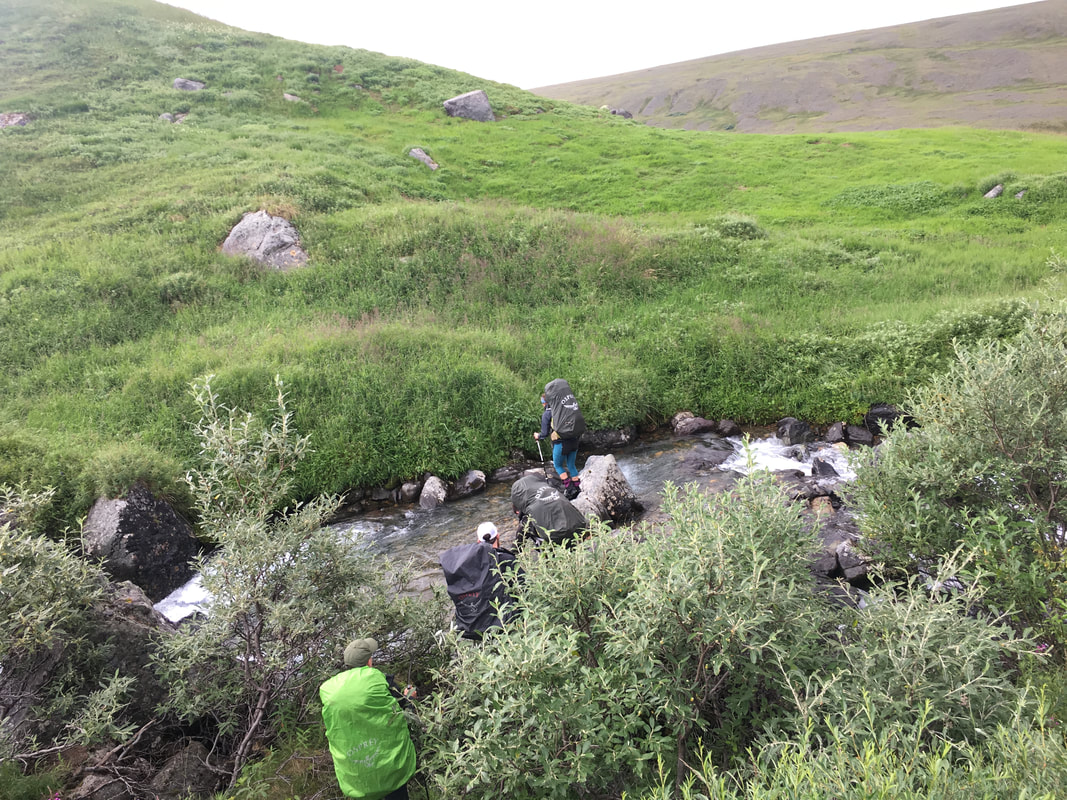 | 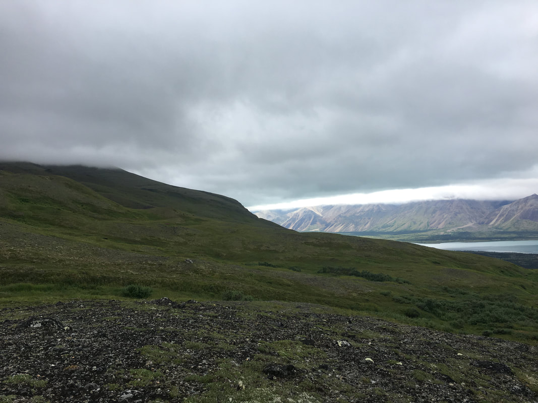 |
The group was a mama and two cubs, we sat and stared at them for a long while as they lay on the mountainside. They didn’t seem to want to move at the end of the day, much like me. We walked slowly as a group towards them and down the mountain but they began to move around the cliffs across from us. We slowly kept our path down, thinking the pine forest would provide protection and they wouldn’t follow us into there. I watched them as we continued to move lower towards the tree line. All of a sudden, someone called out a fourth bear, and sure enough here comes papa running up the mountainside towards them… Luckily we were a quarter mile off and continued on our path towards Lower Twin. We stopped for a quick water break and spotted two Moose moving down into the forest, another animal to worry about…
We picked a bearing and entered the woods, dropping down into a ravine before making it to the dense forest and working out way south. Every once in a while I would call out a course correction to Joe as he led us through the brush but we moved quickly, trying to avoid the mosquitos. After over 8 miles bushwhacking, avoiding bears, crossing rivers and sliding down the side of mountains we finally made it to the north shore of Lower Twin Lake and setup camp. Everyone went for a much needed swim in the crystal clear water, we enjoyed cards on the beach and took our time to think about the journey so far as we neared our last two days in Lake Clark.
We picked a bearing and entered the woods, dropping down into a ravine before making it to the dense forest and working out way south. Every once in a while I would call out a course correction to Joe as he led us through the brush but we moved quickly, trying to avoid the mosquitos. After over 8 miles bushwhacking, avoiding bears, crossing rivers and sliding down the side of mountains we finally made it to the north shore of Lower Twin Lake and setup camp. Everyone went for a much needed swim in the crystal clear water, we enjoyed cards on the beach and took our time to think about the journey so far as we neared our last two days in Lake Clark.
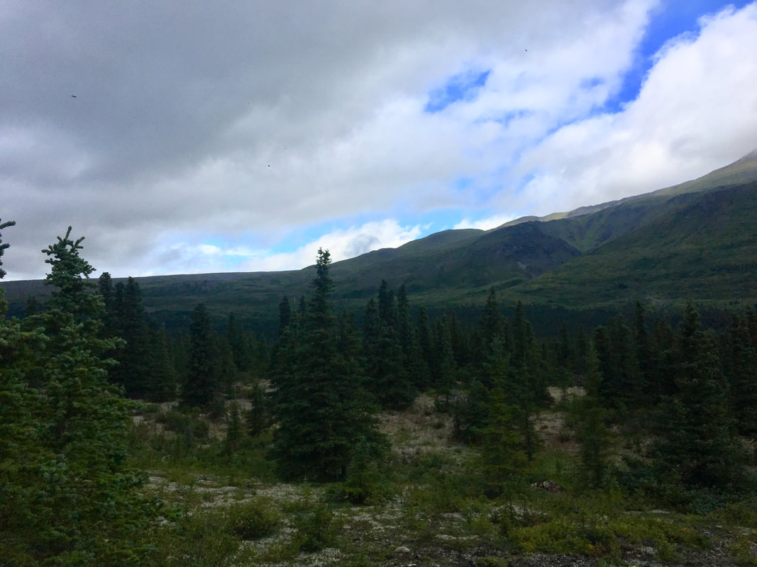 | 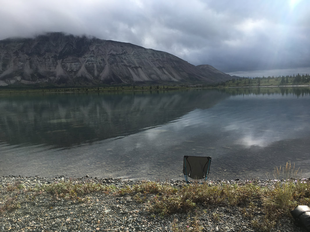 |
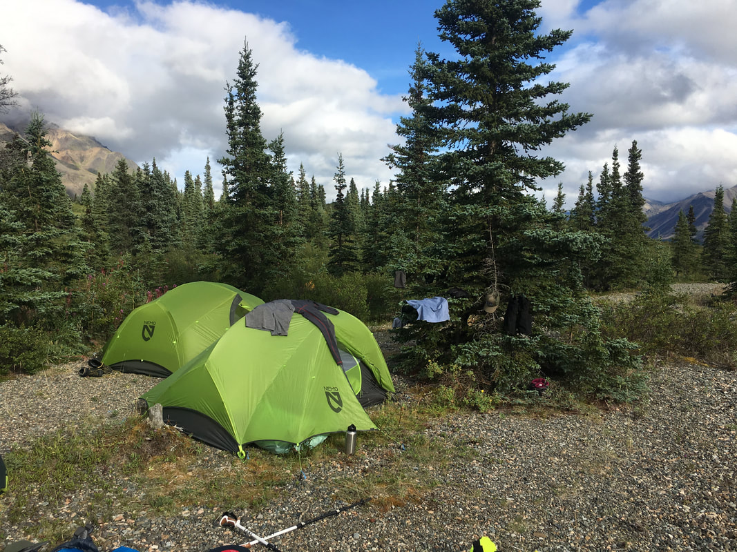
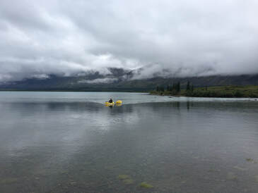
I thought about how traveling with these guys was like traveling with a big happy family. I enjoyed how we bounced jokes off each other, laughed at each other’s struggles and supported each other when we needed to. Some days, like this day, were long and hard and filled with bears while other days were short “strolls” along beautiful scenery.
I thought about how the peaks weren’t as rugged and towering as The Winds in Wyoming, The Colorado Rockies or the Sawtooths in Idaho but they were packed in tighter than any of those ranges. The terrain was more unforgiving but it was breathtakingly beautiful and seemed as if every inch of it had something living there. I’ve been a lot of places and in many mountains but I can honestly say I’ve never experienced a landscape so vast. The amount of wildlife also amazed me, in one day we saw 7 grizzly bears, 2 moose, swans, ptarmigans, sheep, ground squirrels and an abundance of birds and bugs all surviving in this harsh landscape. It was a beautiful place to end a long day.
On the fifth day we awoke to rain, something we expected a lot more than we got on this trip. All of us laid hesitantly in our tents, hoping it would stop before giving up and crawling out for breakfast. As the morning went out and we packed up camp the rain tapered off and we got ready to cross the lake on our Kokopellis. The mouth of the Lower Twin Lake empties into the Chilikadrotna River and the water is cold, waste deep and moving fast so we planned to use our packrafts to shuttle people and gear across the gap. As the Will and I made our way across the lake, the rain stopped. Slowly but surely, after a lot of back and forth, we all made it across the lake and were on our way to our first stop, the ranger cabin on the south shore. Joe and I continued along in the packrafts while the others hiked along the shore. To him and I this was like a beach vacation, to everyone on the shore, not so much. After about a mile and a half we made it to the ranger cabin for lunch and a bathroom break on a real toilet seat. There was no ranger at home, but we made ourselves cozy outside on the porch for a bit. Eventually we packed up and continued along the shore of the lake, taking turns paddling and walking. After several hours of up and down as well as walking on rocks and snacking on blueberries we finally made it to the connector between Upper and Lower Twin Lakes. We called our bush pilot on the SAT phone and let them know that we would be there and waiting in the morning. For tonight though, we enjoyed floating down the river between the two lakes, playing Flux and eating the last of our food, knowing pickup was a few hours away. As we drifted to sleep that night, the first bits of Alaskan night finally hit.
In the morning we slowly made breakfast and packed up, getting tricked by a few different planes into thinking they were ours. Eventually our guy showed up, loaded us up and we were flying above the lake, covering what had taken us hours the day before in a matter of minutes. We were on our way to Anchorage, leaving the backcountry behind for now.
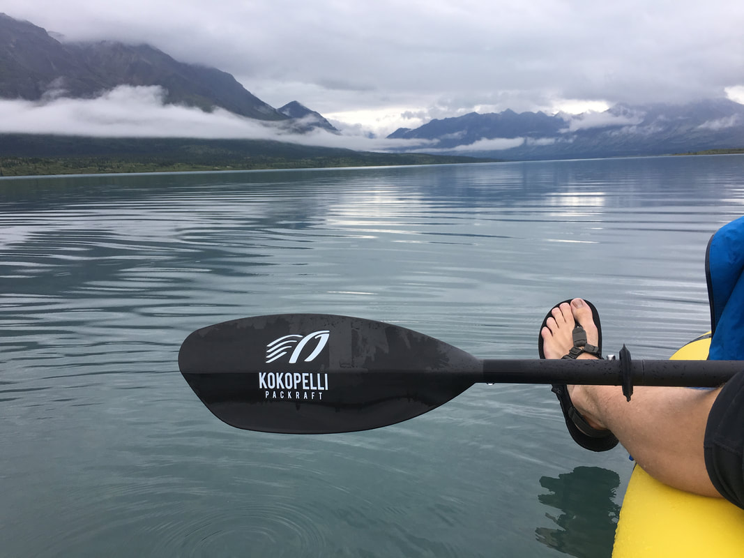 | 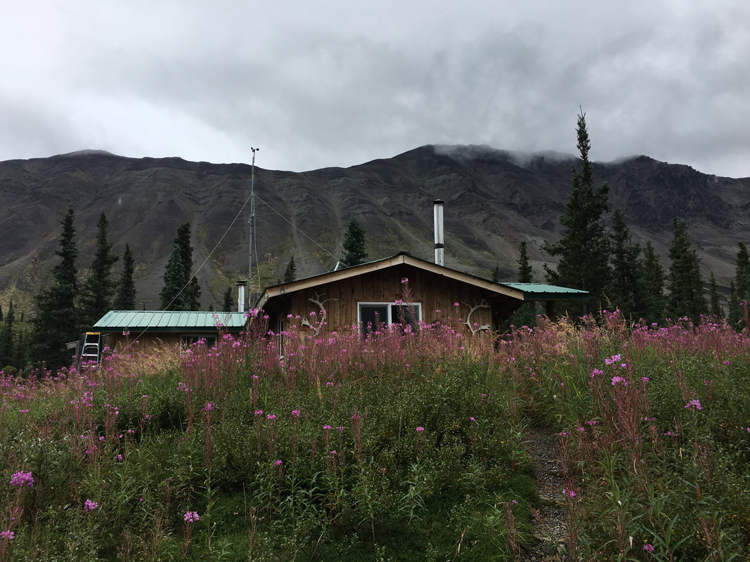 |
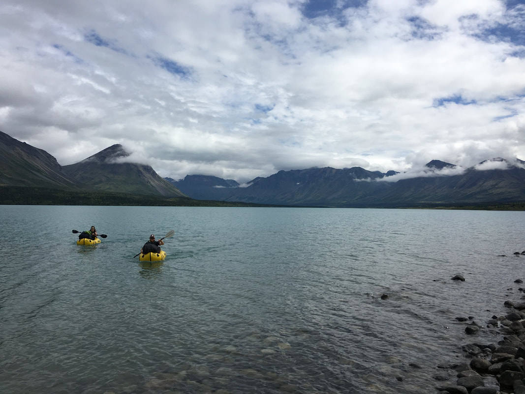 | 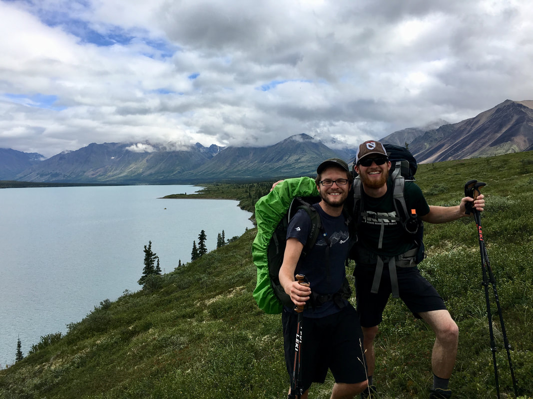 | 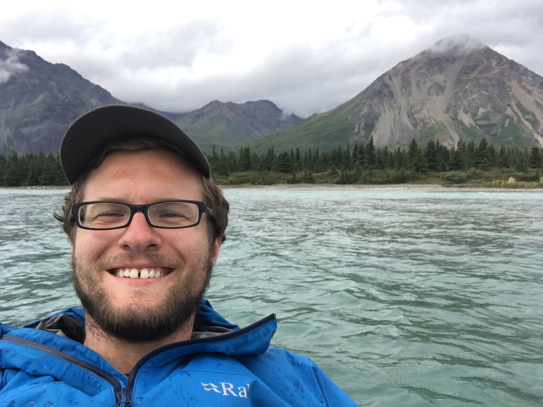 |
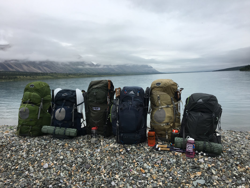 | 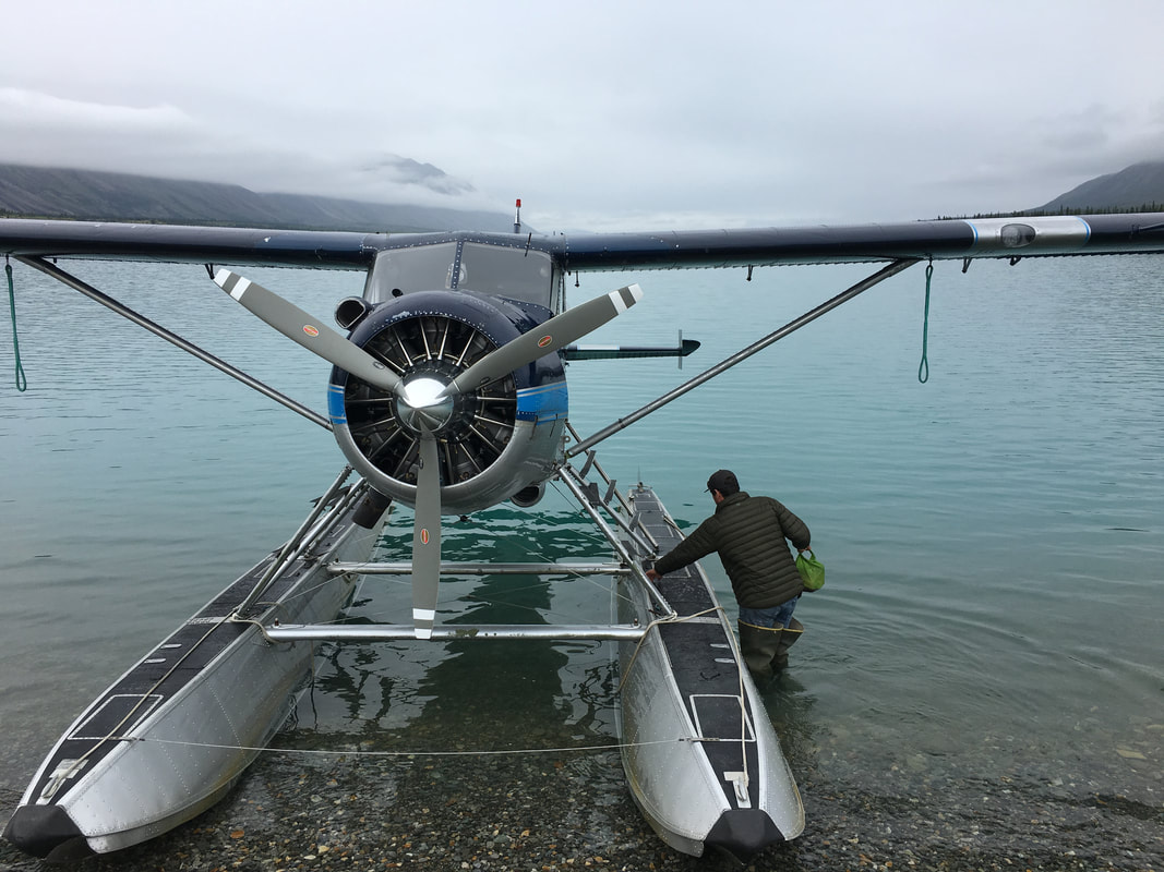 |
Kenai Fjords National Park
After another bush plane flight we found ourselves sitting in the parking lot of Trail Ridge Air waiting for the rental cars, trying to decide what to do with the rest of our day and the thing on most peoples’ mind was food. We drove to downtown Anchorage to 49thState Brewing and sat down for drinks and sandwiches and more food than most people probably wanted to eat. Then, after stuffing ourselves we began the two hour drive down the beautiful Kenai Peninsula to Seward and Miller’s Landing were we were going to stay for the next two days.
Miller’s Landing was our first chance at a shower in about a week and to my surprise, everyone but me passed on the opportunity. They missed out because a shower was great… The next day we got up, grabbed a grocery store breakfast and headed out to Exit Glacier for a climb up the mountain to the Harding Ice Field. The group had gotten a little too cozy in the past 24 hours being out of the backcountry, but I was prepared to crush this thing and get them back in the groove. Joe had told us it would take 8 hours and I could sense everyone was dreading that haul, so I did what I do best and started down the trail as fast as I could. Everyone followed suit (for the most part) and we quickly shook off the morning haze and were moving our way up along the glacier. After just under 4 hours we arrived at the top of the Exit Glacier Trail and looked out over the Harding Ice Field. It was massive. The sheet of ice stretched on for miles and had whole mountains buried in its icy belly. We relaxed and enjoyed the view before all beginning to get the feeling it was time to start heading down. As quick as we went up, we went down, back to the car and back to camp to get our gear ready for sea kayaking in the national park for the next three days. Everyone worried about being cold, about the rain and other things and didn’t know what to pack. For me, I was more worried that the guide wouldn’t bring enough food and I would be hungry…
Miller’s Landing was our first chance at a shower in about a week and to my surprise, everyone but me passed on the opportunity. They missed out because a shower was great… The next day we got up, grabbed a grocery store breakfast and headed out to Exit Glacier for a climb up the mountain to the Harding Ice Field. The group had gotten a little too cozy in the past 24 hours being out of the backcountry, but I was prepared to crush this thing and get them back in the groove. Joe had told us it would take 8 hours and I could sense everyone was dreading that haul, so I did what I do best and started down the trail as fast as I could. Everyone followed suit (for the most part) and we quickly shook off the morning haze and were moving our way up along the glacier. After just under 4 hours we arrived at the top of the Exit Glacier Trail and looked out over the Harding Ice Field. It was massive. The sheet of ice stretched on for miles and had whole mountains buried in its icy belly. We relaxed and enjoyed the view before all beginning to get the feeling it was time to start heading down. As quick as we went up, we went down, back to the car and back to camp to get our gear ready for sea kayaking in the national park for the next three days. Everyone worried about being cold, about the rain and other things and didn’t know what to pack. For me, I was more worried that the guide wouldn’t bring enough food and I would be hungry…
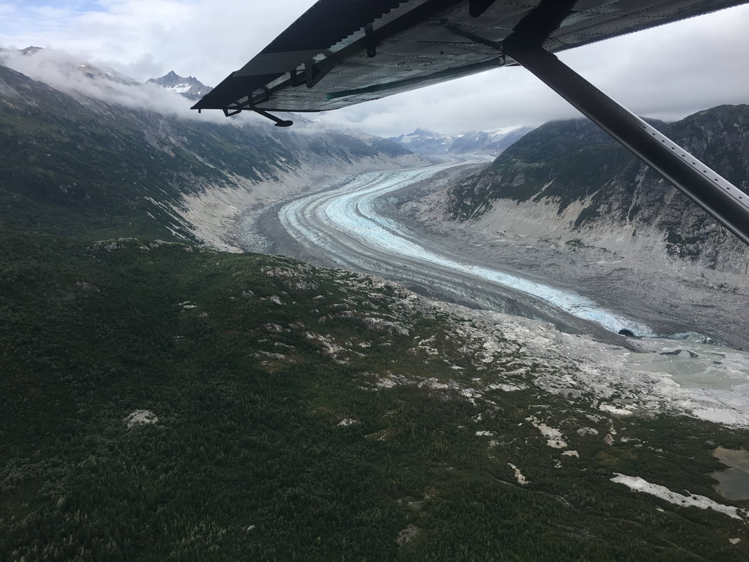 | 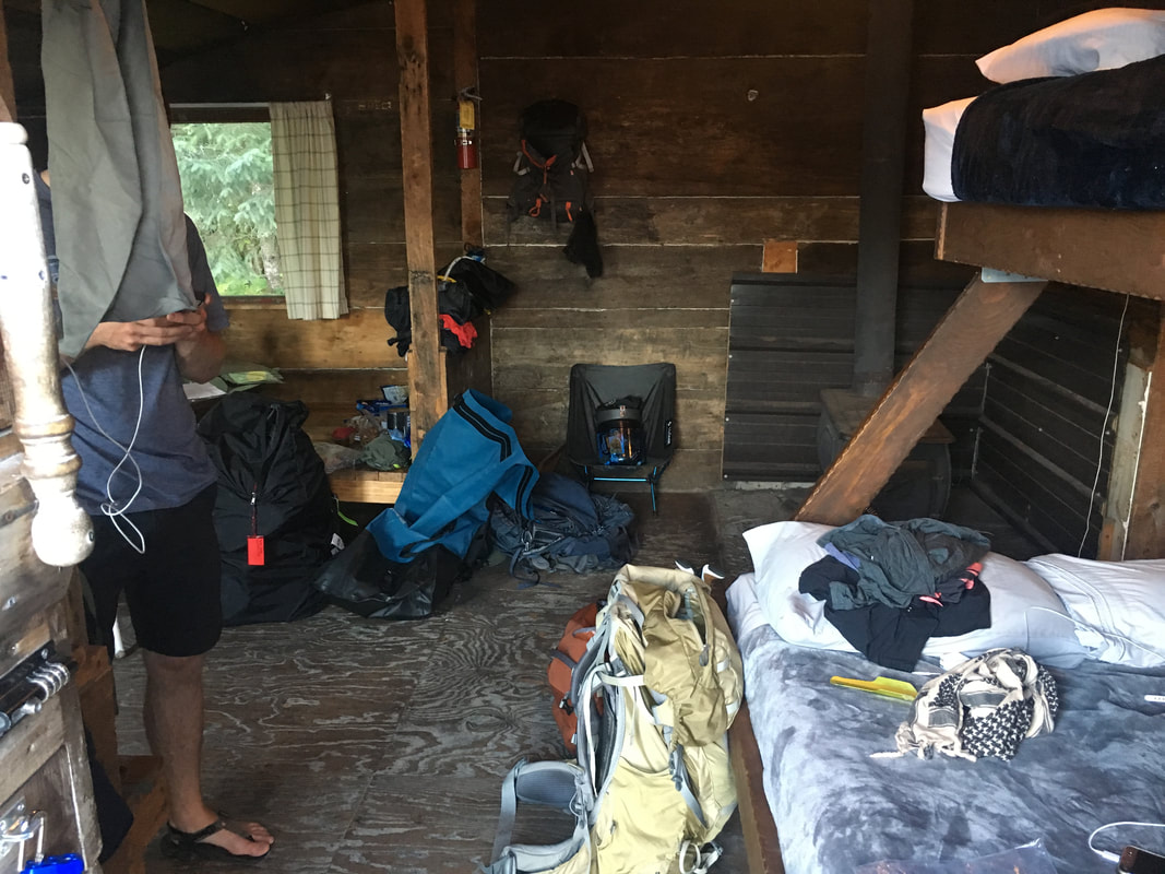 | 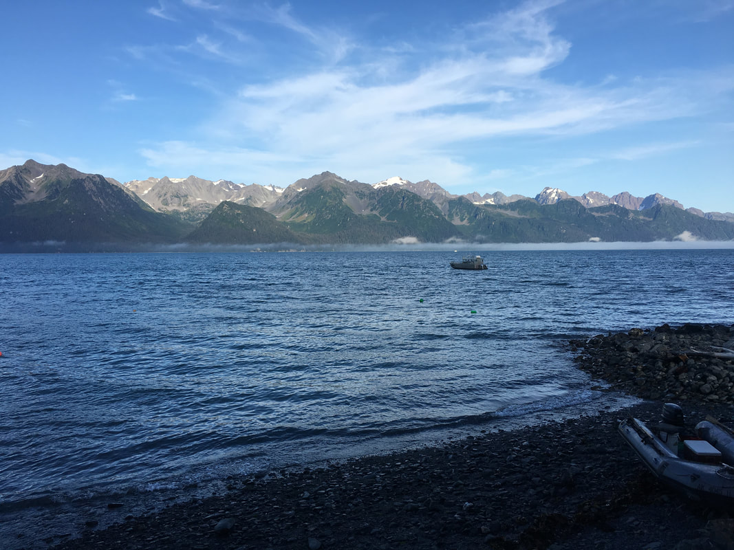 |
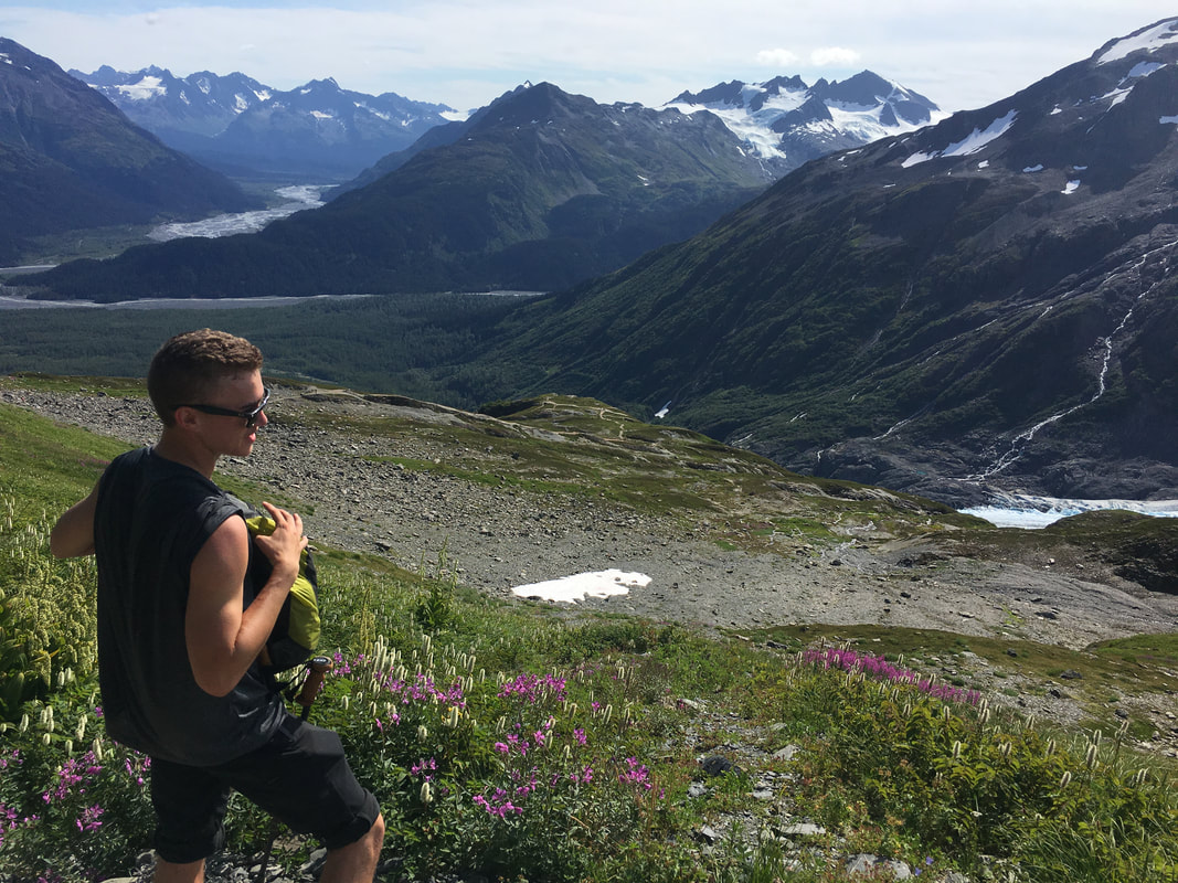 | 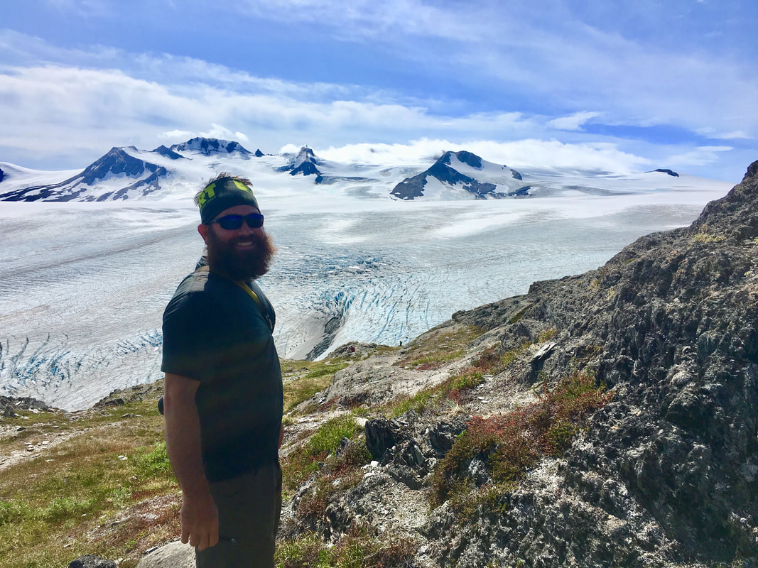 |
We awoke the next morning at 5:30AM and walked to the dock. We watched the captains load their boats and the guides haul out kayaks for their groups. Eventually a rather lanky and interesting character named Dritz came over and introduced himself as our guide for the next few days. We were stoked, he seemed just like us, a kid wanting to have some fun. Before we knew it we were on our water taxi scooting out along the ocean to the Northwest Fjord. We arrived after about 2 hours of watching seals and puffins outside the boat and quickly setup camp, I as eager to get on the water. We grouped up in tandems and started off with our goal for the day being to paddle to the Northwest Glacier that formed the bay. After about two miles of paddling, a crazy strong head wind stopped us in our tracks and we returned to camp not wanting to push forward in such poor conditions.
The rest of the day was spent catching up on sleep, playing cards and going on a short paddle and hike to Southwest Glacier near our camp. After all that we got lucky and one of the fishing boats decided be nice and dropped off two huge salmon flays and a flay of rockfish. Dinner that night was good…
The rest of the day was spent catching up on sleep, playing cards and going on a short paddle and hike to Southwest Glacier near our camp. After all that we got lucky and one of the fishing boats decided be nice and dropped off two huge salmon flays and a flay of rockfish. Dinner that night was good…
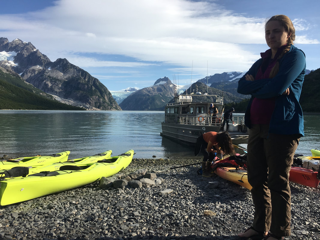 | 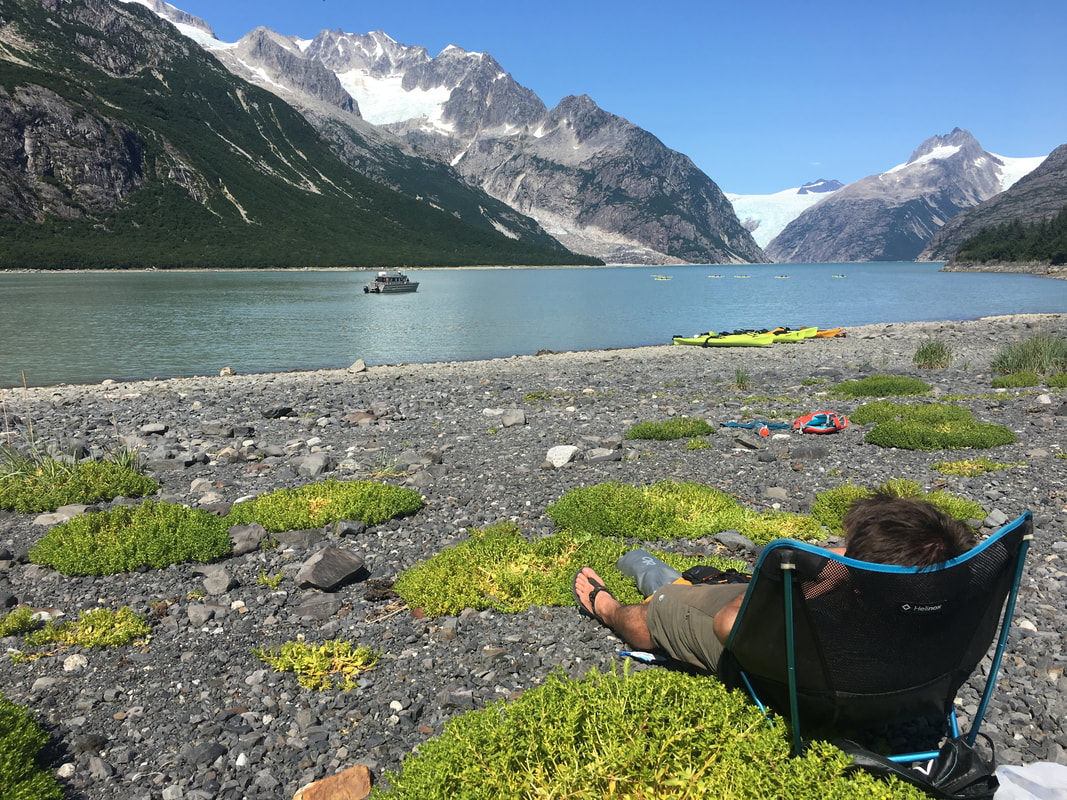 | 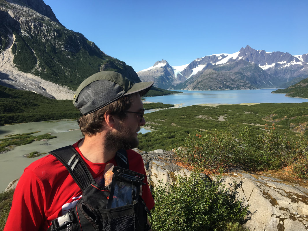 |
The next day we got up early and paddled out towards the ocean, our goal was to get on the moraine formed by Northwest Glacier at its greatest extent in the 1900s. It was a slightly tricky thing to do, you could walk on much of the moraine even in high tide but we wanted to hit it right at the lowest tide when the top would be exposed. So we slowly meandered up the coastline, watching seals pop in and out of the water and keeping our eyes open for more creatures. We arrived on beach a little after 1PM and low tide wasn’t till 2:30… We took some time to play in the sand, eat lunch and enjoy a beautiful view before going for a walk down the moraine. The rocks on it were covered in muscles, there were little tidal pools full of life everywhere and once you reached the end of the rocks, you could truly feel how large the glacier really was at its biggest. Eventually we walked back to the boats and headed back to camp, stopping to pick berries along the way. We spent that evening doing a lot of talking, we all wanted to know more about our guide Dritz. He was a wanderer for a while, and a musician, and just in general a good person. The guy knew almost everything about the area we were in and he smoked like a chimney. He seemed to see the world around him in a different way and somehow at 24 had everything figured out. It was an interesting evening.
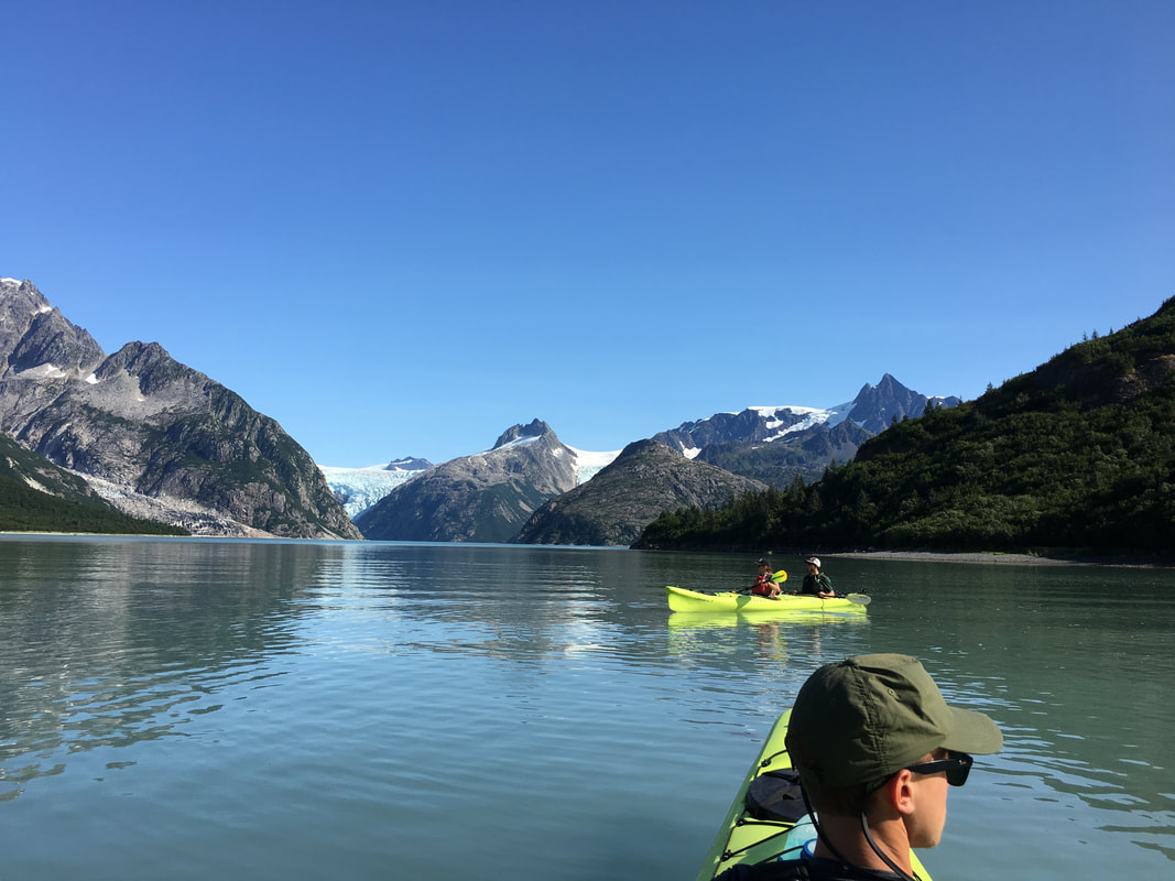 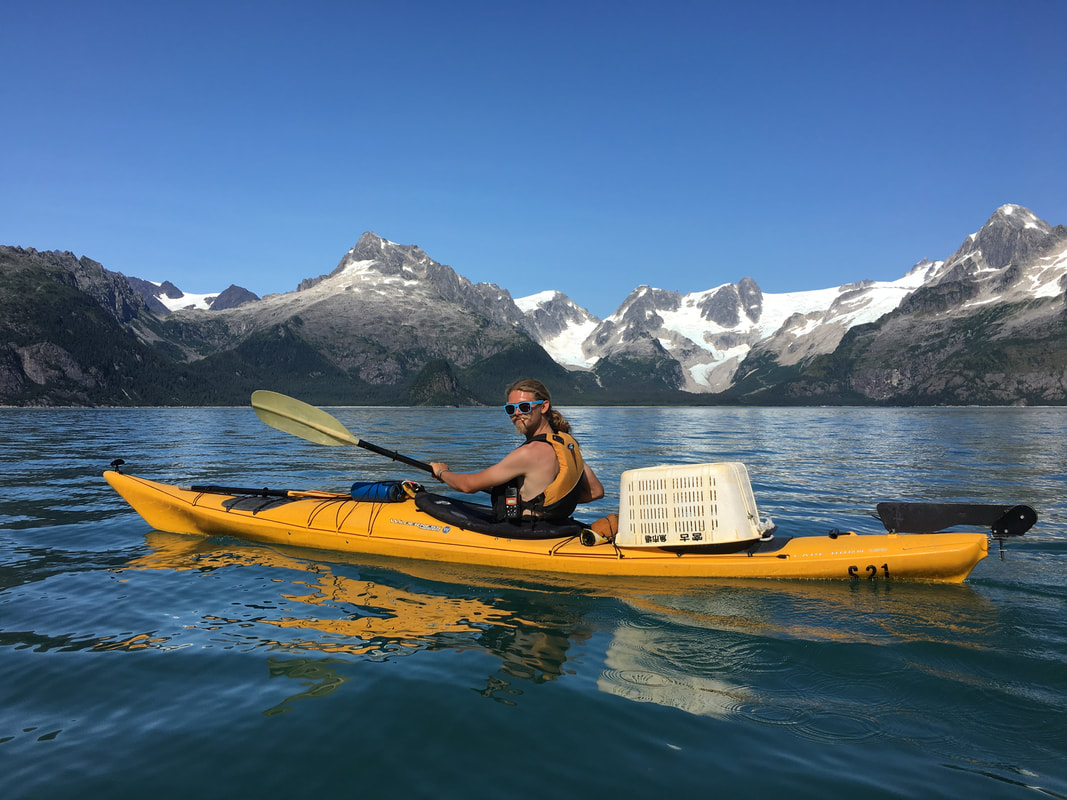 |  | 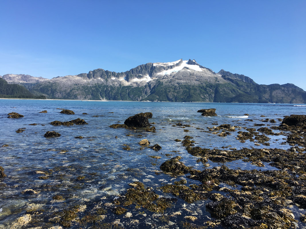 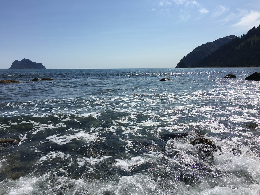 |
The final morning in Kenai we woke up to another beautiful day, quickly packed up camp and paddled hard out the Northwest Glacier. Our pickup boat would be back at the Southwest Beach at 4:30PM so we couldn’t be late. The Glacier seemed small once we got to it until I saw a tour boat in front of it and you could actually see how massive this ice behemoth really was. We sat for a while as the wind from the glacier blew our boats around with ease and watched the ice bergs float by. Eventually we landed on Redstone Beach near the glacier and had lunch while we soaked up the views. We lazily made our way back to Southwest Beach since we had plenty of time left in the day and lounged for a while before spotting a pod of orcas hunting just off shore. It was an awesome thing to watch as they came out of the water, a last little bit of icing on the cake.
The water taxi to take us back to Seward arrived right on time, full of fishermen… We got loaded up, snagged some seats and began the two hour ride back to town. Sea Kayaking in Kenai felt like a completely separate trip, just days before we had been whacking our way through the bush in Lake Clark and now we were in a completely new place, with new challenges, new laughs and new adventures already leaving it behind. Dritz made the journey even more amazing, he had a life story twice his age, knew so much about the world around him and seemed to love every minute of his life. We tipped him very nicely… (Always tip your guides kids)
After we arrived back to Seward from our paddling journey we found ourselves tucked away in a cozy sea side retreat, surprised by Joe’s gracious upgrade from where we planned to stay. We sat on the balcony overlooking Resurrection Bay, laughing, eating and drinking trying not to remember that the end of this grand journey was just a few days away from us.
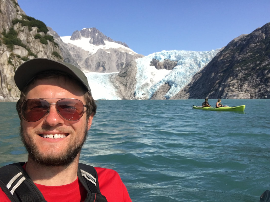 | 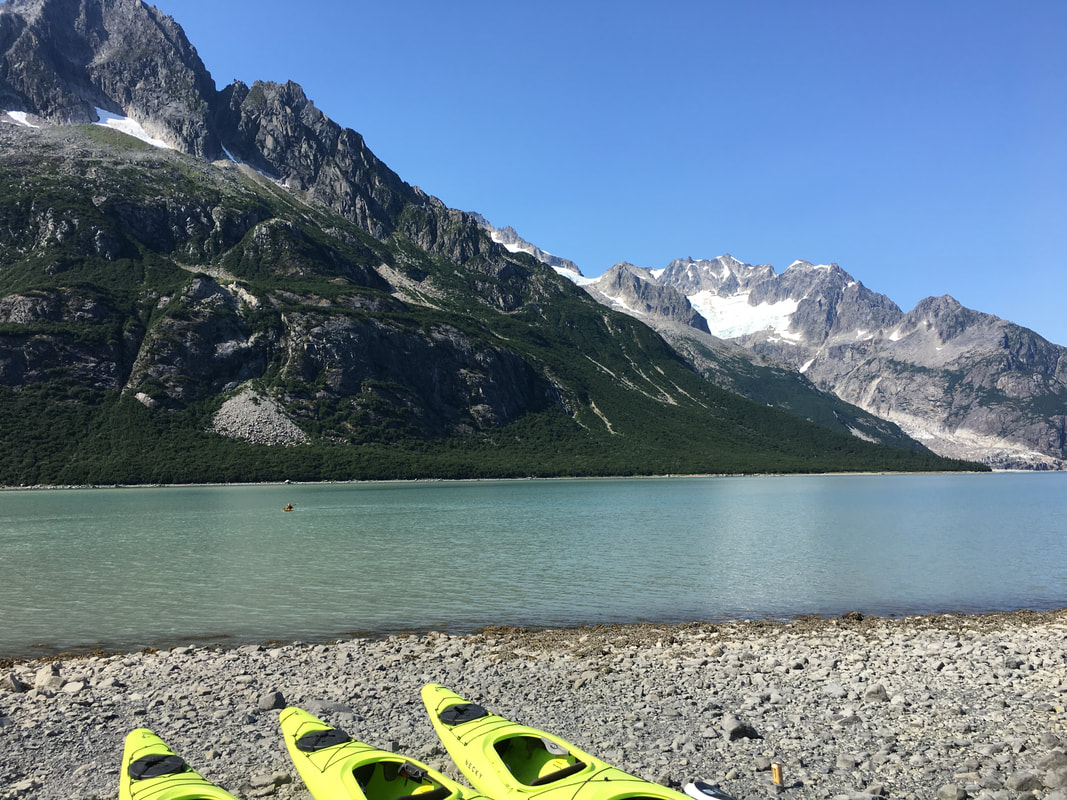 |
On Saturday we drove north into the Chugach National Forest working our way back towards Anchorage. I don’t think any of us wanted to leave that bungalow but we found a nice cheap campsite managed by the Forest Service. For one last time, we setup camp, hoped back in the cars and drove north to Crow Pass to hike up to one more glacier. After days in boats our legs had become sore and tightened up again, the first mile was rough. Eventually most of us fell into a stride and worked our way up the pass to its alpine lake and Crow Glacier. We sat enjoying our last moments in the Alaskan backcountry for a while before dark clouds of to the west on the other side of the mountains made us think twice about begin up there. We quickly made our way down below treeline, helping an older woman with a fear of heights down along the way (kudos to Olivia). We arrived near the car just as it started to rain the hardest and heading back towards the campground. In the evening we had one last camp meal, went for a little hike, saw another moose 50’ away, and watched schools of salmon float in the river nearby. It was a nice last night out…
On Saturday we drove north into the Chugach National Forest working our way back towards Anchorage. I don’t think any of us wanted to leave that bungalow but we found a nice cheap campsite managed by the Forest Service. For one last time, we setup camp, hoped back in the cars and drove north to Crow Pass to hike up to one more glacier. After days in boats our legs had become sore and tightened up again, the first mile was rough. Eventually most of us fell into a stride and worked our way up the pass to its alpine lake and Crow Glacier. We sat enjoying our last moments in the Alaskan backcountry for a while before dark clouds of to the west on the other side of the mountains made us think twice about begin up there. We quickly made our way down below treeline, helping an older woman with a fear of heights down along the way (kudos to Olivia). We arrived near the car just as it started to rain the hardest and heading back towards the campground. In the evening we had one last camp meal, went for a little hike, saw another moose 50’ away, and watched schools of salmon float in the river nearby. It was a nice last night out…
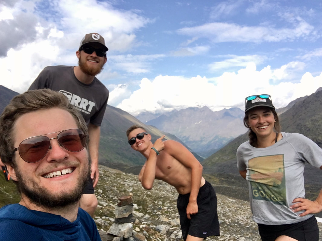 | 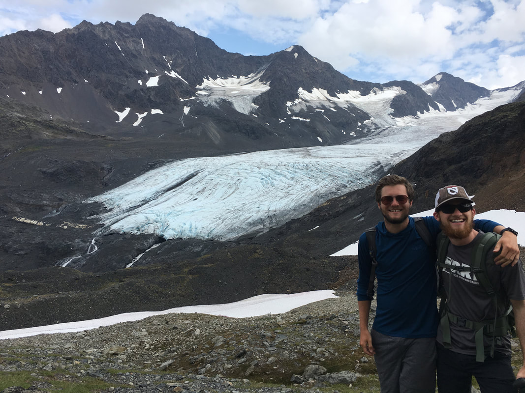 |
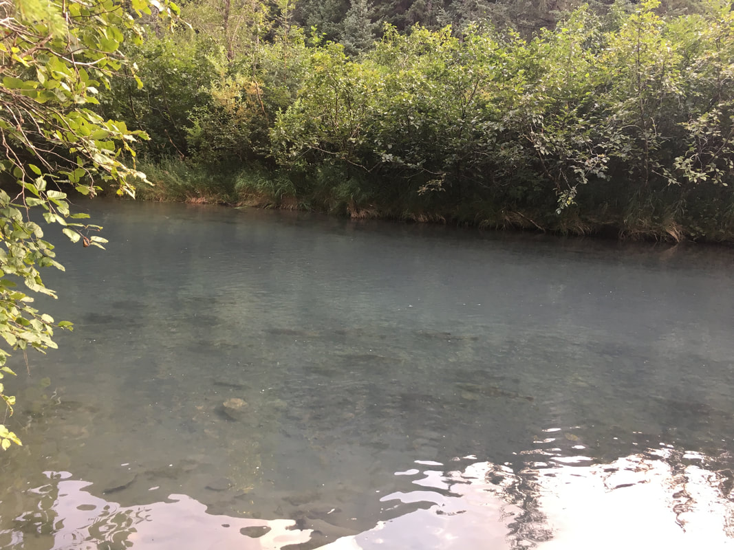
Sunday we returned to Anchorage to enjoy a nice hotel with a pool, and showers, and a complimentary breakfast buffet. We had dinner downtown, I feasted on Cod and Crab Legs and bought way too much booze and we all celebrated a trip well done and even better friends made.
On Monday, I went for a run while all the lazies slept in, we had breakfast, watched some New Girl and left for the airport. The trip had ended just days ago but already felt like a lifetime away. I found places I can’t wait to revisit, I grew some awesome friendships, I saw breathtaking views, I made jokes and laughed and enjoyed the hell out of a trip that’s been a long way coming. To have been able to do what we got so lucky with was an amazing thing and it will keep me dreaming for a long time about the trips to come.
On Monday, I went for a run while all the lazies slept in, we had breakfast, watched some New Girl and left for the airport. The trip had ended just days ago but already felt like a lifetime away. I found places I can’t wait to revisit, I grew some awesome friendships, I saw breathtaking views, I made jokes and laughed and enjoyed the hell out of a trip that’s been a long way coming. To have been able to do what we got so lucky with was an amazing thing and it will keep me dreaming for a long time about the trips to come.
 The fall came just as we left | "To the lover of wilderness, Alaska is one of the most wonderful countries in the world." |
A few days after graduation I took off on a trip out west, the goal was to visit National Parks, new and old to me, and relax before starting my new full-time job. I’ve been very busy recently and it’s taken me a long time to get this together, but in total we visited five National Parks, and hiked over 50 miles. It was a long trip that took me all the way to the northern coast of California along the Pacific Ocean for a night on the beach. We traveled almost 6,000 miles in 12 days, going from the central grasslands, through the Rockies, across Utah and the Mojave Desert before going up and over the southern Sierra Nevada Mountains to Yosemite and making our way to San Francisco before finishing our journey up the coast, it was a whirlwind of a trip.
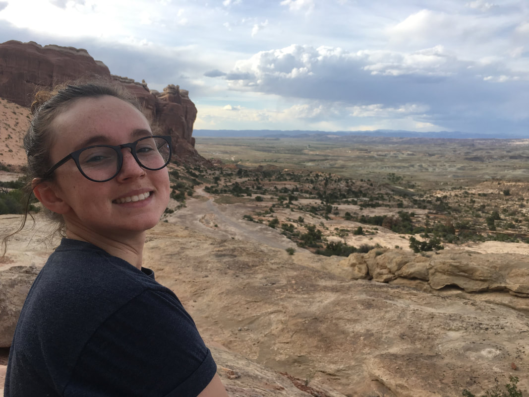 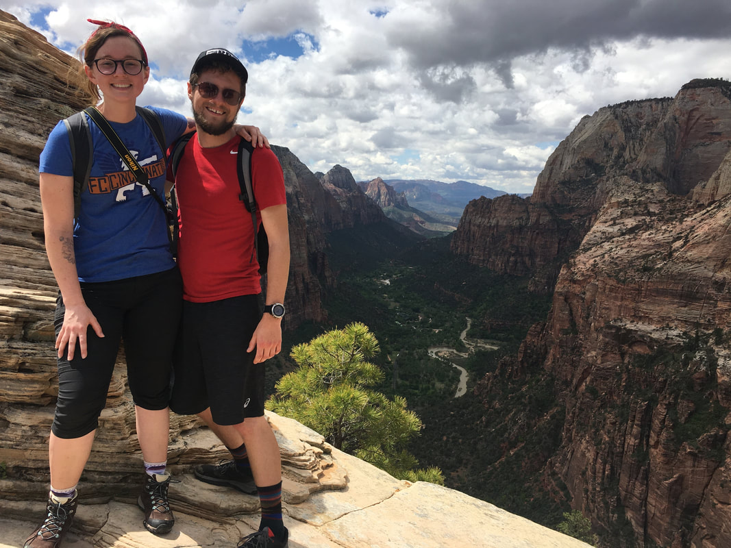 |  | 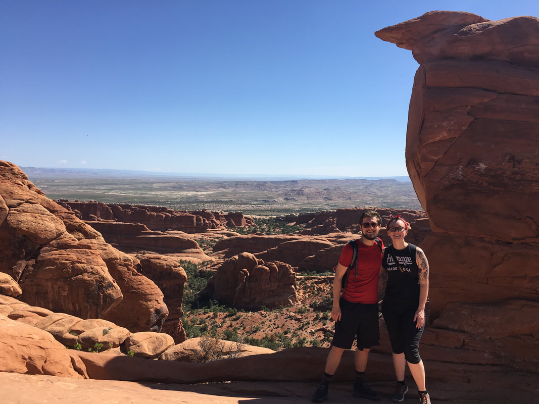 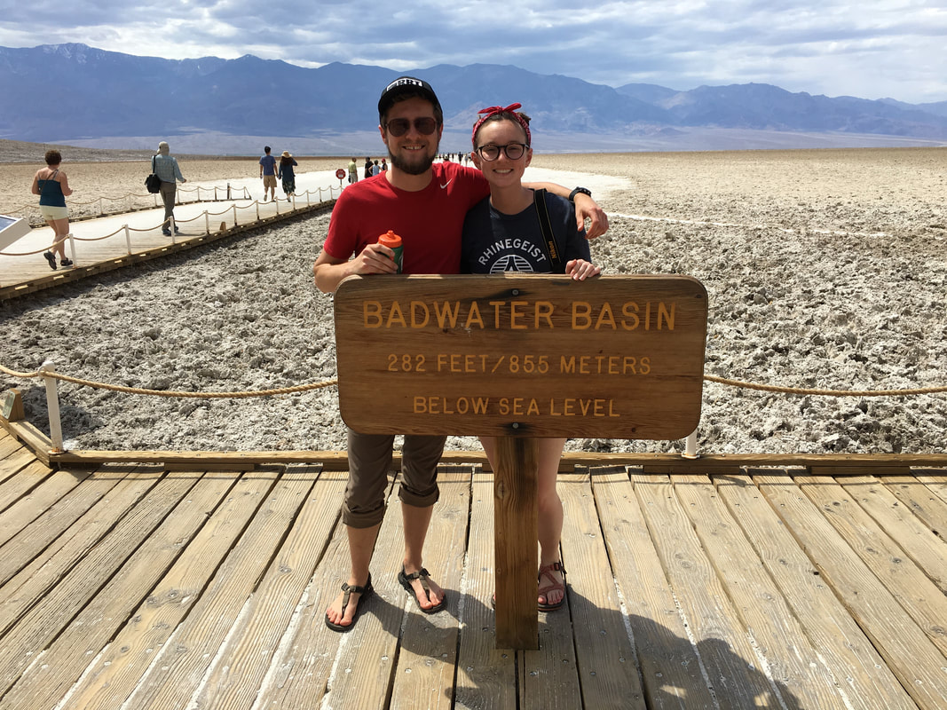 |
All of that moving and revisiting old destinations got me thinking about the people I’ve led on trips and all the places I’ve gone to. I figured maybe I had traveled to a dozen places and taken maybe 50 or 60 different people on trips. So, when I got home from my journey to Arches, Zion, Death Valley, the PCT, San Francisco and The Redwoods I decided to do some counting and look at all of the trip sheets I had collected over the years. Most people would just throw away their trip contact forms, but in all my hoarding and obsessiveness in collecting cheap mementos, I’d saved almost every single one since the first trip I led to Red River Gorge almost 4 years ago.
When I looked back and counted, I found something that amazed and surprised me, I had taken 118+ people on 22 different trips to 18 different places, and those are just the ones I kept track of over the last few years. We had visited National Forests, Parks and wilderness areas across the country. We had gone canoeing in The Boundary Waters, we had snowshoed part of the way around Crater Lake, we had suffered in desert heat, we climbed the highest peaks on the continent and we played in the tallest sand dunes in North America. It was amazing to think about all the things I had done and all the people I had been able to share these adventures with.
I’ve learned so much from the people I've traveled with over the years and they've hopefully learned on journeys with me. They’ve shown me what it is to be a leader, what it takes to get people into your mindset, as well as how to encourage people to push onward in the face of adversity. On the other hand, I guess I taught them how to travel cheap, how to get places and do things that most of them probably never thought they’d be doing. I helped people become leaders of their own groups of friends and go on their own journeys. I guess learning was mutual.
As I stood atop Yosemite Point, halfway through our trip, and stared out into the Sierra Nevada Mountains, I thought about how far I had come. I thought about both on this journey (from Ohio, to Arches, to Zion, to Death Valley, over the Sierra Nevadas all the way up Yosemite Falls) and on all the ones before this. I thought about the places I had visited and all the people I had had the chance to share those experiences with. I also thought about the adventures still to come, the places I still want to go, and the stories left to be told.
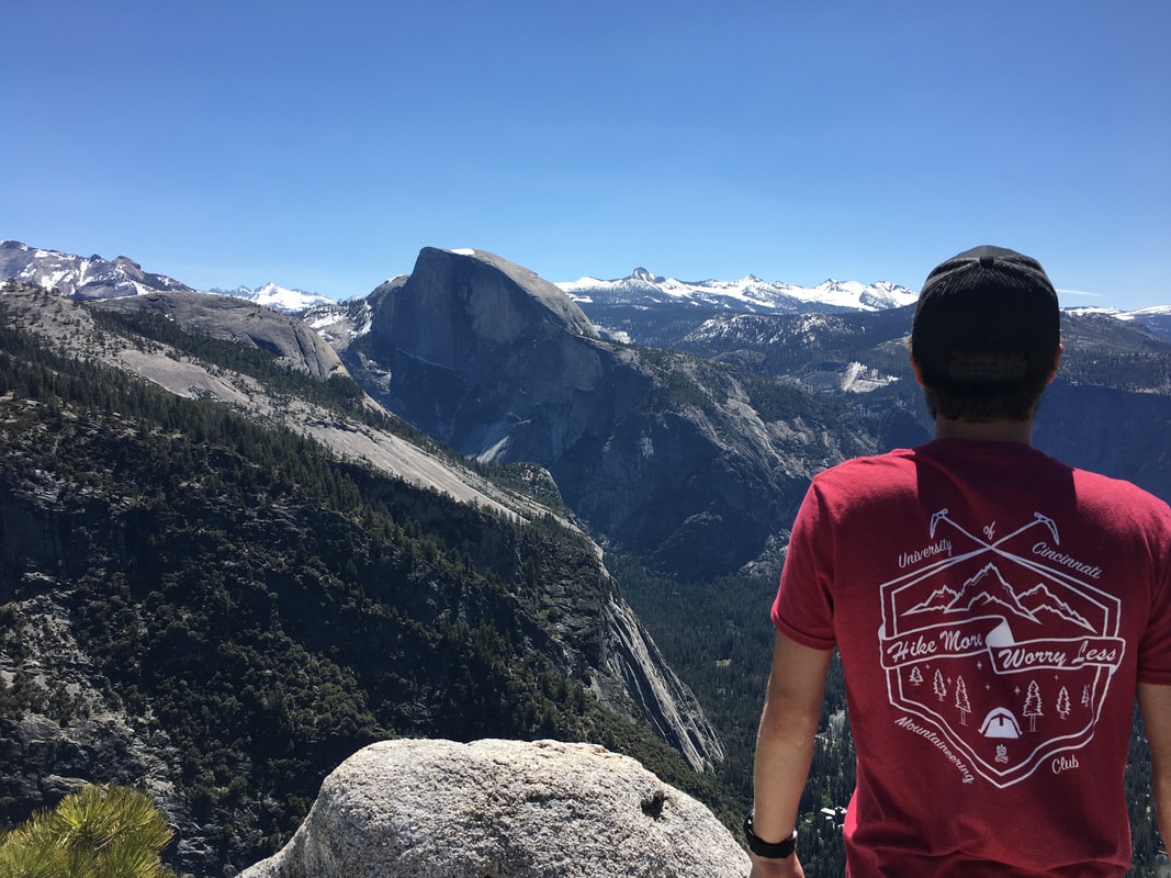
Clara and I rounded out our journey along the Pacific Coast, enjoying a night in San Francisco, a night camping on the beach and a night by a fire with redwoods towering over us. We eventually found ourselves in the Salt Flats of Utah for one last night under the stars before finally making it back home to our real lives. A few days after getting back, we started our full-time jobs and life has been moving on ever since.
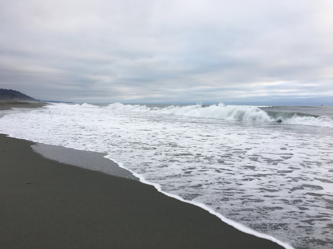 | 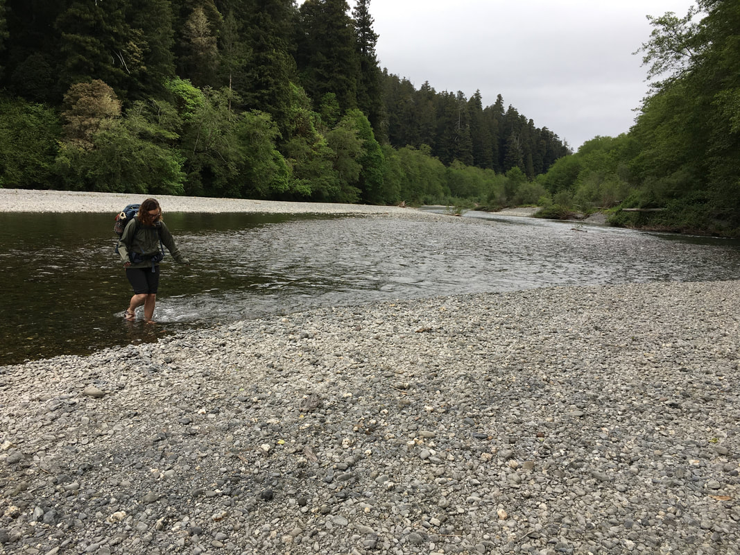 |  |
What my last trip taught me was that Clara and I won't kill each other when we travel together without others, she'll just get a little mad when I'm hiking too fast, especially up hill (sorry, can't help it, in my mind its just wavy...) This trip also reminded me and reaffirmed that I will forever be fueled by my travels, I will always long for the felling you get on an adventure, and I will always want to keep moving. Luckily, I get a ton of vacation time, so shouldn’t be a problem…. Until the next journey!
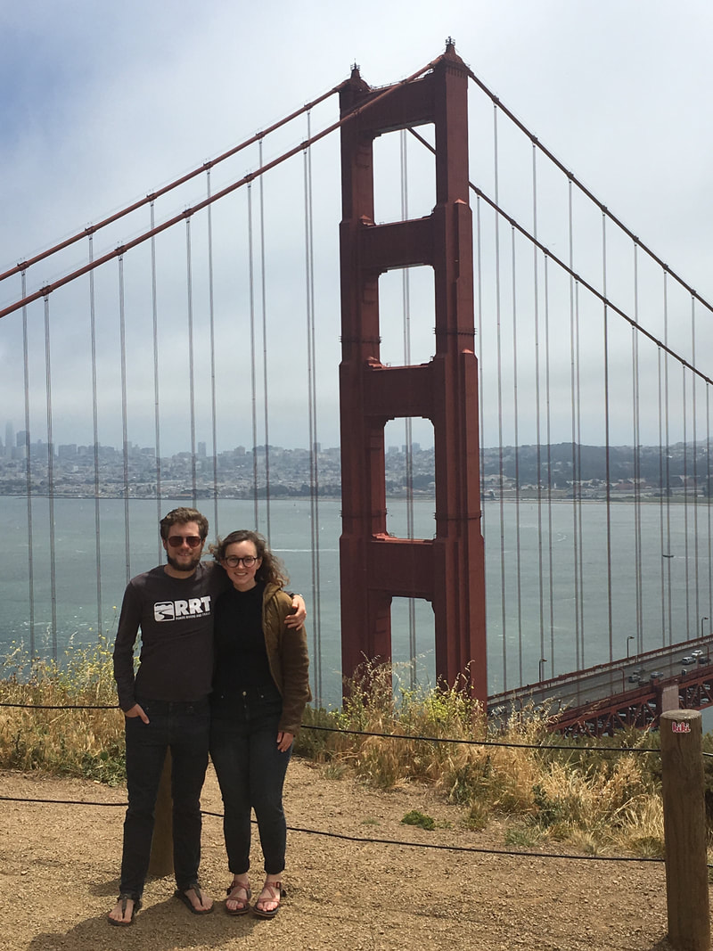 | "There is science, logic, reason; there is thought verified by experience. And then there is California." |
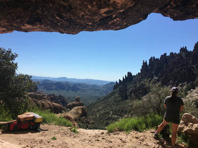 The View From Fremont Saddle
 I’ve gone on many trips over the past five years; I’ve traveled to almost every state, I’ve hiked in deserts, climbed mountains, canoed across lakes and so much more. I’ve led all sorts of people on these journeys, ranging from more experienced than me all the way to people who have never backpacked. Every trip has left me feeling differently afterwards and after my trip to the Superstition Wilderness in Arizona, I’m left with a feeling I can’t quite describe...
We left Cincinnati early on a Saturday morning and began our adventure across the country. We all quickly became friends during the car ride, singing, playing games and getting to know each other. It was a long ride, as usual, but seemed to fly by. Twenty-six hours after beginning our journey we arrived in the Superstition Wilderness at the Peralta Trailhead ready to hit the trail. We had heavy bags with water for 3 days, not quite sure what the desert would bring. About halfway up the first canyon, a local told us there was water everywhere and this was one of the wettest springs ever. The woman said she was 65 and had lived there for her entire life so, we happily poured out our water on the desert floor and quickly made our way up the to of Fremont Saddle. From there, we enjoyed the beautiful views and a much-needed snack.
After lunch, we quickly covered the rest of the day’s ground into camp, setup, swam in the flowing creek to wash off the day’s work and relaxed at camp after a long car ride. As the night set in, we enjoyed the beautiful views and a warm fire.
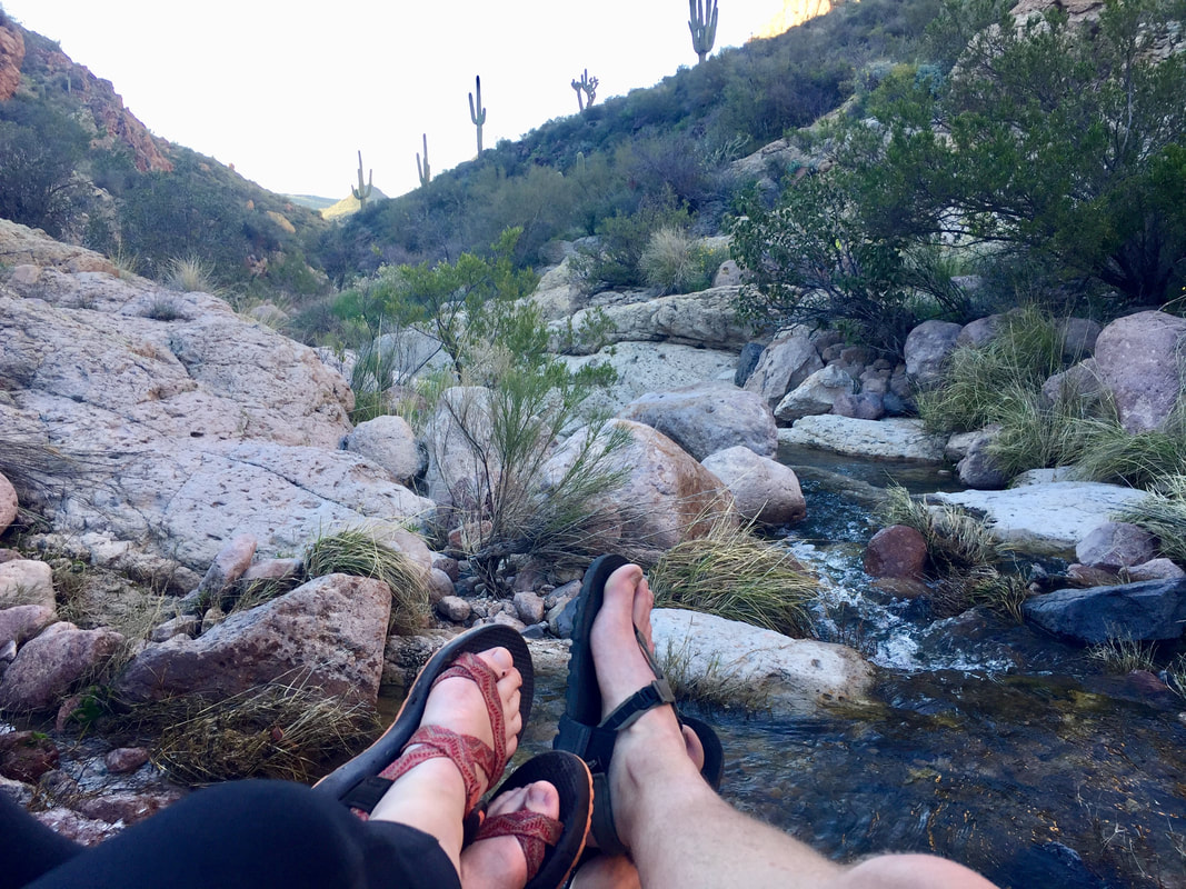 | 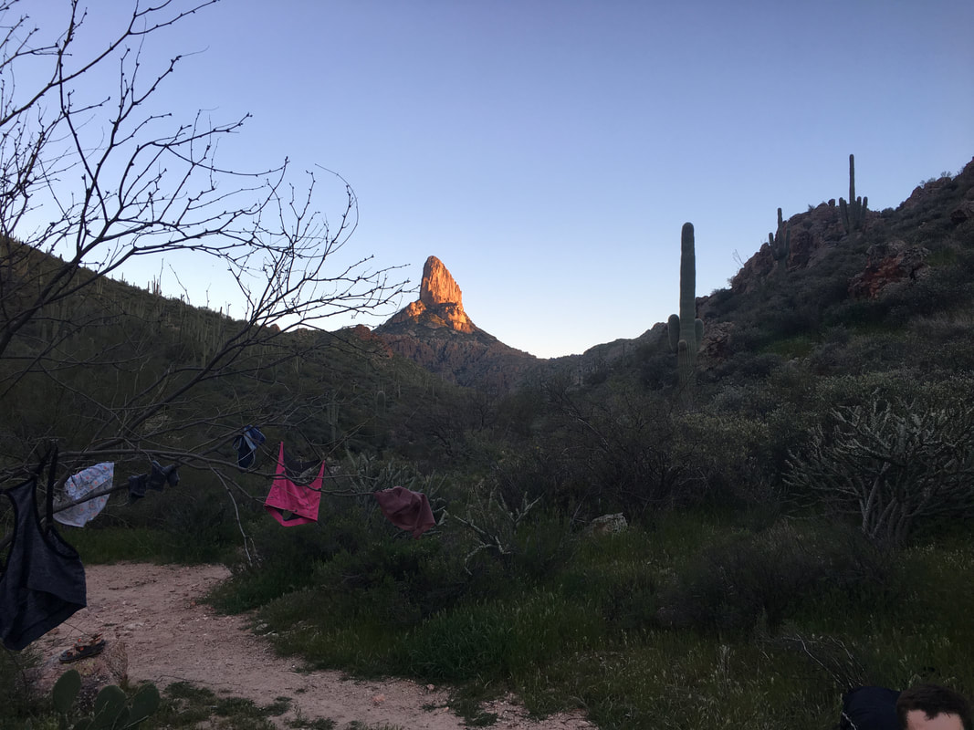 |
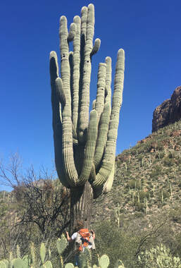
The next day we woke up, got breakfast and hit the trail early. We knew we had a long day with a lot of uphill coming (little did we know how much uphill). Shortly after leaving camp, we went over Bull Pass behind Black Top Mesa and went down into the next canyon where we found another flowing creek. The water was cold and felt great under the hot sun. After that stop, we moved down the trail, passing giant cacti, beautiful riverside campsites and lush green desert cliff-sides. It was an awesome morning, but the up was about to put a damper on that...
We turned off of the Dutchman’s Trail onto Peter’s Trail and began a big uphill climb above Charlebois Spring. When we first mapped out the route, we got this as ~1,400’ of gain, not too bad, but we were way off. About an hour into the climb up the canyon and over the ridge, we realize it’s gonna be a long day. We make it most of the way to the top before stopping for lunch and enjoy a bit of shade hidden behind some rocks.
As we pass over the final bit of the ridge, we dropped down into a dense canyon with a river flowing through it. The thorns tore at our clothes and packs and you had to keep your eyes out for pricker bushes hiding in with the regular branches. It was slow going and morale was definitely at a low point as we pushed onward. I will say, for as rough of a day as it was, these guys killed it and I couldn’t have wished for a better group of people to have been out there with. We neared the last ridge after almost 8 hours on the trail. There was a small campsite with not much water at the top. We voted and the group chose to continue down into Peter’s Canyon and look for a better spot.
The cliff down was steep, but the views of the canyon in front of us were amazing as the sun went down. We quickly found our way to water, and after a little searching, found a campsite perfect for our group. After the day we had just had, I was exhausted. I was out of energy, out of water and hurting hard. Luckily, I got taken care of and eventually recovered. We sat under the stars, sang songs around the campfire and enjoyed setting still after a long day of moving.
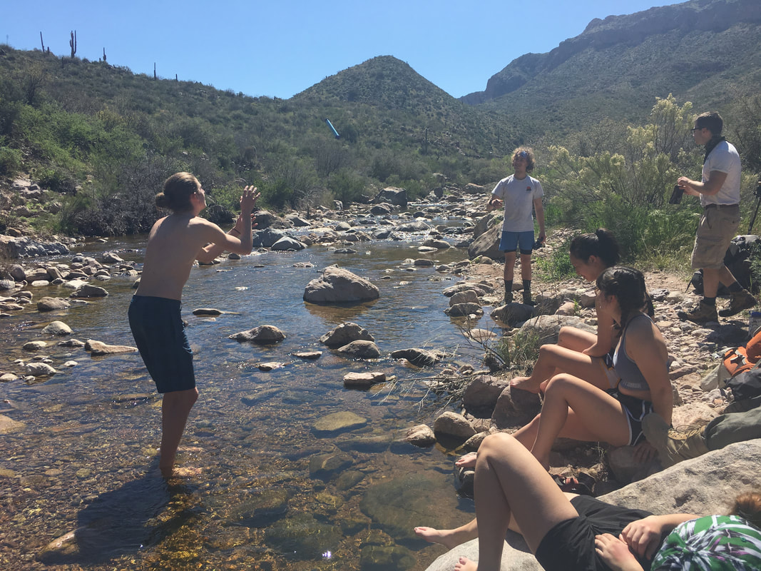 | 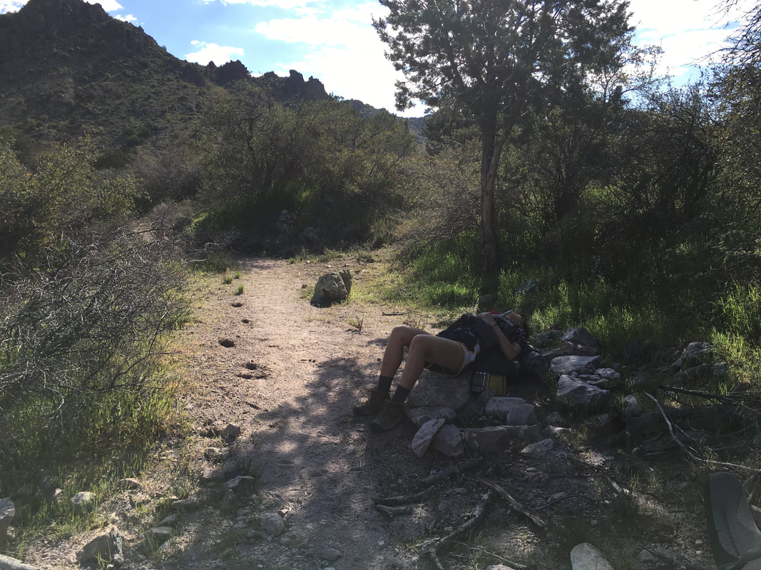 | 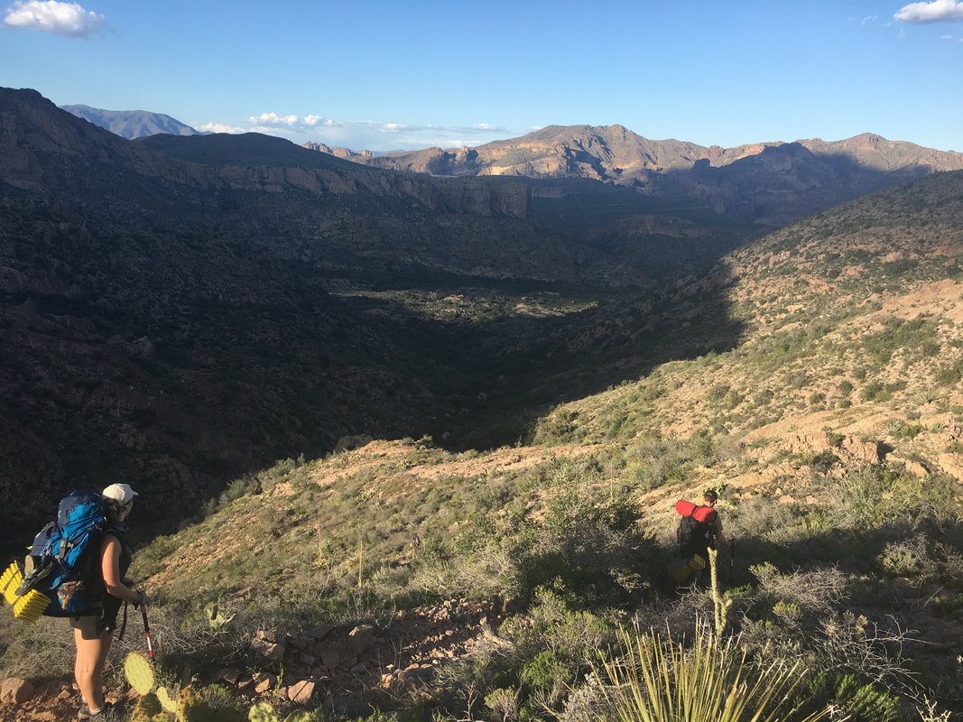 |
In the morning we awoke to yet another beautiful clear blue day with a few wispy clouds in the sky. We were lucky this morning because most of our hike was downhill for the first bit. We were down in Peter’s Canyon and the brush along the trail was thick. The trail also crossed several different flowing rivers which complicated the hike as well, normally these would probably be dried out, but they were gushing. Every once in a while, we would cross a river and loose the trail, only to find it a few minutes later. It was a good morning, and moral was high after the day before we had had. After a few hours of hiking, we began our uphill slug over the last big hill of the trip. It was a long push, and everyone was tired but once we reached the top of the hill for lunch, everyone was happy. We sat, ate, drank, took pictures and looked down into the valley below towards where our camp that night would be.
A few hours later we were on our way down the Red Tanks Trail through LaBarge Canyon and it was one of the most beautiful sections of the hike…. The canyon walls were covered in flowers and cacti, you could listen to the river gushing below and the trail was rocky, technical and fun. We quickly descended to the junction with Whisky Spring Trail only to find the campsite we had been told about was taken and the couple there wasn’t too keen on sharing... Luckily, we bushwhacked and scouted around for a bit and found a decent place by the river to call home. We enjoyed the rest of the sun for the day, swam in the river, and sat by a campfire late into the night, enjoying each other’s company.
A few hours later we were on our way down the Red Tanks Trail through LaBarge Canyon and it was one of the most beautiful sections of the hike…. The canyon walls were covered in flowers and cacti, you could listen to the river gushing below and the trail was rocky, technical and fun. We quickly descended to the junction with Whisky Spring Trail only to find the campsite we had been told about was taken and the couple there wasn’t too keen on sharing... Luckily, we bushwhacked and scouted around for a bit and found a decent place by the river to call home. We enjoyed the rest of the sun for the day, swam in the river, and sat by a campfire late into the night, enjoying each other’s company.
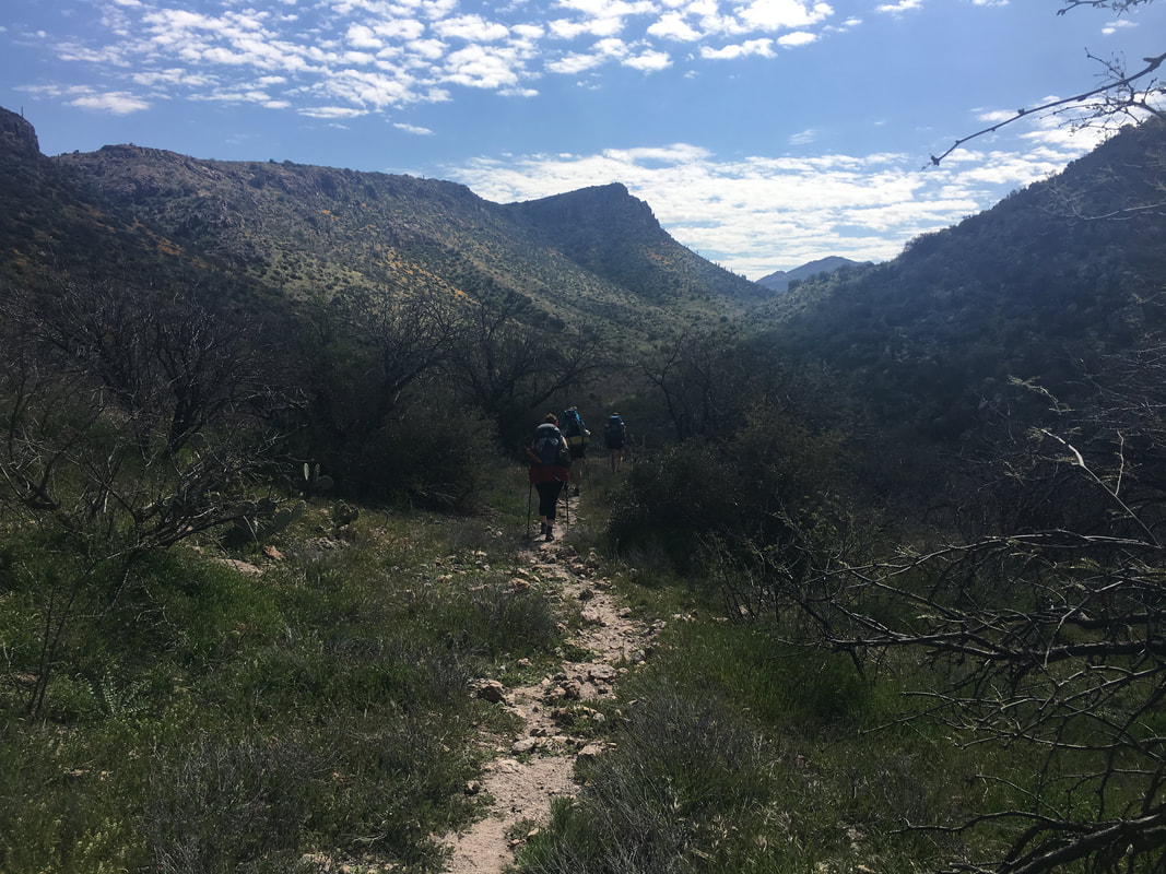 |  | 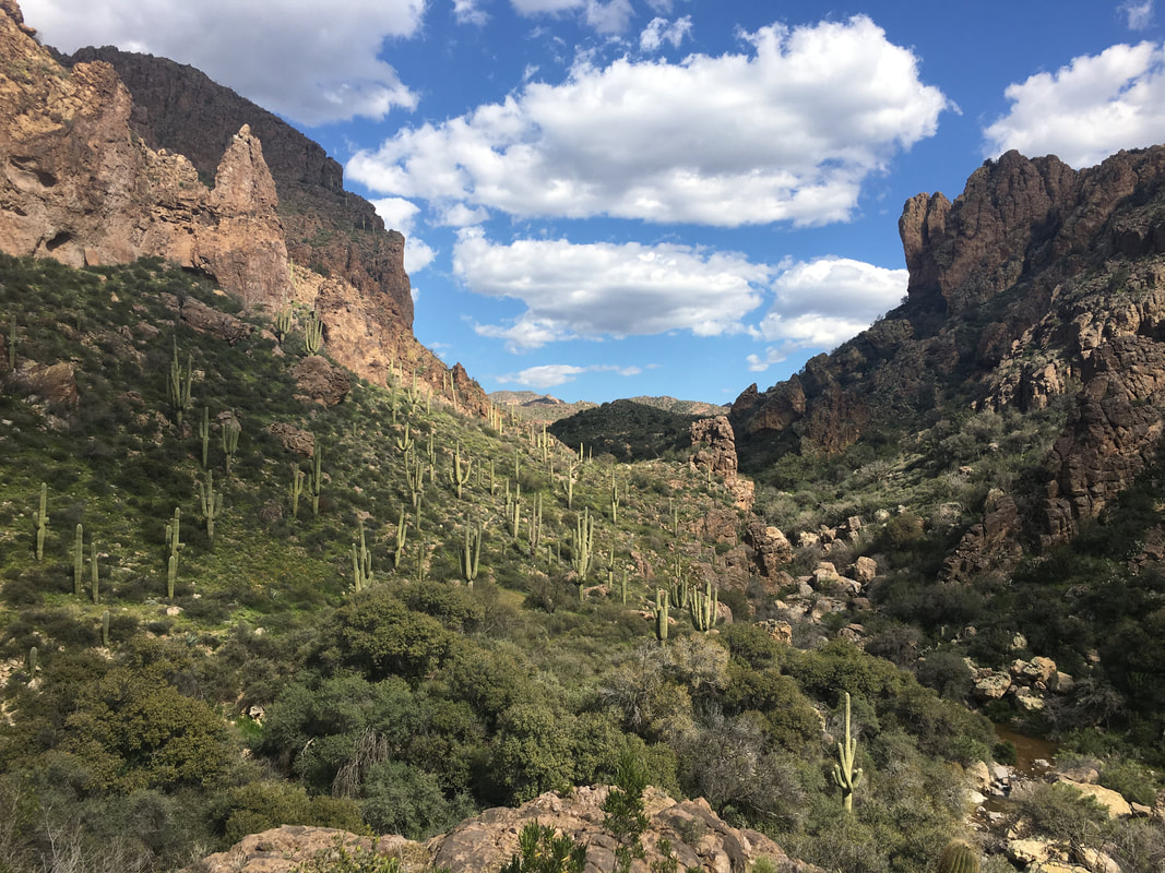 |
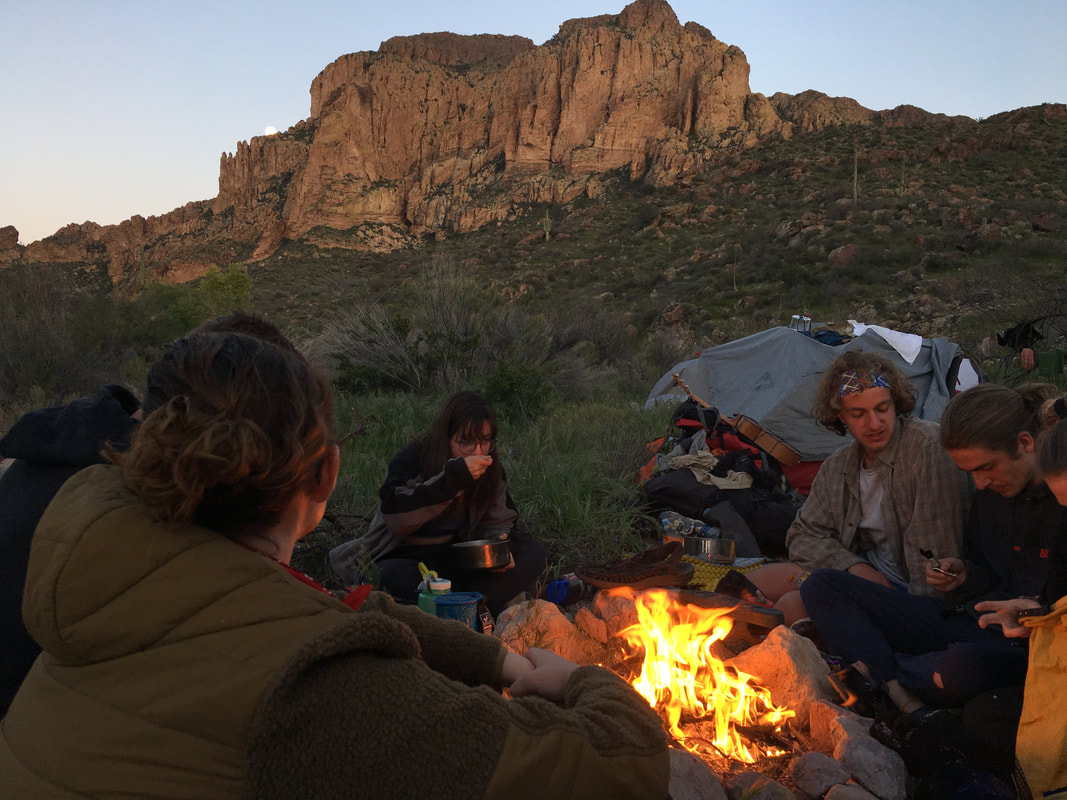 | 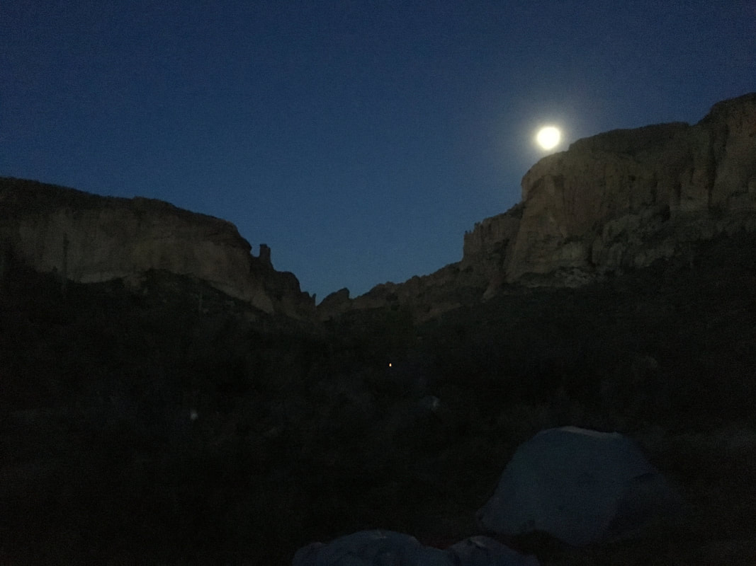 |
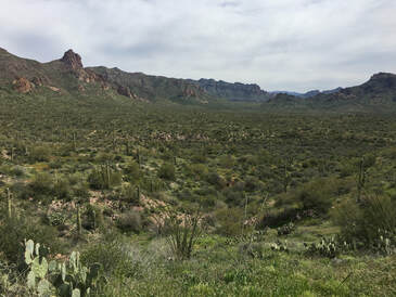
On the final day, we woke up early, cleaned up camp and hiked the final 6 miles back to the car. It was slightly uphill, but we quickly covered it knowing cushy seats, fresh clothes and town were close to us. We all covered the distance at our own pace, and I think each of us spent the time thinking about the journey we had just finished, at least I know I did. We covered 32 difficult miles with 7,000’+ of elevation gain. We spent long, hard days in the desert with each other and we all came out as friends. There wasn’t one point where any of us were against each other, there wasn’t one point in the trip where a member of the group wasn’t willing to help another and there wasn’t one evening of the trip where we weren’t all happy sitting around a campfire.
After we left Superstition we journeyed on to Colorado, opting to spend 24 hours in Great Sand Dunes National Park instead of climbing a 14er as we had originally planned and of course we had some fun getting there. In retrospect I’m happy with the decision we made in the moment and I think everyone on the trip enjoyed that last night just as much as they would have enjoyed climbing the 14er. That last morning we woke up, raced to Pizza Ranch, stuffed our faces and worked our way back across the country to Cincinnati.
After we left Superstition we journeyed on to Colorado, opting to spend 24 hours in Great Sand Dunes National Park instead of climbing a 14er as we had originally planned and of course we had some fun getting there. In retrospect I’m happy with the decision we made in the moment and I think everyone on the trip enjoyed that last night just as much as they would have enjoyed climbing the 14er. That last morning we woke up, raced to Pizza Ranch, stuffed our faces and worked our way back across the country to Cincinnati.
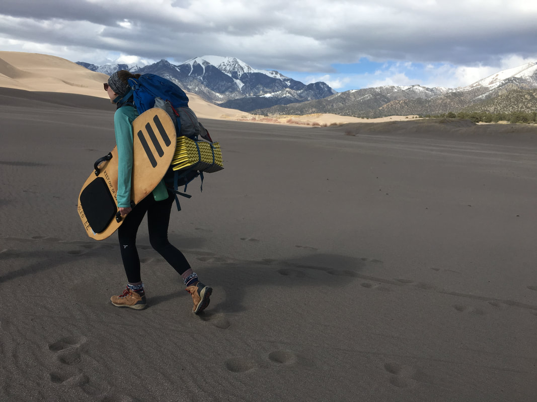 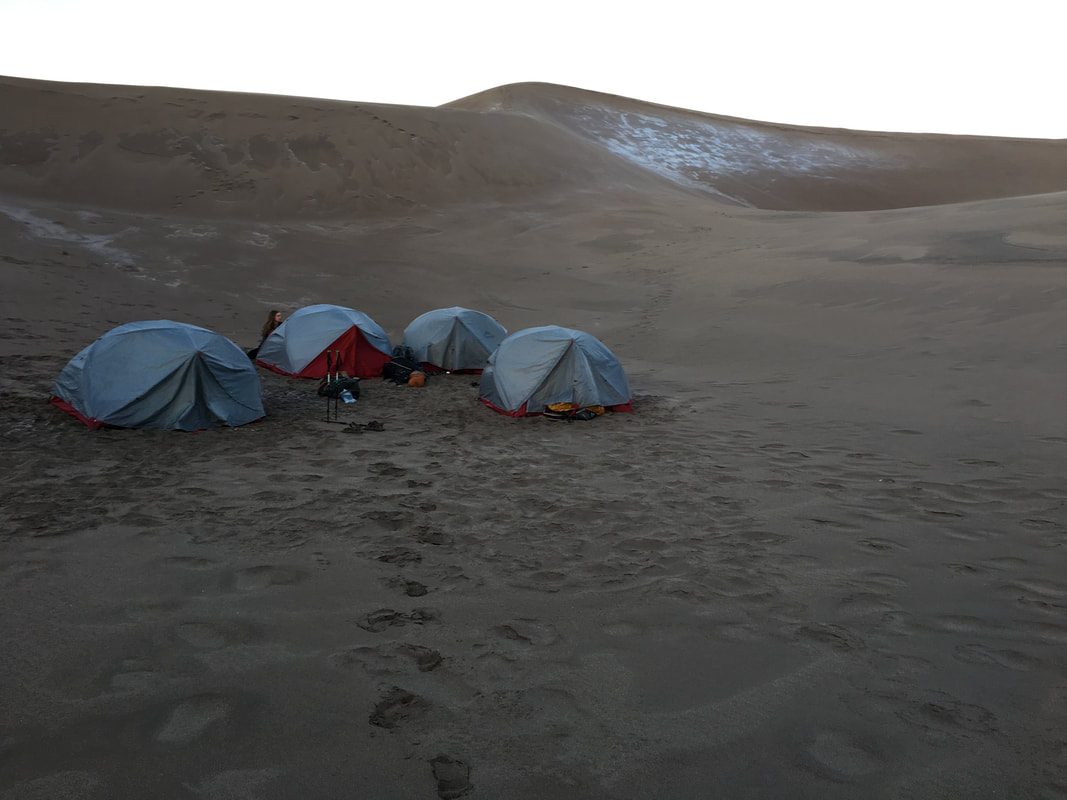 | 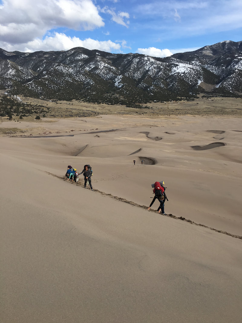 | 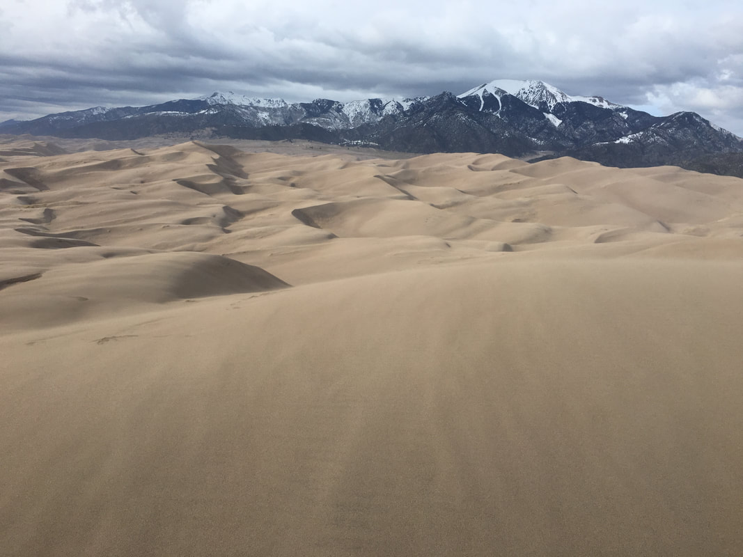 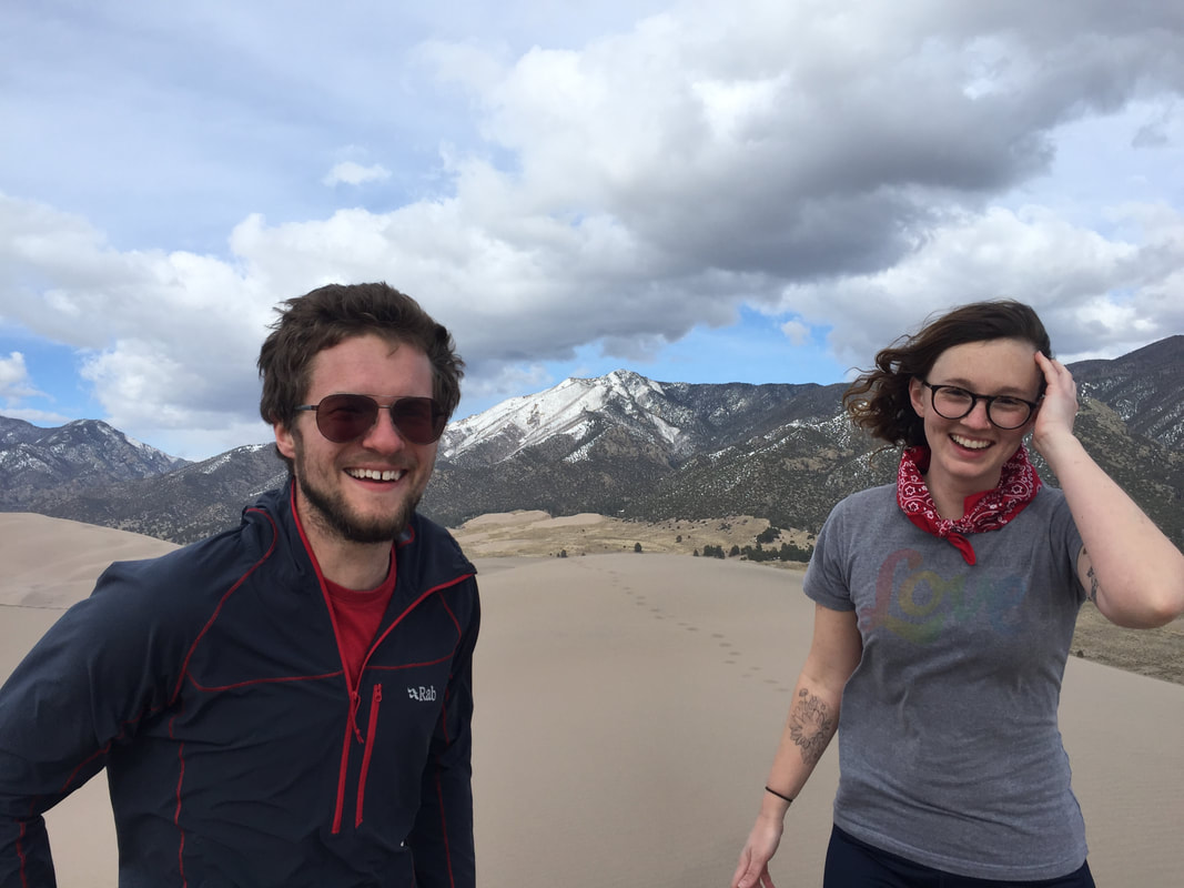 |
This trip was my last trip as a student and my last spring break. It was the culmination of everything I have learned over the past several years, from managing a group to planning trips to expecting the unexpected and even with all this, the group taught me even more lessons. It was awesome to be able to take people on their first trip west, and for a few of them, take them on their first backpacking trip. I hope I planted a seed in them that will lead them to where I am now, happy and full of excitement for the next journey.
 | "A forest is mystery but the desert is truth. Life pared to the bone" |
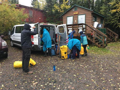 Unloading the Van to Get on the Water
 Guiding trips always has its challenges. Sometimes it’s organizing the group or finding the right route or making sure everything during the trip works out. I can honestly say leading trips through UCMC (University of Cincinnati Mountaineering Club), the biggest issue I usually run into is people signing up for trips they aren’t prepared for. Luckily, on this trip, that wasn’t the case.
We left Cincinnati late on a Tuesday evening with the intent to drive overnight 15 hours to Northern Minnesota and enter the Boundary Waters Wilderness at the furthest point along the Gunflint Trail via our outfitter, Voyagers Canoeing, we would spend 4 days on the water in the wilderness.
Right off the bat getting there I was worried about my plan. My last big UCMC trip had ended in a change of plans (but a wonderful trip), not getting to complete our route at Crater Lake due to poor weather. This trip I had the same worry, the weather in Cincinnati leaving was in the 80s and up in Minnesota it was in the low 40s with snow forecast overnight the first evening. That swing in temperatures was enough to make me shiver a bit those first few hours... I tried to stress how cold it would be, and feel having not acclimated to that weather yet and I think everyone got the point but not one of us would say that we wouldn’t have brought something extra if we could have after the journey.
Once we arrived and rearranged our bags, we got our boats and paddles then set to loading up and launching down the Gull River. Within minutes, someone had already fallen in the water trying to get in their canoe, my worst fear. The water and air temperature were a perfect recipe for hypothermia, luckily, we were still right by the outfitter and warm dry clothes.
Useful Vocabulary:
Portage - “The carrying of a boat or its cargo between two navigable waters.”
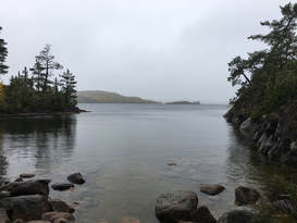 Mile's Island Cove Camp
 After picking up the pieces after that first mishap we began our journey. Since there was a batch of storms rolling through, the wind was blowing hard out of the northeast, so I elected to flip the route to avoid a strong head wind the entire first day. Doing that meant I had no idea what to expect of how the day would go.
We paddled for a short while before coming to Trails End Campground and our first portage. It was a messy and long portage that most people would usually avoid in warm weather by walking their boats up the small creek, but in our freezing temperatures that was a no go. So, we unloaded boats, spent some time bushwhacking a trail and put in at the next small lake. Not long after we had yet another portage, this one with a bit better of a trail... Again, we unloaded boats and carried gear to the next put in. After about an hour of all of that crap right out the gate we found ourselves on Seagull Lake entering the wilderness.
Seagull was the second largest lake we would find ourselves on, and it
was dotted with islands, this made navigating somewhat a trick. Since
you didn’t have signs you just had to pick islands and paddle to them
then check to make sure you had the right island by looking for where the
next one should be. It was definitely a learning curve the first bit and
I definitely got us off the easiest route a few times throughout the journey.
After about 6 miles of paddling and the two portages early on in the day
we found ourselves in camp at Mile’s Island. It was a nice spot with three tent spaces, a tree in the middle and a good area to setup a kitchen under some trees. Everyone worked well together setting everything up and getting settled in. After it settled down, I cozied up for a warm nap only to wake up to all 8 other people piled in one 3-person tent for warmth playing cards, luckily, they didn’t smell too bad yet. A few hours later we all curled into our warm sleeping bags and began our first cold night’s sleep.
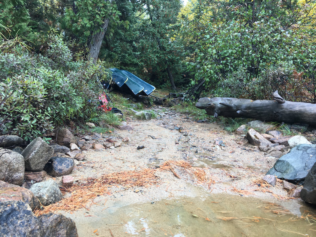 | 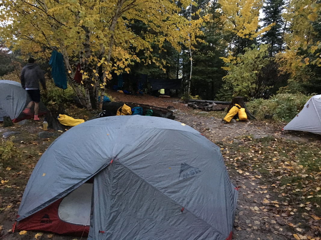 |
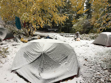 The First Morning
 It wasn’t a terrible first night, sleeping laying down is honestly always a treat after a night driving... What was interesting was waking up to snow in the beginning of October, I think that was a bit of a shocker to everyone. To me it was beautiful and a welcome sign of the end of a hot summer. Luckily there was only about 3” of snow so it was easy to dust everything off, get breakfast and get on the water.
Getting ready in the cold definitely led to later starts, we usually didn’t hit the water until between 10 & 11AM but that was alright because it meant less time sitting cold in camp. That morning was a tough paddle, we had a good bit of wind and some decent waves as we made our way west across Seagull lake towards our first big portage. Lake the day before, it was another day of island hopping but we had the added benefit of shelter from the wind. We slowly slogged across the water and made our way to the bay that lead to our portage. At this point the sun was starting to pop out and the day was looking up.
My first idea was to avoid the portage by paddling up a small creek, when that didn’t work out, we ended up hauling all our gear across about 1/3 of a mile of puddly, muddy and wet trail to Alpine Lake and as we did the carry the weather began to change... The snow came back, the sun went away, and the wind whipped up, it was trash. People got chilly and the thought of cutting the day short began to circulate since we were near a campground.
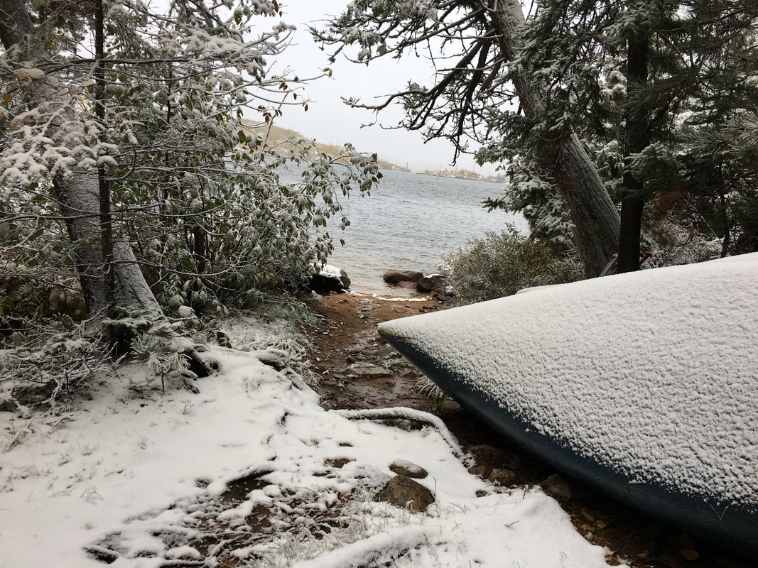  | 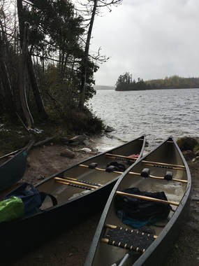 | 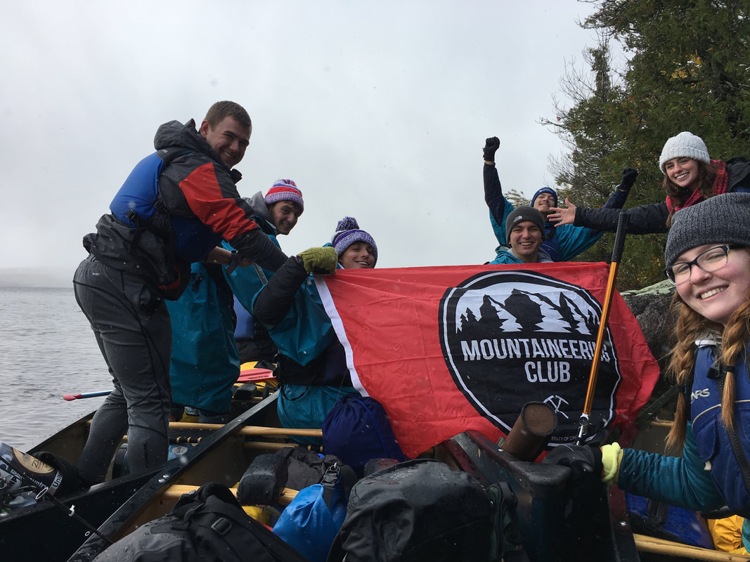 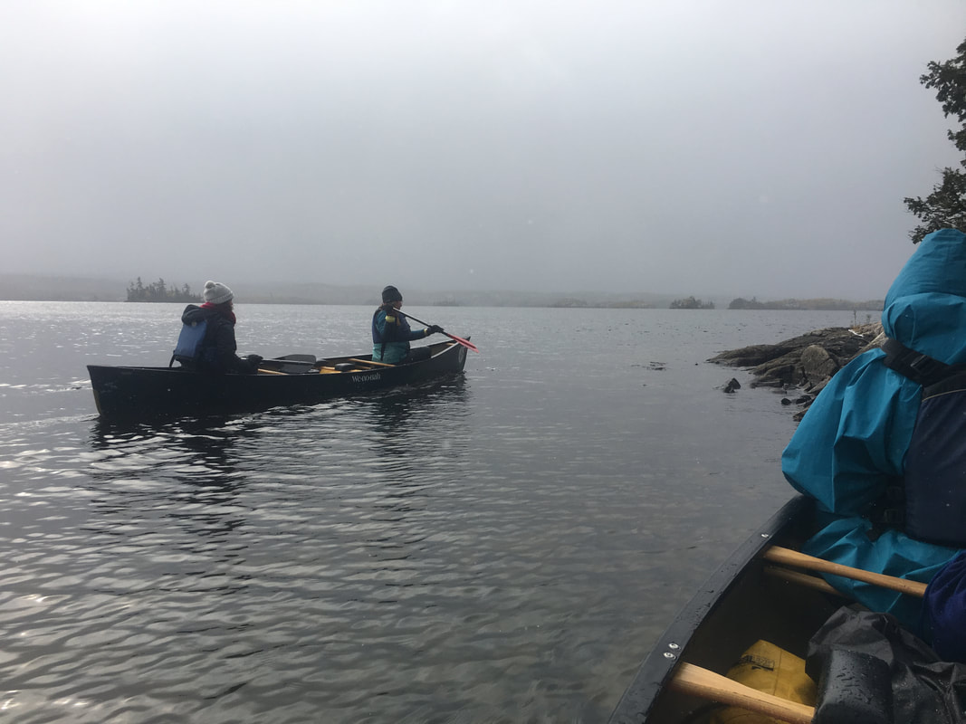 |
I had to quell that thought in both myself and the group, we needed to complete at least 2 more miles of paddling to be in a good place for our third and longest day. Luckily as we finished the carry the weather cleared up and we found ourselves back on the water. I even found myself with a boat change, now sitting middle in the three man instead of captain in a two man, this made navigating so much easier. Over the course of the next hour we enjoyed some beautiful fall weather as we worked our way across Alpine Lake to the final portage of the day. This one was short, less than 1/4 mile and it was relatively dry (compared to the first). We quickly hauled gear and boats across to Red Rock Lake and could see our home for the night perched up on a rocky cliff just above the water.
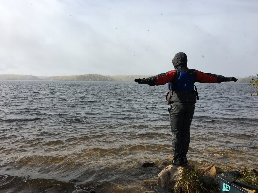 | 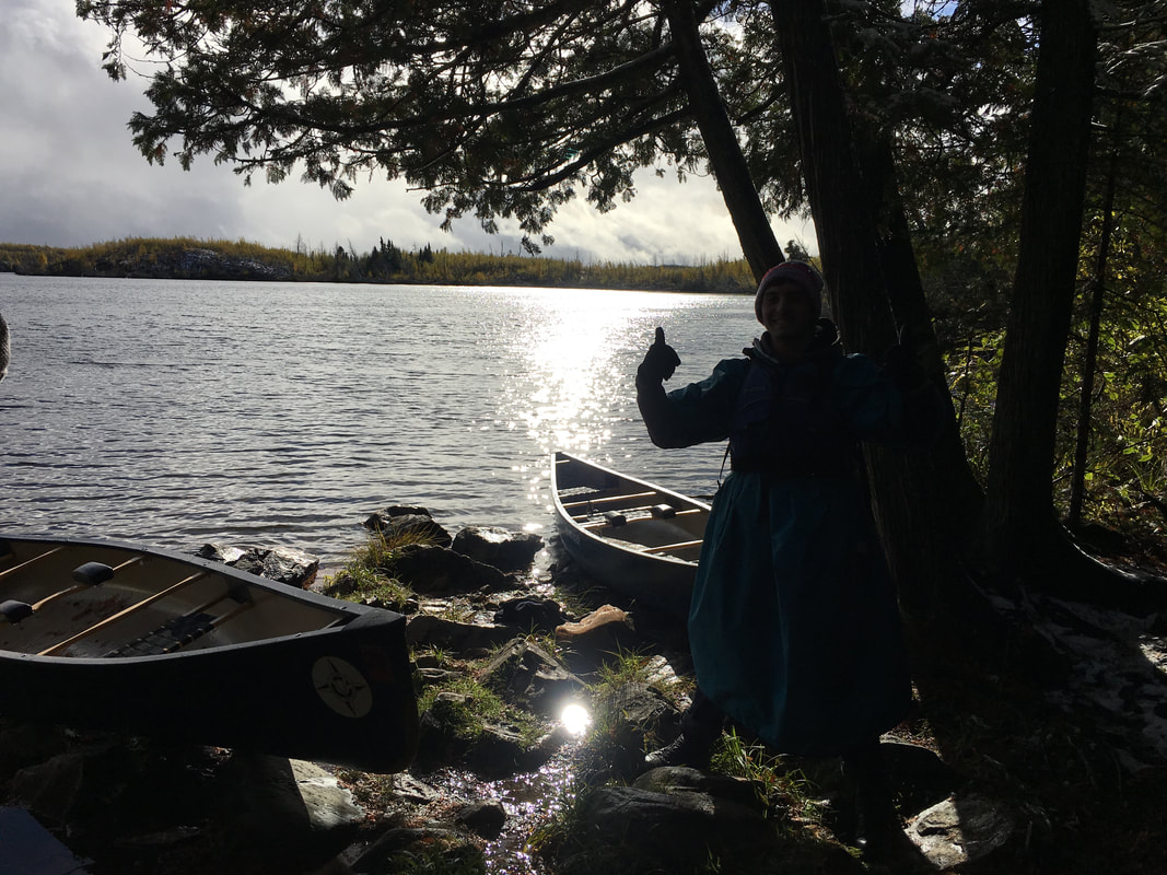 | 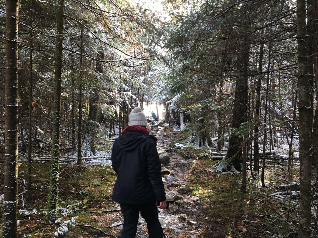 |
It was the first night with a fire, the first night with a clear sky and the first moment that I could just sit there and relax. We were all happy and warm, spirits were high, and we were ready for more adventure on the water. The next day we awoke to more cool crisp air with cloudy skies and calm water to paddle on. We headed north along Red Rock Lake to the small portage to Red Rock Bay and our final lake of the trip, Saganaga Lake. Saganaga Lake was also the biggest lake of the trip, which gave it its own unique challenges.
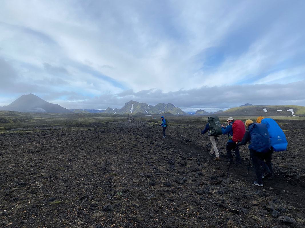 | 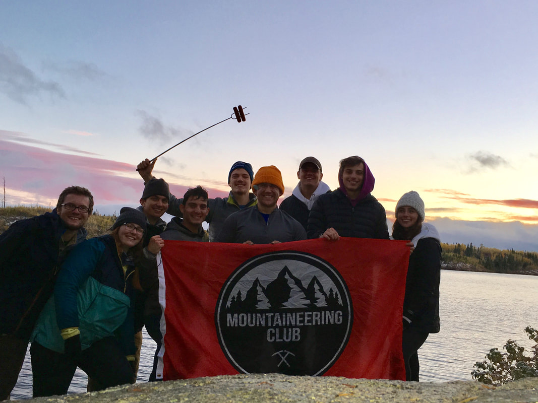 | 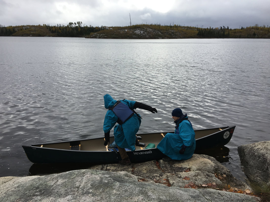 |
 The Last Morning
 Normally, if a boat blows over, no big deal, pick your stuff up, get to shore, reload and get back to paddling. With the cold weather and water and the windy day, tipping here would be a recipe for disaster, sunken boats, hypothermia and much more could quickly become major issues. We worked our way around the bay, paddling in on and off snow which added to the beauty. As we neared the mouth of the bay the wind whipped up and blew hard south down from Canada giving us a difficult cross wind to paddle in. It was a game of skipping across small inlets trying to get to sections of the lake that were slightly more protected by islands. As we passed the largest part of the lake you could peer across the water into the Canadian wilderness, it made you feel how wild this place truly was.
As we continued on and got closer to camp the wind whipped up the greatest of the entire trip and the site wasn’t setup the best for it…. We had harsh wind blowing across the lake right into the campsite, there wasn’t much cover and it was already a cold day. So, we setup the best we could, made a fire, hunkered down and enjoyed our last night in the wild the best we could. In the morning we awoke to one of the coldest of the trip but luckily it was a short paddle back to our car that day. We had a fun morning, enjoying every last bit of our final bit of the journey.
As we continued on and got closer to camp the wind whipped up the greatest of the entire trip and the site wasn’t setup the best for it…. We had harsh wind blowing across the lake right into the campsite, there wasn’t much cover and it was already a cold day. So, we setup the best we could, made a fire, hunkered down and enjoyed our last night in the wild the best we could. In the morning we awoke to one of the coldest of the trip but luckily it was a short paddle back to our car that day. We had a fun morning, enjoying every last bit of our final bit of the journey.
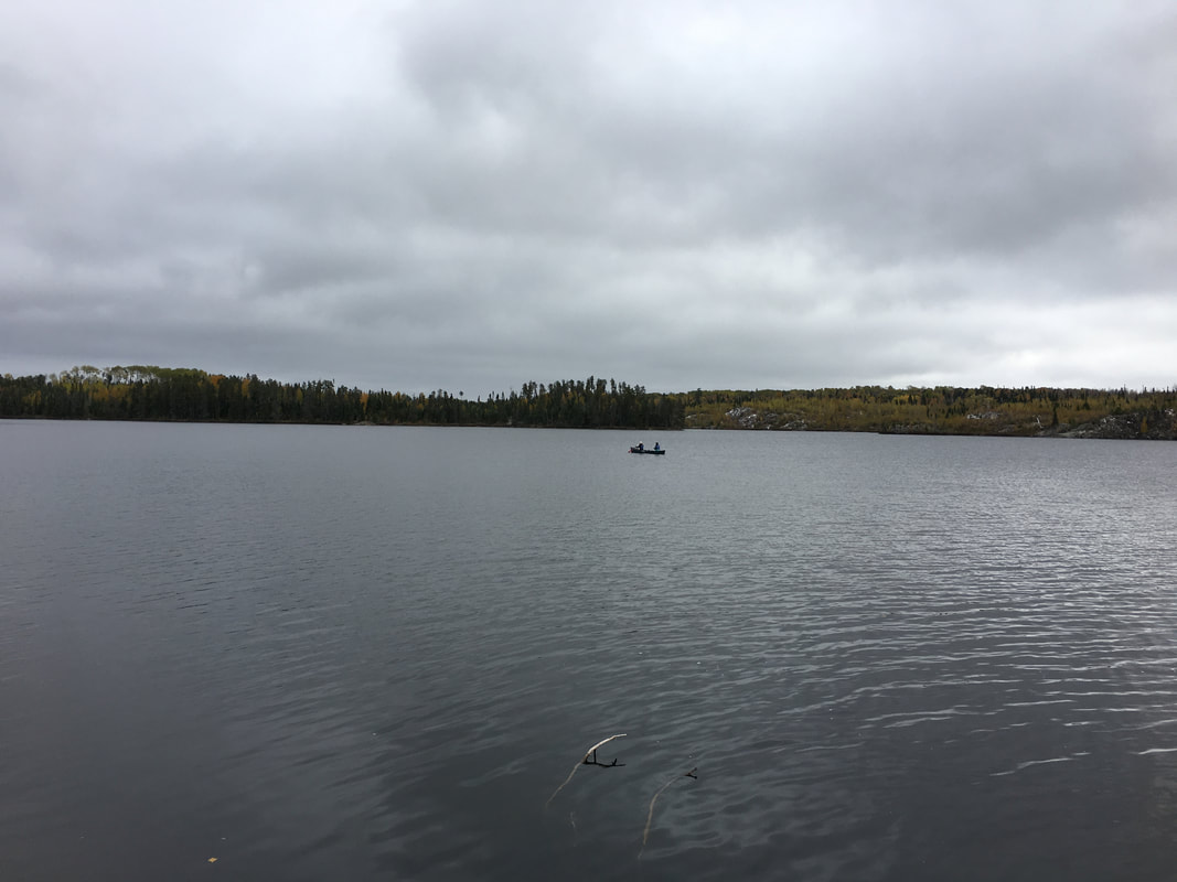 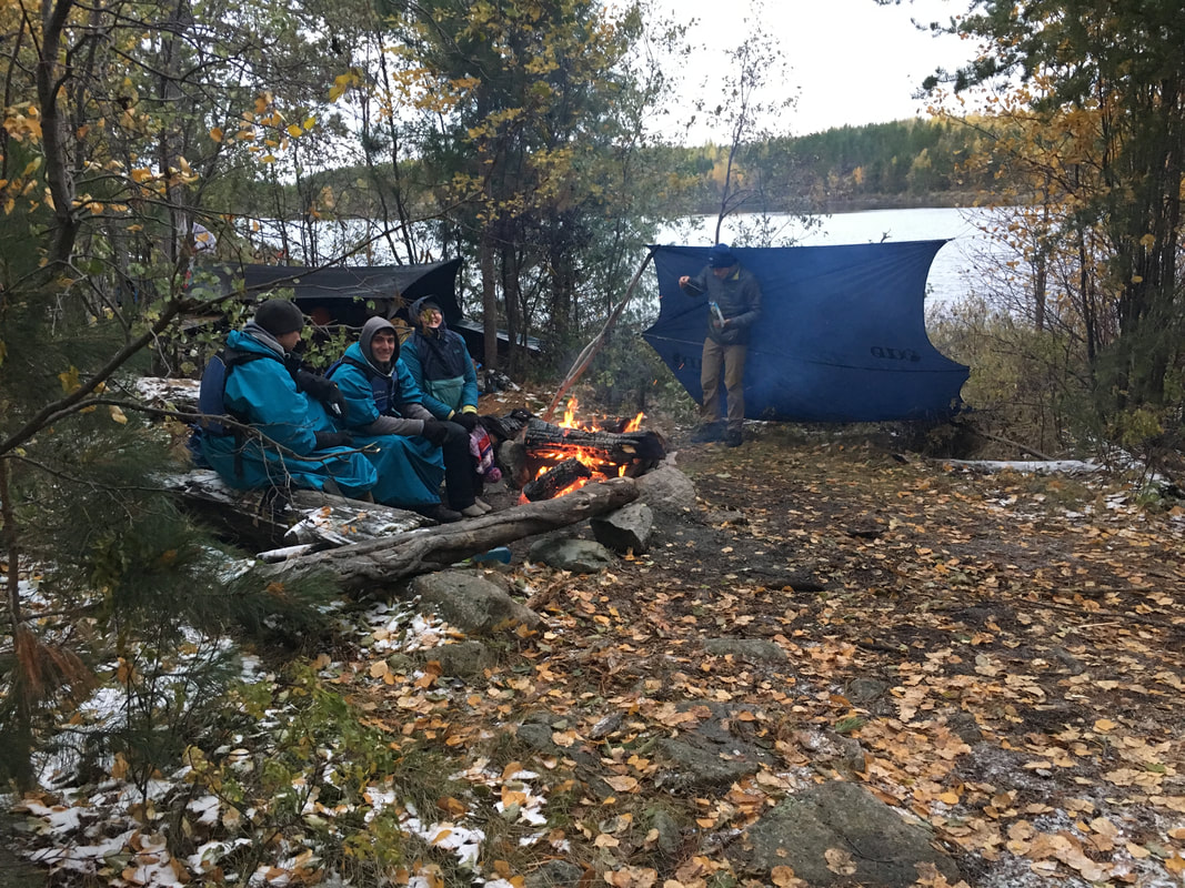 | 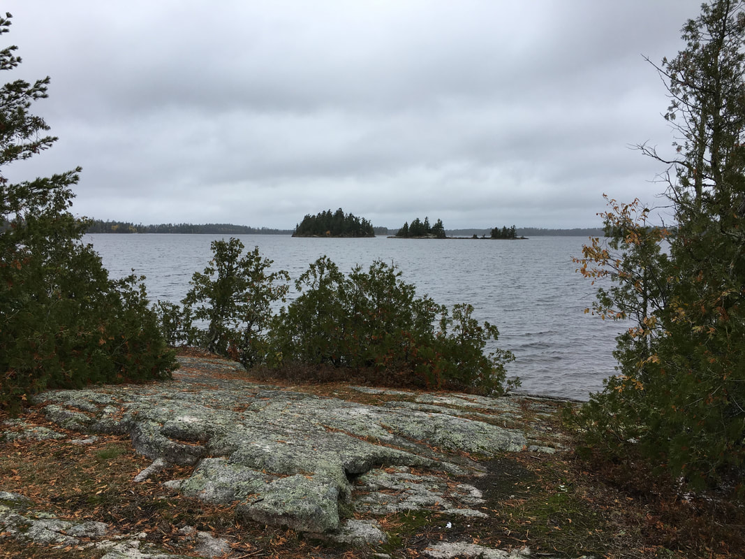 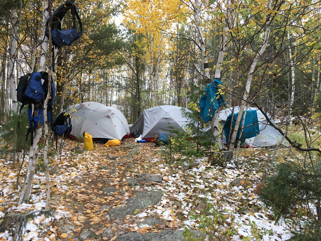 | 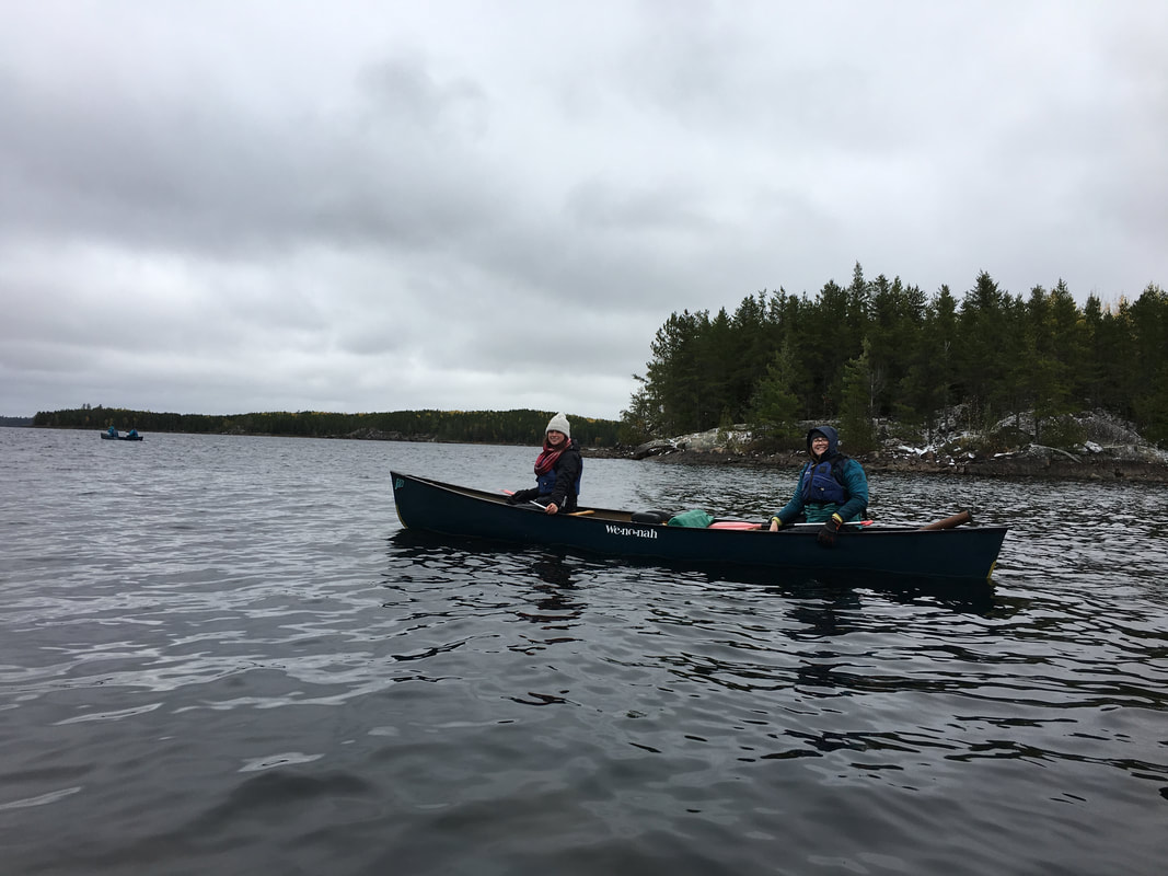  |
Once we arrived back at the dock and ended our journey a few of us made the unsmart decision to dive into the lake, it was freezing…. The air was about 30 degrees and the water might have been in the upper 40s, when I ran into the shower hot water felt like pins and needles, but it also felt amazing after 4 days of being cold and not showering. We loaded up the van and headed south for some delicious Pizza Ranch, one last fun night camping out in Wisconsin and then a bit more of a drive back to Cincinnati the next day.
It was a rewarding trip, it was a difficult trip, it was a fun trip and it was rejuvenating. I couldn’t have gotten any luckier with the group and the new friends I made. I couldn’t have had a more amazing time out there. Hopefully I get feeling back in my toes in the next few weeks, but regardless this is a trip I’ll be dreaming about for months to come.
It was a rewarding trip, it was a difficult trip, it was a fun trip and it was rejuvenating. I couldn’t have gotten any luckier with the group and the new friends I made. I couldn’t have had a more amazing time out there. Hopefully I get feeling back in my toes in the next few weeks, but regardless this is a trip I’ll be dreaming about for months to come.
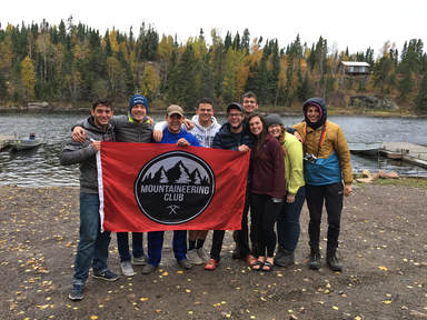 |  |
"Go confidently in the direction of your dreams. Live the life you have imagined"
-Henry David Thoreau
| Everything leading up to this trip and everything after it has been unbelievably busy, but for the week I was gone everything was perfect. My trips keep me sane, they get me balanced again and they reconnect me to where I need to be and this one was no different. 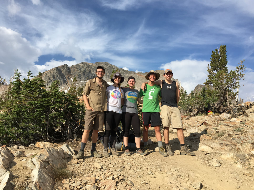 | 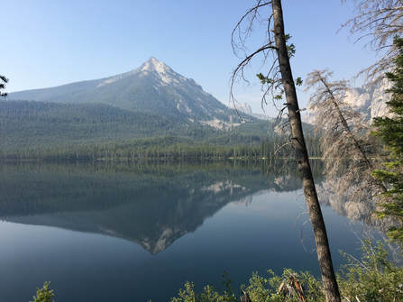 We left early on a Wednesday morning with a plan in hand:
|
It was definitely a different trip from the start, getting everything and everyone together had its usual kinks. We had to abandon the original plan because we couldn't secure permits to Glacier National Park (it ended up being on fire that week anyway...), I had to cut the group size because of difficulty finding another vehicle and the people I was used to traveling with couldn't come. All of these issues ended up melting away though and I ended up with a great group of people and having an amazing time along the way.
As usual, we drove through the night to the Sawtooth Wilderness in Idaho and as usual it was a fun and goofy, yet uncomfortable night. We arrived in a completely different landscape than the one we had left behind, with cooler temperatures, fresh alpine air and towering mountains all around us. I knew the first day would be difficult because of the elevation gain and our exhaustion, but I also knew the milage was low. We hiked up and up and up, through boulder fields, past alpine lakes, streams and waterfalls onward to the Twin Lakes. When we arrived we were all tired from a long drive and a good day of hiking, we made camp and curled up in hammocks along the crystal clear lakes for a quick nap. It was a beautiful afternoon and a glorious feeling to be back among the towering mountains of the west.
As usual, we drove through the night to the Sawtooth Wilderness in Idaho and as usual it was a fun and goofy, yet uncomfortable night. We arrived in a completely different landscape than the one we had left behind, with cooler temperatures, fresh alpine air and towering mountains all around us. I knew the first day would be difficult because of the elevation gain and our exhaustion, but I also knew the milage was low. We hiked up and up and up, through boulder fields, past alpine lakes, streams and waterfalls onward to the Twin Lakes. When we arrived we were all tired from a long drive and a good day of hiking, we made camp and curled up in hammocks along the crystal clear lakes for a quick nap. It was a beautiful afternoon and a glorious feeling to be back among the towering mountains of the west.
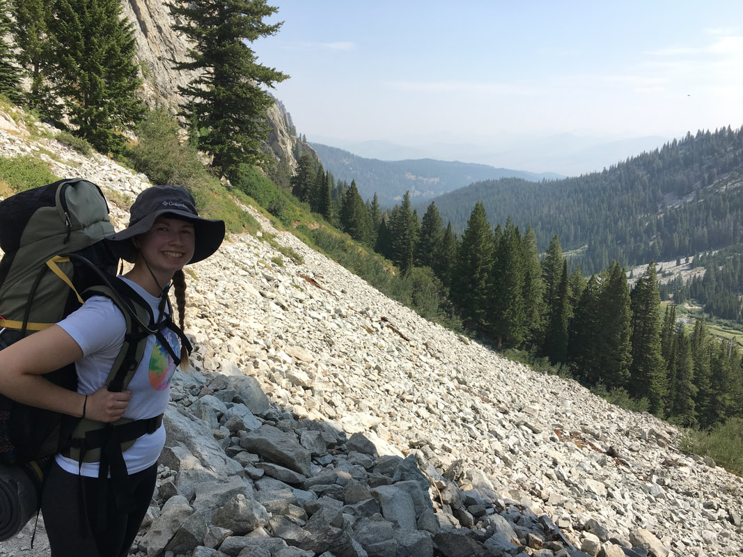 | 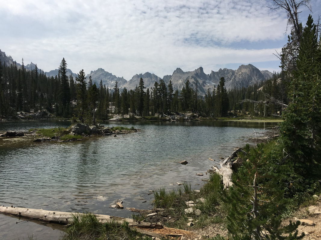 |
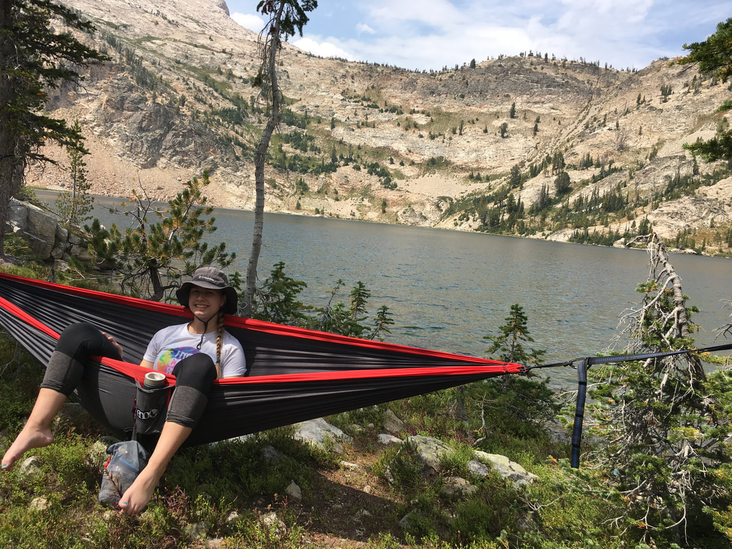 | 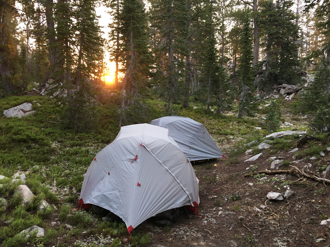 |
The next day, we knew we had a few big uphills and possibly some bad weather coming our way, but we pushed forward. We were all rejuvenated after a good night's sleep and the plan was to go over the first pass (in the photo above the red hammock on the left), down into Toxaway Basin and back up about 1,800' over Imogene Pass to camp near Imogene lake about 8 miles away, there was a little pushback on the idea. It was a difficult hike and some thought there might be a better way to do it (I honestly thought there was a better way to do it and I planned the damn trip...), but we all stuck together and pulled through. After a long hike we arrived at what is probably one of my favorite campsites ever. The day involved a lot of dust, a lot of gain, a few lightning strikes, running from the clouds, making some friends and a much needed waterfall swim.
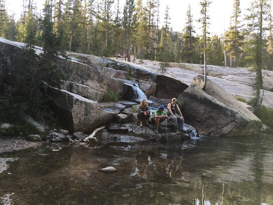 | Day number three we planned on hitting a backcountry summit, Payette Peak about 2,000' above us. The morning started pretty usual and then we found out one of our friends still wasn't feeling well from the day before. Its always a hard position to be in when someone from your team isn't doing well, you want to encourage them on and you also want them to feel better so you just have to try and understand their position. She opted to stay behind for the day as we began our journey. For several hours we bushwhacked our way up to the north towards our summit, it was grueling work going up through the boulder fields. Quickly, we came to our turn back time of 12PM. |
We were still about an hour's climb from the summit of Payette Peak at 10,221', but it seemed like we were already higher than that. A quick consult with the map, and admittedly my phone (great signal at 10,000' in the Sawtooths), I found out we were just off of the summit of Hidden Peak at 10,336' (technically just part of the summit of Mt. Cramer to the east), so we decided to push upwards another 100' feet for it. After moving through some difficult class 2 climbing we arrived at the unofficial summit, had lunch, signed the summit register, took some photos and headed back down to camp. Honestly the hike down was almost worse than the hike up. We wanted to get off the ridge so badly we went straight down hill towards one of the unnamed alpine lakes, which was admittedly a great place for second lunch but, when we tried to bushwhacked the way we came we discovered a 100' cliff we needed to work around. After awhile, we found a better way down, arrived on a pretty obvious trail and got our way back to camp for a much needed swim and a good reunion with our abandoned friend.
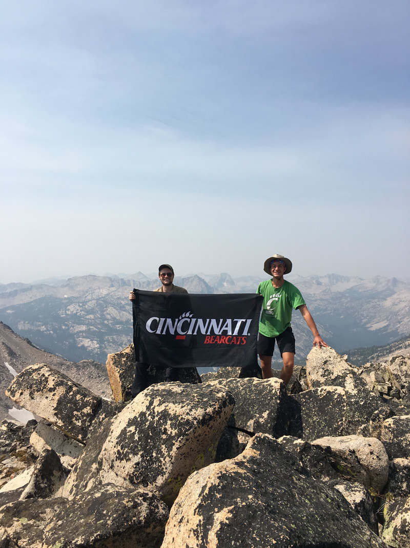 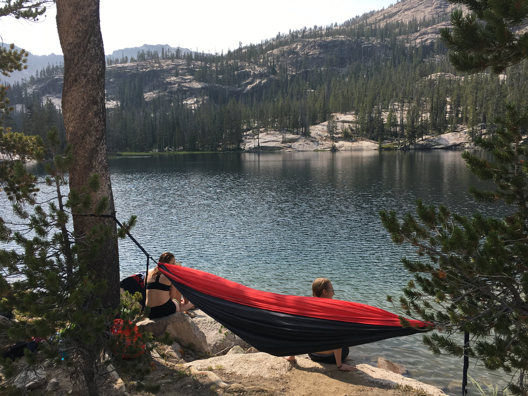 | 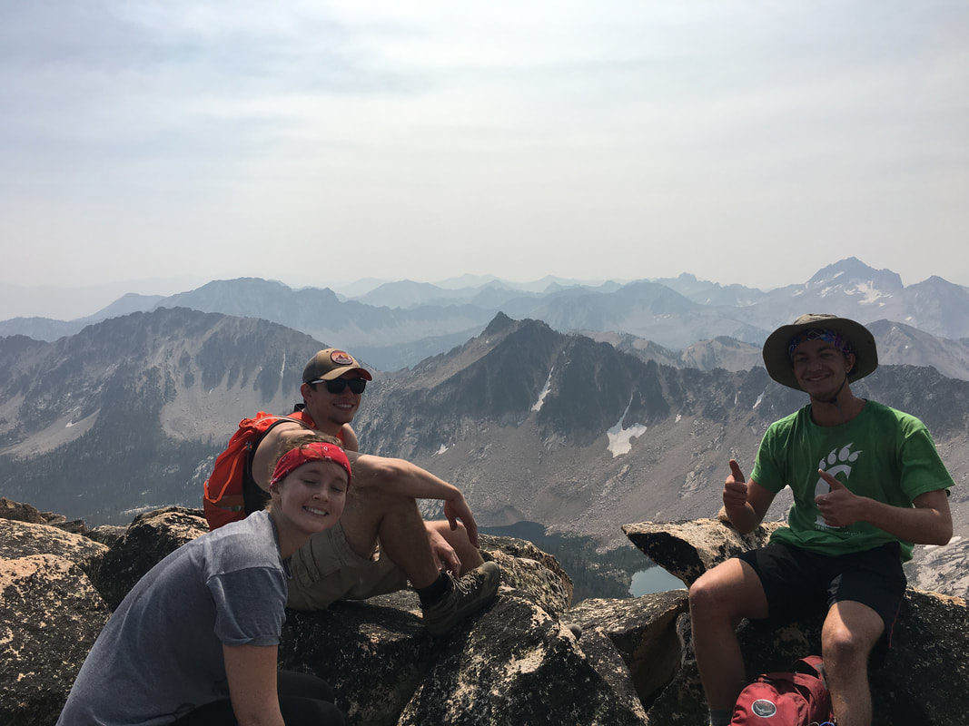 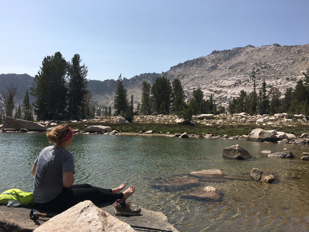 After catching up with our friend and getting a good swim in the freezing cold Imogene Lake we talked about what the next day had to offer us. With our friend feeling no better than she had in the morning we decided that it was best to just turn it into a 10 mile day out to the car. This would give us an extra day, and allow us to pretty much flip our trip to get a little bit more relaxation time. |
We woke up on day four and huffed it out to the car. I think I spent every 20 minutes of the hike thinking about how to flip the trip and pack everything in better to give us more time somewhere else. We powered through the day, with some difficult terrain hidden right at the end of the hike. After packing up the car we made a run for Craters of the Moon National Monument to camp for the night. We loaded up on food and meds and made it south just in time to grab one of the few remaining campsites. It was a stark contrast from where we had been earlier in the day, but it was nice to have running water (although sulfury) and a real toilet seat.
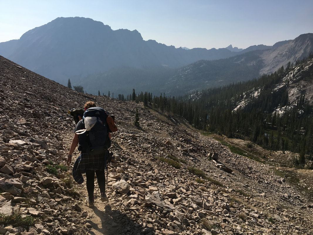 | 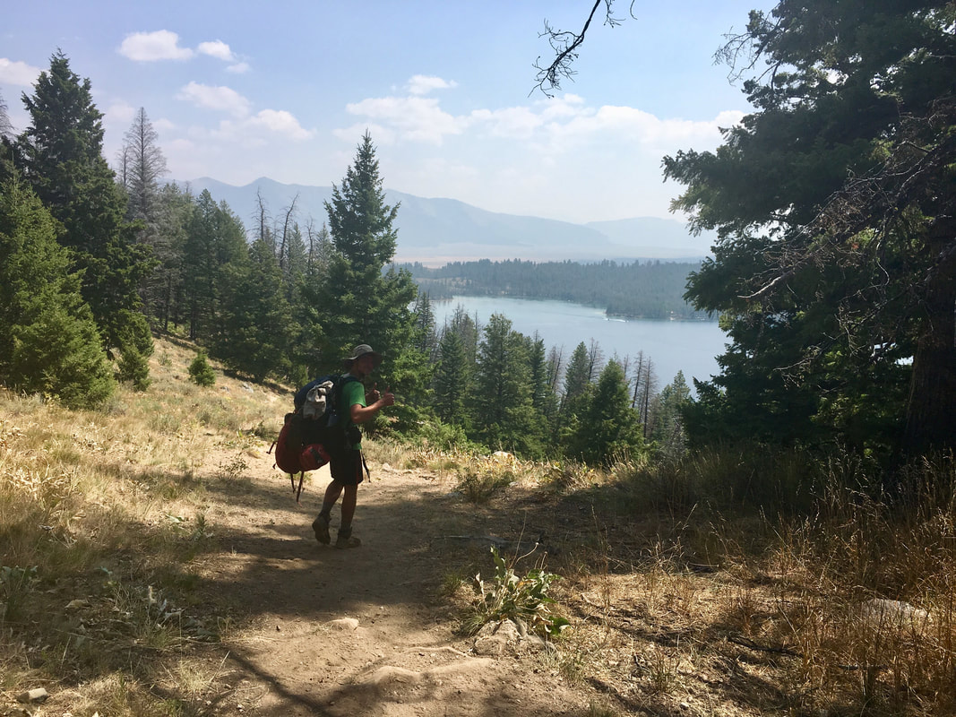 |
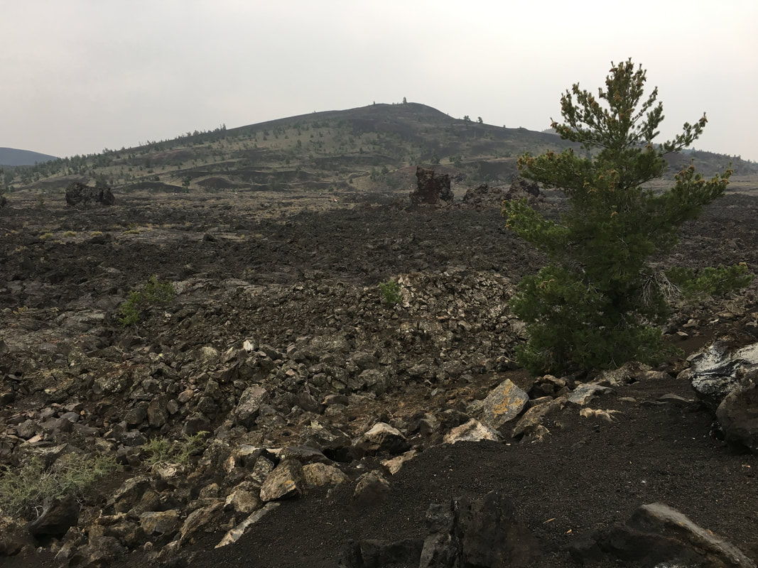 | 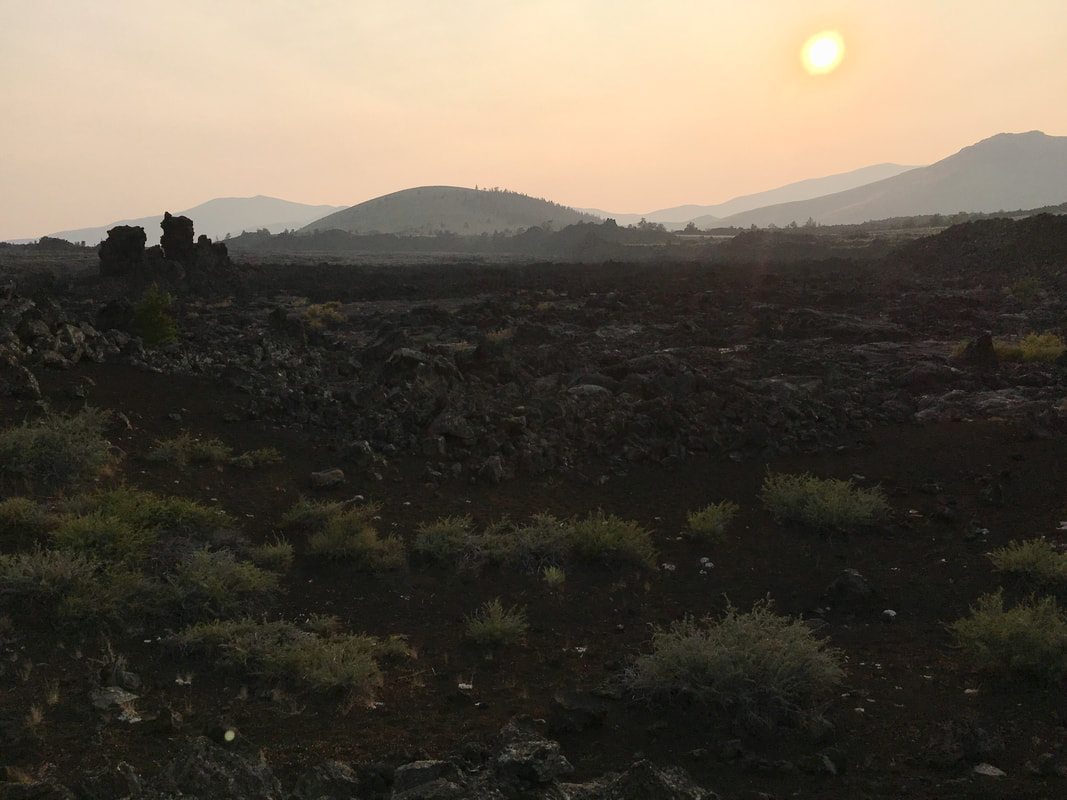 |
Crater's was a lava hell scape, somewhere that millions of years ago, the earth had oozed up through its skin to form this desolate and barren landscape. It was definitely weird to go from our alpine lakes to the rocky desert. We slept on the soft rocky pumice and woke up the next morning to crawl through lava tubes, climb ancient cinder cones and explore where long ago there had been volcanos dominating the area. We ended the day with a stop at Pickle's Place for dinner and a campsite 5,000' below the summit of Borah Peak. It was an uneasy evening for everyone, there were different levels of nervousness all around, some about the Class III section though Chicken-out-Ridge, some about their ability to complete the climb and others, a nervous uneasiness that they wouldn't make the top because their group would all turn back (me). I tossed and turned all night long, wanting to wake everyone up and get moving early to give us more time for the hike, but I held back and stuck to the plan.
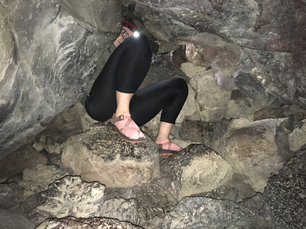 | 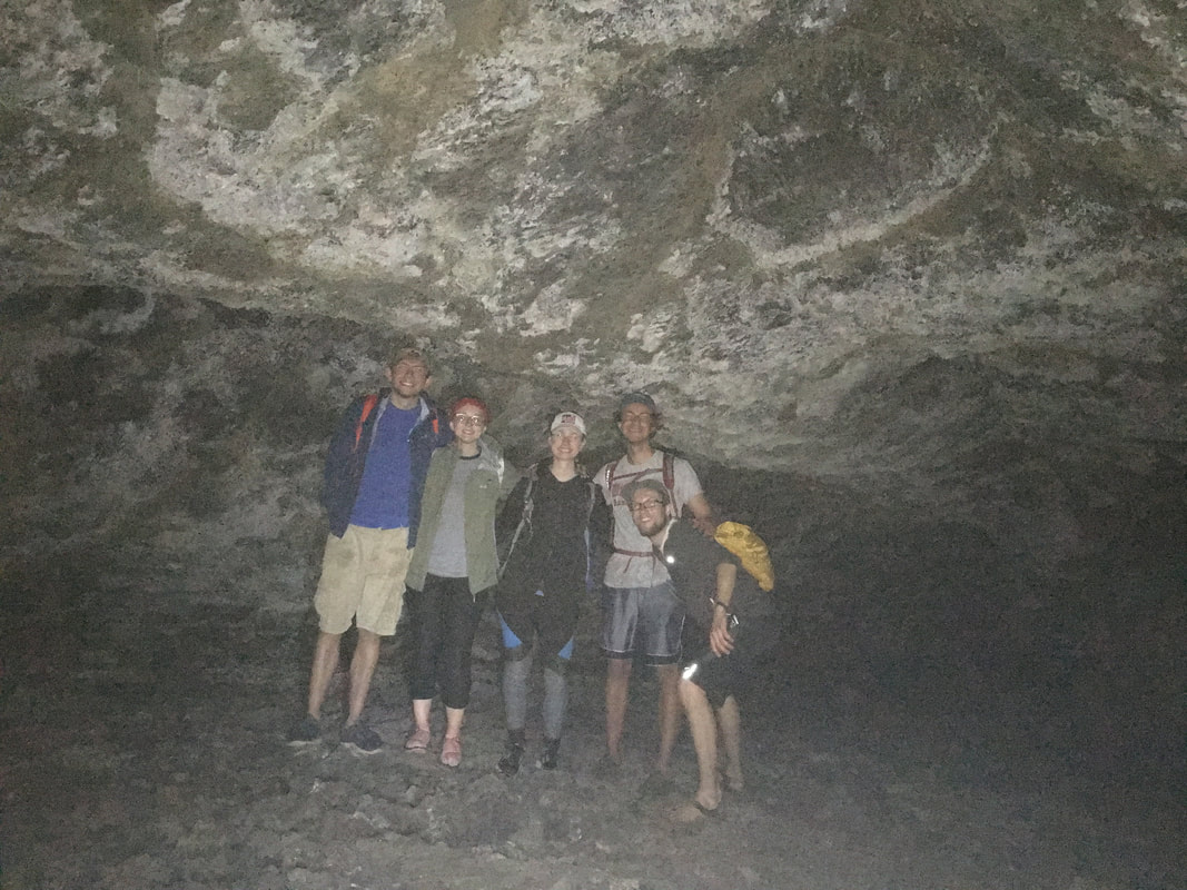 |
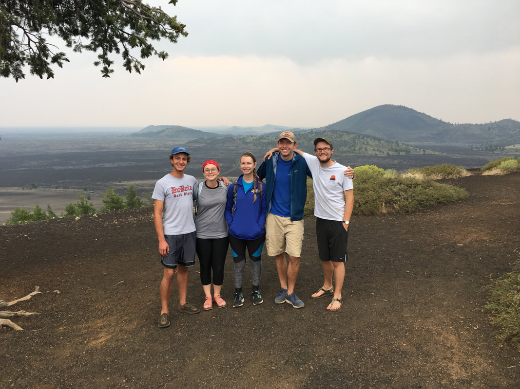
We woke up at 5AM for breakfast and hit the trail by 5:30. Right out the gate we lost one climber to foot problems, but we continued on. As we climbed under the light of our headlamps, the sky slowly grew brighter and I got more and more worried that I would lose the rest of my group. My partner and I were keeping a good pace up the steep slopes but the other two were already decently far behind, although still moving forward. As we found the ridge up to Chicken-Out, my partner and I made two friends out of another duo aiming for the summit. They were surprised by our pace and for the next hour or so we played leapfrog up and onto Chicken-Out-Ridge where we waited for our friends. Again, above 10,000' in the Sawtooths, great cell signal. I called the other two climbers in our party and they said they weren't far behind us so we patiently waited in the cold 20 degree morning air. It was bitterly cold and my partner and I did not have the proper clothing to sit where we sat but we wanted to give our friends a chance to catch up. As they slowly approached, one of them (who has a fear of heights) started to break down a bit. I was proud of him for having made it as far as he had but I knew that here would either be a growing point for him or it would be a turning point in the climb. Three of us continued up through Chicken-Out-Ridge.
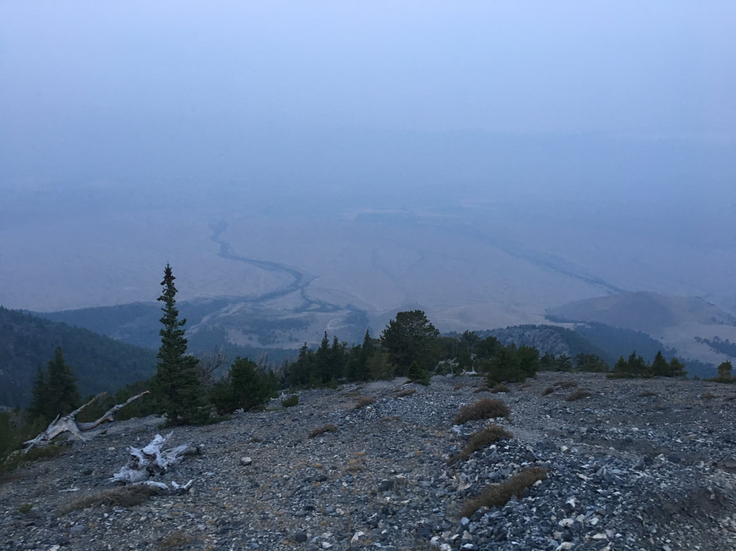 | 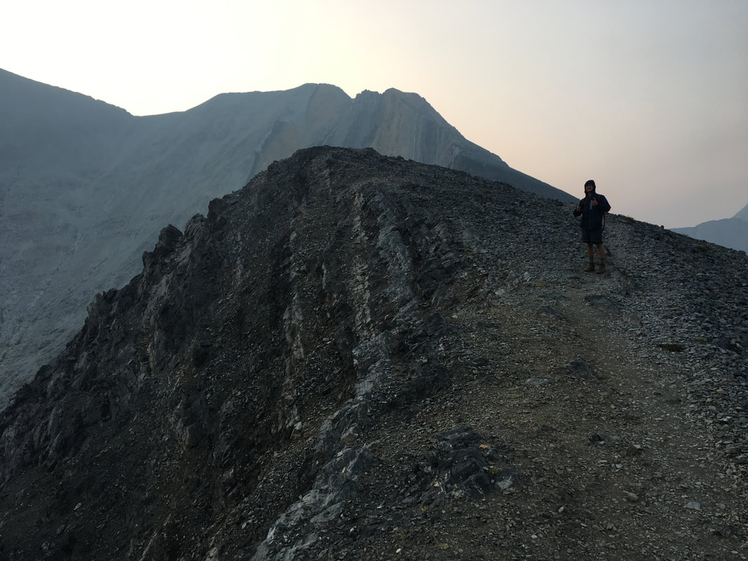 |
We already knew there was a group in front of us and we hoped we could spot them and follow their route but they were already far ahead of us. Luckily between the other two and myself we had a pretty decent group and found our way over the Class III ridge and its rocky towers onto the summit saddle with relative ease. I was proud of the other two I was with and happy that we had come together where our skills complimented each other.
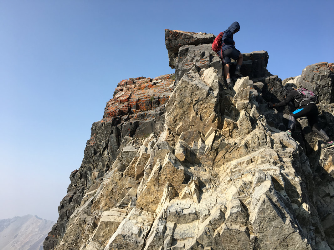 | 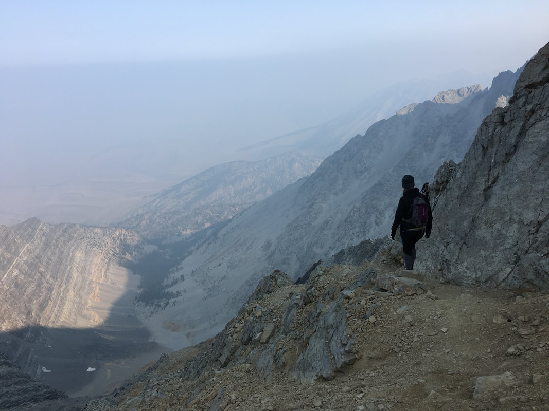 |
The last 900' of climbing was in no way easy, the scree filled slopes would fall away at your feet and there were paths everywhere that all looked like they went to the top. We knew our route, kept our line and slowly pushed upward with the cool morning air keeping us going along with a thirst for the summit.
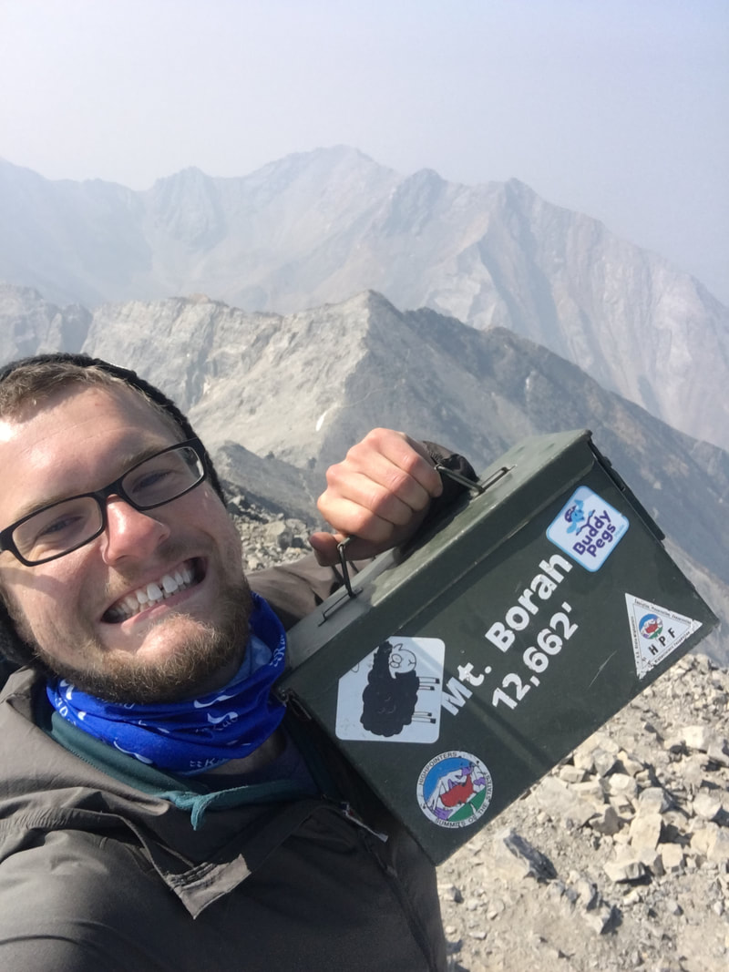 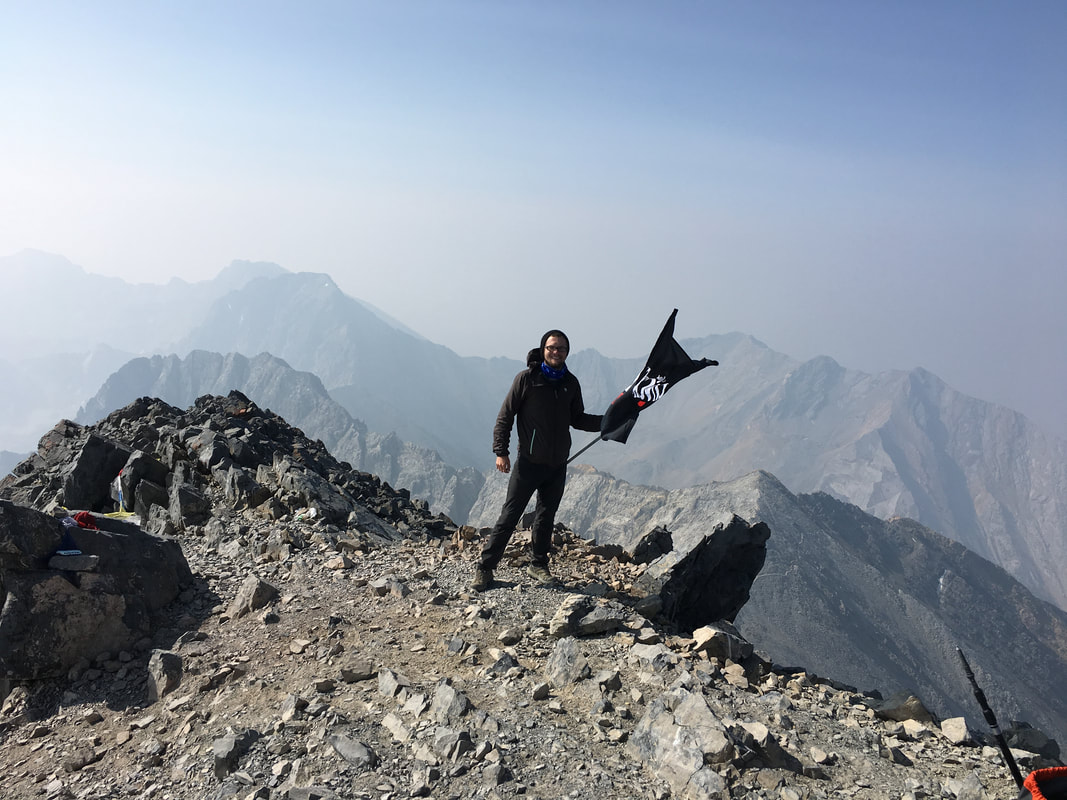 | 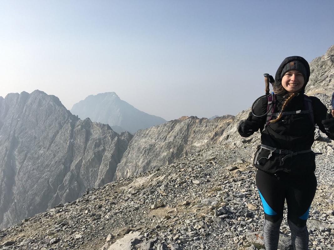 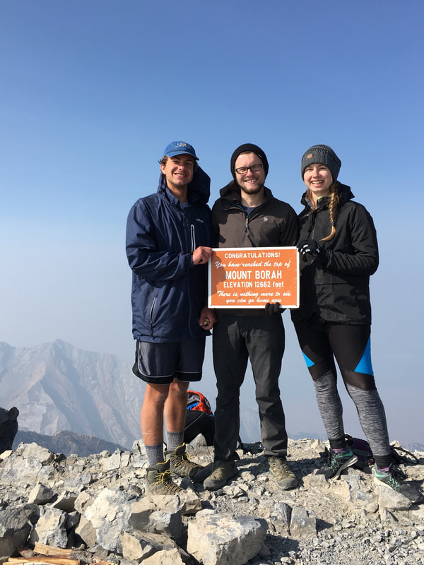 |
The 12,662' summit was amazing, it reminded me how much I had missed the mountains after a long break from any western journeys through the summer. As usual, we got a snack, rested up, took some photos and talked to others as they made their way onto the summit behind us. It was a relief to have made the summit, but I knew we still had a long way down and a long drive home. We definitely enjoyed that moment and it was a growing moment for all three of us who got there and I'm sure even for those who didn't as well. Reaching the roof of the world is always one of those tingly and body numbing feelings and you never want to leave but before I knew it we were heading down through the ridge. We continued down the steep slopes and were in the car heading for a cushy grass campground with hot showers, lakeside views and our only campfire of the trip before I knew it.
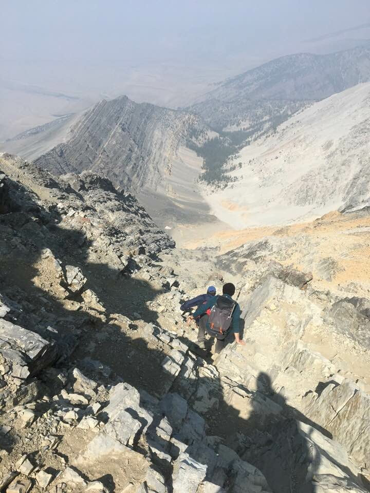 | 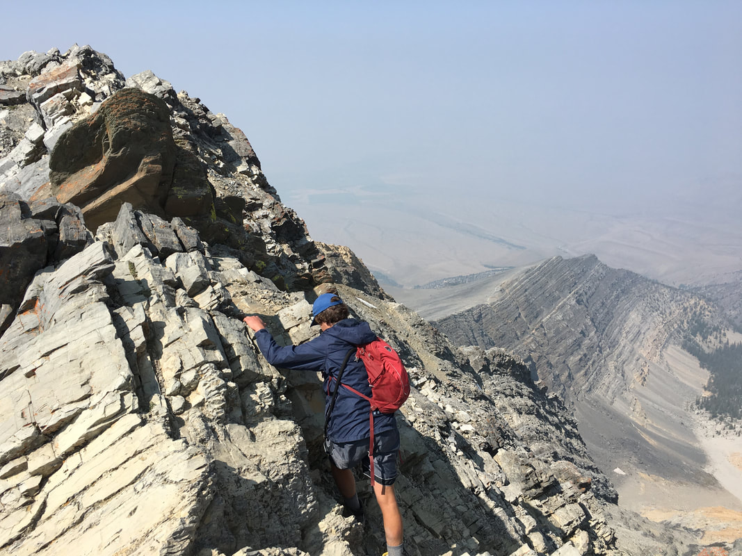 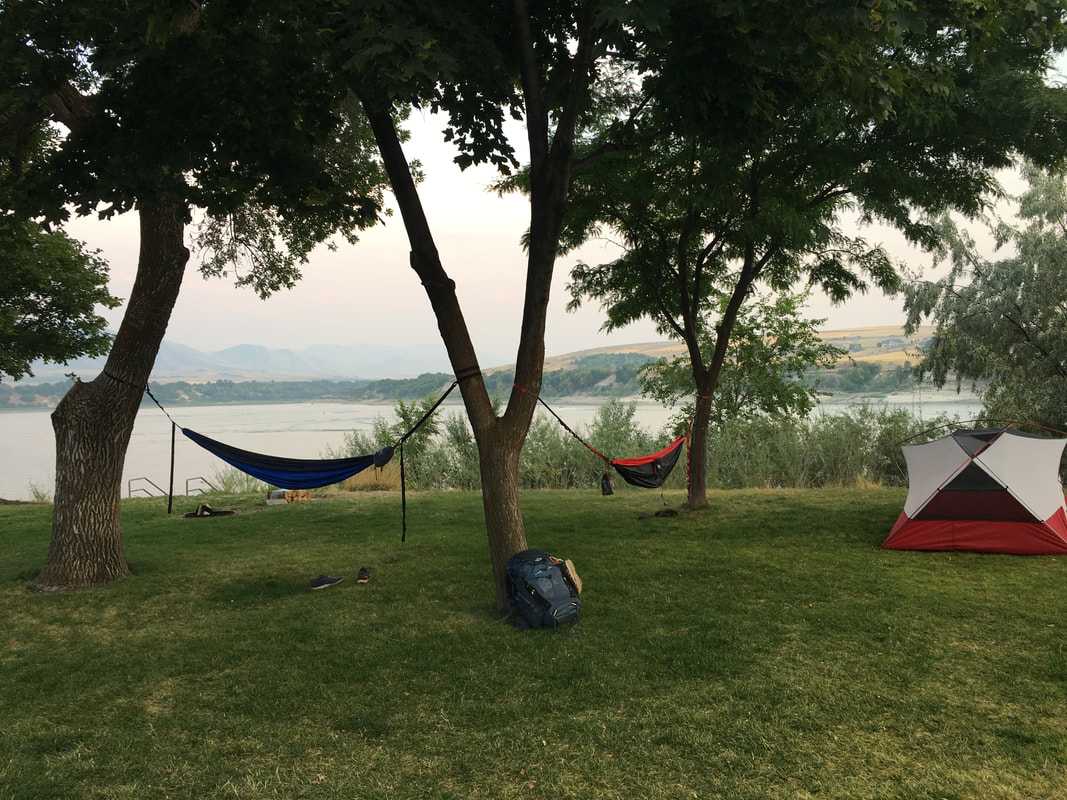 |
After a terrific night of sitting around a campfire, stuffing our bellies and knowing that our bodies were in for a long rest we continued home. On our way we stoped at my favorite post trip dive for a much needed dinner, Pizza Ranch (3451 Mountain Lion Dr, Loveland, CO 80537 or 1761 S Pueblo Blvd, Pueblo, CO 81005), only eat this if you've been gross and in the wilderness for a week or it won't taste the same. We gorged on pizza before finishing the overnight drive back to Ohio. It was an amazing trip, filled with awesome memories and it got me excited for my next journey. I thought about everything else I needed to do, all the mountains still left to climb and areas to explore. I forgot about life and I was in a different world while I was out there traveling. I came back rejuvenated.
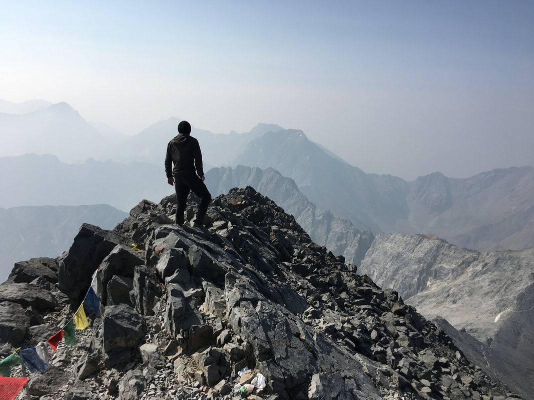 | "Coming together is a beginning; keeping together is progress; working together is a success." |
I have to say, so far this year; the month of June has probably been my busiest yet. Between work and travel I didn’t have an empty day on the calendar. I whitewater rafted in Pennsylvania, hiked in Red River Gorge Kentucky, backpacked along the western coast of Michigan, and flew “across the pond” for an amazing couple of days in London and Paris. It was an awesome and exhausting months’ worth of travels that reinvigorated me when I got home, settled some of my long lasting urges and at the same time, created all new ones.
The month began with a rafting trip to Pennsylvania with some old friends and a few new ones as well… I spent a day rafting Class V rapids on the Upper Youghiogheny River with some folks I had never met and then spent the next day running self-guided Class III+ rapids with my group of friends where we all found ourselves in the water at some point or another. It was a wild weekend and made me thirsty for some more time on a river somewhere, whitewater or not.
 After that I spent some time in Red River Gorge, backpacking and hiking around with the doggo, enjoying a place that I’ve come to know extremely well. There’s never a dull moment in The Gorge and I always want to go back and find my next adventure there. In the middle of the month I flew to London to visit one of my best friends. We saw the city, enjoyed a slightly different culture than ours and had a great time along the way. I hiked the White Cliffs of Dover and enjoyed train rides around the English country side. We conquered Paris over the course of a day, climbing to the tallest points in the city, eating delicious food and having quite the journey along the way. I walked around in Iceland (even if only on the airport tarmac) and got inspired for future adventures.  | 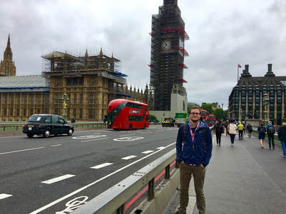 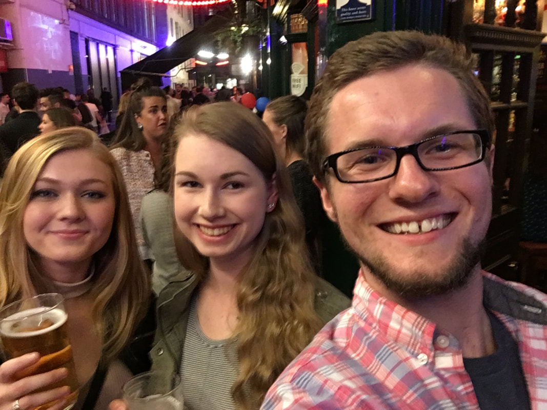 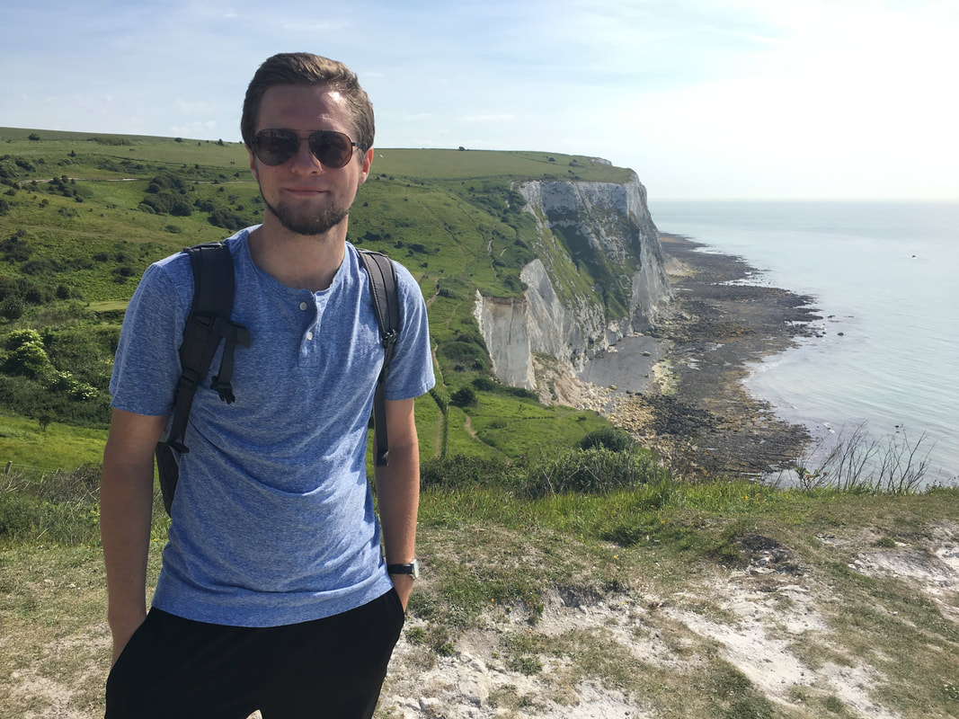 |
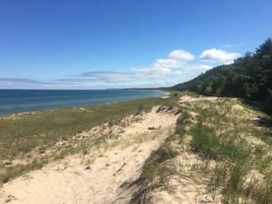
I rounded out the month with a trip that had been in the works for a while now, a visit back up to Nordhouse Dunes Wilderness, situated on the western shore of the Lower Michigan Peninsula. After discovering it back in October, its become one of my favorite places in the Mid-West. We laid in the sand, played in the water, had a great time around a campfire and I made some awesome new friends. It was both a relaxing and tiring weekend; different from the first time I had been there back in October but still rewarding none the less.
All my rampant traveling in June got me thinking about what I want my life to be like in the coming years. I’m sure no matter what it will be filled with traveling, but what will that traveling look like? Will it be these little micro-trips that I’ve been doing? Will I start traveling abroad more? Am I going to spend more time in cities than in the wild places I’ve come to love? Odds are slim on that one… Will I start traveling solo because the people that I used to find myself adventuring with will all get too busy with their own lives? I realized I had no idea what the answers to most of these questions were and that the style and types of my future travels is far from being clear.
I think I have a unique situation where I never feel stressed or overly tired from my life or my travels. Often the only way I make it through a day at work is by thinking back on the last journey I had and using it as inspiration to work towards the next. I also find that when others say they are too busy for a trip, I will always find a way to make it work because we make time for what we love and what makes us happy.
My future is undoubtedly filled with traveling. Will it be as much as I did this past month, I have no idea… Will it be frequent and to far flung, unknown places, I’m sure of it… Will it be full of the same people I’ve come to thoroughly enjoy traveling with, I have no idea… The reality is that people grow older, get busy and change what they are doing. One thing I do know is that I will continue to journey the world wherever and whenever I can, I will always try to drag those around me along for the ride and I will surely reach out to friends old and new as our paths cross in our lives and in our travels.
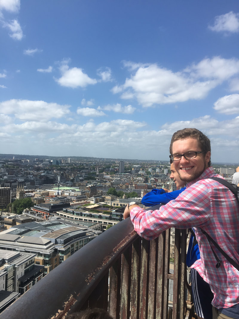 | "One's destination is never a place, but always a new way of seeing things." |
*In the Spring of 2019 WOWAir went out of business so the flight details of these trips are no longer accurate...
I've always had it in my mind that right now is the best time to plan any trip. Whether I'm planning for a backpacking trip to the American west or a flight across the Atlantic to visit friends in Europe I know that right now I'll have the best budget in mind since I'll want to get out of my chair and immediately go off on the trips I'm planning... One thing I definitely noticed when finding prices is, to travel cheap you need to be flexible on your dates, one of the biggest costs if you're not will be your air travel. For me I tried to keep air travel close to half of my overall costs (which can be extremely difficult). I also used Hostels.com to look at a wide variety of hostels in the destination cities to find the best place at the best price. Read about each destination below then click on the photo or location for a fully planned trip itinerary created your's truly.
Reykjavik, Iceland
Why Here?
Iceland has been a dream of mine for several years. Its capital city is full of diverse culture and overflowing with things to do. Then if you look inland, there's limitless trails, fjords and waterfalls to discover. Also, the country is easy to travel around via public transportation.
How Much?
$880 for 12 days not including food and other expenses
What to do?
Visit the iconic Blue Lagoon, Mt. Esja over looking the city and hike the Laugavegur trail from Landmannalaugar to Porsmork (I love the names).
London, United Kingdom
Why Here?
London is the capital of what was once one of the world's greatest empires. Its built up on top of itself so much that you get modern skyscrapers sitting next to buildings from the 15th century. London also serves as a great home base for large Europe trips with airfare relatively cheap and trains going almost anywhere you can think of.
How Much?
$985 for 5 days with a guess at food, drinks and other expenses
What to do?
What is there not to do? Get a pint, visit Paraliment, Big Ben and the Eye of London. Say hello to the Queen. Catch a train outside of the city to nearby destinations.
Amsterdam, Netherlands
Why Here?
Amsterdam is the inspiration and setting for quite a few of my favorite comedy movies, its also a city covered in art, culture and history. With gothic canals, churches and the Red Light District there's plenty to keep you entertained and get you in trouble too...
How Much?
$1073 for 5 days that includes travel, lodging and a guess at expenses
What to do?
Walk the Red Light, visit iconic locations, take a trip to the top of the city, have a Heine where they're made and so much more.
Berlin, Germany
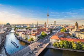
Why Here?
Berlin is a city that was wrecked by war, torn apart and put back together again. Its people, for almost three decades, were even parts of different countries that were divided both physically and ideologically but Berlin rose from all of its history into a rich and modern city.
How Much?
$825 for 5 days including travel, lodging and a guess as expenses
What to do?
Spend a morning at Berlin's oldest park, see the Reichstag, walk through the Holocaust Memorial and surly visit a beer garden.
Milan, Italy
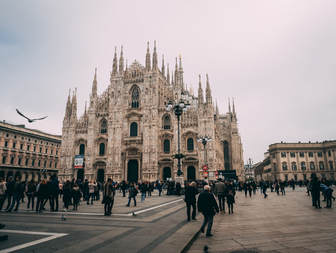
Why Here?
Milan is about as steeped in history as they get. From famous buildings and paintings by Leonardo and Michelangelo to sprawling urban markets and mind blowing food, you'll never want to leave.
How Much?
$1033 for 5 days in Milan and the added option for a day in Reykjavik, depending on who you fly with and at an added expense.
What to do?
Walk the streets and take in the history, eat till you drop or explore the many museums in the city.
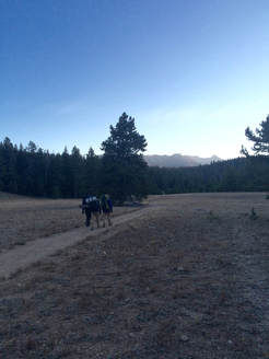
We all have a favorite place. To some its a cafe in their hometown, or a city they've traveled to. For others its the deserts of Utah or the mountains of Colorado or Tennessee. For me, its the Wind River Range in Wyoming.
I first planned to travel to the Winds in the spring of 2016 but a late winter storm dumped almost 2' of snow across the range and we ended up going to Zion and Great Sand Dunes National Parks instead (still amazing places). It wasn't the trip I had planned for but it was the trip that I got. Later that year we took another stab at the Winds. The plan was to drive over night to Wyoming and spend two days there and acclimate to the elevation before heading to Colorado to bag 14ers in the Rockies. We left on a Saturday and arrived at the Big Sandy trail-head on the south end of the range right at daybreak. It was an amazing site to be hiking among these giants as the sun rose over them. Our goal for this first trip was simple, enjoy our limited time, soak up the sites and get to the Cirque du Towers, a world renown destination for hikers and rock-climbers, home to famous climbs like Wolf's Head, and Pingora as well as Mitchell Peak and War Bonnet.
I first planned to travel to the Winds in the spring of 2016 but a late winter storm dumped almost 2' of snow across the range and we ended up going to Zion and Great Sand Dunes National Parks instead (still amazing places). It wasn't the trip I had planned for but it was the trip that I got. Later that year we took another stab at the Winds. The plan was to drive over night to Wyoming and spend two days there and acclimate to the elevation before heading to Colorado to bag 14ers in the Rockies. We left on a Saturday and arrived at the Big Sandy trail-head on the south end of the range right at daybreak. It was an amazing site to be hiking among these giants as the sun rose over them. Our goal for this first trip was simple, enjoy our limited time, soak up the sites and get to the Cirque du Towers, a world renown destination for hikers and rock-climbers, home to famous climbs like Wolf's Head, and Pingora as well as Mitchell Peak and War Bonnet.
| We soaked in the sun and flew down the first five miles of the trail to Big Sandy Lake where we took our first break for the day admiring the towering peaks around us. I don't think the feeling of amazement, being in one place one day and | 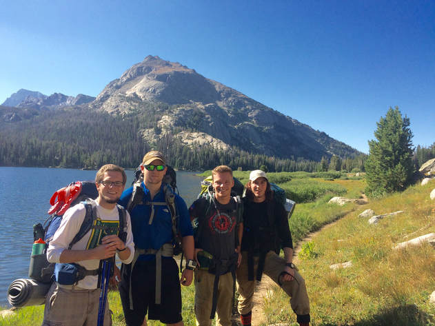 | then being in the middle of Wyoming in the mountains or anywhere the next will ever wear off. It really makes you appreciate the places you go and the opportunities you get. We knew what came after lunch would be a tough hike. |
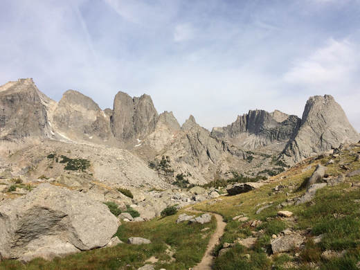 Heading into the cirque from "the climbers pass"
 The next section of the hike took us up through Jackass Pass up almost 2,000' over the course of three miles, a steep ascent. It was tiring and we groaned here and there, but boy was it worth it... Close to Jackass Pass we actually discovered that there was an easier route called "the climbers route" after chatting with an older couple on their way out and decided to give it a go. I'll tell you what, having done the hike both ways, its definitely the preferred route. Once you crossed over the divide you enter the actual cirque and the sight of these rugged mountains and untamed wilderness takes your breath away...
Unfortunately we only had a little over 24 hours in the range, so we explored as much as we could, climbed around, searched for spots for the next time and then packed up and headed back out the following day. That time left me wanting to go back and wanting more. It was an amazing and rewarding trip that I would go back and redo with another group a year later. I continued on to Colorado to summit several 14ers and end a wonderful trip.
Unfortunately we only had a little over 24 hours in the range, so we explored as much as we could, climbed around, searched for spots for the next time and then packed up and headed back out the following day. That time left me wanting to go back and wanting more. It was an amazing and rewarding trip that I would go back and redo with another group a year later. I continued on to Colorado to summit several 14ers and end a wonderful trip.
A Year Later...
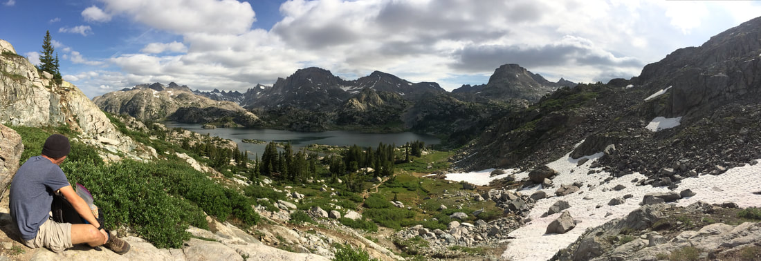
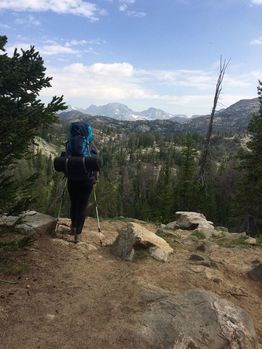 |  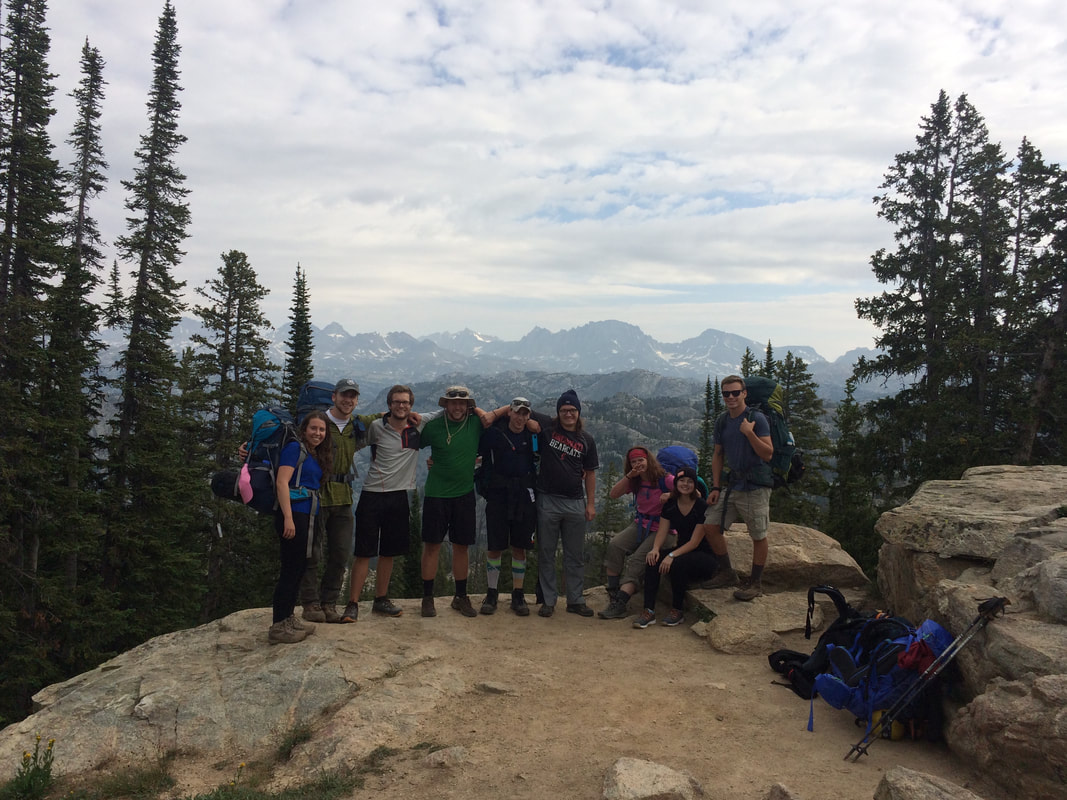 | 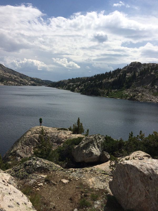 |
After my trip to Wyoming in the Fall of 2016 I lead friends on trips to the Guadalupe Mountains in Texas, several national park in Utah and all over eastern Kentucky. We created close friendships with each other and that made me want to take them somewhere that I really enjoyed and share my past experience with them, so I was going back to the Winds.
For this trip we were going to focus most of our time in the Wind River Range with some time at the end of the trip set aside for climbing Longs Peak in Colorado, a whole other blog in and of itself... Our goal was to explore the north end of the range this time near Elkhart trail-head getting into areas such as Titcomb Basin, Indian Basin and Indian Pass where the Knife Point Glacier resides as well as revisiting the Cirque du Towers in the south. We followed a similar plan, left early Saturday from Cincinnati, drove through the night and hit the trail at sunrise, and just like last time, it was an amazing morning. We hiked into the range constantly watching as the mountains above Titcomb Basin and Indian Pass grew closer and closer to us. As the day continued on some of the group began to suffer from exhaustion and a little bit of altitude sickness so we played it safe and made camp near Seneca Lake. Our goal the following day would be to get up to Indian Pass and the glacier.
For this trip we were going to focus most of our time in the Wind River Range with some time at the end of the trip set aside for climbing Longs Peak in Colorado, a whole other blog in and of itself... Our goal was to explore the north end of the range this time near Elkhart trail-head getting into areas such as Titcomb Basin, Indian Basin and Indian Pass where the Knife Point Glacier resides as well as revisiting the Cirque du Towers in the south. We followed a similar plan, left early Saturday from Cincinnati, drove through the night and hit the trail at sunrise, and just like last time, it was an amazing morning. We hiked into the range constantly watching as the mountains above Titcomb Basin and Indian Pass grew closer and closer to us. As the day continued on some of the group began to suffer from exhaustion and a little bit of altitude sickness so we played it safe and made camp near Seneca Lake. Our goal the following day would be to get up to Indian Pass and the glacier.
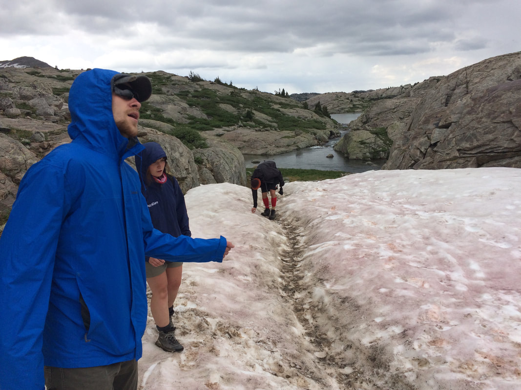 | 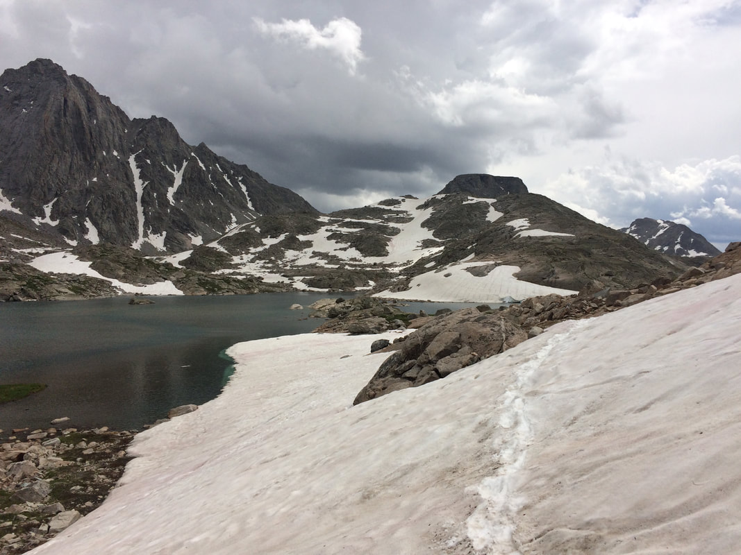 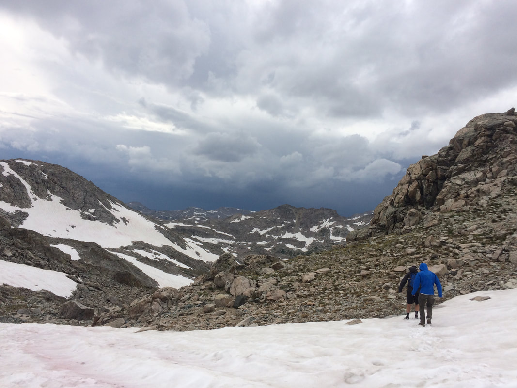 | 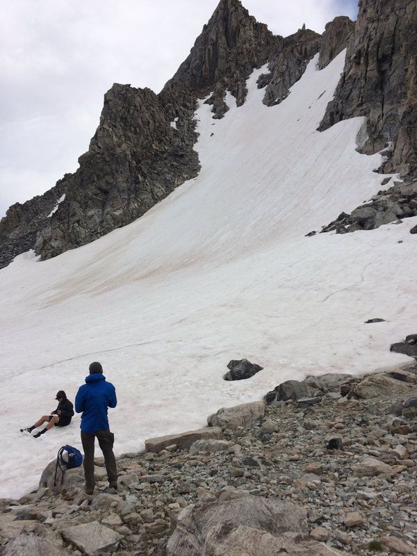 |
The next day when we started out it was a cloudy day and I quickly realized that there was going to be much more snow than I had previously expected... As we neared the cutoff for Indian Pass we heard thunder up in the basin and figured that it wasn't a safe idea to head up so we detoured north about 2 miles into Titcomb Basin and took in the sights from a little safer of a distance. A little after lunch, five of us decided we thought we had enough energy and a clear weather window that we wanted to go for the pass and the glacier so off we went. About half way there one of our group started experiencing severe exhaustion and decided to turn back with another member of our party, the other three of us continued onward. After about another hour and 1,000' of gain we found the top of the pass and the Knife Point Glacier. It was awesome, we laid in the snow and tried to hide from the wind blowing over the divide while we took in the views. Eventually we turned back and headed down towards Island Lake and our camp, seeing an incoming storm on the horizon. About halfway down the pass we had the most terrifying display of thunder and lightning that I have ever experienced. There were strikes within feet of us, hail and thunder that shook your whole body. Luckily we had so much adrenaline from the first strike we ran down out of the storm and made it to camp for a warm meal and good nights sleep. The next day we continued on, hiking back to the cars and on to Big Sandy trail-head and the Cirque.
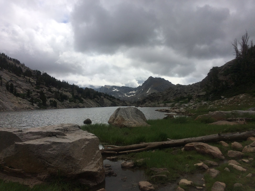  |  The Infamous Jackass Pass | 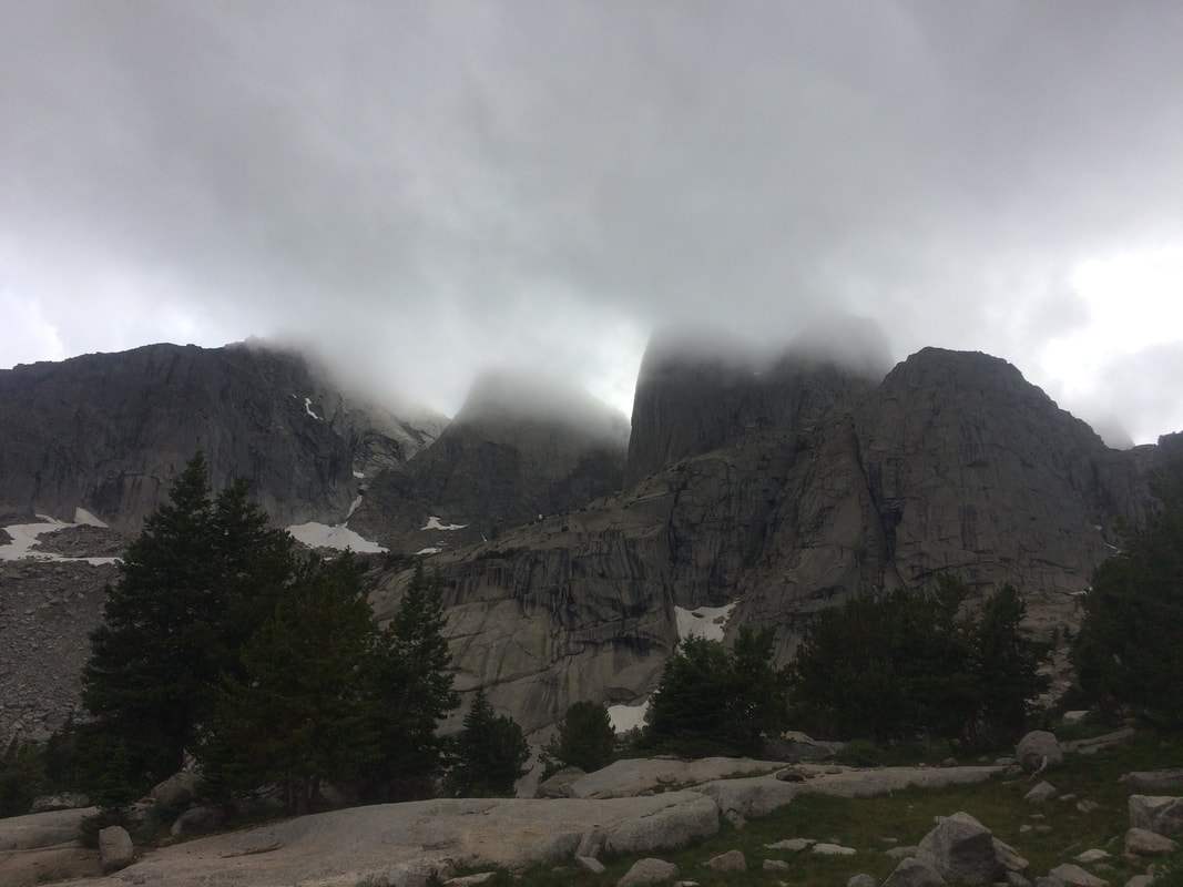 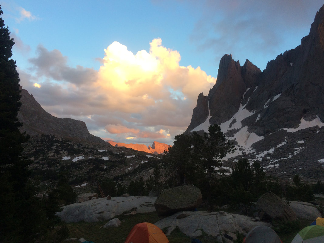 |
The remaining two days consisted of a repeat of a wonderful trek back into the Cirque with some friends that had never experienced this amazing place. We met back up with some climber friends that had separated from us back on day one and traded stories having had been apart for five days. We hid from afternoon storms and soaked up the mountain views. It was an amazing time with an awesome group of people in a truly breath taking pace. After we left the Winds we set out to conquer Longs Peak with many of our minds still stuck in the Winds. It just went to show how attached you can become to a place and how much you can enjoy the people you get to travel with.
The places I go are amazing, I'm lucky I get to do these things and the people I get to travel with are just as amazing. For now the Winds will remain at the top of my list as my favorite destination, but who knows, maybe a trip in the not so distant future will dethrone them and become my next day dream...
The places I go are amazing, I'm lucky I get to do these things and the people I get to travel with are just as amazing. For now the Winds will remain at the top of my list as my favorite destination, but who knows, maybe a trip in the not so distant future will dethrone them and become my next day dream...
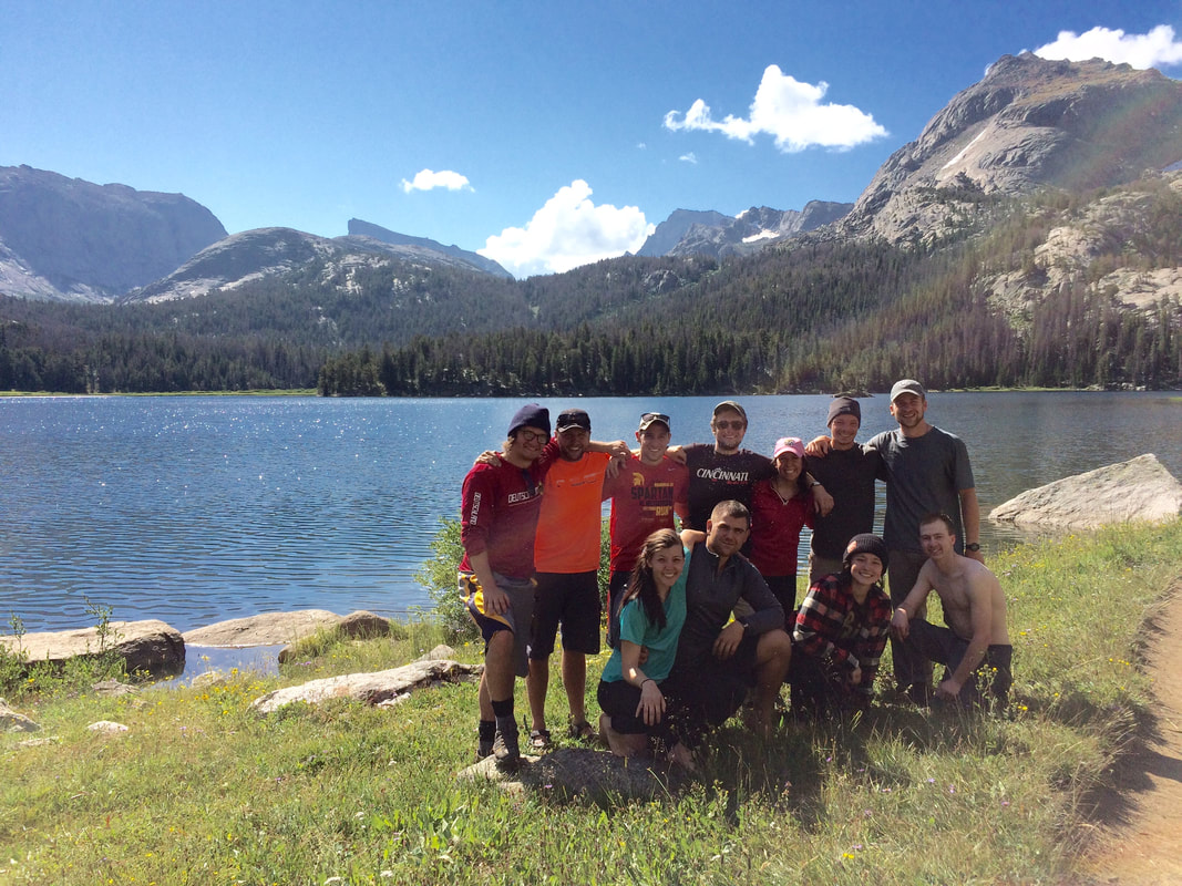
“A mountain is the best medicine for a troubled mind. Seldom does man ponder his own insignificance. He thinks he is master of all things. He thinks the world is his without bonds. Nothing could be farther from the truth."
-Finis Mitchell
I love my long expeditions into the mountains as much as the next guy, maybe even a little bit more. Days on end out on the trail are what I live for, but when I can't get that kind of time I play weekend warrior just like everyone else. Most of the time when I want to get out for a weekend trip I wander down to Red River Gorge, Kentucky and explore the scenic cliffs, majestic overhangs and dense forest canopy. Sometimes though, I've wondered what else is out there in my reach for a weekend trip. So, to answer this question, I've decided to pick a new destination every other weekend and find 5 more great places to hike within a sort drive of the city I call home, on-top of Red River Gorge.
1. Indiana Dunes National Lakeshore, Indiana
Drive Time: ~4 hours & 20 minutes via I-65
Destination: Dunewood Campground
1. Indiana Dunes National Lakeshore, Indiana
Drive Time: ~4 hours & 20 minutes via I-65
Destination: Dunewood Campground
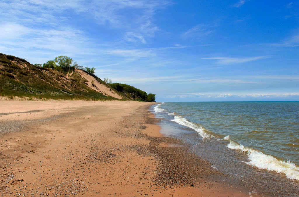 | Indiana Dunes, just east of Chicago, nestled on the southern shore of Lake Michigan is a beautiful place. I have yet to find a place on the shores of the Great Lakes that I haven't enjoyed. Although there isn't much opportunity for backpacking here, the cost for the Dunewood Campground and the many day hikes in the area make it a close and attractive location. Many people complain about not being close to the ocean in the mid-west but I think the lakes are even better than the ocean... Be sure to check out the Cowel's Bog Trail to get away from the crowds and see a unique ecosystem. Also, make sure you spend a sunset on the many miles of beaches. |
2. The Shawnee National Forest, Illinois
Drive Time: ~4 hours & 40 minutes via I-64
Destination: Garden of the Gods Backpacking Trailhead
Drive Time: ~4 hours & 40 minutes via I-64
Destination: Garden of the Gods Backpacking Trailhead
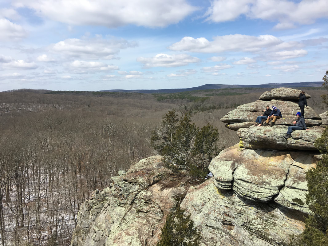 | Visiting the Garden of the Gods (not the one in Colorado unfortunately) was an awesome adventure. I departed Cincinnati around 9PM EDT and got to Illinois a little after midnight local time. After night hiking for about 30 minutes I found the rest of my group's camp (them having got there a few hours before). I setup, settled into my sleeping bag and woke up to about 3" of snow and plenty of adventure the next day. We hiked, climbed and enjoyed our journey around the area, definitely a place I'll be going back to. |
3. The Hoosier National Forest, Indiana
Drive Time: ~2 hours & 30 minutes via I-64
Destination: Two Lakes Loop Trailhead
Drive Time: ~2 hours & 30 minutes via I-64
Destination: Two Lakes Loop Trailhead
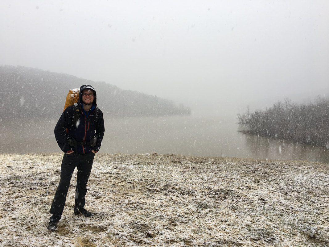 | Just a short drive from Cincinnati. I completed the Two Lakes Loop as an overnight trip in February. The weather had tricked us (or at least me) into thinking this would be an early spring hike with warm temperatures and lots of mud, instead we got cold temperatures, snow and A TON of mud. We crossed rivers in 30 degree weather, found a guy literally running laps around us on the trail and much more. It was a fun getaway and definitely a place I need to go enjoy in warmer weather! Bring lots of socks for this one. |
4. The Shawnee State Forest, Ohio
Drive Time: ~2 hours via Ohio-32
Destination: Backpackers Parking Area outside the State Park
Drive Time: ~2 hours via Ohio-32
Destination: Backpackers Parking Area outside the State Park
 | The Shawnee State Forest area is also known as the Little Smokies and I found out why on this trip. I set out on an adventure, not quite sure what to expect, on the hike I found awesome views, trickling streams and more than a few upward climbs. If you don't mind time in the thick woods then this is the place for you, and if you like fall colors or a little bit better of a view go in the late fall and winter. On my trip I also visited the Copperhead Fire Tower, one of the oldest in the state. As we climbed you could feel it sway in the wind but the views of the forest around me were well worth it. Definitely a place to go if you're looking for an easy get away and some uncrowded trails. |
5. Nordhouse Dunes Wilderness, Michigan
Drive Time: ~7 hours via I-31 (Ya its over 5 hours but its worth it...)
Destination: The Nurnberg Trailhead (Heads up, involves 5 mile drive down a sandy dirt road)
Drive Time: ~7 hours via I-31 (Ya its over 5 hours but its worth it...)
Destination: The Nurnberg Trailhead (Heads up, involves 5 mile drive down a sandy dirt road)
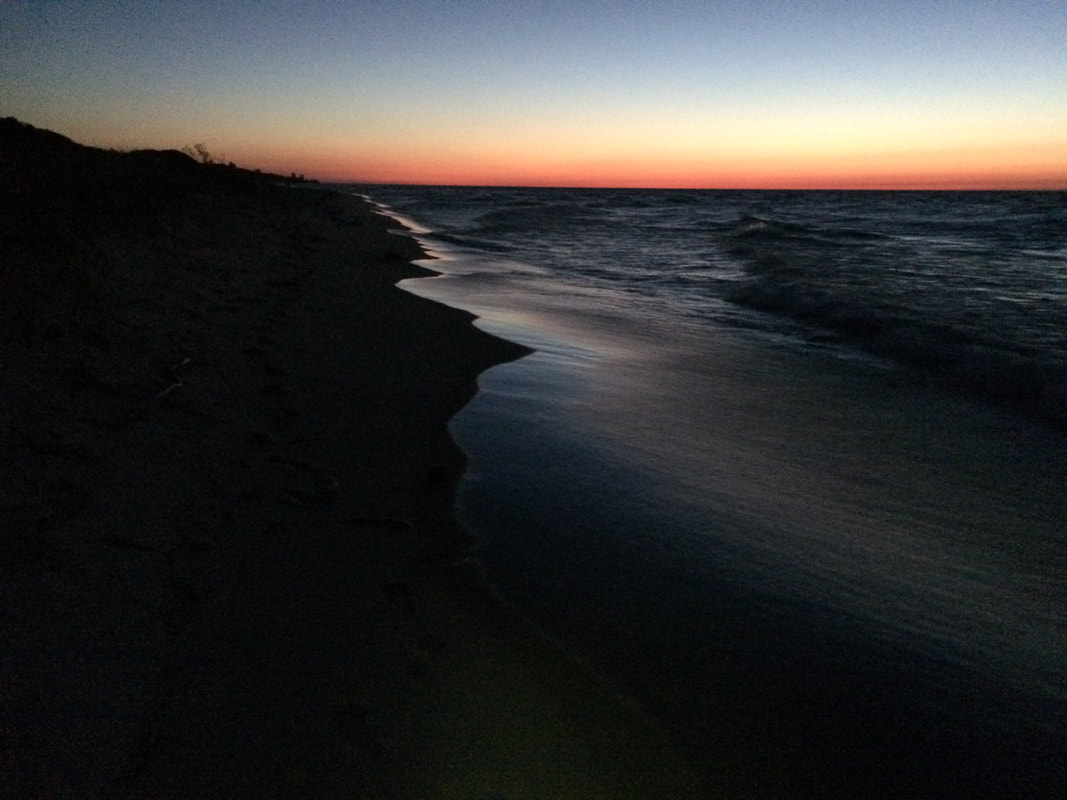 | I stoped by the Nordhouse Dunes on the tail end of a 5 day trip around Michigan. I made some great friends on this trip and I also found one of my favorite places... Nordhouse Dunes is slightly out of the 5 hour range I dedicated this piece to but its definiately worth the extra time. Situated on the west coast of Michigan along the shore of Lake Michigan its a beautiful and isolated place. When we went in early October we only saw one other person and one other vehicle at the trailhead. As one of southern Michigan's only wilderness areas and being decently off the beaten path I would for sure recommend a visit. Be sure to bring a swimsuit, towel and flip-flops! |
Any trip out is a wonderful time, but to find new places to travel to makes it that much more exciting. Some of these places, especially Nordhouse Dunes, I already plan on taking others back to.
"And this, our life exempt from public haunt, finds tongues in trees, books in running brooks, sermons in stones, and good in everything."
-William Shakespeare
 Our Trusty Steed
 You often take off on a trip and expect one thing to happen, but little do you know everything is going to go in a completely different direction. This story starts with myself and my group taking off for Crater Lake National Park from Cincinnati, Ohio on a Friday evening with 12 of us, packed to the gills in a passenger van with a long ride ahead and no idea what we had signed up for.
The drive was long but easy; I had previously traveled with my cousin Nathan and my buddy Alex and knew they would be able to pull through the long night shifts. I figured the others could too, but I wanted to play it safe on the way out there. After 34 hours on the road we finally arrived in Klamath Falls, Oregon to collect our snowshoes and head up the road to Crater. We met the owner of a local shop who we rented shoes from and he told us what to expect up at Crater Lake, he also proceeded to tell us about wolves, bears and mountain lions and I could see some of my group member’s eyes widen.
It was a foggy day in town as we headed up Mt. Mazama (the long extinct volcano that holds Crater Lake in its teeth) but as we got closer the fog cleared and we could see the snowcapped peaks around the rim. After a short time, we gathered our permits drove up to the rim, got everything situated (including the car that had to be left 3 miles back, 1,200’ down at the visitor’s center in case the road up to the rim closed due to high snow, PS thanks for the rides up and down Craig and Sharron) and we were off. Our goal was to circumnavigate the entire caldera in 4 days and 3 nights, close to 30 miles all the way around. In the summer this would be a pleasant and nice trip, with very little elevation change and beautiful views, but in the winter, you strap on snowshoes and sometimes posthole deep into the 7’ snowpack making the hike a whole different challenge.
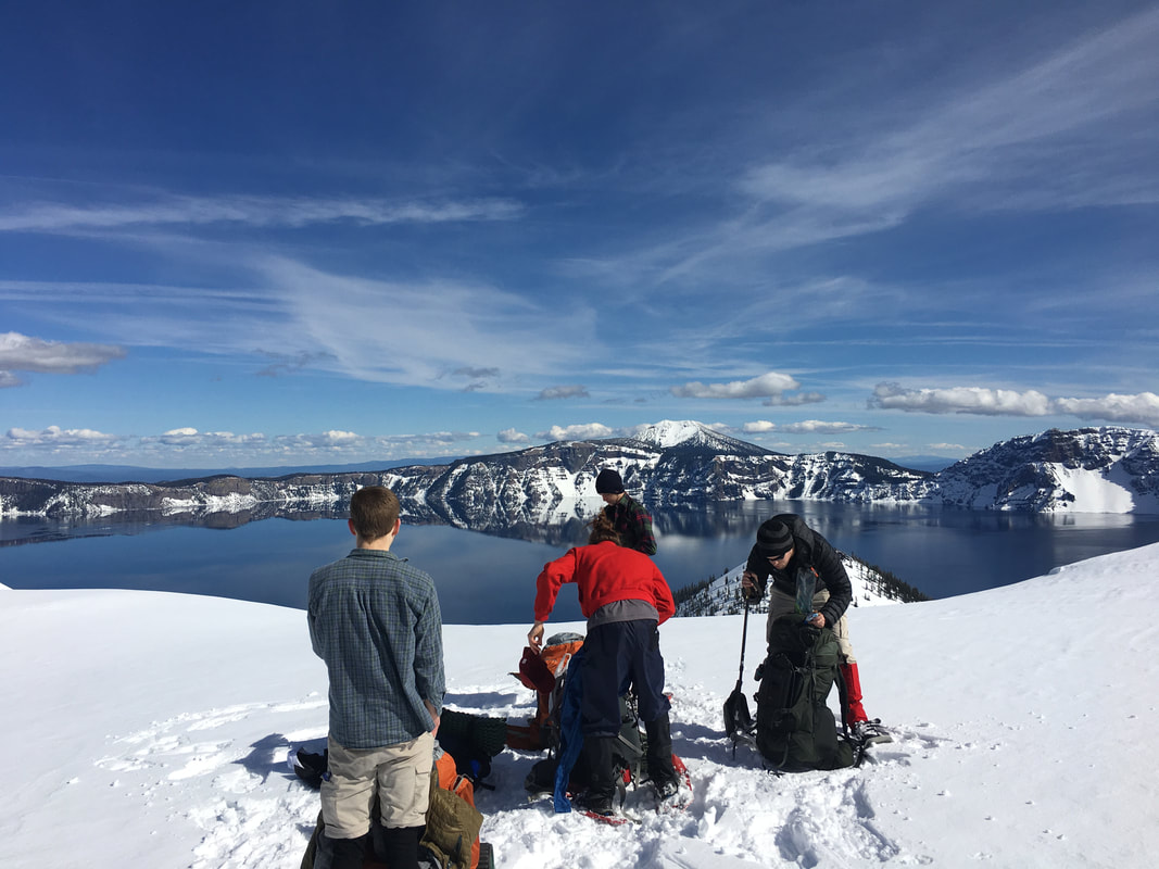 One of The Many Overlooks
 For most of the day everyone was getting used to the bulky snowshoes, we were enjoying the views and for those of us who didn’t already know each other, we were becoming friends. As the day went on I could feel myself start to wear out, having only slept for 5 hours out of 48 will do that too you… I really wanted to get into camp and knew we were getting close, after about 5 hours on the trail we had covered close to 7 miles, not bad for snowshoe pace. We made our goal for the day which was a good sign since I had already doubted our chances for success earlier in the day after seeing the upcoming forecast of snow later in the week. Once we got in, we stamped the snow, setup tents and dug out a pretty rugged snow kitchen. I was so exhausted from the past several days I collapsed into a deep nap waking up almost an hour later feeling much better.
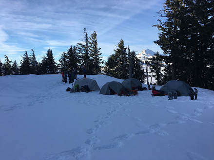 Camp At Crater Lake
 Apparently during my nap though the group had gotten to talking, several of them felt that we wouldn’t be able to complete the loop the way we were going and wanted to figure out a plan B. The way I saw it we had three options, split the group up and half goes on and half goes back then we rendezvous in a few days, we all go back and spend another night in the snow with a sunset summit of Watchman Peak or we could book it out in the morning, get the snowshoes back, get some money back and make the best of what we have for the rest of the trip. We decided on the latter. In the morning, we packed up and headed out the way we came. I had a lot on my mind that morning, it was a beautiful hike, but I was going the wrong way. I knew if we went the rest of the way we’d have an extremely difficult few days ahead of us and what I wanted more was for everyone to have an amazing spring break. We arrived back at the car, dropped off the shoes and I did a little impromptu trip planning in the parking lot.
 In A Burnt Out Red Wood | It was decided that we would drive to California that night and camp, then in the morning we would hit the beach and day hike then backpack up into the mountains for the night. The next day we would come down and drive to either the Umpqua or Alvord hot springs in Oregon and camp depending on the weather at each location. Finally, from there we would continue back the way we came, spending a night in the Salt Flats of Utah and getting home sometime Saturday. All of this happened and so much more… |  Taking A Dip In The Pacific |
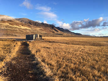 Alvord Hot Spring
 It was an amazing trip, with amazing sights. We sat in hot springs in the desert, swam in the Pacific, hiked among the Red Woods and wandered the Salt Flats. It shook a little of the urge to run off from me but made me hungry for a long trip out in the backcountry. I made great new friends and figured out that I’m pretty damn good at solving my problems (especially when I-80 closed and we had to detour through the back roads of Wyoming). I look forward to my next adventure, I couldn’t have been happier with this one and I’ll keep dreaming of more.
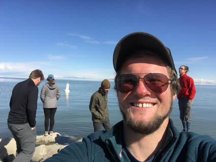 The Great Salt Lake | "It's not the mountain we conquer, but ourselves" |